eSymetric Run.GPS UV User manual
Manual for Run.GPS Trainer UV and Run.GPS
Trainer UV Pro
Version 2.4.1 August 1st 2012
1

Content
1. Introduction ................................................................................................................................... 6
1.1. verview: Features ............................................................................................................... 6
1.2. Typical Scenarios .................................................................................................................. 7
1.2.1. Jogging ........................................................................................................................... 7
1.2.2. Marathon Training ......................................................................................................... 7
1.2.3. Marathon ........................................................................................................................ 7
1.2.4. Hiking ............................................................................................................................. 7
1.2.5. Race Cycle Riding .......................................................................................................... 8
1.2.6. Bike Tour ......................................................................................................................... 8
1.2.7. Skiing .............................................................................................................................. 8
1.2.8. Inline Skating .................................................................................................................. 9
1.2.9. Canoeing ........................................................................................................................ 9
2. First Steps ................................................................................................................................... 10
2.1. Installation (Windows Mobile) .............................................................................................. 10
2.2. Installation (Google Android) ............................................................................................... 11
2.3. First Training Recording ...................................................................................................... 12
2.4. Licensing and Versions ....................................................................................................... 13
3. GPS Support ............................................................................................................................... 16
3.1. GPS Configuration .............................................................................................................. 16
3.2. GPS Status .......................................................................................................................... 18
3.3. GPS Setup on a Pocket PC with Built-in GPS .................................................................... 18
3.4. GPS Setup on a Pocket PC with External GPS Device ...................................................... 19
3.5. GPS Setup on a Windows Smartphone with External GPS Device .................................... 21
3.6. Testing a Bluetooth Connection with „SerialTester“ ............................................................. 23
4. Functions and Features .............................................................................................................. 25
4.1. Control Bar .......................................................................................................................... 25
4.2. Main Menu ........................................................................................................................... 26
4.3. Main Screens ...................................................................................................................... 28
4.3.1. Recorder ....................................................................................................................... 28
4.3.2. Navigator ...................................................................................................................... 29
4.3.3. Map .............................................................................................................................. 30
4.3.4. Laps .............................................................................................................................. 30
4.3.5. Diagram ........................................................................................................................ 31
4.3.6. Additional Screens ........................................................................................................ 32
4.4. Configuring Screens and Displays ...................................................................................... 34
4.4.1. List of Available Displays .............................................................................................. 34
4.5. Geo-Coding Photos, Audio Recordings and Videos ........................................................... 42
4.5.1. Training Upload: Automatic Multimedia File Search .................................................... 42
4.5.2. Manual Assignment of Images ..................................................................................... 43
4.6. Training Log & Plan ............................................................................................................. 44
4.6.1. Adding Manual Trainings .............................................................................................. 44
4.6.2. Training Planning .......................................................................................................... 45
4.7. Voice utput ........................................................................................................................ 47
4.7.1. Voice Announcements .................................................................................................. 48
4.8. Navigation ........................................................................................................................... 50
4.8.1. Bee-line Navigation ..................................................................................................... 50
4.8.2. nline Navigation ......................................................................................................... 50
4.8.3. Importing Routes from GPS-Sport.net ......................................................................... 53
4.8.4. Creating Routes with Google Earth .............................................................................. 54
2

4.8.5. Importing Routes from ther Sources ......................................................................... 55
4.9. Placemarks .......................................................................................................................... 57
4.9.1. Creating Placemarks .................................................................................................... 57
4.9.2. Managing Placemarks With GPS-Sport.net Route Planner ......................................... 58
4.9.3. Downloading Geonames Placemarks from the Internet .............................................. 59
4.9.4. Importing and Exporting Placemarks ........................................................................... 60
4.10. Virtual Training Partner ...................................................................................................... 61
4.10.1. Virtual Training Against Yourself ................................................................................. 61
4.10.2. Virtual Training Against Another Athlete ..................................................................... 62
4.11. Interval Training and Speed Warnings .............................................................................. 63
4.12. Automatic Lap Detection ................................................................................................... 64
4.12.1. New Lap When Target Is Crossed ............................................................................. 64
4.12.2. New Lap When Covering a Defined Distance ............................................................ 65
4.13. Loading Altitude Profiles .................................................................................................... 66
4.14. Using Heart Rate Monitors ................................................................................................ 67
4.14.1. Polar® WearLink®+ transmitter Bluetooth® ............................................................. 68
4.14.2. Zephyr™ HRM and HxM ............................................................................................ 70
4.14.3. ANT+™ ....................................................................................................................... 72
4.14.4. FRWD B Series ......................................................................................................... 73
4.14.5. Recording Heart Rate With the regon Scientific Heart Rate Logger ....................... 75
4.14.6. Exporting Heart Rate Data ......................................................................................... 76
5. Maps ........................................................................................................................................... 77
5.1. nline Maps ........................................................................................................................ 77
5.1.1. The penStreetMap Project ......................................................................................... 77
5.1.2. Activating the penStreetMap layer in Run.GPS ........................................................ 78
5.1.3. Loading Maps Prior to a Planned Tour ......................................................................... 78
5.1.4. Contribute to the penStreetMap using Run.GPS ...................................................... 79
5.1.5. Cycle Map and penPisteMap .................................................................................... 80
5.1.6. Adding More nline Map Layers .................................................................................. 81
5.2. Run.GPS Atlas Format ........................................................................................................ 83
5.3. Instant Trail Mapping ........................................................................................................... 85
5.4. Raster Maps ........................................................................................................................ 86
5.4.1. Importing from GPS-Sport.net ...................................................................................... 87
5.4.2. Importing from Google Earth ........................................................................................ 89
5.4.3. Importing from other sources using a GPX path .......................................................... 92
5.4.4. Importing from ther Sources using XML Position Files ............................................. 93
5.4.5. Help – My Maps Aren't Being Displayed ..................................................................... 94
6. nline Services .......................................................................................................................... 95
6.1. Requirements For Use ........................................................................................................ 95
6.2. Live Tracking ....................................................................................................................... 96
6.2.1. Live Tracking on a Different Portal Server ................................................................... 97
6.3. Synchronize Training Plan ................................................................................................... 99
6.4. Download Cart ..................................................................................................................... 99
6.5. Synchronize to Portal .......................................................................................................... 99
6.6. Find Friends ....................................................................................................................... 100
6.7. Find Routes ....................................................................................................................... 101
6.8. Find Wikipedia Articles ...................................................................................................... 102
6.9. nline Place Search .......................................................................................................... 103
6.10. nline Update .................................................................................................................. 103
6.11. Download penStreetMap ............................................................................................. 103
7. Reference ................................................................................................................................. 104
7.1. Configuration ..................................................................................................................... 104
7.2. Keyboard Layout (Windows Mobile) ................................................................................. 107
7.2.1. Keyboard Layout on the Main Screens ..................................................................... 107
7.2.2. Keyboard Layout on Input Dialogs ............................................................................. 108
7.2.3. Keyboard Layout When Application is Locked ........................................................... 108
3

7.3. Keyboard Layout (Google Android) ................................................................................... 109
7.3.1. Keyboard Layout on the Main Screens ...................................................................... 109
7.4. File System ....................................................................................................................... 110
7.4.1. The Run.GPS Data Directory ..................................................................................... 110
7.4.2. Moving the Data Directory to the Storage Card (Windows Mobile) ............................ 111
7.5. Security Issues .................................................................................................................. 113
7.6. Technical Data ................................................................................................................... 114
7.7. Conserving Battery Power ................................................................................................. 115
7.8. How Can I Improve the GPS Reception of my Device? .................................................... 116
4

Run.GPS may NOT be used for car navigation!
Talk to your doctor before you go for intensive sports!
This manual is copyrighted by eSymetric GmbH.
Windows and Windows Mobile are registered trademarks of Microsoft Corporation.
Google and Google Earth are registered trademark by Google Inc.
Polar is a registered trademark by Polar Electro y.
ANT+ is a registered trademark by Dynastream Inc., CND.
The geonames.org service (www.geonames.org) is licensed under Creative Commons Attribution 3.0 licence, see
http://creativecommons.org/licenses/by/3.0/.
penStreetMap (www.openstreetmap.org), Cycle Map (www.cyclemap.org), penPisteMap
(www.openpistemap.org) and Gosmore are licenced under „Creative Commons Attribution Share-Alike 2.0“
licence (see http://creativecommons.org/licenses/by-sa/2.0/).
Application translation credits: Czech - Jan, Spanish – Eduardo, Paco, Dutch - Guus, Hebrew - Arie, French –
Antoine, Italian – Daniele, Swedish – Krille, Portoguese – Perinei, Norwegian: Harald, Danish: Klavs
5

. Introduction
Run.GPS is your sports companion. It provides you training analysis, training planning and
navigation. All you need is a PDA or Smartphone with built-in GPS or an external GPS
device.
1.1.Overview: Features
Some of the features Run.GPS offers you:
●Beeline navigation and route based navigation
●Comprehensive training information, also via voice output through your earphones
●Recording tracks
●Analysis of training sessions, continuous calorie calculation
●Creating speed and altitude diagrams
●Importing and displaying raster maps or automatic creation of a map (Instant Trail
Mapping)
●Upload training recordings to the GPS-Sport.net and GPSies.com portal websites
●Live tracking of athletes on GPS-Sport.net
●15 freely configurable screens (6 in Run.GPS Trainer UV)
●Training planning (Run.GPS Trainer UV Pro only)
●Creation of reports (Run.GPS Trainer UV Pro only)
6
1.2.Typical Scenarios
.2. .Jogging
Simply put Run.GPS without doing any preparation
work in your pocket. ptionally download some
maps from GPS-Sport.net.
The runner is safely guided back to his/her starting
point when running on unknown terrain. After the run
a calorie report can be created and the track can be
viewed on GPS-Sport.net and the link be sent to friends.
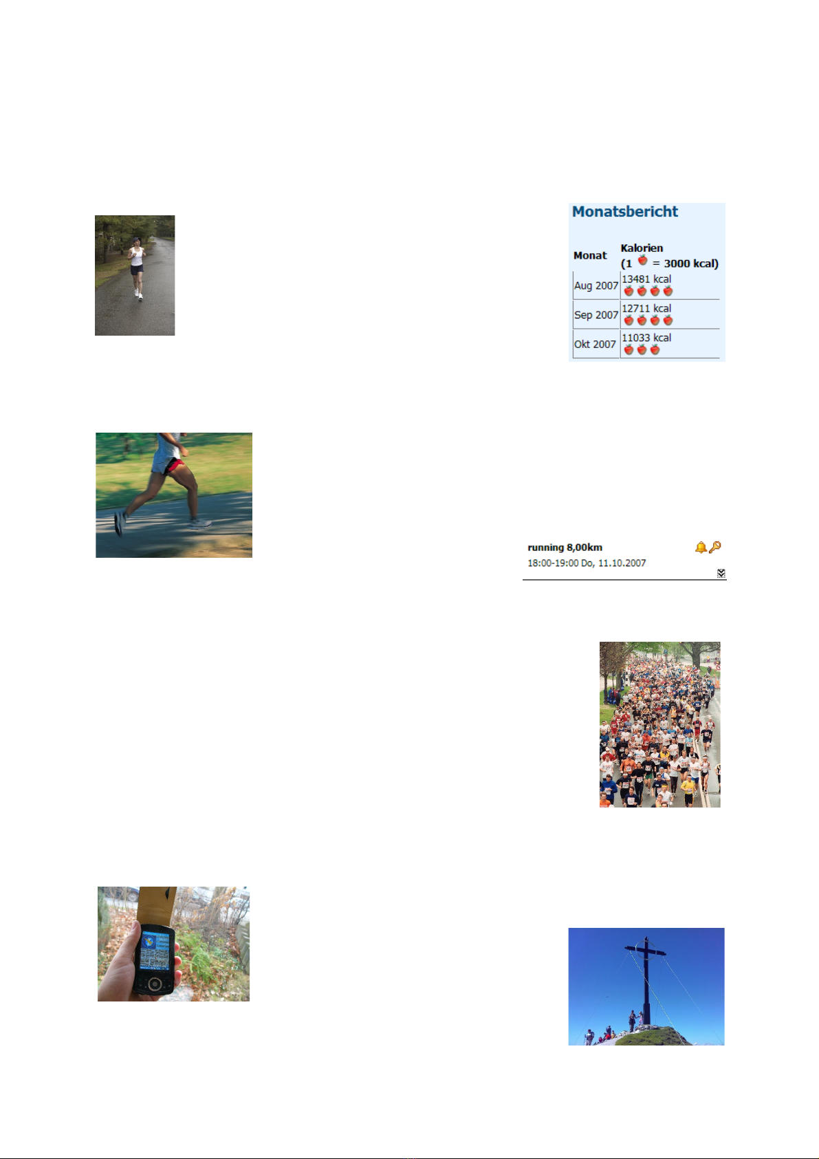
.2.2.Marathon Training
All training units are planned beforehand. The training plan is being
synchronized with the Pocket utlook calendar, with the result that
the athlete is always reminded in time of training sessions ahead.
A detailed training analysis follows, enabling the athlete to monitor
his or her improvements in performance.
.2.3.Marathon
The committed sportsman obtains the track data for the competition
some weeks before the actual competition. Thus he can run the
competition track (or part of it) before the competition using the
Run.GPS route navigation (with voice output on the earphones).
During the competition the athlete is particularly interested in training
data such as the estimated remaining and total time, the current speed
and the remaining distance
.
.2.4.Hiking
The night before a major hike, the mountaineer downloads the
track data and a map for the planned hike from one of the many
internet portals offering tour data. Getting
lost is virtually impossible and the
mountaineer is happy because he or she
always knows how much of the track is
still ahead.
7
(Trainer UV Pro only)
.2.5.Race Cycle Riding
A racing biker never has the time to stop and take the map out.
Therefore, he or she plans the tour beforehand on the GPS-
Sport.net portal. With one click he or she transfers the tour data
from the „GPS-Sport.net Route Planner“ to his or her PDA.
The PDA is either mounted on the handle bar or
the athlete puts it in a bag and listens to the
spoken instructions on the earphones.
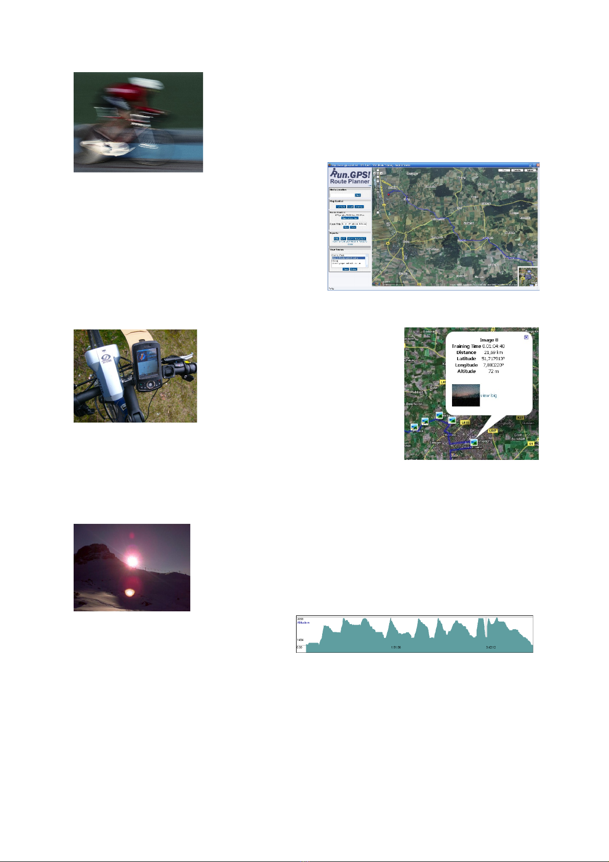
.2.6.Bike Tour
The entire tour is planned with
Run.GPS Route Planner. Places of
interest are marked with
placemarks.
n the tour navigation is the most
used Run.GPS feature. Sights
photographed on the tour are
automatically being geo-coded, i.e. displayed in the right spot
on the map.
.2.7.Skiing
The skier simply put the PDA in his anorak. Run.GPS creates a
profile of his capabilities (at least regarding speed and
endurance): maximum speed, average speed, distance etc. If
required Run.GPS can lead you back to the starting point.
Ski-lifts and descents can be recognized in the altitude diagram:
8

.2.8.Inline Skating
n a portal website like GPSies.com, there are many interesting
tours for inline skaters – worldwide. Run.GPS is the best tool to
follow these tours in a convenient fashion.
.2.9.Canoeing
Run.GPS leads the canoeist on the best path to the
correct exit place and gives advice concerning
covered distances and distances ahead.
9
2. First Steps
2.1.Installation (Windows Mobile)
To install Run.GPS, simply go to the download page at www.rungps.net and obtain the
correct version for your device.
The EXE installer are always used when installing from a PC, whereas the CAB installers are
used when directly installing on the PDA or Smartphone. In the following, only the EXE
installers are described.
n Windows Mobile 6 or greater the .Net Compact Framework is already pre-installed and
therefore the installer version without the .Net Compact Framework can be chosen.
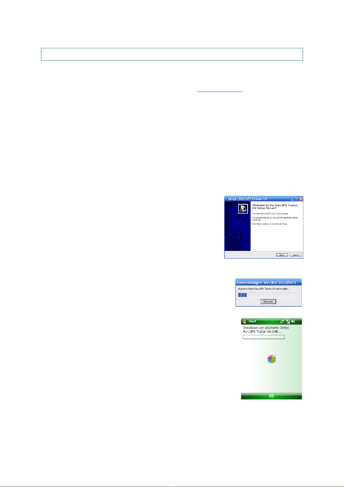
For installing Run.GPS, do the following:
1. Download the correct installation program
2. Connect your mobile device to your PC
3. Start the installation program on the PC by double-
clicking it
4. Follow the instructions
5. Finish the installation by confirming on your mobile device
10

2.2.Installation ( oogle Android)
There are two ways to install Run.GPS on Google Android:
Installation via Android Market
1. pen “Market” app on your Android phone
2. Search for “Run.GPS”
3. You'll get access to trial and full versions
Installation via download from www.rungps.net
1. Install an application manager like “Astro” (you can get it for free from Android
Market)
2. Download the Run.GPS APK file from www.rungps.net >> Downloads
3. Copy the file to your smartphone's SD card via USB cable
4. Use the application manager to install the application from your SD card
11
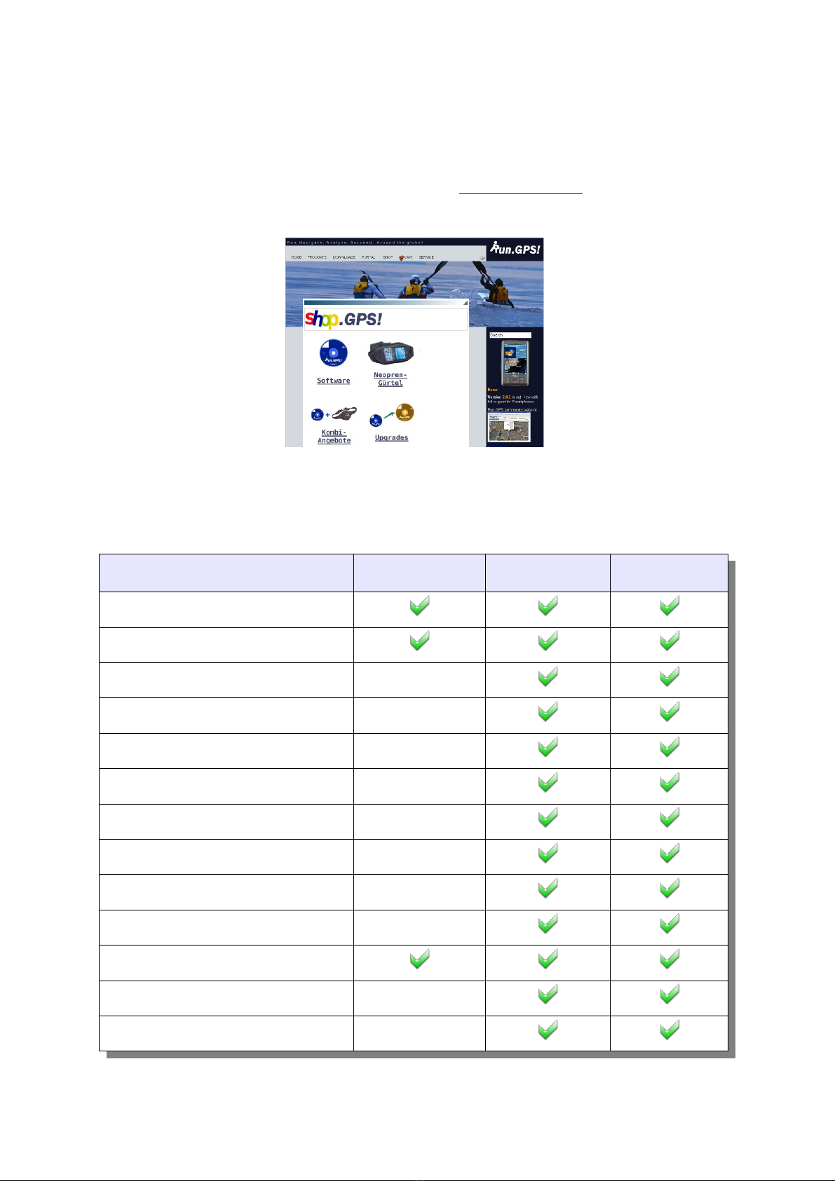
2.3.First Training Recording
This is a short tutorial on how a first training session can be recorded successfully:
1. Start Run.GPS
2. Check the status of the GPS (Main Menu > GPS Status or
click on signal strength display)
3. Go outside and maybe put your device to the ground (to
avoid movement) in an open spot to ensure optimal
reception – wait until the signal quality display says „good“
4. Close the GPS status dialog and push the start button
5. Move some hundred meters and push „Stop“
Congratulations! This is your first GPS recording. You can now
create an analysis report (Run.GPS Trainer UV Pro only) or
upload your recording to the GPS-Sport.net portal.
12
2.4.Licensing and Versions
You can obtain licences fast and easy in our shop at www.RunGPS.net. Licences for the
Android versions can also be found on Android Market.
The different licence types “Run.GPS Lite”, “Run.GPS Trainer UV” and “Run.GPS Trainer
UV Pro” are characterized by the following feature matrix:
Feature Run.GPS Lite Run.GPS Trainer UV Run.GPS Trainer
UV Pro
Trainings recording
Training upload
Voice output
Live Tracking
Route Navigation
nline utdoor Navigation
Displaying raster maps
Direct download of penStreetMap maps
Importing routes as KML or GPX
Incremental backup
Instant Trail Mapping
Friend Finder
Route Finder
13
Six user configurable screens
Training planning
Import and Export of training plans
Synchronization with Pocket utlook
(Windows Mobile only)
nline syncing of training plans with GPS-
Sport.net portal
Calorie consumption report
Detailed training analyses
Sports report
Week report
Month report
Training comparison report
Exporting training recordings as GPX, KML
or CSV
Exporting placemarks as KML or GPX
Fifteen user configurable screens
The Windows Phone 7 release of “Run.GPS Trainer” is a mixture of the Pro and non-Pro
version. This is due to restrictions in the operating system, see
http://www.rungps.net/wiki/Windows_Phone_7_Restrictions
Supported languages:
EN DE ES FR RU CZ NL HE IT PT SE NO
Program *** **
Voice *
Documentation
*) not in Windows Mobile 5/6, Windows Phone 7
“”) not in Google Android, Windows Phone 7
***) not in Windows Phone 7
14
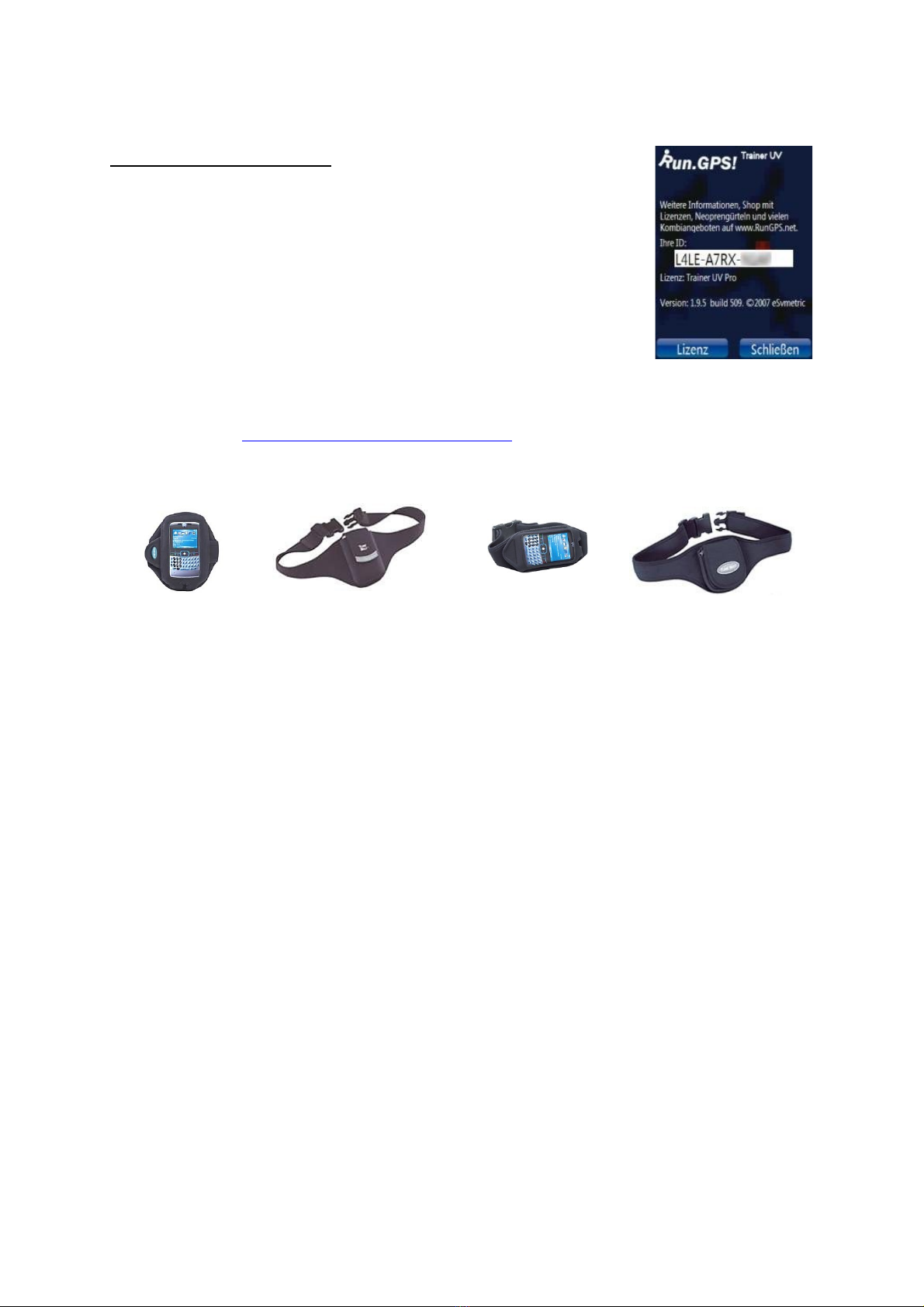
rdering licences in the shop:
1. Select desired software licence (Trainer UV or Trainer UV
Pro)
2. Pay by money transfer (prepayment) or PayPal (through
PayPal it's also possible to pay be credit card)
3. Activate by entering the Run.GPS ID (see right)
4. You'll receive your licence code and invoice via email
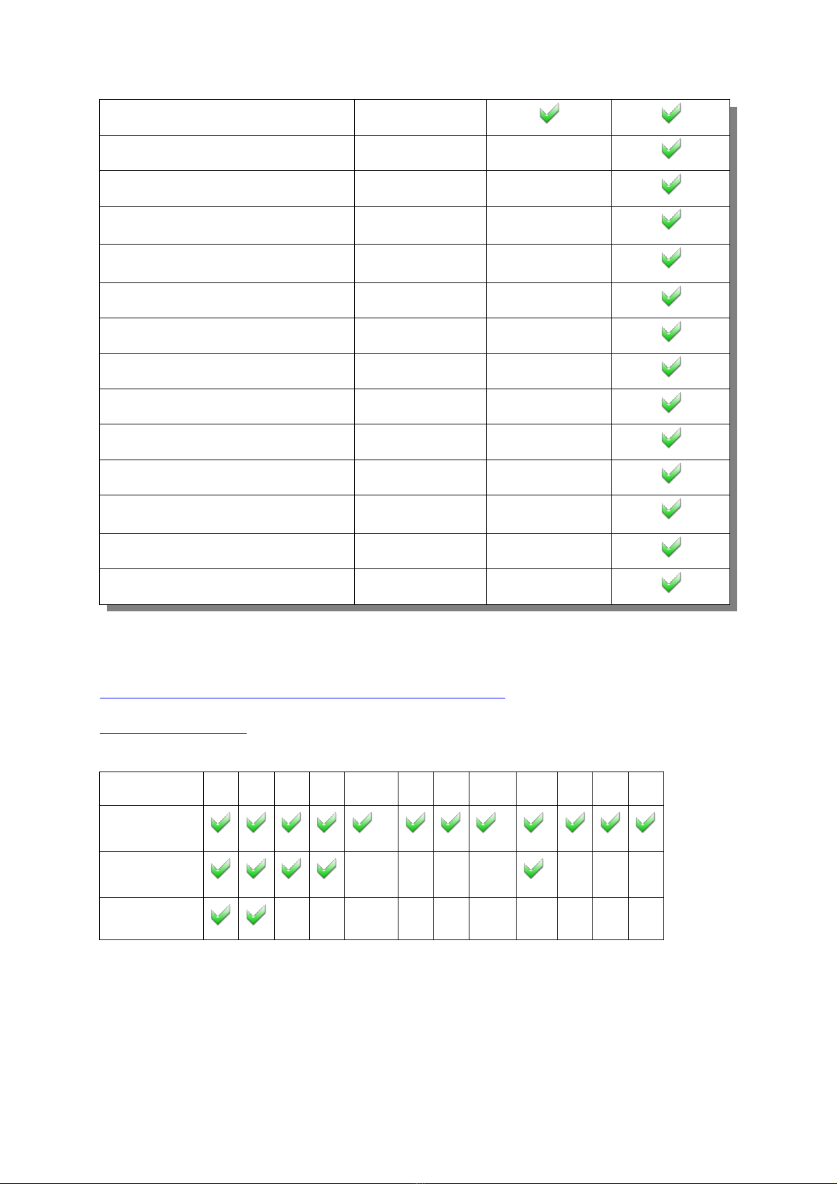
In our web shop (http://www.rungps.net/wiki/ShopEN/), you can also obtain useful neoprene
belts which are ideal for taking your PDA or Smartphone or GPS device with you:
15
3. GPS Support
Getting the GPS running is usually the biggest obstacle when using programs like Run.GPS.
Especially with older devices finding the correct settings is sometimes a challenge.
The following two types of connecting to the GPS are supported:
●Windows managed GPS („Intermediate GPS“):
●if possible, this should be preferred
●it is not required to find out any further parameters (like C M port)
●only possible with Windows Mobile 5 or greater and only on some PDAs
●serial connection using a C M port
●it is necessary to find out which C M port to use and at what baud rate
●the settings are either found automatically using the „scan C M ports“
function or you have to search the web or other sources for the correct
settings
●for external (Bluetooth) GPS devices this is the common type
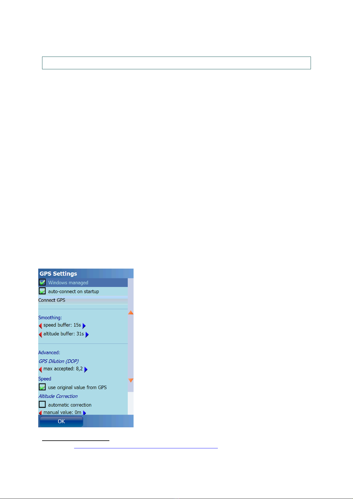
3.1. PS Configuration
The GPS configuration can be accessed from the main menu choosing Configuration > GPS
Configuration.
Ideal configuration: managed by Windows Mobile (selecting a C M port not required)
Smoothing Buffer: originally GPS devices provide very
inaccurate speed information (especially when the speed is
low). Therefore, the original speed coming from the GPS
device is thrown away and instead calculated using a
complex adaptive algorithm. When you move at a constant
speed for a long time (e.g. Marathon) it is recommended to
use a big smoothing buffer (e.g. 60 seconds). When your
movement is dynamic or at high speed (e.g. Rallye) you
should use a small smoothing buffer (e.g. 20 seconds).
Accordingly it is possible to smooth the GPS geographical
altitude.
Maximum accepted GPS Dilution: by this setting you can
influence the quality of your track recording. If the GPS
dilution of precision (D P) value is greater then the
configured maximum dilution, the GPS position data is
skipped. The smaller the D P value, the better the GPS
signal.1
Speed – use original values from GPS: if activated, the
(smoothed) speed values from the GPS device are used. If
1 also see http://en.wikipedia.org/wiki/Dilution_of_precision_(GPS)
16
not activated, Run.GPS will compute speed and pace. This can make sense especially for
older devices.
Altitude correction is only required for a few devices which output altitudes with a constant
value added or subtracted. Try automatic correction first if this is the case. Errors in altitude
measurement can be normal since GPS based altitude measurement is relatively inaccurate.
GPSID fix: required only for the Mio A701; must not be activated on other devices – this
leads to the GPS coordinates being totally wrong (multiplied with about 0.01)
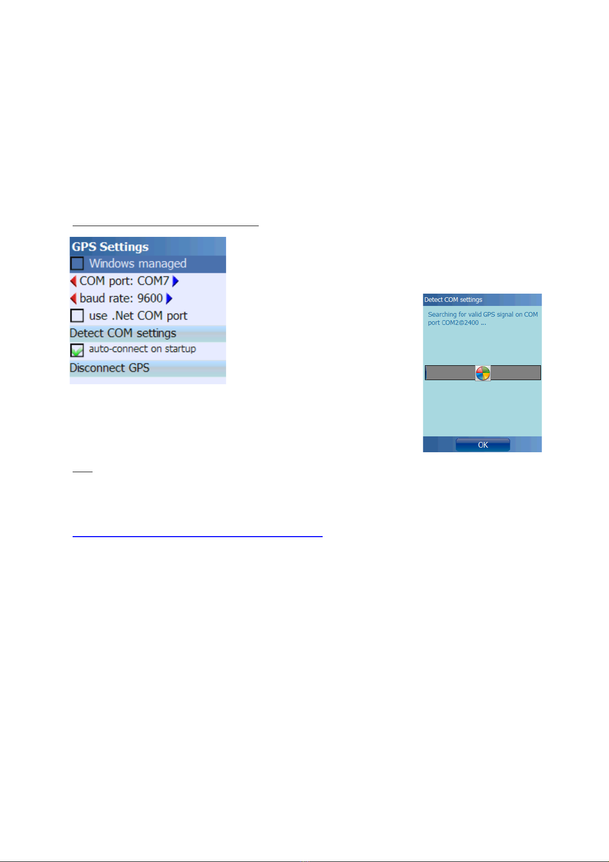
Configuration using serial (C M) port:
C M port and baud rate can be entered manually or
detected automatically. Automatic detection does not work
in all cases – if it doesn't, you should search the web or
other sources for the correct settings.
Use .Net COM port: this setting makes sense only on very few
devices (e.g. “HP Ipaq 2200”). Please use only if required. n
incompatible devices this can “freeze” your device (e.g. “MDA
Compact III”).
Hint: if your device is “frozen” because you checked the “use .Net C M port” function, and
you cannot start Run.GPS any more, delete the file “My
Documents/Run.GPS/configuration.xml” to reset the Run.GPS configuration.
Some selected configurations can be found on the Run.GPS web site:
http://www.rungps.net/wiki/DeviceConfigurationEN
17
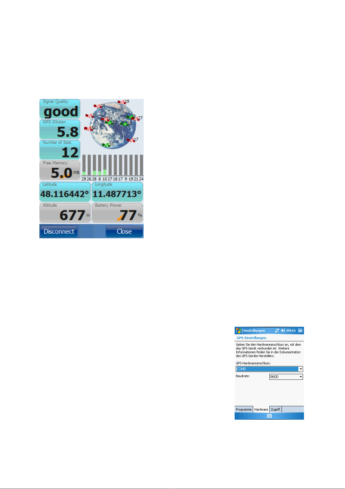
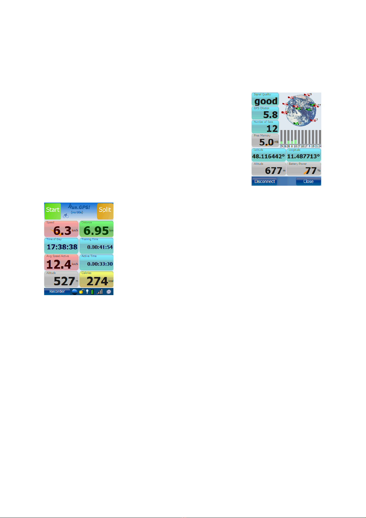
3.2. PS Status
The GPS status window can be opened by either pressing the GPS status button in the
control bar or by selecting „GPS Status“ from the main menu.
The diagram shows the current positions of the GPS
satellites found. Satellites with sufficient signal
strength are marked green.
All info displays can be changed by holding the
buttons for about 2 seconds.
GPS Dilution: also “Dilution of Precision”, “D P”; this
values expresses the suitability of the current satellite
constellation for position determination; values from 1
to 6 are good, for values greater 10 the position can
not be determined
The GPS device can be connected or disconnected
trough this dialog. Disconnecting the GPS can be
wise for instance when taking a rest (because the
GPS consumes really much battery power).
3.3. PS Setup on a Pocket PC with Built-in PS
If you call a PDA with built-in GPS your own, getting it connected to Run.GPS should be
relatively easy. Sometimes, though, the parameters have to be found by exhausting
investigation.
1. First try to connect your GPS using „Windows managed“ GPS
2. If that does not work, try to scan the C M ports („Detect C M Settings“)
3. If that also fails, try searching the web for the correct settings
Hint: From Windows Mobile 5, there is a dialog „GPS“ in the
system settings. Among other things the GPS hardware port can
be found there.
In most cases the hardware C M port has to be used.
18

3.4. PS Setup on a Pocket PC with External PS Device
This works approximately in the same fashion as when connecting to a built-in GPS – with
the difference that the Bluetooth connection has to be established first.
First of all switch on Bluetooth on your Pocket PC. Then search for
Bluetooth devices.
Connect to the Bluetooth GPS device and enter the password/PIN
code (often „1111“)
Activate the following service: „Serial Port“
Create a new outgoing port
19
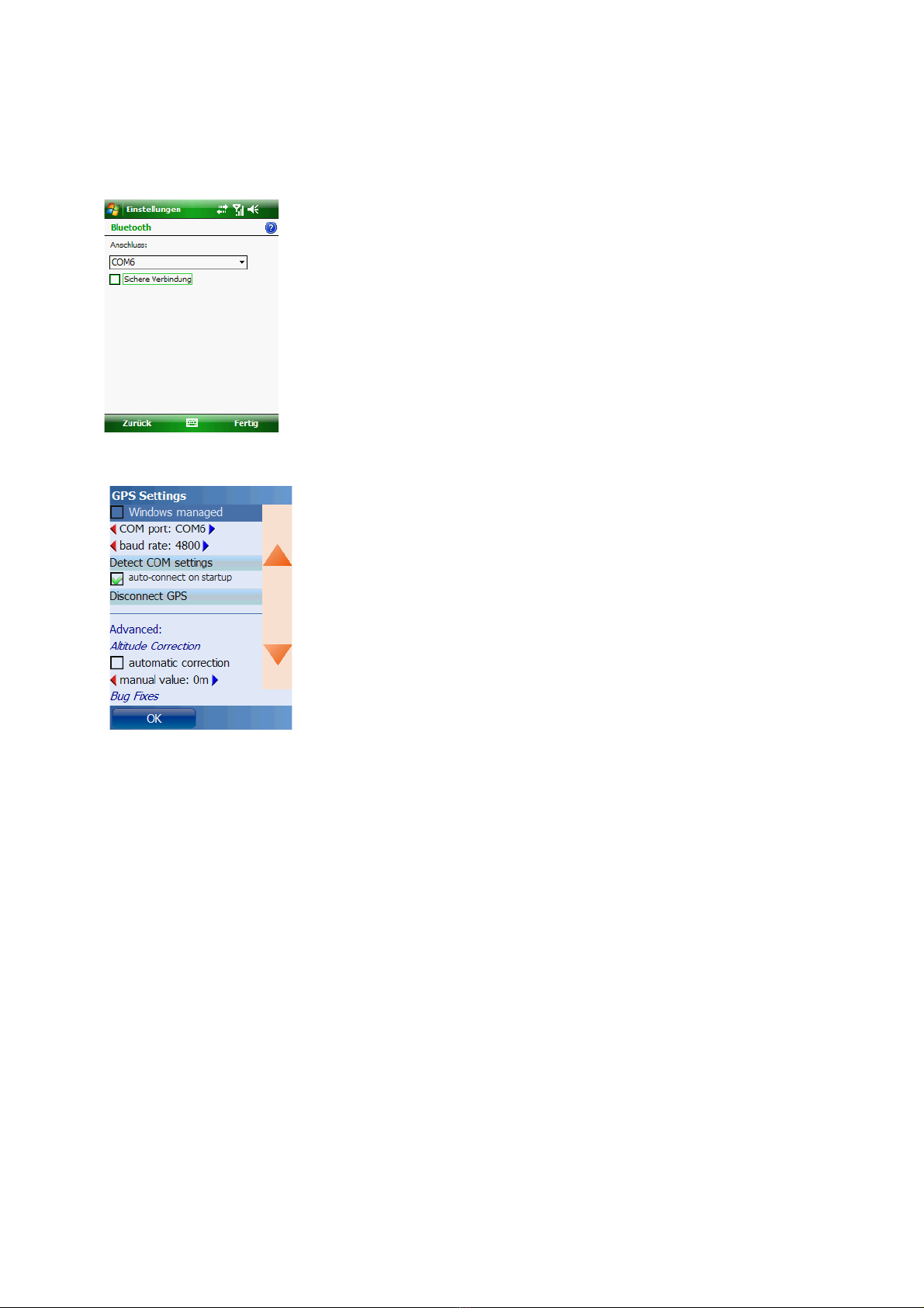
Assign a C M port number – which one does not matter
Enter the C M port number in Run.GPS
You may also try out different baud rate settings
20
This manual suits for next models
1
Table of contents
Popular Fitness Electronic manuals by other brands


Sami
Sami WS-2301 wearable instruction manual

Polar Electro
Polar Electro FT80 Getting started guide

Kettler
Kettler SF1B Training and operating instructions

Kettler
Kettler ST 2610-9 Training and operating instructions

Polar Electro
Polar Electro Team2 Quick guides

Kettler
Kettler ELYX 5 Training and operating instructions


