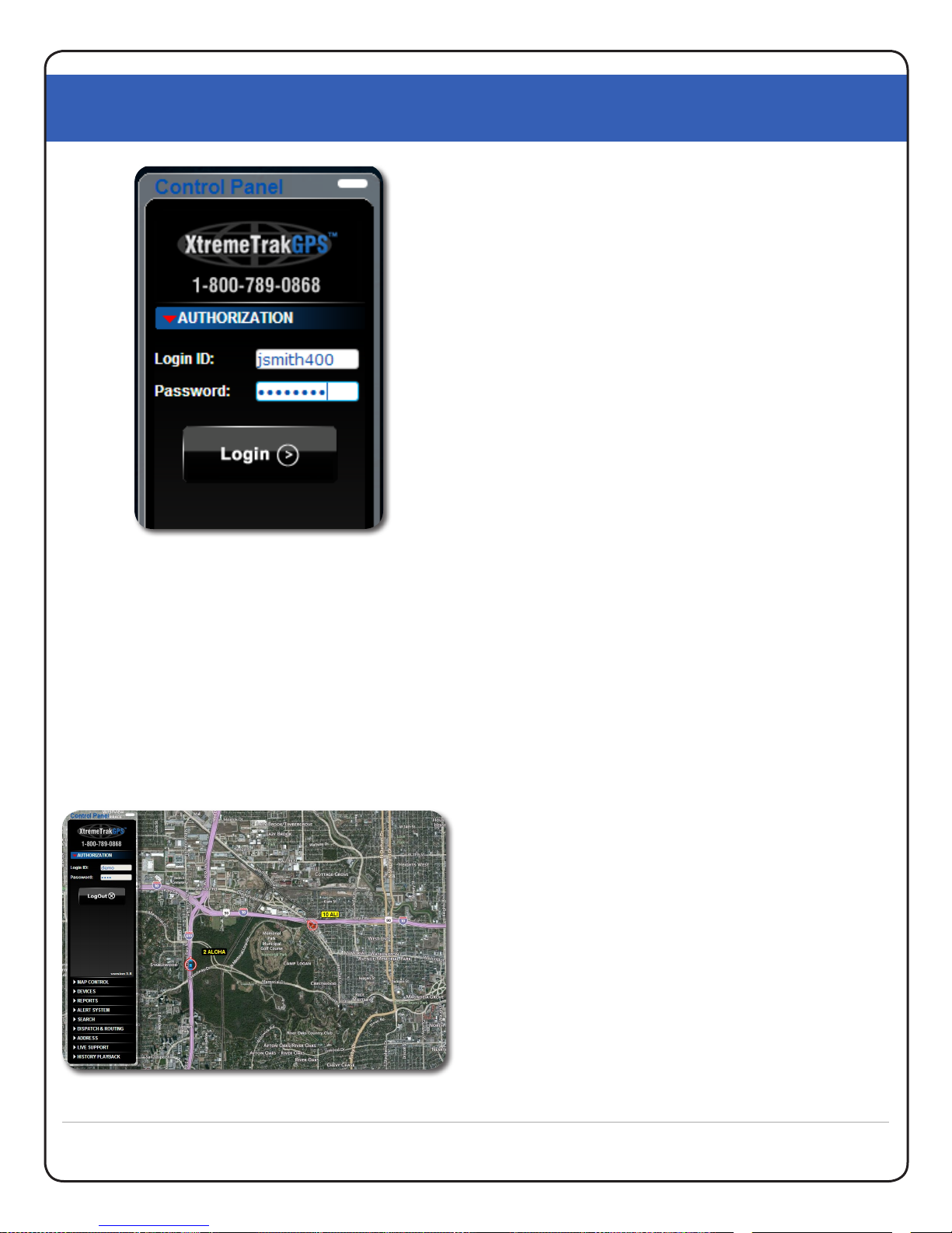
XtremeTrakGPS XT-300 User Guide
XT-300 USER GUIDE
10
Safari, Chrome, etc.) allow you to enable popups from
our site specically while connuing to block popups
from unwanted sites.
If the checkbox is turned on for “Fastest Time”, the route
will be opmized and the stops reordered in such a
manner as to allow the driver to complete all stops in the
shortest amount of me.
If the checkbox is turned on for “Shortest Distance”, the
route will be opmized and the stops reordered in such a
manner to allow the driver to complete all stops with the
lowest possible mileage. Please note that the shortest
mileage is not always the fastest me – for example,
interstate travel might predicate slightly higher mileage,
but also higher speed and thus shortest me. In order
to receive driving direcons, the popup blocker on your
browser may need to be disabled temporarily to enable
the pop-up window with driving direcons to appear.
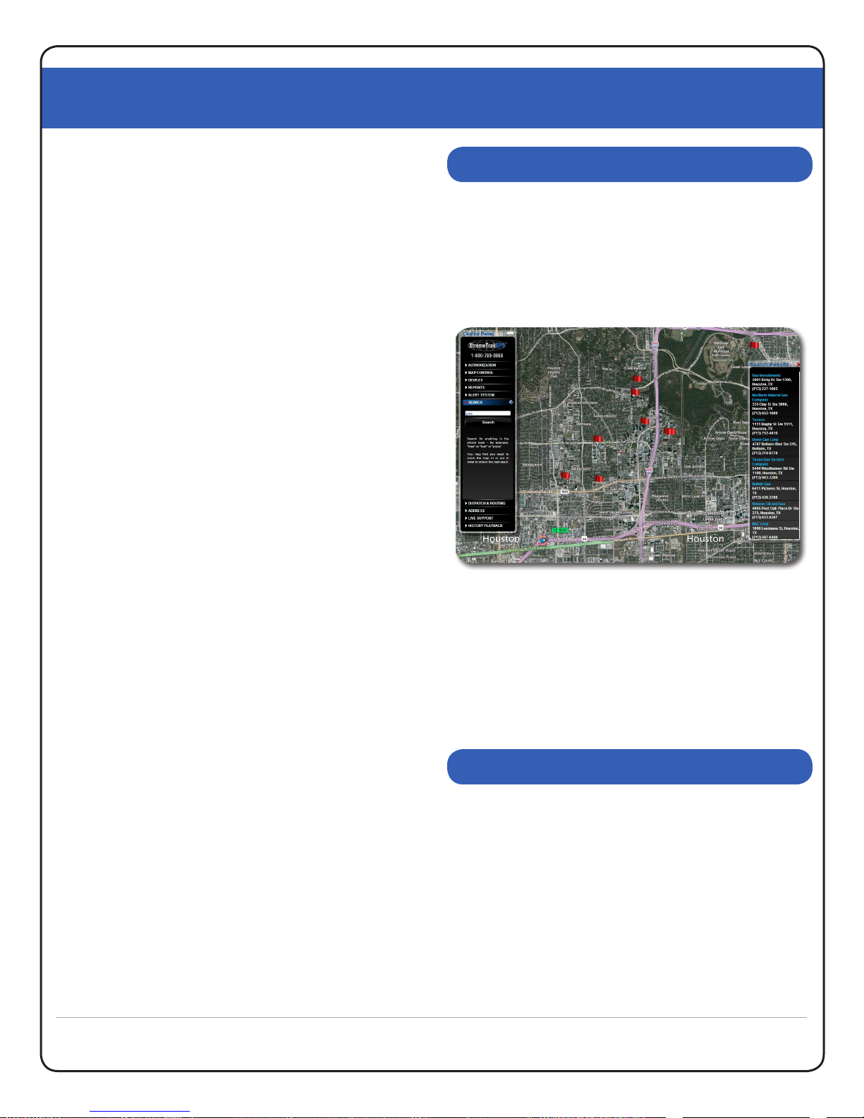
The Address Markers tab exists to enable the placement
of user-dened markers on the map. These markers can
provide quick and easy locaon of warehouses, oces,
and other landmarks relevant to your daily use of the
US Fleet Tracking vehicle tracking system. To access
this feature, select the “Address Markers” tab and click
“Show Address Editor”. Aer typing the name you wish
to appear on the marker label, type the address into the
address eld and click the “Find Lat:Lon” buon. The
system will nd the closest match in the database and
populate the latude and longitude with that locaon.
Alternavely, if you know the latude and longitude
(based on the posion of a vehicle), you can simply type
the latude and longitude and click the “Find Street
Address” buon. To place the marker on the map, click
the “Add Address” buon at the lower right corner of
the Address Editor window. A target icon will appear at
the locaon specied. When your mouse is placed over
this target icon on the map, a small window will appear
providing complete address informaon. To remove an
address marker, simply select that item in the list on
the le side of the Address Editor Window and click the
“Remove” buon. When you are nished creang or
eding your address markers, click the [X] at the upper
right corner of the Address Editor Window to close and
resume normal operaons.
In yet another of our connuing paern of industry rsts
(and our undying dedicaon to world-class customer
support), XtremeTrakGPS provides LIVE on-line chat
support from within the vehicle tracking interface.
With LIVE Chat Support embedded directly into our
tracking system (See Figure 11.0, next page), you can ask
quesons or be given direcon on how to use specic
parts of our system even while you connue to interact
with the system. There is no need to close the chat
window or go try something and come back. In fact, you
can leave the Live Support window open even while you
manipulate the map – zoom in, zoom out, pan the map,
select an individual vehicle or all vehicles, or even run
reports or historical playback. No other vehicle tracking
product on the market provides such an advanced level of
technical support and assistance to the user community
– because no other vehicle tracking company cares as
deeply about the sasfacon of its clients.
To talk with a LIVE support engineer, simply select the
Live Support tab on the control panel, and click the
buon labeled “Live Support System”. A window will
appear at the top of your screen similar to Figure 11.0.
LIVE CHAT SUPPROT
ADDRESS MARKERS