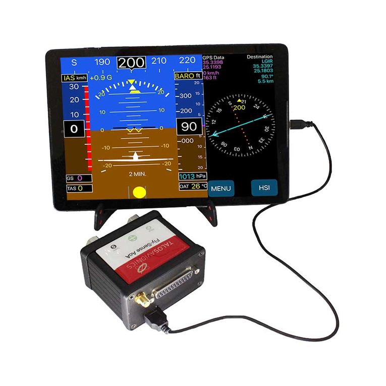
Digifly FMS50MM User manual

FMS50MM+EFIS
ver4.10uk16/01/2002
EFISInstrumentation
FMS50MM
FMSAT

DigiflyInternationalGuarantee
DearCustomer,
ThankyouforpurchasingthisDigiflyproductwhichhasbeen
designedandmanufacturedtothehighestqualitystandards.If,
unfortunately,somethingshouldgowrongwiththisproductDigifly
guaranteefreeofchargelabourandreplacementpartsduringa
periodof24monthsfromdateofpurchase.
TheDigiflyguaranteeappliesprovidedtheproductishandled
properlyforitsintendeduse,inaccordancewithitsoperating
instructionsanduponpresentationoftheoriginalinvoiceorcash
receipt,indicatingthedateofpurchase,dealer'snameandmodel
andproductionnumberoftheproduct.
TheDigiflyguaranteemaynotapplyif:
-thedocumentshavebeenalteredinanywayormadeillegible;
-repairsorproductmodificationsandalterationshavebeenexecuted
byunauthorisedserviceorganisationsorpersons;
-damageiscausedbyaccidentsincludingbutnotlimitedtolightning,
waterorfire,misuseorneglect.
IncaseyourDigiflyproductisnotworkingcorrectlyorisdefective,
pleasecontactyourDigiflydealer.Inordertoavoidunnecessary
inconvenience,weadviseyoutoreadtheoperatinginstructions
carefullybeforecontactingyourDealer.
DigiflyEuropes.r.l.
53ViaStradelliGuelfi
40138Bologna-Italia
Tel.+39051533777
Fax.+39051532965
Internet:www.digifly.com
E-Mail:[email protected]
1

INDICE
IntrodutcionPag4
1.1FMS50MM.................................Pag.5
1.2FmmATsensorinstallation.........Pag.5
1.2.1Warnings.................Pag.5
1.2.2Mounting.................Pag.6
1.2.3Airpressuresensing.Pag.6
1.2.4Electricalsupply......Pag.6
1.2.5Connectionof
interfacecable....Pag.6
1.2.6Operativelmits........Pag.6
1.3Electricalschemes......................Pag.7
andCONFIGURATION
2.1CalibrationoffmsAT...................Pag.8
2.1.1Calibrationnotes......Pag.8
2.1.2Calib.ofmagneticfield
andaccelerationsensors..... Pag.9
2.2Autoconfigurationof
sensormodules...................Pag.9
Pag.10
4.1MovingMapscreen....................Pag.11
4.1.1Navigationdata........Pag.11
4.1.2Cartogrphicsection...Pag.12
4.1.3Navigationsystem....Pag.13
4.2Keyboard....................................Pag.13
4.2.1Basicfunctions..........Pag.13
4.3Menues......................................Pag.14
4.3.1Waypoint.................Pag.14
4.3.2SaveFix...................Pag.15
4.3.3Routes......................Pag.16
4.3.4Settings...................Pag.19
4.3.5GPSpage.................Pag.20
4.4DeadReckoning.........................Pag.21
4.5Autopilot....................................Pag.21
1INSTALLATION
2CALIBRATION
3SWITCHINGONandOFF
4MOVINGMAP
2

4.6Backlight/Mapcolors................Pag.21
NOTESaboutMovingMapPag.22,23,24
5.1Introcuction................................Pag.25
5.2Overview..................................Pag.26
5.2.1Descriptionofindividual
instruments.......................Pag.26
5.3DescriptionoffmsAT...................Pag.27
5.4MeaningofkeyswithEFIS..........Pag.27
5.5Altimeters/Anemometersadjust.Pag.28
5.5.1ZeroQFE.........................Pag.28
5.5.2QFE/QNHadjustment......Pag.28
5.6Instrumentationmenu................Pag.29
5.7Units (availableonlyinEFIS).......Pag.29
5.8Flightaltituderecording..............Pag.29
5.9Instrumentsimulator...................Pag.30
NOTESaboutEFISmodulePag.31,32
6.1Softwareupgrades......................Pag.33
6.2Upgradeprocedures...................Pag.34
6.2.1Check-Listcustomization...Pag35
6.3Terminal.....................................Pag.37
6.4Barometercalibration..................Pag.37
6.5AnemometerSlopecalibration....Pag.37
6.6Zeroanemometer.......................Pag.37
NOTESaboutMaintenancePag.38,39
7.1FMS50General..........................Pag.40
7.2MovingMap..............................Pag.40
7.3EFIS...........................................Pag.41
7.4FmsAT........................................Pag.41
Pag.42
5EFISMODULE
6Maintenance
7Technicalfeatures
8Mechanicalfeatures
QUICKGUIDEBackManual
3

Introduction
TheDigiflyinstrumentationisafullmodularsystemwhich,dependonthe
differentmodules,letyouabletoobtaindifferentfunctions:
Moving-MapGPSorMoving-MapGPS+EFIS.
4
Necessarymodulesforthefullfunctions
GPS-Moving-MAp+Efis:
Necessarymodulesforthefullfunctions
GPS-Moving-MAp:
Moving-MapGps+Efis
Moving-MapGps

51Installation
1.1FMS50MM
-Theunitshouldbeconnectedtothebatterythroughadedicated
switchandfuse.
-Usemetalonlysparkplugcaps.
-Neverfastensensorcablestohighvoltagesparkplugscablesorlay
downnearhighvoltagecoils.
-Checkthebatterychargercircuit/regulatorproperoperation.
-Batteryvoltageshouldneverexceed15VevenattopengineRPM.
-Positionthe9pinRS232plugandcableinaneasilyaccessiblearea,
inthebackofthepanel,todownloadfuturesoftwareupgrades.
-Forpanelinstallationusethespecificallyprovidedboltonthe
bottomplateoftheinstrument.Donotuseorchangeanyofthe
screwsoftheinstrument.
-Allowclearairflowthroughtheairductsothe instrumentsides.
-PositiontheGPSantennaawayfromsourcesofelectromagnetic
interference(Radiotransmitters,strobo,transponderet.),witha
clearviewofthesky.ChecksatellitereceptionwiththeGPSPAGEof
FMS50.
Followtherecommendationsduetoinstallationofacompass,away
fromferromagneticpartsorvaryingmagneticfields.
1.2InstallationoffmsATsensormodule.
1.2.1Warning

1.2.2Mounting(fmsAT)
1.2.3Airpressuresensing(fmsAT)
1.2.4Electricalsupply(fmsAT)
1.2.5ConnectionofinterfacecablefmsAT
Thefrontplateshouldbeperpendiculartogroundandalso
perpendiculartotheairplanemainaxis.Themoduleshouldnot
receiveexcessivevibrationsfromtheengine,withpeaksnot
exceeding2G.Frontpanelmountrequires4screwsbrassorstainless
steel,nonferromagnetic.
ConnectthoughaTjointtheStaticandDynamicinputoffmsATtothe
existinglines.Avoidwaterenteringthroughthetubingintothe
instrument.
TheRed(positive)andBlack(negative)wiresoutofthefemaleplugto
fms50(providedintheinstallationkit)shouldbeconnectedtothe
sameelectricalsupplyofFMS50MM,toswitchonsimultaneouslyboth
units.
Alloweasyaccessibilitysincethesamecableisusedfordownloading
toFMS50MMofthesoftwareupgrades.
ThesystemwillnotprovideaccuratePitchandRollindicationswith
anglesexceeding60°andinconditionsofheavyturbulenceorrapid
turns,butwillimmediatelyrecoverproperoperationundernormal
flightconditions,withoutanyneedofre-calibration.
1.2.6Operativelimits(fmsAT)
6

7
9polesmale
9polesfemale
DYNAMIC
STATIC
fmsat(backview)
PITOTTUBE
STATICINPUT
AUTOPILOT
GPS
RECEIVER
RCAPLUG
RXGPSNMEA
TXAUTOPILOTNMEA
GND
YELLOW
ORANGE
RED
BLACK
+12Vmax150mA
LEDWarning
470Ω½W
470Ω½W
LEDAlarm
GPS&I/O
1
2
3
5
46
1
2
3
4
6
5
7
POWER
4A
-+
1.3ElectricalSchemes
fms50(backview)
Followingthisindicationsduringthemountingyouwillensurea
properusageofyourDigilfyinstrumentation.

8
2Calibrationandconfiguration
2.1CalibrationoffmsAT
2.1.1Calibrationnotes
2.1.2Calib.ofmagneticfieldandaccelerationsensors
SwitchonFmsATandmovetoSETUPmenubypressing,insequence,
thefollowingkeys:
ScrollwithkeystofunctionCALIB_ACC_XYZ.
Followingthisproceduremagneticfieldsensorsandacceleration
sensorsarecalibratedonsite.Nore-calibrationisneeded,unless
otherinstrumentsareaddedinthevicinityofthefmsAT,oriftheunitis
installedintoanotherinstrumentpanel.
Positiontheairplaneonaleveledsurfaceawayfromametalmassor
buildings..
Pressingkeyaccelerometerswillstorethepositionas0pitchand
0skid,withZaxissetto1G.
ScrollwithkeytoCALIB_LOCAL_Xandpresskeytwice.
Withkeys,enteracompensationsothatthevalueunder
FINALreads0.Storethevaluepressingkey.
ScrollwithkeytoCALIB_LOCAL_Yandpresskeytwice.With
key,enteracompensationsothatthevalueunderFINAL
reads0.
Storethevaluepressingkey.

ScrollwithkeytoCALIB_LOCAL_Yandpresskeytwice.With
keysenteracompensationsothatthevalueunderFINAL
reads
1800.Storethevaluepressingkey.(Attention!ThisistheZaxis
componentofthemagneticfielddependsonlatitudeandlongitude.
Consultthetableintheappendixforthevalueinyourarea).
Returntothemainpagebypressingkeytwiceand
2.2Autoconfigurationofsensormodules
FMS50softwareautomaticallycheckswhichmodulesareelectrically
connectedandautomaticallysetsconfigurationparameters.Oneof
thetwoserialportsisconnectedtotheGPSsensor,theAUXportcan
beeitherconnectedtotheLap-LinkcabletoaPCforsoftware
download,ortothefms50,automaticallyenablingEFISdisplay.When
theinternalmoduleforenginedataisinstalledaadditional
engine/flightdatapagesareenabled.Itispossibletoselectwhether
theinternalmoduleorfmsATisthesourceofflightdata.Tochoosein
theMOVINGMAPmenuselectSETTINGSthenINSTRUM.Withthe
directionkeysmovetoFLIGHTDATASOURCEandselectATfor
fmsATorF.MODfortheinternallyinstalledflightmodule.
INSTRUMENTDATAOUTenablesordisablesFMS50computeddata
sentoutonAUXport.
‘
9

3Switchingonandoff
FirstturnontheairplaneengineandthenpowerupFMS50with
connectedmodules(fmsAT).ToswitchoffselectthemainMENUpage
andselectthefunctionPOWEROFF.ThemessageWAITFEW
SECONDSwillappear,followedbySWITCHOFFTHEUNIT.FmsAT
doesnotneedaswitchon/switchoffsequence.
10

4MovingMap
4.1Movingmapscreen
4.1.1Nagigationdata
Themovingmapscreenisdividedin2sections:
-Navigationdatasection(,,).
-Cartographicsection().
Nameofdestinationifactive()
Timetodestination()
DistancetoDestination().
GroundSpeed()
AnalogDirectionIndicator()Arrowpointingstraightupmeans
ontrack.
NumericDirectionIndicator()
AutopilotON()topleftposition.
Lat/LongSeealsosection4.4DeadReckoning.
’“”
•
Bottomsection
Middlesection
Topsection
’
“
”
TO
TTGDST
GS
ADF
BRG
A
1 4 5
7
8
9
62 3
11

4.1.2Cartographicsection•
Inthissectionofthescreentheelectronicmapispresented
withdetailsdependingonscaleandtypeofC-MAPcartridgeinserted.
Thecursorpositionisindicatedonthescreenbyacross().
Aircraftposition()withtheindicationoftheCoursePrediction
(continuousblinkingredline).Therecordedtrackcanalsobe
displayed(goto).Thedestinationwaypoint(if
selected)connectedtocurrentpositionbyadottedline.Thewaypoints
withdifferentsymbols,,;
Informationonairportsandradioassistancecanbedisplayedby
positioningthecursorontheAirportandon.
AwindowwillpresentrelevantinformationtakenfromJeppesendata
base.Ifadditionalinformationispresentpress,whenfinished
presstoleave.
Controlareasarepresentedbyintermittentlines:
_____F_____=FIR,
_____T_____=TMA,
_____C_____=CTR,
_____A_____=ATZ.
Restrictedareasaredelimitedbydottedlines:
..............R............
ObligatoryVFRroutesarepresentedascontinuouslineswithreport
Positions:
ULMsurfacesareindicatedasanemptycircle.
Minimumaltitudesofthesector()arepresentedinfeetwiththe
followingnotation=3700piedi.
Airportswithairstripslengthbelow3000feetareshownas(the
barshowsairstriporientation)
Airportswithrunawayover3000feetpresentedasafilledcircle.
NorthUP
doubleclicking
+
SETTINGS/TRACK
ZOOM+
INFO
MENU
MEF
Q
%&.
_∆___∆___
12

4.1.3Navigation
Insertionandactivationofawaypoint
4.2KeyboardfunctionsinMovingMap
4.2.1Basicfunctions
Avalidfixisrequiredtoactivateawaypointandpresentnavigation
datainthedifferentsectionsofthescreen.Withoutanactivewaypoint
underthedistancebetweenactualpositionandcursoris
presented.
Awaypointcanbeenteredfromthewaypointmenuormovingthe
cursortothedesiredpositionandon.All
auxiliaryinformationfornavigationwillappear.Thekeynow
changesto,withathecursormovesontothe
destinationortocurrentposition.Withathewaypoint
isdeactivatedandauxiliarydataarecleared.
Allreceivedcommandsechowithabeep.Themeaningofthekeywill
change inthedifferentscreens,itsactualfunctionwillbeshownnear
thekey.
ZOOM+HigherresolutiononMap,lowerscale.
ZOOM-Lowerresolution,higherscale.
FIX/DESTCursormovestoactualpositionorto
selecteddestination.
MENUToaccesstoallsystemfunctions.
LIGHT(FMS50MM)Setsback-lightintensity.
MOVECURSORUseroundUp/Down/Left/Righttomovthe
cursor.
INSTRUMENTATIONEFIS/FMS50MMISelectsInstrumentation
page.
AIRPORTINFOZOOM+withthecursoronan
airportsymbolforinfoonairportselected.
INFOCONTR.AREASMovecursortoselectedareaand
ZOOM-
GOTOWAYPOINTMovecursortoselecteddestinationand
.Ifnavigationto
waypointisalreadyactiveitwillthentoggle
andbede-activated
FULLSCREENtoturnauxiliarydata
on/off.
ALTIM./COORDIN.keytochange
DST
FIX
FIX
DEST/FIX
FIX/DEST
MENU
LIGHT/INST
doubleclicking
singleclick doubleclick
Doubleclick
double
click
doubleclick
Doubleclick
Doubleclick
13

altimetersettingsorcurrentcoordinates.
KeyFunctionKeyFunction
Zoomin.Infoairports.
Zoomout.Infocontrolledareas.
Fix/Destination.Gotowaypoint(on/off).
MainMenuAllscreen(on/off).
LightorInstrument.Altimeter(on/off).
PresskeytoaccesstomainMenu.
Usekeysto
selectdesiredfunction.
Pressthekeyor
Keytoactivatea
function.
PresstheKeyto
leaveorreturnto
previousMenu.
Thisfunctionmanagesadatabasewith200waypoints.
Keyboard’smainfunctionssummary
4.3.1Waypoint
ŒŒŒ
•••
ŽŽŽ
•••
•••
4.3Themenues
MENU
UP/DOWN
ENT
RIGHT
MENU
14

Thefollowingfunctionsaresupported:
:Presskeystoselectline1
(emptyline),pressEDITandenterusing
waypointdata.confirms,deletes.
Selectwaypointwithkeys,
thenpressandenterusingmodify
waypointdata.confirms,deletes.
Selectwaypointwithkeys,thenpress
(aconfirmmessagewillappear)pressoncemoreto
confirm,toabort.
Selectwaypointwithkeys,then
press(aconfirmmessagewillappear)pressoncemore
toconfirm,MENUtoabort.
Withalongwaypointlistpressto
movetonextpage,toleaveWAYPOINTsectionpress.
Savescurrentpositioninthewaypointdatabase.Thenamewillbe
automaticallyassignedandthesymbolwillbe.
ENTERANEWWAYPOINT
MODIFYWAYPOINTDATA
DELETEWAYPOINT
ACTIVATEWAYPOINT
SCANNINGWAYPOINTLIST
UP/DOWN
UP/DOWN/LEFT/RIGHT
SAVEESC
UP/DOWN
EDITUP/DOWN/LEFT/RIGHT
SAVEESC
UP/DOWN
DELETDELET
MENU
UP/DOWN
GOTOGOTO
PAGE
MENU
4.3.2SaveFix
S
15

4.3.3Routes
Arouteisdefinedasawaypointlisttobereachedinsequence.
Beginningfromfirstwaypointtheprogramwillindicatethedirection
(noteADFindicator)toreachthenextwaypoint.Whenthesubsequent
wayointisreachedthenextwaypointinthelistwillbeautomatically
activated.
Fms50currentlysupports10routes,withamaximumof10waypoints
foreachroute,allbelongingtothewaypointdatabase.
Theactiverouteisshownonthemapbyalineconnectingtheselected
datapoints,thedirectionisshownbychangingthesymbolofthe
waypointtobereachednext.
EntertheRoutesmenu
Left/ rightkeytoselecttheroute.
Downkeytoenterthemode,allkeyschangedefinition
(seefurtherdown).
Activatestheroutebeingshown.IftheRoutewas
alreadyActive,thisfunctioncanbeusedtonow
deactivateit.
Reverseswaypointsequence.
Deleteswaypointsfromroutelist,thewaypoints
arenotdeletedfromthedatabase.
Returntothemainmenu
Createanewroute
EDITROUTE
ACT/DEACT
REV
CLEAR
MENU
16

MeaningofkeysineditRoute
Activatingaroute
UP/DOWN/LEFT/RIGHTyoucanmovebetweenwaypointsor
selectthefirstemptypositiontoentera
newwaypoint.
INSERTkeyInsertsawaypointinthecurrentposition.
PressingINSERTthewaypointdatabase
isopened,thewaypointcanbeselected
(editfunctionsalsoavailable).
REMOVEkeyThewaypointisremovedfromtheroute
(notdeletedfromthedatabase).
CHANGEkeyTheselectedwaypointcanbeexchanged
withanotheroneselectedfromthedata
base.
MENUkeyReturnstorouteselection.
Twomodesareforeseen
1-AfterselectionofROUTESmenu,selectwithLEFT/RIGHTkeysthe
routetobeactivatedthenpressACT.ThemessageACTIVEwill
appearonthescreenandthefirstwaypointinthelistwillbeactivated.
ActivationoftheroutewillclearapreviousGOTOcommand.
17

2-Doubleclickonawaypointwhichbelongstoaroute.Ifawaypoint
belongstomorethanoneroute,theroutewiththelowestnumberwill
beselected.Ifyouhavealreadyawaypointactiveyoushouldfirst
deactivateitwithathenyoucanselecttheroute
Inanactiverouteyoucanchangetheactivewaypointwithanotherin
therouteontheFIXkey.Thismustbedoneforevery
waypointiftheparameterRTARRIVALissettoOFF,otherwiseifitisset
toON,arrivingwithinapredefineddistancefromtheselected
waypointwillautomaticallyactivatethenext.TochangeRTARRIVAL
gotoSETTINGS->TRACK. Thisparameterhasnoeffectonthe
GOTOcommand.
doubleclick
doubleclicking
ChangingGOTOtoanotherwaypointwithinanactiveroute
18

Deactivatingaroute
Deletingaroute
ReversingaRoute
Twomodesareforeseen
FromthemainmenuenterintheROUTESmenu,selecttheactive
routeandpressDEACT.
ontheFIXkeywithacursorinanypositionofthe
screen,differentfromthewaypointsbelongingtotheActiveRoute.
EnterintheROUTESmenuselecttheRoutetobedeletedandpress
CLEAR.
EnterintheROUTESmenuselecttheRoutetobereversedand
pressREV.
Thefollowingitemscanbeselectedordisabledonthedisplayedmap.
HIGH.Highways.
ROADS.Mainroadsandsecondaryhighways.
RAIL.
POWER.Powerlines.
RIVER.
BUILT.Cityboundaries.
TRACK.Smallroads.
NAMES.Namesofvillages, mountainsetc.
AIRP.Airports
VOR.
NDB.
INTER.Intersections.
CONTR.ControlledAreas.
RESTR.RestrictedAreas.
FIR.
MORAMinimumOffRouteAltitude.
V.OBS.VerticalObstacles.
!
!Doubleclick
LANDelements
VFRelements
4.3.4.Settings.
19
This manual suits for next models
1
Table of contents
Other Digifly Avionic Display manuals
Popular Avionic Display manuals by other brands
Kanardia
Kanardia INDU 80 manual
Castleberry Instruments & Avionics
Castleberry Instruments & Avionics 300-14EL Selection and Installation Guide
SAFE FLIGHT
SAFE FLIGHT SCc Quick reference guide
Skywatch
Skywatch SKY497 installation manual
BENDIXKing
BENDIXKing Skymap IIIC pilot's guide
Garmin
Garmin Cessna Caravan G1000 reference guide
uAvionix
uAvionix AV-30-E Service manual
Garmin
Garmin GIA 63 installation manual

Garmin
Garmin GPS 400 Pilot's guide and reference

Precision Flight Controls
Precision Flight Controls USB Throttle Quadrant Console user guide

PS Engineering
PS Engineering PAR200A Installation and operation manual
MGL Avionics
MGL Avionics FF-1 operating manual
