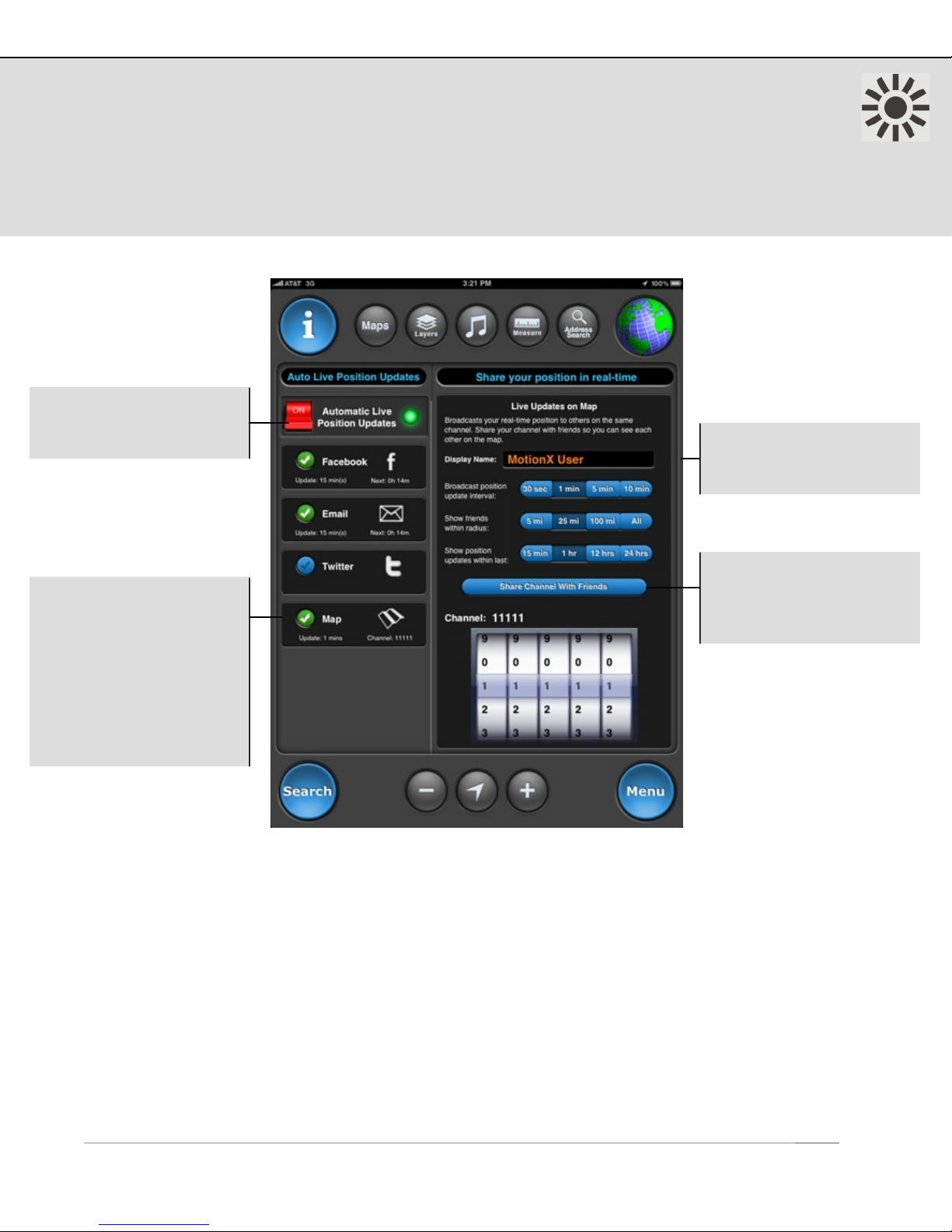
6. Auto Live Updates
Share your real-time position automatically via Facebook, Twitter, email, or displayed
on the maps of friends using MotionX-GPS HD. Auto Live Position Updates will run (GPS
chipset remains active) when MotionX-GPS HD is backgrounded if Setup > Multitasking
is set to either Optimized or Always On. A data connection is required for this feature.
1 Auto Live Map Updates Setup:
• Edit your display name so your friends can identify you (default is “MotionX User”)
• Define a 5-digit channel. Share your channel with friends who want to see your location.
• Define an interval for broadcasting your location (ranging from 30sec to 10min). Your friends’
latest known locations are updated at the interval they have selected.
• Select a radius within which you would like to display your friends’ locations.
• Select a time interval to display your friends’ last known position updates. Choosing 12 hours,
for example, will allow you to see their last position for 12 hours after their last update.
• Share your channel selection with friends via email.
• TapTap® a friend’s location sign on the Map to view the time of their last location update.
US and Foreign Patents Granted and Pending.Fullpower®, MotionX®, TapTap®, and ShakeShake® are registered trademarks of Fullpower Technologies, Inc.
All other trademarks remain the property of their respective owners. © Copyright 2003-2012 Fullpower Technologies, Inc. All rights reserved.10
On/Off: Enable or
disable Automatic Live
Position Updates.
Map: Share your real-
time position with friends
who are also using
MotionX-GPS. Go to the
Map page to see their
latest position update.
Your friends will see your
latest update on their
Map page. 1
Configure your live
updates sharing
preferences.1
Email friends or family
your channel setting and
link to follow you on a
browser-based map