manuals.online logo
Brands
  1. Home
  2. •
  3. Brands
  4. •
  5. Garmin
  6. •
  7. GPS
  8. •
  9. Garmin 3000 Series User manual

Garmin 3000 Series User manual

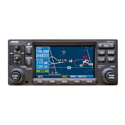
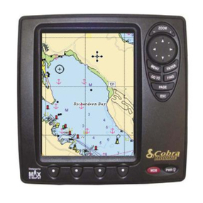
GPSMAP®3000 series
Garmin’s GPSMAP 3000 series
chartplotters deliver top-of-the-line
navigation and interface options along
with exceptional display quality.
Whether you choose the 6-inch
display or step up to the 10-inch,
you’ll get bold, sunlight-readable color.
These plotters also have configurable
display windows, 1 PC monitor output
and 2 video inputs, so you can keep an
eye on the stern or the engine room.
Both have an optional remote control.
For advanced capabilities, these plotters
have a built-in high-speed marine
network that can link additional displays
and remote sensors for weather, radar
and sonar data overlays.
Full-featured plotters show you the big picture
©
2004 Garmin Ltd. and its subsidiaries
Garmin International, Inc.
1200 East 151st Street
Olathe, Kansas 66062, U.S.A.
913/397.8200 fax 913/397.8282
Garmin (Europe) Ltd.
Unit 5, The Quadrangle
Abbey Park Industrial Estate
Romsey, SO51 9DL, U.K.
44/1794.519944 fax 44/1794.519222
Garmin Corporation
No. 68, Jangshu 2nd Rd.
Shijr, Taipei County, Taiwan
886/2.2642.9199 fax 886/2.2642.9099
www.garmin.com
Specifications are preliminary and subject to
change without notice.
*Subject to accuracy degradation to100m
2DRMS under the U.S. Department of
Defense Selective Availability Program.
REV1104 M01-10173-00
Navigation features
Waypoints/icons: 4000 with name, symbol and comment,
with support for proximity waypoints
Routes: 50 reversible routes with up to 300 points
each, plus MOB and TracBack
®
modes
Track log: 10,000 point automatic track log, with
15 saved tracks, 700 points per saved
track, lets you retrace your path in
both directions
Alarms: Anchor drag, arrival, off course, shallow
water, proximity waypoint, deep water,
clock and battery
Tables: Built-in celestial tables, with sun
and moon rise, set and location;
tide tables for the U.S.
Map datums: More than 100, plus user datum
Position format: Lat/Lon, UTM/UPS, Loran TDs and
other grids, including user grid
Languages: 10 (with software update)
GPS performance (with GPS 17HVS)
Receiver: WAAS enabled, 12 parallel channel GPS
receiver continuously tracks and uses up
to 12 satellites to compute and update
your position
Acquisition times:
Warm: Approximately 15 seconds
Cold: Approximately 45 seconds
AutoLocate™:Approximately 5 minutes
Update rate: 1/second, continuous
GPS accuracy:
Position: < 15 meters, 95% typical*
Velocity: 0.05 meter/sec steady state
DGPS (WAAS) accuracy:
Position: < 3 meters, 95% typical
Velocity: 0.05 meter/sec steady state
Dynamics: 6 g’s
Interfaces: 3 data ports allow for NMEA 0183
and proprietary Garmin
2 composite video inputs
1 VGA PC monitor output
Moving map features
Basemap: Built-in worldwide marine basemap with
coastlines, rivers, lakes, political
boundaries, tide data for the U.S.,
cities and interstates
Data cartridges: User-programmable or preprogrammed
data card containing detailed
BlueChart™marine cartography
Plotting scales: 20 ft. to 800 nm with dedicated
push-button zoom control
Power
Source: 10-35v DC
Usage: 3006C = 25 watts max. at 10v DC
3010C = 25 watts max. at 10v DC
Physical
Size: 3006C = 10.25"W x 6.5"H x 3.25"D
3010C = 13.1"W x 8.8"H x 3.25"D
Weight: 3006C = 3.2 lbs. (1.5 kg)
3010C = 4.5 lbs. (2.1 kg)
Display: 3006C = 6.4" diagonal (16.3 cm)
high-resolution, 256 colors with
backlighting (640 x 480 pixels)
3010C = 10.4" diagonal (26.4 cm)
high-resolution, 256 colors with
backlighting (640 x 480 pixels)
Case: Fully gasketed, high-impact plastic alloy,
waterproof to IEC 60529 IPX7 standards
Temperature range: 5˚ F to 122˚ F (-15˚ C to 50˚ C)
Accessories Infra red remote control
Standard: GPS 17 external remote sensor
Power/data cable
Bail mount
Template for flush mounting
Protective front cover
Owner’s manual
Quick reference guide
Audio/video cable
Optional: Blank or preprogrammed data cards
with BlueChart™marine cartography
USB data card programmer
Second mounting station
MapSource™CDs:
NEXRAD Radar with precipitation
type (animated, high resolution)
Wind speed and direction
GPSMAP®3000 series
Garmin Marine Network
GA 31 GPS 17GDL 30/30A
GMS 10
GPSMAP 3010GPSMAP 3006GSD 20
Garmin Radar
available 2005
compatible

Other manuals for 3000 Series

1

This manual suits for next models

2

Other Garmin GPS manuals

Garmin GPSMAP 79S User manual

Garmin

Garmin GPSMAP 79S User manual

Garmin GPSMAP 400 series User manual

Garmin

Garmin GPSMAP 400 series User manual

Garmin GPSMAP 4000 Series User manual

Garmin

Garmin GPSMAP 4000 Series User manual

Garmin GPSMAP 8400 series Instruction manual

Garmin

Garmin GPSMAP 8400 series Instruction manual

Garmin Cessna Caravan G1000 User manual

Garmin

Garmin Cessna Caravan G1000 User manual

Garmin Montana 600 Instruction manual

Garmin

Garmin Montana 600 Instruction manual

Garmin Cessna Caravan G1000 User manual

Garmin

Garmin Cessna Caravan G1000 User manual

Garmin GPSMAP 640 User manual

Garmin

Garmin GPSMAP 640 User manual

Garmin Cessna Caravan G1000 Manual

Garmin

Garmin Cessna Caravan G1000 Manual

Garmin GPSMAP 525s - Marine Chartplotter Reference guide

Garmin

Garmin GPSMAP 525s - Marine Chartplotter Reference guide

Garmin eTrex Vista Cx eTrex Vista Cx hiking... User manual

Garmin

Garmin eTrex Vista Cx eTrex Vista Cx hiking... User manual

Garmin Nuvi 465 User manual
Garmin

Garmin Nuvi 465 User manual

Garmin 796 User manual

Garmin

Garmin 796 User manual

Garmin APPROACH G80 Instruction manual

Garmin

Garmin APPROACH G80 Instruction manual

Garmin nuvi 350 User manual

Garmin

Garmin nuvi 350 User manual

Garmin GPS 400W User manual

Garmin

Garmin GPS 400W User manual

Garmin GPSMAP 420 User manual

Garmin

Garmin GPSMAP 420 User manual

Garmin Gpsmap 430 - marine gps receiver Assembly instructions

Garmin

Garmin Gpsmap 430 - marine gps receiver Assembly instructions

Garmin NUVI User manual

Garmin

Garmin NUVI User manual

Garmin 1620 User manual

Garmin

Garmin 1620 User manual

Garmin GPSMAP 7400 Series User manual

Garmin

Garmin GPSMAP 7400 Series User manual

Garmin eTrex - Hiking GPS Receiver User manual

Garmin

Garmin eTrex - Hiking GPS Receiver User manual

Garmin 276Cx User manual

Garmin

Garmin 276Cx User manual

Garmin G1000 NXi Owner's manual

Garmin

Garmin G1000 NXi Owner's manual

Popular GPS manuals by other brands

Alpine Blackbird PMD-B200P owner's manual

Alpine

Alpine Blackbird PMD-B200P owner's manual

Saab R4 Short Instruction guide

Saab

Saab R4 Short Instruction guide

Race Navigator RN ONE user manual

Race Navigator

Race Navigator RN ONE user manual

MOKO LW004-CT Product introduction

MOKO

MOKO LW004-CT Product introduction

UsGlobalSat BC-307 user manual

UsGlobalSat

UsGlobalSat BC-307 user manual

Nextar MN2607 Update instructions

Nextar

Nextar MN2607 Update instructions

EDIATec ECW100 operating manual

EDIATec

EDIATec ECW100 operating manual

Bad Elf BE-GPS-2200 Guide

Bad Elf

Bad Elf BE-GPS-2200 Guide

GlobalTop GPS-G66 user manual

GlobalTop

GlobalTop GPS-G66 user manual

ORBCOMM CT 3000 installation guide

ORBCOMM

ORBCOMM CT 3000 installation guide

Rope M588L user manual

Rope

Rope M588L user manual

Canon iP4700 - PIXMA Color Inkjet Printer On-screen manual

Canon

Canon iP4700 - PIXMA Color Inkjet Printer On-screen manual

Fujitsu eclipse installation manual

Fujitsu

Fujitsu eclipse installation manual

THOMSON GPS 420 user guide

THOMSON

THOMSON GPS 420 user guide

Brodit 215267 Mounting instruction

Brodit

Brodit 215267 Mounting instruction

Racelogic LabSat 3 quick start guide

Racelogic

Racelogic LabSat 3 quick start guide

I-gotU GT-1800A manual

I-gotU

I-gotU GT-1800A manual

Agilion WIRELESS TAG ASSET PULSE PHASE user manual

Agilion

Agilion WIRELESS TAG ASSET PULSE PHASE user manual

manuals.online logo
manuals.online logoBrands
  • About & Mission
  • Contact us
  • Privacy Policy
  • Terms and Conditions

Copyright 2025 Manuals.Online. All Rights Reserved.