manuals.online logo
Brands
  1. Home
  2. •
  3. Brands
  4. •
  5. Humminbird
  6. •
  7. Software
  8. •
  9. Humminbird Platinum cartography User manual

Humminbird Platinum cartography User manual

Platinum™ Cartography
Accessory Manual
Platinum™ Cartography
Accessory Manual
Platinum™Cartography
Thank You!
Thank you for choosing Humminbird®, America's #1 name in fishfinders. Humminbird® has built its reputation by designing and manufacturing top-quality,
thoroughly reliable marine equipment. Your Humminbird® is designed for trouble-free use in even the harshest marine environment. In the unlikely event that
your Humminbird® does require repairs, we offer an exclusive Service Policy - free of charge during the first year after purchase, and available at a reasonable
rate after the one-year period. For complete details, see the separate warranty card included with your accessory. We encourage you to read this operations
manual carefully in order to get full benefit from all the features and applications of your Humminbird® product.
Contact our Customer Resource Center at either
1-800-633-1468
or visit our website at
www.humminbird.com
.
WARNING! Th s dev ce should not be used as a nav gat onal a d to prevent coll s on, ground ng, boat damage, or personal njury. When the boat s mov ng, water depth may
change too qu ckly to allow t me for you to react. Always operate the boat at very slow speeds f you suspect shallow water or submerged objects.
CAUTION: Plat num™ Cartography s des gned to supplement the use of author zed government charts, not be used nstead of them. You should use off c al government
charts for the most up to date nformat on to ensure safe nav gat on.
Platinum™ Cartography is a registered trademark of Navionics®.
800 Series™, 900 Series™, 1100 Series™, Cannon®, Cannon ink™, Humminbird®, HumminbirdPC™, Inter ink™, X-Press™ Menu, Structure ID®, SmartCast®, UniMap™ and WeatherSense® are
trademarked by or registered trademarks of Humminbird®.
© 2010 Humminbird®, Eufaula A , USA. All rights reserved.
i
Table of Contents
ii
How Platinum™ Cartography Works 1
Multi-Media Card (MMC)/SD Slot 2
Software Updates .................................................................................................... 2
Additional Platinum™ Cartography Key Fun tions 3
VIEW Key .................................................................................................................. 3
MENU Key ................................................................................................................ 3
4-WAY Cursor Control Key ...................................................................................... 4
EXIT Key .................................................................................................................... 4
INFO Key .................................................................................................................. 5
GOTO Key .................................................................................................................. 5
ZOOM [+/-] Keys ...................................................................................................... 6
Views 6
Chart/Pilot Book Combo View ................................................................................ 7
How to Use the Pilot Book ...................................................................................... 8
Moving Through the Pilot Book .............................................................................. 8
Bird’s Eye View........................................................................................................ 11
Chart View .............................................................................................................. 13
Nearest Port and Chart Information...................................................................... 14
How Platinum™ Cartography Affe ts The Menu System 15
Navigation X-Press™ Menu Platinum™ Cartography Addition
(Navigation Views only) 16
Overlay Transparency
(only n Nav gat on V ews when Chart Aer al Overlay s v s ble)
...... 16
Exaggeration
(only n Nav gat on V ews, 1100 Ser es™ models only)
................................ 16
Chart Menu Tab Platinum™ Cartography Additions 17
Chart Detail evel .................................................................................................. 17
Map Borders............................................................................................................ 18
Platinum™ Menu Tab (only with Platinum Cartography MMC/SD card) 19
Chart Aerial Overlay .............................................................................................. 19
3D Aerial Overlay .................................................................................................... 19
Platinum 3D ............................................................................................................ 19
Troubleshooting 20
Fishing System Doesn’t Power Up ........................................................................ 20
Fishing System Defaults to Simulator with a Transducer Attached .................. 20
Display Problems .................................................................................................... 21
Finding the Cause of Noise .................................................................................. 22
Humminbird® A essories 23
Glossary 24
Conta t Humminbird® 30
531598-2EN_E
How Platinum™Cartography Works
Platinum™Cartography is only available in the 858c, 898c, 955c, 957c, 958c,
967c, 997c, 998c and 1100 Series™models if you have an optional-purchase
Navionics®Platinum™Cartography MMC/SD card installed. Platinum™
Cartography provides:
• a photographic overlay on certain views,
• additional icons for ports and other landmarks,
• pilot books that provide commentary from captains for certain ports,
• panoramic photos of some ports (such as marinas), and
• 3D Platinum™Cartography.
3D Platinum™Cartography displays a 3 dimensional rendered view of both
the water where you are navigating and the ports and land masses in the
area surrounding the boat's position. Land is shown in varying shades of
yellow, with the color changes indicating the relative height above sea level.
Water and submerged objects are shown in varying shades of blue, with the
color changes indicating the relative depth.
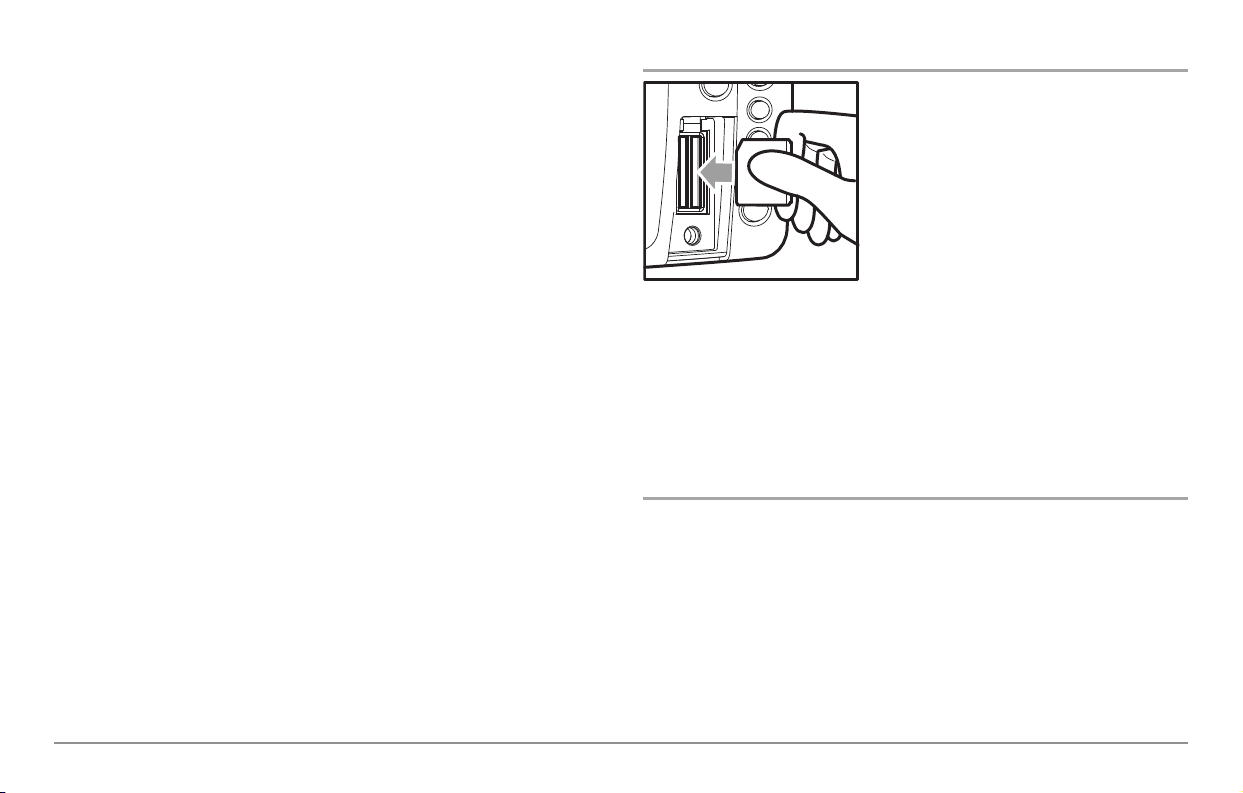
NO E: If you cannot see any Platinum™information, the MMC/ D card installed
in your control head may not have any Platinum™data for the area you are
viewing. In this case, zoom out far enough to see the dotted gridlines on the
Bird’s Eye View, which indicate areas where 3D data is available. Then, using the
4-WAY Cursor Control key, move into the center of the dotted gridlines, and press
the Zoom + key to zoom in again. ee Bird’s Eye View for more information.
NO E: It may take a moment for the Platinum™information to load.
The user interface will change to show the following Platinum™Cartography
features when you install a Navionics®Platinum™Cartography MMC/SD card:
• A new Platinum™main menu tab will appear that contains the Chart
Aerial Overlay, 3D Aerial Overlay, and Platinum 3D menu choices;
• The Chart/Pilot Book View is added to the Views Menu, and to the
views rotation after the Chart View (The Chart/Pilot Book View is
hidden by default);
• The Bird’s Eye View changes to show charts loaded with 3D
representations for a new 3D Bird’s Eye View that has the following
added functionality:
- The zoom level will affect how much space is taken up in the view
and how much white space is shown.
- Platinum™Navaids (navigational aids) are displayed as long as the
Chart Detail Level is set to Navigation or higher.
- An aerial photo overlay is shown on the 3D representation of the
Bird's Eye View.
NO E: You must be zoomed in enough, but not too close, to be able to see the
3D overlay.
• Chart views will display Navionics®Platinum™items, depending on the
Chart Detail level set; when All is selected, all of the Platinum™icons
that are available on a particular part of the map will be displayed.
- When Chart Aerial Overlay is set to Visible on the Platinum™Main
Menu, you'll see a photo on top of your chart, and the Overlay
Transparency X-Press™Menu that allows you to adjust the
transparency via a slider will be added to the Chart views.
1
• INFO key functionality:
- Port Info has new functionality. The following three selections come
up as a submenu:
Port Information
Pilot Book
(see
How to Use the Pilot Book
for more information)
Panoramic Photo:
(see
Nearest Port and Chart Information
for more
information)
NO E: Each selection is displayed only if it is actually available for the port, and
if only one selection is available, it is displayed without any submenu selection.
NO E: Choosing any of these options cursors to the item of interest.
Multi-Media Card (MMC)/SD Slot
Your Humminbird®Fishing System also has a
multi-media card (MMC)/SD slot that is used
to insert optional-purchase cards containing
additional detailed maps. If you insert an
MMC/SD that contains a more detailed
chart for a particular location, your
Humminbird®Fishing System will retrieve
that chart and display it automatically. Use
the illustration to locate the position of the
MMC/SD slot cover, remove the MMC/SD
slot cover, then insert the MMC/SD into the
slot. The label on the MMC/SD should face toward the left side of the unit.
Press down on the card until it clicks into place and replace the slot cover.
Then, replace and tighten snugly - do NOT overtighten, as this will not
improve water resistance, and may damage the cover.
Software Updates
Use the MMC/SD slot to update the software version of your control head.
To update the software in your control head, plug in the appropriate
MMC/SD card that contains a software update file; the unit will recognize it,
will tell you what software version your control head is currently running,
and will ask you if you want to update the software in the unit to match that
on the MMC/SD card. You can obtain software updates from the
www.humminbird.com
website.
Inserting an MMC/SD
into the Card Slot
2
Additional Platinum™Cartography Key Functions
Your user interface consists of a set of easy-to-use keys that work with
various on-screen views and menus to give you flexibility and control over
your fishing experience. Your control head operations manual contains full
descriptions of the functions of these keys, but the following keys have
additional Platinum™Cartography functionality when a Platinum™
Cartography MMC/SD card is installed:
• VIEW key
• MENU key
• 4-WAY Cursor Control key
• EXIT key
• INFO key
• OTO key
• ZOOM [+/-] keys.
VIEW Key
The VIEW key is used to cycle through all available views.
Press the VIEW key to advance to the next view. Repeatedly
pressing VIEW cycles through all views available. Views can be hidden to
optimize the system to your fishing requirements.
• When you have the Platinum™MMD/SD card installed, the view
rotation will include the Chart/Pilot Book View.
NO E: Use the Views tab under the Main Menu to change each view to Hidden
or Visible.
MENU Key
The MENU key is used to access the menu system.
X-Press™Menu -
Press the MENU key once for the X-Press™Menu. The
X-Press™Menu displays the new Overlay Transparency Platinum™X-Press™
Menu choice in any of the Chart navigation views when Chart Aerial Overlay
is set to Visible. See
Navigation X-Press™Platinum™Cartography Additions:
Overlay ransparency (only in Navigation Views when Chart Aerial Overlay
is visible)
for more information.
Main Menu -
Press the MENU key twice for the tabbed Main Menu System.
The Main Menu System is organized under tabbed headings to help you find a
specific menu item quickly: Alarms, Sonar, Navigation, Chart, Setup, Views,
Accessories, and Platinum™tabs are part of your tabbed Main Menu System.
3
4-WAY Cursor Control Key
The 4-WAY Cursor Control key has multiple Platinum™
Cartography functions, depending on the situation:
Pilot Book Selection -
Use the 4-WAY Cursor Control keys to select a
port icon (shown as a sailboat within a white square), then press the
INFO key to display the Port Info menu. When a pilot book is
available, you can use the 4-WAY Cursor Control keys to select a pilot book,
then use the 4-WAY Cursor Control keys to navigate through the pilot book,
in combination with the OTO key. See
How to Use the Pilot Book
for more
information.
NO E: You can also view the pilot book by pressing the VIEW key until the
Chart/Pilot Book View appears.
Change 3D Perspective -
Use any arrow key to change the perspective in the
3D Bird's Eye View. Subsequent presses of arrow keys rotate and tilt the 3D
representation.
EXI Key
The EXIT key has one function specific to Platinum™
Cartography:
• If you are viewing a panoramic photo in a Bird's Eye or Chart view,
pressing EXIT will exit the panoramic photo and return you to the
normal view with the cursor active.
4
INFO Key
Press the INFO key while in any navigation view
to display information about objects that are
nearest to an active cursor.
NO E: You can use the INFO key to obtain extra information about specific
Navionics®icons.
NO E: Your control head will have one of the keys shown here. Both keys
function in the same way.
Chart Info menu:
If the cursor is not active, pressing the INFO key
will highlight the Chart Info menu. Use the 4-WAY
Cursor Control key to highlight Nearest Port,
Nearest Tide Station or Nearest Current Station,
then use the RI HT Cursor key to display the
requested information.
Port Info menu:
If the cursor is active, pressing the INFO key will
display the Port Info menu. From the Chart Info menu,
if you choose Nearest Port using the 4-WAY Cursor
Control keys, the Port Info menu will also be
displayed. Use the 4-WAY Cursor Control key to
highlight Port Information, Pilot Book or Panoramic
Photo (some of these may not be present, depending on what is actually available
for the map at this location), then use the RI HT Cursor key to display the
requested information.
NO E: Not all menu choices will be displayed, as they are dependent on what
information is available from your MMC/ D card at that point in the map.
NO E: The built-in UniMap™does not contain Port, Tide or Current information.
This information is only available from optional purchase MMC/ D cards.
NO E: If a Chart Information text box appears instead of one of the Info menus,
this means that there is no additional pilot book or panoramic photo information
available near your cursor's location.
GO O Key
The OTO key has additional Platinum™Cartography
functionality in the pilot book, where it is used to move from
screen to screen in the pilot book hierarchy. See the
Chart/Pilot Book View
section for more information.
5
ZOOM (+/-) Keys
Press the - or + ZOOM keys while in any of the Navigation
Views or the Sonar Zoom View to change the scale of the view
to appear closer or farther away.
NOTE: Plat num™nformat on, such as a 3D or photograph c overlay,
w ll not be d splayed f you are zoomed out too far, or zoomed n too
far. Use the ZOOM keys to adjust your perspect ve unt l you can see
the Plat num™nformat on.
Views
Chart/Pilot Book Combo View will be added to the
View Rotation when a Platinum™Cartography
Multi-Media Card (MMC)/SD Card is installed in
the Fishing System. In addition, the following views
will have additional Platinum™Cartography features
added to them:
New P atinum™ Cartography View:
• Chart/Pilot Book Combo View
Navigation Views Affected by P atinum™ Cartography:
• Bird's Eye View
• Chart Views
Sonar
Views
Track
View
Combo
View
Bird's
Eye
View
6
Chart/Pilot Book Combo View
The pilot book is a collection of captain's log entries, displayed in book form,
that is associated with certain ports. Chart/Pilot Book Combo View shows
both the Chart and Pilot Book views in a combination split screen. You can
perform any of the functions for either of these views, but only when the
view you want to control is selected as the active side.
NO E: Press the MENU key once to access the Navigation X-Press™Menu, and
using the 4-WAY Cursor Control Key, change the Active ide of the Combo View
to right or left.
NO E: The Chart/Pilot Book Combo View defaults to Hidden; you must make it
Visible using the Chart/Pilot Book View menu on the Views Main Menu tab.
However, if you select Pilot Book from the Port Info menu, you will be taken to
the Chart/Pilot Book Combo View automatically, regardless of how the view is set
to display. ee View Main Menu and Nearest Port and Chart Information for
more information.
NO E: ee Chart View for more information about the Chart side of this view.
When you select Pilot Book from the Nearest Port submenu, or from the
selected port if your cursor is active, the pilot book will open to the selected
port on the Chart/Pilot Book Combo View. If you then change to a different
view on the view rotation (using the VIEW key), then re-display the
Chart/Pilot Book Combo View, the pilot book will remain open to the last
page displayed until you power down the unit. If you have not yet selected
a port when you go to the Chart/Pilot Book Combo View in the view rotation,
the pilot book will open to the pilot book index. See
Moving hrough the
Pilot Book
for more information.
Chart/Pilot Book Combo View
Use the UP and DOWN 4-WAY Cursor Control
Keys to scroll up and down in the display
Highlighting the Home icon and then pressing
the GOTO Key takes you back a level - this icon
is inactive if you are in the Pilot Book Index.
13
Highlighting the left arrow icon and pressing
the GOTO Key takes you to the previous page. Highlighting the right arrow icon and pressing
the GOTO Key takes you to the next page.
24
1
24
3
7
How to Use the Pilot Book
There are three ways to access the pilot book:
The first way is to press the INFO key with the
cursor inactive anywhere on the Bird's Eye or
Chart View in order to display the Chart Info
menu, then select Nearest Port to view the Port
Info Submenu and choose Pilot Book.
NO E: The Chart Info menu is available when the
cursor is inactive or in Bird's Eye View.
The second way to access the pilot book is to use the
4-WAY Cursor Control keys to move directly over the
desired port (which will have a port icon indicating
port information) and press the INFO key to view the
Port submenu, then choose Pilot Book.
NO E: The Port Info ubmenu is available when
the cursor is active and over a port icon on a
chart view.
When you select Pilot Book from either of these submenus, the view
changes to the Chart/Pilot Book Combo View. If this view is hidden in the
view rotation, it will automatically be made visible when you select Pilot
Book from either of the submenus, and will remain visible until you remove
the Platinum™Cartography MMC/SD card or hide the Chart/Pilot Book
Combo View using the View main menu tab (see your Fishing System
Operations Manual for more information).
The third way is to make sure that Chart/Pilot Book View is turned to Visible
using the View Main Menu, then rotate to it using the VIEW key.
NO E: If the Chart Information text box appears, a pilot book might not be
available. Check your cursor position first. Unless you are in the Chart/Pilot Book
Combo View, you must have your cursor positioned inside one of the Platinum™
map borders, and directly over a port that has a pilot book associated with it, to
view a pilot book.
Moving Through the Pilot Book
Use the UP and DOWN arrows on the 4-WAY Cursor Control keys to scroll up
and down in the pilot book index. The scroll bar will indicate your position.
Use the LEFT or RI HT arrows on the 4-WAY Cursor Control keys to move the
highlight to different items. To activate a highlighted selection, press the
OTO key.
As you scroll up or down, the first item to appear on the new page of the
pilot book will be automatically highlighted.
Highlight the previous or next arrows at the bottom of the screen and press
the OTO key to move to another page in the pilot book.
When you highlight the Home icon and press the OTO key, the page that is
the next level up in the hierarchy will be displayed (this may be the Index page).
If you try to move past the available choices, an error beep will sound.
Port Info Sub-menu
Chart Info Menu
8
The pilot book is divided into the following categories:
Index:
Displays the various pilot books available for this map.
1. When you are viewing a pilot book, and are at the top level (the
index), you can scroll through the index using the UP and DOWN
4-WAY Cursor Control keys.
2. Use the LEFT or RI HT 4-WAY Cursor keys to highlight items in the
list of books available, then press the OTO key to move into the
Table of Contents for the selected pilot book.
Chapter Table of Contents:
Displays the chapters available in the selected
pilot book.
1. Use the 4-WAY Cursor Control keys to move through this Table of
Contents and to select a particular chapter for viewing.
2. If you continue to press the LEFT or RI HT 4-WAY Cursor Control
keys, and highlight the Home icon at the bottom of the screen, you
may press the OTO key to move back to the pilot book index.
Pilot Book Chapter Table of Contents
Pilot Book Index
9
Heading Table of Contents:
Displays the headings available in the selected
chapter.
1. Use the 4-WAY Cursor Control keys to move through this Table of
Contents and to select a particular heading for viewing.
2. If you continue to press the LEFT or RI HT 4-WAY Cursor Control
keys, and highlight the Home icon at the bottom of the screen, you
may press the OTO key to move back a level to the Chapter Table
of Contents.
Page View:
Displays the actual pages of the selected heading in the chapter
of the pilot book.
1. Use the UP and DOWN 4-WAY Cursor Control keys to scroll up and
down within the first page, or use the LEFT or RI HT 4-WAY Cursor
Control keys to highlight the previous or next arrows at the bottom
of the page, then press the OTO key to advance to another page.
2. If you continue to press the LEFT or RI HT 4-WAY Cursor Control
keys, and highlight the Home icon at the bottom of the screen, you
may press the OTO key to move back to the Heading Table of
Contents.
Pilot Book Page ViewPilot Book Heading Table of Contents
10
Bird’s Eye View
Bird's Eye View -
This view shows a 3D, perspective view of the track from
a point above and behind the boat (the eye point). As the boat turns, the eye
point moves to follow the boat.
When you press the 4-WAY Cursor key in the Bird’s Eye View, the position of
the eye point will shift. This allows you to move and turn the eye point so
that you can look off to the sides, or even behind the boat. Pressing the
RI HT or LEFT arrow keys on the 4-WAY Cursor key turns the eye point right
or left, while pressing the UP arrow key moves the eye point forward, and
pressing the DOWN arrow key moves the eye point backward.
Pressing the EXIT key moves the eye point back to its original position behind
and above the boat.
You can use the INFO key to get information on the objects near the boat.
See
Nearest Port and Chart Information
for more information.
3D View:
Once Platinum™Cartography is added to your Fishing System, the
Bird's Eye View changes to a 3D View. When you are zoomed out, it will
appear as if you are in normal Bird's Eye View. Press the Zoom + key to see
the view in 3D.
Photographic Overlay:
Once Platinum™Cartography is added to your Fishing
System, and 3D Aerial Overlay is set to Visible using the Platinum™
Main Menu, the Bird's Eye View changes to show a photographic overlay.
When you are zoomed out, it will appear as if you are in normal Bird's Eye
View. Press the Zoom + key to zoom in and view the photographic data
(when photographic data is available in the map).
NO E: Platinum™information, such as a 3D overlay or photographic data, will not
be displayed if you are zoomed out too far, or zoomed in too far. Use the ZOOM
keys to adjust your perspective until you can see the Platinum™information.
See
Platinum™Menu ab: 3D Aerial Overlay
for more information.
Platinum™gridlines will only be displayed appropriately on the Bird's Eye
View if Map Borders is set to MMC/SD Only or All Visible. See
Chart Menu
ab; Platinum™Cartography Additions: Map Borders
for more information.
NO E: The entire view may not be completely filled up with information,
depending on the zoom level.
Bird’s Eye View, Showing 3D and Photographic Data and avaids
Depth peed of Boat
14
Course: Direction that boat is traveling
relative to North Reference
Land Contours
25
Boat Icon
1
2
4
5
6
3
6
Latitude and Longitude Position of Boat
3
11
Bird's Eye View Zoomed In Too Far - o 3D or Photographic Data Visible
Depth peed of Boat
14
Course: Direction that boat is traveling
relative to North Reference
Boat Icon
25
1
2
4
5
3
Latitude and Longitude Position of Boat
3
Bird's Eye View Zoomed Out Too Far - o 3D or Photographic Data Visible
Depth peed of Boat
14
Course: Direction that boat is traveling
relative to North Reference
Land Contours
25
Boat Icon
1
2
4
5
6
3
6
3D Data Gridlines
7
Latitude and Longitude Position of Boat
3
7
12
Chart View
Chart View
shows cartography from the built-in UniMap™or an optional
MMC/SD map for the area surrounding your current position. The current
track (also known as the position history or breadcrumb trail) showing where
the boat has been, along with saved tracks, waypoints, and the current
route (when navigating), are overlaid on the chart.
You can use the 4-WAY Cursor Control key to shift/pan the chart to another area.
You can use the ZOOM (+/-) keys to zoom in and out.
You can use the INFO key to get information on the chart objects near the cursor.
Photographic Overlay:
Once Platinum™Cartography is added to your Fishing
System, and Chart Aerial Overlay is set to Visible using the Platinum™Main
Menu, the Chart View changes to show a photographic overlay. When you are
zoomed out, it will appear as if you are in normal Chart View. Press the Zoom +
key to zoom in and view the photographic data (when photographic data is
available in the map).
See
Platinum™Menu ab: Chart Aerial Overlay
and
Navigation X-Press™
Menu; Platinum™Cartography Addition: Overlay ransparency
for more
information.
In addition, the Chart View will display Platinum™Cartography data and
icons if Chart Detail Level is set to All.
Map borders will only be displayed appropriately on the Chart View for
Platinum™Cartography if Map Borders is set to MMC/SD Only or All Visible.
See
Chart Menu ab; Platinum™Cartography Additions: Map Borders
for
more information. See
Chart Menu ab; Platinum™Cartography Additions:
Chart Detail Level
and
Nearest Port and Chart Information
for more
information.
Chart View
Depth Cartography
14
Course: Direction that boat is traveling
relative to North Reference. Boat Icon
25
Map cale
3
1
2
3
4
5
13
Nearest Port and Chart Information
Platinum™Cartography provides additional information when you press the
INFO key on a part of the Bird's Eye or Chart Views that contains Platinum™
information. Whether the cursor is active or inactive will determine exactly
what you see, as well as whether there are pilot books or panoramic photos
available for your specific location.
Pressing the INFO key when the cursor is not active
displays the Chart Info menu, which in turn allows
you to select Nearest Port. Nearest Port has
additional Platinum™Cartography functionality (Port
Information, Pilot Book, and Panoramic Photo) when
that information is available for the port:
• If you select Pilot Book from this submenu, the
Chart View changes to a new view, the Chart/Pilot
Book Combo View. See
Chart/Pilot Book Combo
View
for more information.
• If you select Panoramic Photo, a new window will
be displayed that is similar to the Tide Station Box,
that covers the width of the screen, but not the
readouts. Pressing EXIT removes the panoramic
photo image from the screen and returns you to the
Chart View with the cursor active.
When you press the INFO key when the cursor is active, you will see the
same choices, but without the Nearest Port submenu.
NO E: If no pilot book or panoramic photos exist for your location, only the Chart
Info data window will be displayed.
Chart Info Data Window
Panoramic Photo
earest Port Submenu:
Panoramic Photo
earest Port Submenu
Chart Info Menu
14
How Platinum™Cartography Affects he Menu System
The menu system is divided into easy-to-use menu modules. The components
of the menu system that are affected by Platinum™Cartography are:
X-Press Menu -
When a Platinum™Cartography
MMC/SD card is installed, the X-Press™Menu will
change to include the following menu item
(depending on the view you are in): Overlay
Transparency. See the
Navigation X-Press™Menu;
Platinum™Cartography Addition (Navigation
Views only)
for more information.
Main Menu Tabs -
When a Platinum™Cartography
MMC/SD card is installed, the following tab
headings will appear: Alarms, Sonar, Navigation,
Chart, Set Up, Views, Accessories, and Platinum™.
NO E: ee your Fishing ystem Operations Manual
for information on the full menu choices.
Main Menu System
ormal User Mode
X-Press™Menu
15
Navigation X-Press™Menu
Platinum™Cartography Addition
(Navigation View only)
The Navigation X-Press™Menu provides access to
the settings most frequently used. Press the
MENU key once while in the Bird's Eye View, the
Chart View, or the Chart/Pilot Book Combo View,
to access the Navigation X-Press™Menu.
NO E: Menu choices will vary depending on system
settings, such as whether you are currently
navigating, as well as what model you have.
The Navigation X-Press™Menu will be added to
the menu system when a PS is connected to the
Fishing System. When a Platinum™Cartography
MMC/SD card is also installed, the following
Platinum™-specific choice is added to the
Navigation X-Press Menu:
• Overlay Transparency (only in Navigation
Views when Chart Aerial Photo is visible).
Overlay ransparency
(only in Navigation View when
Chart Aerial Overlay i vi ible)
Overlay Transparency
allows you to change the transparency of the chart
aerial photo overlay when it is visible. When the Overlay Transparency is set
to 0%, the overlay will be completely opaque. When the Overlay
Transparency is set to 100%, the overlay will be completely invisible. (See
Platinum™Main Menu ab: Chart Aerial Overlay
for more information).
To change the transparency of the chart aerial overlay:
1. Highlight Overlay Transparency on the Navigation X-Press™Menu.
2. Use the RI HT 4-Way Cursor Control key to change the transparency
of the overlay. (0% - 100%, Default = 30%)
Exaggeration
(Navigation View , 1100 Serie ™model only)
Exaggeration allows you to stretch the highs and lows on the 3D view so
that hills and mountains look taller, and valleys and depths look lower.
Exaggeration is only available for the 1100 Series™.
To change the setting of Exaggeration:
1. Highlight Exaggeration on the Navigation X-Press™Menu.
2. Use the RI HT 4-WAY Cursor Control key to change the exaggeration
setting. (0 - 10, Default = 0)
avigation X-Press™
Menu Affected By Platinum™
Cartography
16
Chart Menu ab
Platinum™Cartography Additions
Press the MENU key twice to access the Main
Menu System, then press the RI HT cursor key to
select the Chart tab.
NO E: Menu choices will vary depending on system
settings.
The Navigation Menu Tab will be added to the
menu system when a PS Receiver is connected
to your Fishing System. The following Chart menu
choices will have additional functionality when a
Platinum™Cartography MMC/SD card is also
installed:
• Chart Detail Level
• Map Borders
Chart Detail Level
Chart Detail Level
allows you to select how
much chart detail you want displayed on the
avigation
Views.
Basic
shows
land areas, ports, obstructions and restricted areas.
avigation
shows
navaids, landmarks, ferryways and navigation routes in addition to the
Basic
information.
Underwater
shows depth contours, fishing areas, underwater
wrecks, tides and currents in addition to the
Basic
and
avigation
information.
All
shows roads, buildings, railways, and other notations in
addition to the
Basic
,
avigation,
and
Underwater
information.
To change the Chart Detail Level setting:
1. Highlight Chart Detail Level on the Chart Main Menu.
2. Use the LEFT or RI HT 4-WAY Cursor Control keys to change the
Chart Detail Level setting. (Basic, Navigation, Underwater, All,
Default = All)
NO E: ome chart details are only available with optional-purchase MMC/ D cards.
If you have a Platinum™Cartography MMC/ D card installed, selecting All will add
all of the new business, wreck, road, and other Platinum™icons to the Chart views.
Chart Menu Tab
Affected by Platinum™
Cartography
17

Other manuals for Platinum cartography

1

Other Humminbird Software manuals

Humminbird waypoint User manual

Humminbird

Humminbird waypoint User manual

Humminbird AS CR Quick start guide

Humminbird

Humminbird AS CR Quick start guide

Popular Software manuals by other brands

Alphasmart NEO2 SmartApplet user guide

Alphasmart

Alphasmart NEO2 SmartApplet user guide

ArcSoft VIDEO IMPRESSION 1.5 manual

ArcSoft

ArcSoft VIDEO IMPRESSION 1.5 manual

F-SECURE MOBILE SECURITY 3.1 FOR S60 user guide

F-SECURE

F-SECURE MOBILE SECURITY 3.1 FOR S60 user guide

IBM ZVM - FOR LINUX V6 RELEASE 1 Getting started

IBM

IBM ZVM - FOR LINUX V6 RELEASE 1 Getting started

HP Integrity BL860c installation guide

HP

HP Integrity BL860c installation guide

Colorbyte Software 2000/XP quick start guide

Colorbyte Software

Colorbyte Software 2000/XP quick start guide

Barco MediCal Pro Installation & user manual

Barco

Barco MediCal Pro Installation & user manual

3Com Network HotSync Handbook

3Com

3Com Network HotSync Handbook

VBrick Systems Portal Server ETV v4.2 user guide

VBrick Systems

VBrick Systems Portal Server ETV v4.2 user guide

Brother 2 user guide

Brother

Brother 2 user guide

Adobe 65029121 - Flash Media Streaming Server Developer's guide

Adobe

Adobe 65029121 - Flash Media Streaming Server Developer's guide

Canon HV20 - VIXIA Camcorder - 1080i instruction manual

Canon

Canon HV20 - VIXIA Camcorder - 1080i instruction manual

SilverFast OPTICFILM 7500I SE Guide rapide

SilverFast

SilverFast OPTICFILM 7500I SE Guide rapide

Netscape NETSCAPE MANAGEMENT SYSTEM 4.5 - PLUG-IN manual

Netscape

Netscape NETSCAPE MANAGEMENT SYSTEM 4.5 - PLUG-IN manual

Cabletron Systems SmartCell ZX-250 installation guide

Cabletron Systems

Cabletron Systems SmartCell ZX-250 installation guide

Digital Blue Digital Movie Creator 3.0 quick start guide

Digital Blue

Digital Blue Digital Movie Creator 3.0 quick start guide

AVG ANTI-VIRUS BUSINESS EDITION 9.0 - REV 90.6 user manual

AVG

AVG ANTI-VIRUS BUSINESS EDITION 9.0 - REV 90.6 user manual

Canon DC22 - 2.2MP DVD Camcorder instruction manual

Canon

Canon DC22 - 2.2MP DVD Camcorder instruction manual

manuals.online logo
manuals.online logoBrands
  • About & Mission
  • Contact us
  • Privacy Policy
  • Terms and Conditions

Copyright 2025 Manuals.Online. All Rights Reserved.