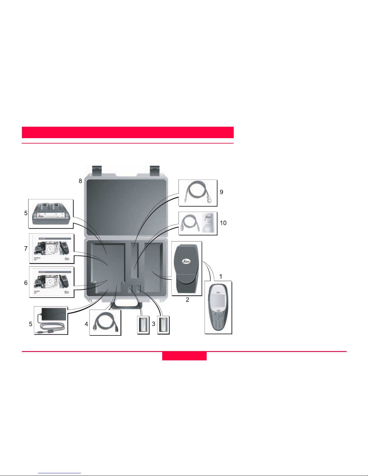
Description of the System
9
Leica Geosystems GS20 User Manual-1.0.0en
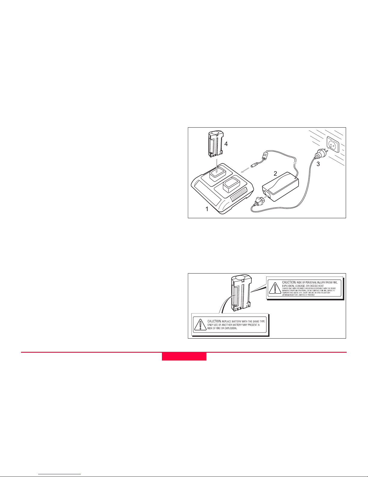
Charge the Batteries
Your Leica Geosystems GS20 is powered by a recharge-
able 7.2 V, Li-Ion battery.
Note that a new battery's full performance is achieved only
after two or three complete charge and discharge cycles.
The battery can be charged and discharged hundreds of
times but it will eventually wear out. When the operation
time is noticeably shorter than normal, it is time to buy a
new Leica Geosystems GEB90 Li-Ion Battery.
The Leica Geosystems GEB90 Li-Ion, 7.2 V, batteries may
be charged using the Leica Geosystems GKL24 Dual Bay
Battery Charger. Please find more information about your
Leica Geosystems Dual Bay Battery Charger in the GKL24
Chargers User Manual.
One batteries, fully charged, will power the GS20 for about
7 hours continuously. Operating times will be shorter when
working in cold weather.
CAUTION:
Replace Battery with the same type only. Use of an-
other Battery may present a risk of personal injury
from fire, explosion, leakage, or excess heat.
Precautions:
Use only the Leica Geosystems GEB90 Battery to power
the GS20 or WoRcs.
CAUTION:
Charge only with Leica Geosystems GKL24
Charger. Use of another charger may present risk of
personal injury from fire, explosion, leakage, or
excess heat.
Precautions:
When charging Leica Geosystems GEB90 Batteries make
sure to use only the Leica Geosystems GKL24 Charger.
CAUTION:
Never carry a Leica Geosystems GEB90 Battery
loose. It can be affected by temperature extremes,
accidental short circuit, shock and vibration. This
may present a risk of personal Injury from fire, explo-
sion, leakage or excess heat.
Precautions:
Always carry it in its case and secure it. When transporting
the Leica Geosystems GEB90 Battery by road vehicle, rail,
air or ship, always use the complete original packaging
(case and cardboard box), or its equivalent, to protect it
against temperature extremes, short circuit shock and
vibration.
CAUTION:
Do not dispose of battery in fire. Disposing in fire
may present a risk of personal injury from fire, explo-
sion, leakage, or excess heat.
Precautions:
Dispose Leica Geosystems GEB90 Batteries only
according to local regulations (e.g. recycling).