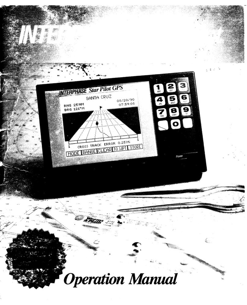
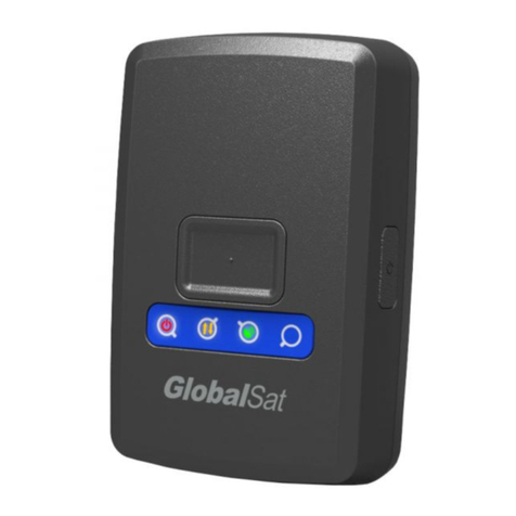
Interphase Star Pilot GPS User manual

*.4
'+:,=
..,
,.. .n+
'E':,,
{ffi
**
'!&'
t",
OperationMM

Tableof Contents
To Our Customer
Important Notice
Warranty Information
(ieneral
Information
UnitInstallation
DisplayUnit
PowerConnection
Antenna
Installation
Star
Pilot
GPS
Antenna
BasicOperation
Star
PilotKeyboarcl
Alpha-Numeric
Keys
Common
Sofikey
Functions
Power/Backl
ightControl
Getting
Started
TurningtheStarPilotOn
The
MenuScreen
What
Is
A Waypoint'l
Enterin-e
Waypoints
(
1)Position
Mode
Saving
Present
Positionina
Waypoint
(2)
PlotMode
Features
ofTrack
Plot
(3)
Navigate
Mode
(4)
Waypoint
Mode
Creating
Routes
(5)
Status
Mode
(6)
Set
Up Mode
TheBasicsof GPS
Advanced
NavigationGuide
GPS
Mocles
Navigational
Terms
Error Messages& Troubleshooting
Tips
GPS
HealthMessages
ErrorCodes
Specifications
How To ObtainService
Warranty
1
-t
+
-5
6
6
6
l
l8
8
IJ
ti
9
l0
l0
l0
ll
ll
12
12
la
l-)
13
l1
t6
l6
t8
19
20
2l
21
2l
22
22
22
.,)
:-'\
25
21

Overhead
GPS antenna/receiver
Antenna cable
Star
Pilot
GPSdisplal,unit
Power cable
UnitInstallation
Display
Unit
The compactsizeof theStar Pilot allows lor easyinstallation
in
most any boat.
To getmaximum perfbrmance
and lif-cfrom your unit.
thetollowing guidelinesshould
beconsidered
when selectinga
mounting
location:
l) Selecta locationwherethe unit isprotected
1}om
excessive
temperature.
Heat is oneof the worst enemiesof electronic
components.and will acceleratecomponent aging.thereby
reducing
thetrouble-freelif-eof your Star Pilot.
2) Mount thedisplay
in a locationwhereit will beconvenient
to
routethe
power andantennacables.
NOTE: An optional.in-dashmounting bracketis available
for
thc Star Pilot display unit.Contact
your nearbyAuthorized
Interphase Dealer or thc Interphase Accessories
Sales
Depart-
ment
(408)
427-4444.
Power
Connection
The
Star
Pilotrequires
a
power
sourcewith
a
voltagelevelfiom 10
to 16
VDC.
Low voltagemaycauseadimclisplay.reducedsignal.
weak
beeperandaslow
turn
on.Highvoltagemay
cventually
result
inlailure
of someinternal
part.
Thenominalvoltagclbund
on
most
properly
operating
marine
pow'er
systemsis 13.6VDC. It is
recommended
that
you
checkthe
voltage
supply
whichyouintend
to
operate
fbrthe
proper
level.
Connectthetwo-pin
plug
ontheendol'thc
power
supplycabletothe
power
supply
jacklocated
atthe
rear
of theunit.Connectthe
redwire
to
the
positrve
terminalandtheblack
wire
tothenegativeterminalof
vour
boat's
l2 VDC battcry.orthecorrcspondingconnectionsofthe
maindistribution
panel.
Avoid
connectingdirectlytothe
same
circuit
with
anyelectronics
which
tendtodrawalargeamountof power,
such
asbrlge
purnps.
refri-eerators
andtransmittingradios.
The
power
cordincluded
with
the
Star
Pilotincludesanin-linefuse
holderwitha 1.6Ampfuseinstalled.Be
certain
when
connectingthe
power
cordtothebatterythatthecorrect
polarity
is
observedorthe
fusemayblowand
possible
circuit
damage
may
occur.
WARNING: Ncvcrreplace
thcStarPilot's
in-linefuse
with
a
fuse
ofahigherrating.Alwaysreplacewith
a
fusewith
a
ratin-u
between
I Amp.and1.6Arnp.

Gencral
Informntion
Congratulations
on
your
selection
oftheInterphase
StarPilot
GPS
receiver.
Itsrugged
waterproof
designmakes
it ideal
fbrinstallation
onnearly
any
typeof boat.
TheStar Pilot f-eatures
many
advanced
functions,
and
employs
one
oftoday'smost
sophisticated
GPS
receivers.
The
sequential
three
channelreceiver
design
tracks
uptoseven
GPSsatellites
andis
capable
of providing
accurateposition
information
every
second.
TheStar Pilot designis
compact
andof waterproof
construction.
It
has
along-lifewaterproof
keypad
which
allows
you
toselect
every
navigational
f'eatureyouneedwith the
touch
of abutton.
It has
a
beeper
for arrivalalarm,
anchorwatch
alarm
andit will beepto
acknowledge
whenever
abuttonis
pressed.
The
StarPilotworks
inafullyautomaric
mode
whichyou
need
only
start
uptoinitialize.
There
isnoneed
toenter
anapproximate
Latitude
andLongitude
position.
You
can
selectmany
oftheStar
Pilot'sfeatures
with
theSet-Up
display.
You
canactivate
anAnchor
Alarm,Waypoint
Arrival
Alarm,
setuniversal
orlocal
time.
The
Star
Pilot'sgraphic
navigation
mode
shows
your
distance
off'
the
desired
course
andhowtosteer,right
or lefi.
toget
back
on
course,course
over
ground
andspeed
overground.
TheDatawindow
inthenavigation
mode
allows
you
to
choosea
view
ofestimatecl
time
of arrival.
time
to
go,
velocity
madegood.
distance
made
good.
present
position
latitude
andlongitude,
current
dateand
time.
orlocal
magneticvariation.
The
Star Pilot makesit easy
tostore
your
current
orfavorite
positions
inanyof 100waypoints.
Each
waypoint
is
date
stamped
lor
future
reference
andaWaypoint
Management
Display
letsyou
quickly
scrollthrough
and
viewyour
listing
of waypoints.
You
can
also
pre-program
upto l0 routes
of l0 waypoints
eachforfuture
use.
The
StarPilot's
very
low
power
consumption
(typically
less
than
600milliAmps
at l2 Volts
DC)
makes
it ideatly
suited
for
many
of
today's
smaller
boats.
orcruising
boats,
with
limited
power
availabilitv.

Overhead
Shelfffable
GPS antenna/recciver
Antenna
Star
PilotGPS
displayunit
a* Power cable
UnitInstallation
DisplayUnit
The compactsizcof theStar Pilot allou s tirreasr installation
in
most any boat.
To getmarimuttt pcrlix'tttaltcc
ancl
lil'efrom your unit.
the fbllowing guiclelinesshor.rlclbc'
cottsiclcrccl
r.rhenselcctinga
mounting
location:
l) Select
a location
whcrethc unit is
prtttc-ctcdfrom ercessive
tempcrature.
Heat isoneol-thc \\
orstL'tl!-lllie
sof clcctronic
components.
andwill accclcrate
contponcntaging,
thereby
reducing
thc trouble-free
lite of your Star Pilot.
2) Mount thedisplay in a locatictn
rvhcre
it will bc convenient
to
route
thepower and antenna
cablcs.
NOTE: An optionzrl.
in-dashmounting bracket
is available
tor
thc Star Pilot display unit.Contact
your nearby
Authorized
Interphase Dealer or theInterphase AccessoriesSales
Depart-
ment
(408)
127-4414.
PowerConnection
The
Star
Pilotrequiresi.r
powersourcewitha
voltagelevel
from l0
to I6VDC.Low voltagemaycausea
dimdisplay.
reduccd
signal.
weakbccperand
a
slowtumon.
High
voltagemay
eventually
result
infailureof someinternal
part.Thenominal
volta-ecfoundon
most
properly
operating
tnarine
powersy\temsis 13.6
VDC.It is
rccommendedthat
you
check
thevolta-uesupply
which
you
intendto
operate
forthe
proper
level.
Connect
thctwo-pin
plug
ontheendofthe
power
supply
cabletothe
power
supply
jacklocatedat
therearoftheunit.
Connect
the
redwire
tothe
positive
terminaland
thcblack
wiretothe
nc-qativetcnninal
of
yourboat's
l2 VDC battcry,orthecorresponding
connections
ofthe
rnaindistribution
panel.
Avoidconnecting
directlytothe
sanlecircuit
with
any
electronics
whichtend
todrawalarge
amount
of powcr.
suchasbilge
pumps,refrigeratorsandtransmitting
radios.
The
power
cord
included
withthe
StarPilotincludesan
in-line
fuse
holder
witha 1.6Ampfuscinstalled.
Becertain
whenconnecting
the
power
cord
tothebattery
thatthecorrect
polarity
is
observed
orthe
l'usemayblowand
possible
circuit
damage
mayoccur.
WARNIN(i: NeverreplacetheStar
Pilot'sin-linefuse
witha
fuse
of a
higherrating.
Alwaysreplace
withafuse
with
a
ratin-ebetween
I Amp.and1.6
Arnp.

AntewtnInstallntion
StarPilotGPS
Antenna
TheStar
PilotGPS
Antenna,
withitsreceiver
unit.
ishousecl
ina
durable.
waterproof
casing
designed
formounting
rn
an
opcn
location.
Foroptrmum
signal
reception,
mounttheantenna
witha
360o
view
ofthesky
sothat
itcan
haveline-of-sight
tracking
of the
satellites.
Preventobjects
suchas
poles.
rails,other
antennasand
largecables
fiom obstructing
the
viewbetween
theGPS
antenna
and
thesatellites.
Care
mustalso
betaken
inchoosing
amounting
location
where
radar
beams
orcommunications
transmitterbeams
WILL NOT be
directed
towards
theGPS
antenna.
Mountthe
antenna
onalevelsurface,
suchasacabin
top,orona
standard
marineantenna
extension
pole.
Use
of astandard
marine
antenna
mount
with I
-inch
threads
isrequired
tocomplete
the
installation.
TheStar
PilotGPS
antenna
includes30
feetofantenna
cable.
If
extension
cable
isneeded,call
Interphase
Customer
Service
at
(408)
427-4444
foradvice.
WARNING: Neverattempt
totakeoff the
connector
onthecnd
of
the
cableor
toshortenor splicethe
cable.
Thiscouldcause
damageto
theunit
and
voidany
warranty.
StarPilot antenna/rccetver
Star Pilot antenna/recerver
I
I
I
Backstay -- 8-fbotfiberglass
extender
(l x l.lTHDI
U-shaped bracket
Antenna mount
,/ "
x 14THD)

\U/
Solikeys
MENU
I ESC /\ V I ENTR
Basic
Operation
The StarPilot Keyboard
TheStar Pilot hasbeendesigned
tobeaseasytolearnandoperateas
possible.
Theraised
push-button
keys
provide
atactile
f-eel
toeach
operation
andtheStar Pilot responds
with anaudiblebeep
eachtime
akeyis
pressed.
All keys
necessaryforoperationof theunit
areon
thc
front
panel.
In additionto thealpha-numenc
keys
ontheri-eht
side,theStarPilotusesaunique
approachcalled
"softkeys"
along
thebottomof thedisplay.
These
fivekeysarelabeledbythe
LCD
display
andarecontrolledbytheunit'ssoftware,thus
thename
"softkeys".
The
"softkey"
approachallows
forvery
easyoperation,
it almost
guidesyou
along.even
thoughtheStar
Pilot
possesses
anamazing
number
of advanced
features.
It wouldtakeaconsiderable
numberof
additional
buttonsand
greatly
addto theoperationalcomplexity
if
eachfunction
had
adedicated
button
instead
of usins
the
"softkev"
approach.
Alpha-NumericKeys
The
Star Pilot is
equipped
with analpha-numeric
keypad.
The
alpha-
numeric
keypadconsistsof 12
pushbuttons.
Eachbutton
islabeled
witha
number.lettersorsymbol.
All alphabetand
numberentriesare
madeusingthe
Alpha-NumericKeypadasshownbelow.
Thedisplay
screenshows
youwhere
the
letteris
tobeenteredby the
highlighted
cursor
position.
Example-Press
Key#l:
Itime -l 2times=A 3times=B 4times=C
andetc.forother
keys
andalpha-numeric
characters.
A spaceis
enteredbypressing
Key
#0
twotimes.
PresstheRight
Arrow ontheAlpha-NumericKeypadtomovetothe
nextletterentry.
You may
edit
orcorrect
anentryby usingeither
the
Lefi or RightArrow Keytothe
letter
position
andchanging
theentry.
CommomSoftkey
Functions
Onsomeof thedisplay
screensseenduringoperation
of theStar
Pilot,youwill notearecurrenceof the
followingsofkey
labels.
Theirfunctionsare
identicalin whicheverMODE isbeingused.
When
the
MENU softkeyis
pressed,
theStar Pilot will returntothe
Menu
Screen.
If youhavebeenin adisplayin which
youwere
enteringinformation,andthen
press
theMENU softkey,theStar
Pilot will returntothe
Menu
Screen
withnochanges
beingentered.
Useof theMENU softkey
isalways
requiredin order
tomove
the
Star Pilot fromone
Modetoanother.
Alpha-Numeric
keypad
\\\
I
Power,rbacklight

TheESC.or
ESCAPEsoftkey.
isseenonsomeofthedisplays
which
ask
you
toenter
information,suchas
waypointnamcsorcoordinates.
Pressingthe
ESC
sofikey
will return
theStar
Pilottothe
prcvious
screen
withno
changesbeing
entered.
Thisisuseful.torinstance.if
you
startedentering
awaypoint
nameandthendecided
nottouscthat
waypoint.Using
theESCsofikey,
the
StarPilot
will retruntothe
previousscreen
anddisregard
the
information
youhadstartedtoenter
lbrthe
selectedwaypoint.
Power/BacklightControl
ThePowerOn/Otfbutton
islocatedonthelower
rightside
of the
StarPilot.ToturntheunitOn
press
thePower
Key
once.
Toturn
the
unit
Off press
and
holdthePower
Key
down
untilitbeeps.
The
DisplayBacklight
goes
onautomatically
when
vou
turn
the
Star
Pilot on.
A momentary
push
onthe
PowerKey alternatesthe
BacklishtOn& Off.

GPSantenna/receiver
O
k\/l
Power
cable .r.+-- V
E)
{ {-2Y'
Getting
Started
Checktoseethat
allthecomponents
shownatleti wereincluded
withyour
Star
Pilot.
If a
part
ismissing.contact
theInterphase
CustomerService
Department(408)
427-4444immediately.
WARNING: DO NOT operate
the
Star
Pilot
with
parts
missingor
withparts
otherthanthoseobtained
through
Interphase;doingso
couldcausemajor
navigationalerrors.
Any malfunctionstotheStar
Pilot resultingfrom unauthorized
parts
arenotcoveredby warranty.
Turning TheStarPilotOn
To tum the
Star Pilot on,
press
thePower
Keylocatedonthe
lower
rightcornerof theunitonetime.UsetheUp or DownArrow softkeys
toadiustthedisplayscreen
contrast.
TheMenu Screen
Uponturnon,theStarPilot
will firstshowtheMenuScreen.
There
aresixmodes
for operation
of theStar Pilot.Thefirstthree
modes
(keypad
choices
1,2.3)are
navigationscreens.ThePosition
Mode
featuresaneasyto
view,large
digit
displayofyour
present
latitude
and
longitude.ThePlotand
NavigateModes
provide
navigational
informationingraphicformats,displayinga
plot
ofyour
boat's
courseor asteering
trackto your
destination.
Thenextthree
modes
(keypad
choices4.-5.6) are
for supportof thenavigationscreens.
The
WaypointModemanagesthe
Waypoint
and
Routelibraries.
TheStatus
Mode
givesyou
infbrmationontheconditions
ofthe
Star
Pilotitself,
as
wellastheGPSsatellitesand
system.TheSetUp
Modecanbeusedto
setlocaltimeandthearrivalandanchor
alarms.
Usethe
keypad
ontheri-ehtsideof theunittochoose
anoperational
mode.The
StarPilotisnowstartedandis
locking
ontothe
GPS
satellitesignals.
If this
is
the
first
timeturn-on
fortheunit.
itmay
takeseveralminutesto
get
a
position
fix.
PressKey#1to ChoosethePositionMode
Youwill noticethecurrentdateandtimeon
thetopof thedisplay.
The
time
is
displayed
inUTC(Universal
Time
Coordinated).
Seethe
SetUpModesection,
Pagel9 fordetailsonsettingthetime
toLocal
Time.
At first
the
latitudeandlongitudedigits
may
beall
"0"s.
Notethe
Iowerrightcornerofthedisplay.
BelowtheALT: you
will read
OLD.2Dor3D.OLD meansthattheStar
Pilot
does
nothavea
new
position
fix.If 2D or3D isshown.the
position
iscurrent.
Beadvised
thatit maytakeseveral
minutesfor the
Star Pilot toobtainanew
position
fix. Theremaybetimes
when
the
necessarythreesatellite
positions
are
notreadily
available.
Whentheunitcompletes
its
satellitesearch,
the
"0"swill changeto
yourpresentposition
coordinatesandthedisplayOLD will changeto2D or3D.
Younow
havetheStarPilot
upand
running.Your
position
is
being
constantly
uodated
evervf'ewseconds.
NAVIGATE
ffiffiffi
12
WAYPOINT STATUS
456
3
SETUP
10

NOTE,:Do notbe
alarmed
if the
last
digits
ofthe
Latitude
or
Longitude
sometimes
fluctuate.
This
isnormal
whenthe
Star
Pilot
is
receiving
positioninformation.
What Is A Waypoint?
A Waypoint
is
usually
astarting
point,
destination,
buoy
orchannel
marker,
or any
place
youwishthe
Star Pilot toremember.
It iscan
beafavorite
fishing
spot,
harbor
entrance.
location
of areef.
rocksor
other
important
bottom
structure.
TheStar
Pilot
stores
upto 100
Waypoint
positions.
Waypoints
can
be
stored
using
eitheroftwo
methods.
Youcan
INSTANTLY store
yourboat's
present
position
withthe
SAVEkey,
which
you
will find
whenusing
anyofthethree
Navigational
Modes.
Youcan
store
Waypoints
atanytime
byentering
the
Latitude
& Longitude
coordin-
ates
and
naming
the
waypoints
while
using
thestar Pilot
inthe
Waypoint
Mode.
To Enter a Waypoint
Afierturning
theStarPilot
ON and
viewing
the
MENU Screen,
pressKey#4tobring
upthe
Waypoint
Screen.
The
Waypoint
Log
will beshown
onthe
lefi
sideofthedisplay.
The
cursor
positionwill be
noted
byreverse
video.
Toentera
new
Waypoint,
or
toedit
a
previous
Waypoint,
use
the
Anow Upor
Downsofikeys
till thecursor
is
locatedat
the
position
inthe
Waypoint
Logthat
youwish
touse.
Then
press
the
sofikey
under
ENTR for ENTER.
Afier pressingthe
ENTR,or ENTERsofikey.
aWindowwill open
on
the
rightside
ofthe
display
prompting
you
to
give
the
Waypoint
a
NAME. Use
the
Keypad
Lefi or Right
Arows tomovethe
cursor
to
the
appropriate
letterspace.
There
are
10spaces
forletters
ordigits.
Using
the
method
described
in the
BasicOperation
of the
Keypad,
enter
the
Waypoint
Name.
Afteryouhave
finished
giving
yourWaypoint
aNAME' and
have
entered
it,a
new
Window
will open
onthe
right
side
of the
display.
You
will be
promptedtoenter
inlatitude
and
longitude
coordinates.
Usethe
Alpha-Numeric
Keypadto movethe
cursor
and
cnter
the
latitude
coordinates.
Pressthe
ENTR softkey.
Enter
the
longitude
coordinates.
Press
the
ENTR softkey.
The
Waypoint
entry
is
complete
andthe
display
returnsto the
Waypoint
Screen.
NOTE: Remember
toenter
N for NORTH Latitudes'
W for WEST
Longitudes,
etc.
an
\:r,
h
-
WAYPOINTS
FTNTFCITfl
PT
SUR
PT
PIED
BLAN
PTCONCEPT
TO
VIEW
OR
EDIT
DETAILS
OFA WAYPT,
USE
ARROW
KEYS
THEN
PRESS
ENTR,
MENUI
nre | ^ | vENTR
WAYPOINTS EDIT
NAME
SANTA
CRUZ Ehru
rnaru
EDIT
NAME
WITH
KEYPAD
THEN
PRESS
ENTR,
OR
PRESS
DEL
TODELETE
MENUI
escloell IENrR
WAYPOINTS EDIT
LAT/LON
SANTA
CRUZ LATITUDE
po.sz.sr
N
LONGITUDE
123"03.80
w
USEKEYPAD
THEN
PRESS
ENTR
MENUI
esc| | lrrurn
1l

a1)
\4!9
h
(1) Position
Mode
ChoosingKey#l fiom theMenu
Screenwill call
upthePosition
Screen.
The
upper
part
of thedisplaywill give
youthecurrent
date
andtime
(UTC),
basedon
accurate
datafrom
satellite
signals.
The
StarPilot
uses
GPS
satellite
signals
to
calculate
acuffent
position
inLatitude
andLongitude.
This
position
is
displayed
in
large,
easytoread
digitsin
thc
center
part
ofthedisplay.
The
lower
left
part
ofthe
display.
above
thesoftkey
labels,
provides
Speed
Over
Groundand
Course
Over
Groundreading.
These
terms
areabbreviated
asSOG
andCOG.Please
refer
totheAdvanced
Navigation
Guide.Page
21fbr
more
details.
The
lower
right
part
ofthedisplay,
above
thesofikey
labels,
shows
you
thealtitude
and
thesatellite
receiving
status.
3Dor2Ddisplay
nreansyourpresent
position
is
current.
OLD displaymeans
no
position
fixes
are
being
updated.
SeePage2l oftheAdvanced
Navigation
Guidefor
more
details.
Note
that
thealtitudewill only
be
displayedif the
Star
pilot
has
fixes
onfbur
satellites
and
is
operating
in3Dmode.
The
altitudeaccuracy
will fluctuateplus
orminus
-50metcrs.
which
is
thenormal
tolerance
fbr
GPSaltitude
specifications.
SavingPresent
Position
In A Waypoint
If you
wish
to
savethe
cunent
position
viewed
onthePosition
Screen
ina
waypoint.press
thesofikey
under
thelabel
SAVEonrhe
display.
Upon
pressing
theSAVEkey,
the
SavePresent
Position
Window
opens
to
revealyour
Waypoint
Log.
TheWaypoint
Log
scrollsto
the
first
empty
location
and
datestamps
the
position.
Thedisplay
cursor
will identify
thislocation.
If you
have
decidedtosavethis
position.
press
the
softkeyunder
the
label
ENTR
onthe
display.The
cursorfbr
thiswaypoint
location
will
beshown
solidfbr I second
and
thenreturn
tothe
previous
position
Screen.
After
pressing
ENTR,
thewaypoint
locationwill bedare
stamped.If
asecond
entry
issaved
thatday,
the
datestamp
will befollowed
by a
(WP2),
etc.
SeePage16
oftheWaypoint
Mode
section
toedit
and
nilme
the
waypoint
locations.
NOTE: If atanytimeyou
wish
to
_eet
out
ofthe
SavePresent
Position
Window.press
thesofikey
under
ESC
onthe
display.This
will recall
thePosition
Screen
andno
chanses
will bemade
onthe
Waypoint
Log.
Pressing
the
softkeylabeled
MENU, below
thelower
leftside
of the
display,
brings
the
Star Pilot back
torheMenu
Screen.
'rr:.:
i:.:
:t::t:.: tr:.::: :
r@ SAVE
IN
WAYPOINTS
3(
122
SOG:0KN
COG:230"
MENUI
ESC
I N I V IENTR
t2

(2) PIutMode
Toenter
thePlotMode.chooseKey #2fromthe
Menu
Screen.
The
Star
Pilotdisplaywill startbyusingthelast
PlotMode
dataancl
destination.
ThePlotScreen
provides
a
graphic
map
ofyour
boat's
present
position
and
progress
towardsthedestination
waypoint.The
"N" at
thetop
ofthemapindicatestruenorth.
At thetopof thedisplay
abovethe
mapis
yourpresent
longitude
position.The
rightsideof
thedisplay
showsthedestination
waypoint,
and
just
below
it inthc
middleof therightsideofthedisplay,
yourpresent
latitude
position.
Thelowerrightsideofthedisplayshows
you
the
range.
ordistance
to
your
destinationinnauticalmilesandthe
magnetic
compass
bearingto steer.
Directly
below
themap
shows
thescaleatwhichthc
mapisset.
To setthePlotmaptothedesiredscale,
push
thesofikeyunderSCLE
onthedisplay.
TheSET
SCALE
windowwill openrevealingthe
milescales.
Move
thecursorusingtheUporDownArrowsoftkeys.
When
thecursor
is
setatthedesired
scale.
press
the
ENTRsofikey.
The
Star
Pilotwill return
centeredonthe
Plot
Screen
with
the
map
set
tothe
selectedscale.
ToResettheStar
PilotTrackPlot,
that
is,
toeraseall
plot
tracksand
startanewtrack
plotting,
movethecursortoCLEAR ALL atthctop
ofthe
milesscales
and
press
theENTRsoftkey.
TosettheStar
PilotPlotTracktoanewdestination
Wavpoint.
oress
thesofikeyunder
WPT.
TheNavigate
to
WPTWindowwill opento
view
the
WaypointLog.
UsingthesoftkeyUporDownArrowsmove
thecursortothe
Waypoint
you
desire
asthe
destination.
Press
the
sofikey
under
ENTRto ENTERtheWaypointdestination
you
wishto
navigate
to.
The
StarPilotwill then
return
tothe
Plot
Screen.
Pressing
the
sofikey
under
RTEoperatesin thesamemanneras
TrackPlotting
toaWaypoint.After selectingtheROUTE.the
Star
Pilot will begin
plotting
tothe
firstWaypoint
of the
Route.
See
Pa_ee
l6 oftheWaypointModesection
fbr
detailsonsettingupRoutes.
At anytime
while
you
are
TrackPlotting,youmay
SAVEyour
presentpositioninthe
WaypointLog
by
pressing
thesoftkeyunder
SAVE.
Features
of Track Plot
If your
track
moves
off thedisplayarea,theStar Pilot will auto-
maticallyreset
yourpresentposition
tothe
center.
Thescale
will
remainthesame.
.'.1.-t33"-t1* SETSCALE
SCALES
CLEARALL
1NM
2NM
5NM
22NM
lOONM
250NM
MENUI
ESC
I n I v IENTR
R
I
rfn
l3

SANTACRUZ
BtlG: t18.0
Nltrl - 316€1
BBG:225M P 12:15:52
rxY XTE: o.ooNu 1xn
(3) IYavigate
Mode
PressKey#3from the
MenuDisplay
tostart
theStar Pilot in the
NavigationMode.TheNavigation
Screen
graphically
shows
you
the
RangeorDistance,andCompassBearingto
thedestination
Waypoint
intheupperleftof thedisplay.TheDestinationNameisinthetop
center,and
your
Cross
TrackError
(XTE) isshownin thecenter
bottomofthedisplayabovethesoftkey
labels.
The
3Dperspective
navi-sate
screenf'eaturesadestinationflagatthe
topofthe
navigation
"highway".
Oneachsideof thecentercourse
line,atthe
bottomof thedisplay.
is
anautomaticallyadjustedCross
Trackscale.The
directionof theboat
icon
in thecenterof thedisplay
relates
tothe
present
coursebeingsteered.If your
boatisstopped,or
movingvery
slowly.theboaticonwill changedirections
ina
random
way.
Once
youpick
upspeedandareunderway,the
boat
iconwill
start
representingyour
currentheading.
The
StarPilotNavigationScreenwill begin
providing
datatothe
last
Destination
Waypoint
used.To start
navigating
toanewdestina-
tion,
press
thesoftkeyunderWPT.
The
Choose
WPTWindowwill opentoreveal
your
WaypointLog.
UsingtheUporDownArrowsoftkeys,move
thecursortothe
Waypointlocationyou
wishtonavigate
to.
Press
thesofikeyunder
ENTR.
TheStarPilotwill enter
your
new
destinationWaypoint
and
return
totheNavigation
Screen.
YoumaystartnavigatingaRoute
bypressing
thesofikeyunderRTE.
Aswhen
navigatingtoaWaypoint,you
se
lect
aRouteandthe
Star
Pilotwill beginnavigatingtothefirstWaypoint
ofthe
Route.
ln theupperrightcornerofthedisplayis
aboxcontaining
navigational
data.
By alternately
pressing
thesoftkey
under
DATA,
you
may
choose
from
the
fbllowingpairs
of Data
displays:
SOG- SpeedOverGround
COG -Course
OverGround
LAT - Latitude
LON -Longitude
DATE - Current
Date
TIME - CurrentTime
ETA -Estimated
Timeof Anival
TTG -TimeToGo
VMG -VelocityMade
Good
DMG - DistanceMade
Good
COMPASSVAR - LocalMasneticVariation
RNG: t18.0NM
BRG:225M
NAVIGATETO
WAYPOINTS
SANTACRUZ
FTNTilFFEIF{*iT
1 Xrt
MENUI ESC A I V IENTR
SAN FRANCISCO
RNG: tt8.0
NM - 31491
8RG:225M - 12:'15:52
l4

For
more
details
onthese
navigational
terms.
pleaserefer
tothe
Advanced
Navigation
Guide
section,
Page
21.
As with the
other
navigational
modes,
youmaystore
your
present
position
in aWaypoint
atany
time
bypressingthe
softkey
under
SAVE.
If the
Star Pilot should
momentarily
lose
contact
withthesatellites.
or if youchoose
the
Navigate
Mode
before
the
unithas
located
the
minimal
number
of three
satellites
needed,
navigation
data
will be
blanks
and
at
the
bottom
of the
display
replacing
XTE will be
the
message
POSITION
UNKNOWN.When
the
unit
finds
the
satellites.
it willieturn" navigating
to
yourDestination
Waypoint'
NOTE: You must
have
the
Arrival Alarmontoreceive
audio
or
visual
alert
of arrival
toyour
destination.
15

WAYPOINTS
SANTACRUZ TOVIEWOR
EDIT
DETAILS
OF
A WAYPT,
USE
ARROW
KEYSTHEN
PRESS
ENTR,
MENUIRrE I A I v IENTR
aa)
v{!/
b
(4) Waypoint
Mode
TheStar
Pilotis
capable
of storingupto 100Waypoints,
which
can
beusedtocreateupto l0 Routesof l0 Waypoints
each.
Waypoints
must
be
storedintothe
WaypointLogbeforetheycanbeusedto
create
Routes.Toview
oredit
your
WaypointLog,
press
Key#4
fiom the
MENU Screen.
TheWaypointLogwilt beseenonthe
left
sideofthedisplay.
The
cursorcanbescrolledtodiff-erent
Waypoint
positions
by usingthe
UporDownArrowsoftkeysbelowthedisplay.
Toview,
enter
oredit
aWaypoint
press
thesofikeyunderENTR afierthecursor
islocated
at
theWaypoint
position
desired.
After
pressing
theENTR,orENTERkey,
a
Windowwill open
requesting
you
toenter
oredittheWaypoint
Name.
Usethe
Keypad
Lefi orRightArrowsto move
thecursor
tothe
appropriate
letter
space.Therearel0 spaces
fbrletters
ordi-eits.Usethe
Alpha-
NumericKeypadtoenteroreditthe
letter
spaces.
The
cursor
will
show
which
letter
space
you
areusing.
When
you
havecompletedthe
NAME entr\,.
press
the
ENTER
softkey.
When
you
have
completed
theNAME entry.anewWindow
will
open
ontherightofthedisplay.
Youmay
enteroreditthe
latitude
and
longitude
coordinates
tortheWaypointby usingthe
Alpha-
NumericKeypadtomovethecursortothedesireddigitspace.
NOTE: Remember
toenter
N forNORTHLatitudes.W fbrWEST
Longitudes,etc.
When
you
have
completedthe
latitude
and
longitude
entry,
press
the
ENTR softkey.
The
Star Pilot will returntotheWaypointScreen.
YourWaypoint
will beshownaddedtothe
Waypoint
Logonthe
left
sideofthedisplay.
Creating
Routes
Once
you
haveWaypointsstoredinthe
Waypoint
Log,
you
can
create
ROUTES.The
Star
Pilot
canstoreupto 10Routes.Each
Route
cansequenceupto l0 Waypoints.
To createoreditaRoute,
press
the
softkeyunder
RTEonthe
Waypoint
Screen.
If you
haveanyRoutes
previously
stored.
they
will
beshownonthe
leftside
of thedisplay.
UsetheUpor DownAmowsofikeystomovethe
cursor
totheRoute
youwish
toedit.Pressthesoftkey
ENTRtoENTERtheRouteof
choice.
WAYPOINTS EDITNAME
SANTACRUZ Ehru
rnnru
EDITNAME
WITH
KEYPAD
THENPRESS
ENTR,OR
PRESSDEL
TODELETE
MENUIESCIDELI IENTR
WAYPOINTS EDITLATiLON
SANTACRUZ
FENI]iTT,{| LATITUDE
fo'sz.sr tt
LONGlTUDE
123"03.80W
USEKEYPAD
THENPRESS
ENTR
MENUIesc | | lentrn
WAYPOINTS
N@
PTSUR
PTPIED
BLAN
PTCONCEPT
TO
VTEWOR
EDIT
DETAILS
OFAWAYPT,
USEARROW
KEYSTHEN
PRESSENTR,
MENUI
nre I n I v leNrn
l6

Afteryoupress
the
sofikeyENTR.theEditNameRoute
Window
will open.TheRouteselected
will be
noted
onthe
lett
sideof the
display.If you
wish,
you
can
press
the
sofikeyDEL todeletethe
entireROUTE.UsingtheAlpha-Numeric
Keypad.
you
mayNAME
oreditthe
RouteNamc.
Whenthisiscompleted.
press
thesofikeyENTR andtheStar Pilot
will displaytheROUTEonthetopoftheleftsideandthe
Waypoints
currentlystored
inthe
ROUTE
below.
If youwish
toadda
new
WaypointtoaRoute,orchangea
Waypoint's
Route
position.
usethe
UporDown
Arrowsoftkeysto
move
thecursortothedesired
position
and
press
thesoftkeyunder
ENTR.
The
Star
Pilotdisplaywill show
you
theROUTEandtheWaypoint
positions
ontheleftside
ofthedisplay.YourWaypointLogwill be
listed
onthe
right
sideof thedisplayunderthe
labelNEW WPT.
UsingtheUporDownArrowsofikeys.
move
thecursortothe
Way-
pointyou
wishto
place
inthesequentialorder
position
indicated
underthe
ROUTEWaypoints
onthe
left.Press
the
ENTR
softkey.
andthe
Waypoint
selected
will beentered
inthe
ROUTE.To Delete
aWaypointfiom theRoute.movethecursortothe
*DEL WPT* at
thetopof the
Waypoint
Log.PresstheENTR softkey.and
the
Waypointselectedwill beremovedfrom
the
Route.
The
Star
Pilotwill nextdisplaytheROUTEandits
Waypoints
on
theleftsideofthedisplay.Therightside
ofthe
displaywill ask
if
you
arefinishededitingtheRoute
details.
If youpress
thesofikey
NO,
theStar
Pilotwill return
to
Route
Screen
#3.If you
press
the
softkeyYES.theStarPilot
will returntoRouteScreen#l.lf you
are
done
with
all
Route
editing.
you
may
press
the
MENU sofikeyand
return
tothe
Menu
Screen.
If atanytimeduringuseof theWaypoint
Screens,or
Route
Screens.
pressing
thesoftkey
ESCwhen
shown
will retumtheunittothe
previous
screen.
with
no
changesbeingentered.
Press
the
MENU
softkey
when
showntoexittheWAYPOINT MODE and
return
to
theMenuScreen.
RouteScreen
#l
Route
Screen
#2
Route
Screen
#3
ROUTES
1
2
3
4
5
6
7
8
I
10
TOVIEW
OR
EDIT
DETAILS
OFAROUTE,
USEARROW
KEYS
THEN
PRESS
ENTR,
MENUIWpTSI
n lv lerurn
ROUTE EDITNAME
SC TO SF
SANTACRUZ
ANONUEVO
PIGEONPT
PILLARPT
STFRANCIS
SC TO SF
EDITNAME
WITHKEYPAD
THEN
PRESS
ENTR,
OR
PRESS
DEL
TODELETE
MENUIESC
IDELI IENTR
EDITROUTE
SC TO SF
SANTACRUZ
ANONUEVO
PIGEONPT
PILLAR
PT
STFRANCIS
TOCHANGE
A WAYPOINT
USEARROW
KEYSTHEN
PRESSENTR
MENUI
ESC
I A I v IENTR
EDITROUTE
SCTOSF
SANTACRUZ
ANONUEVO
PIGEON
PT
PILLAR
PT
STFRANCIS
AREYOU
FINISHED
EDITINGTHE
DETAILSOF
THISROUTE?
MENUI
eSC
lYeSl I NO
T]
Route
Screen#4

GoNTROLS/W VER0.12
RCVRS/W VER1.9
GPSMODE 3-DAUTO
GPSHEALTH 2 SATS
LASTFIXAT 13:44.Q7
PDOP O.O
HDOP 3.0
vDoP 1.0
ERROR
CODE OO
a5-)
U!9
h
(5) Status
Modc
TheSTATUSMODE isselected
bypressing
Key#5off the
Menu
Screen.
This
will bring
upthe
Status
Screen
which
provides
the
following
data:
The
top
part
of the
Star Pilot Status
Screen
shows
youtheSoftware
version
of the
control Unit,
the
Antenna/Receiver
Unitandthe
GpS
Mode
currently
being
used,followed
by the
GpSHearth
message.
The
GPS
Health
message
gives
infbrmation
regarding
rhe
Antenna/
Receiver's
current
status
in its
effort
toget
signals
fromthesatellites.
The
center
part
of the
displayprovides
thetime
of therastposition
fix.
Next
are
thevalues
for PDOP,
HDOPandVDOp. These
are
mathematical
values
from
computing
thegeometry
ofthesatellites
being
used
to
calculateyour
current
position.
PDOP
stands
forPosition
Dilution
of precision.
The
lower
therating
the
betteryour
position
fix.Above
l2 isnot
usable.
A pDop of 1-3
is
excellent,4-6
good,7-9
acceptable,
l0-12
marginal.
andl2+
unacceptable.
HDOP stands
forHorizontal
Dilution
of precision.
It indicates
the
accuracy
of latitude
andlongitude
coordinates.
vDoP stands
forvertical
Dilution
of Precision.
It indicates
the
accuracy
of altitude
data
(imporranr
fbr
3Dfix only).
The
bottom
of the
Star Pilot Status
Screen
shows
ERROR
CODE.
If the
unit
is
operating
normally,
thiswill be00.
See
page
2l of the
Advanced
Navigation
Guide
fbr
more
details
on
error
messases.
l8

(6) Set
Up
Mode
Upon
pressingKey
#6,
theStar
Pilot'sGPSSet
UpScreendisplays
informationontheunits
of measure,compass
bearing
andthe
AUTO
CPS
mode.
The
Altitudemeasurements,
when3Dfixesareavailable.
displays
inmeters.
Unitsof Distanceare
innautical
miles.
Bearings
given
on
Navigation
Screens
are
magnetic,and
areautomatically
calculated
from
your
present
position.
TheStar
Pilotoperates
ina
fulyautomatic
GPS
Mode.
Whenever
possible,foursatellite
fixesare
used
forthe
mostaccurate3Dpositioning.Whenonlythree
satellites
are
available,
theStar
Pilot
will provide
2D latitudeand
Iongitude
positioning.
TheStar Pilot allows
youtochoose
theTimeOffset
from Universal
TimeCoordinated
(UTC).
to
provideyouwithanaccuratedisplay
of
localtime
(24
hourclock).
Tooffset
thetime.
usetheUporDown
Arrow sofikeys
toposition
thecursor
atTimeOffset.
Press
theENTR
softkey.
TheTimeOffset
windowwill open,and
youneed
only use
theUp or DownArrow sofikeysto increaseor decreasetheoffset
by
hourunits.
Pressthe
ENTRsofikey
tocomplete
thetimeoffset
cntry.
TheArrival
Alarm
mustbeengaged
for
theStarPilotto
provide
audioor
visual
noticeof arrival
ata
navigationaldestination.
Toset
the
Arrival Alarmonoroff. use
theUp or DownArrow softkeysto
position
the
displaycursor
on
ARRIVAL ALARM. Press
the
ENTR
sofikey.
Use
theArow' softkeysto
position
thecursor
on
ENABLED
(to
tumon)
orDISABLED(to
turn
off).
Pressthe
ENTRsoflkey.
Whenthe
Arrivitl
Alarmisengaged,
theStarPilot
will provide
audio
and
visualnotice
when
-vour
boat
is
within
.05
nautical
milesof your
destination.
TheAnchor
Alann can
besettosound
if your
boat
drifismorethan
.10
nautical
milesfromthe
location
you
set
anchor.
To setthe
Anchor
Alarmonor off. use
theUp or DownAmowsofikeystcl
position
the
display
cursor
onANCHOR
ALRM. Pressthe
ENTRsoftkey.
Use
the
Arrow softkeys
toposition
thecursoronENABLED (toturn
on)
or
DISABLED(to
turnoff).
Pressthe
ENTRsoftkey.
NOTE: To silenceeither
audible
ALARM, press
any
keyonce.
a6l
us!)
bALT
UNITS METERS
DIST
UNITS NM
BEARINGS MAG
ARRIVAL
ALRM
ANCHOR
ALRM
TIMEOFFSET
A
Dll
BI
GI
TIME
ARRIV
ANCH(
HRSFROM
GMT
-8 HRS
PRESSARROW
KEYS
TO
INCREASEOR
DECREASE
THE
OFFSET,THEN
PRESSENTR
MENUI ESC I N I V I ENTR
GPSSET
UP
ALT
UNITS METERS
OISTUNITS NM
BEARINGS MAG
GPSMODE AUTO
TIME
OFFSET .8 HRS
ARRIVAL
ALARM
A
Dlr
BI
GI
TIME
ARRIV
ANCH(
SETOPTION
ENABLED
fitFTfflEril
EMENUI SCI N I V IENTR
t9

The
Basicsof GPS
GPS,
orGlobal
PositioningSystem,
is
a
satellite
navigation
system
designed
toprovideworldwide
positioningandtimeinformation
with
all
weather
capability.
quick
responsetime
andaccuracy
to
within
several
yards.
GPS
ismaintained
bythe
UnitedStates
Department
of
Defense
24hours
aday.
GPS
isasystem
of 24
satellitesorbiting
atanaltitude
veryhigh
above
theearth.
Because
of the
great
altitude,the
satellites'
signals
are
notinterfered
withby theterrain
orgeography,
and
thehigh
frequencyofthesignals
(
l-500
MHz)results
inpracticallyno
interence
fromshipboard
engines
orotherelectronic
systems.
GPSuses
the
principle
ofrangingto
give
youyour
position.Thisis
done
bymeasuring
thedistance
fiom your
position
tothe
position
of
at
leastthree
satellites.
Thedistance
toasatellite
iscalculated
by
measuring
how longit takes
radiosi-unalstoarrive
fiom theknown
positionofeachof the
respectivesatellites
intheirorbits.
Thesatellites
andtheStar Pilot mustbe
precisely
tirned
togenerate
theexact
same
radiosignalat
theexactsame
timein order
tomeasure
thetime
anddistance
calculations
withahighdegreeof accuracy.
Thisisaccomplished
bythe
useofatomic
clocksonall
thesatellites,
and
bycomparing
what
part
of the
radiosignalcode
is
receivedatthe
exactsametime
fromall
thesatellites.
Tocomplete
its
calculations
for
your
position,
the
Star
Pilotlooksup
in its
data
basethe
known
position
ofeachofthesatellites
atthat
exacttime.
Because
theGPS
satellitesare
insuchahigh
orbit,their
positions
atany
given
timeare
quitepredictable.Now.alltheStar
Pilot
needstodo
iscalculateallthis
torthreeor
foursatellites
every
fewseconds,and
you
havecontinuous
position
updatin-e!
GPSsatellites
areconstantly
monitoredby Department
of Defense
ground
stations.Satellite
clocks
andexact
positioninginformation
is
computedand
any
variationsare
notedorcomected
asnecessary.
and
transmitted
totheappropriate
satellites.Other
possiblesourcesof
errors,suchas
atmospheric
dragand
geometric
positionmeasurement
discrepancies,
are
eliminated
bythesophisticated,
mathematical
programmingwithintheStar Pilot GPS
system.
20

Advancedl{avigation
Guide
Thc
Star
Pilotis
designedtobetheeasiesttouseGPSsystem
availabletoday.The
prevrous
sectionsof theoperation
manual
have
detailedthebasicsof installation
andoperationof the
StarPilot.To
utilizethesystemtoits
optimum.the
following
sectiononnaviqation
shouldbestudied.Bybecomingmorefamiliarwith
thesenaviga-
tionalandGPSterms
andconcepts.
you
will increase
your
own
navigational
skills.
GPSModes
The
Star
Pilot
operatesinanautomaticGPSMode.When
three
satellitesareavilable,2D fixesforlatitude
and
longitude
are
given.
If four
satellitesareavailable,3Dfixesforlatitude.longitude
and
altitudeare
given.
LATITUDE/LONGITUDE (LAT/LON) LatitudeiS
thediStance
measuredin degrees
North
andSouthof the
equator.
Longitude
isthe
distancemeasuredindegrees
West
andEast
ofthe
prime
meridian
at
Greenwich,England.
SPEEDOVER GROUND (SOG) Thisis
thetruespeedcalculated
from
thetimeanddistanceoverthe
ground
youhave
travelled.SOG
doesnotconsider
water
speed
ordestinationfbritscalculations.
COURSEOVER GROUND (COG) Thisisthetrue
courseover
the
ground
that
you
arccurrentlyheaded.
CROSS
TRACK ERROR (XTE) Thisis
thedistanceof your
boat,
eitherleftorright.fromthedesiredtrack
(start
point
todestination).
ESTIMATED TIME of ARRIVAL (ETA) Thisis
anestimate
basedonthecurrenttime
and
your
TIME TOGO(TTG).
TIME TO (;0 (TTG) Thisis
calculatedfromthecurrent
distanceto
your
destinationand
your
VELOCITY MADE GOOD
(VMG).
VELOCITY MADE GOOD (VMG) Thisisthe
portion
ofyour
boat'sspeedthat
is
parallel
to
your
desired
track
(start
point
to
destination).
VMG isespeciallyusefulforsailingboats
where
closing
speedonthedesiredwaypointis
displayedregardless
ofcourseor
bearing
changes
(tacking)
made
enroute.
DISTANCE MADE GOOD (DMG) Thisis
the
portion
ofthe
distance
your
boat
has
travelledthatis
parallel
toyour
desiredtrack
(start
point
todestination).
N(True
or magnetic)
coG
+
VMG
I
START
POINT
I
DESTINATION
t
x
i
2l
Table of contents
Other Interphase GPS manuals
