The chart plotter is a precision-crafted GPS
chart Plotter with high-performance receiver
for the Global Positioning System
constellation of satellites, providing precise
location data with a host of navigation
features. Some functions require optional
units and sensors installed on your boat. The
chart plotter can be connected to external
devices with NMEA0183 and NMEA2000
interface and display information.
Following are the examples.
•NAVTEX
•VIDEO
• AIS RECEIVER
• DSC VHF RADIO
•Transducer & sensors
•Autopilot
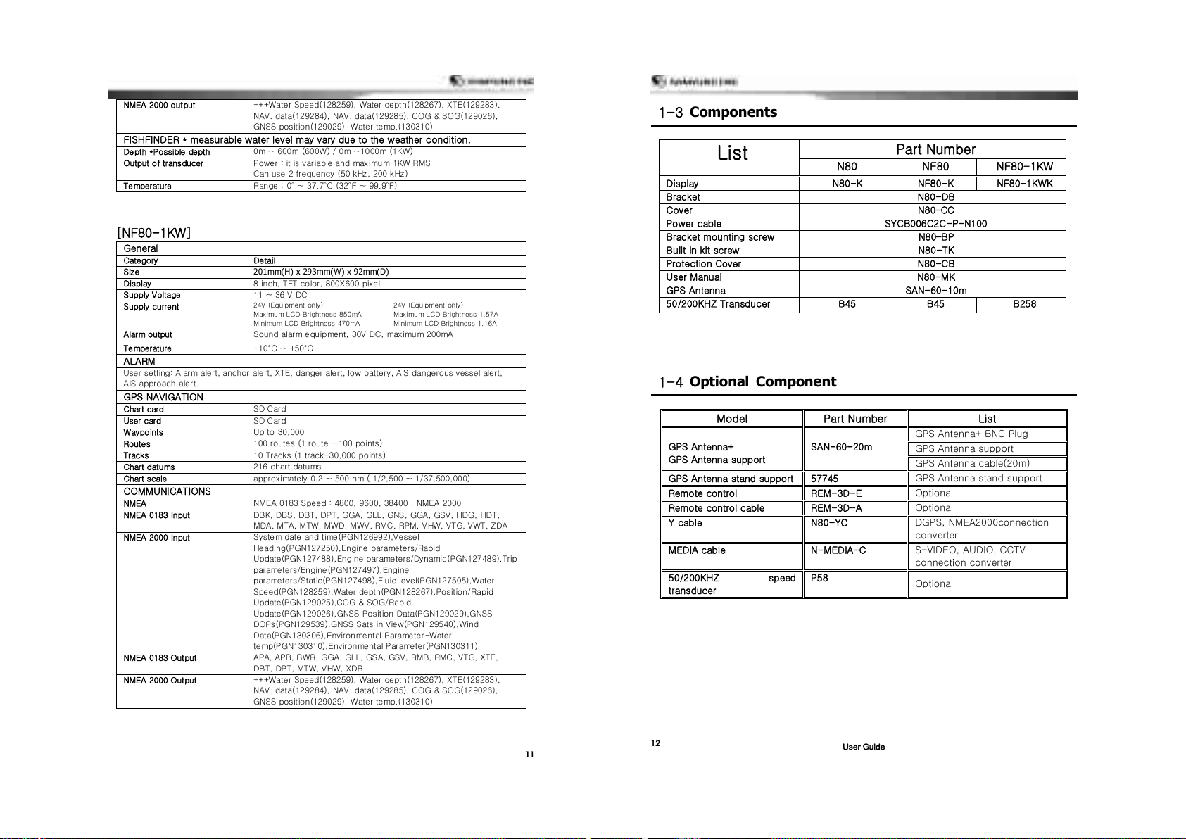
201mm(H) x 293mm(W) x 92mm(D)
8 inch, TFT color, 800X600 pixel
24V (Equipment Only)
Maximum LCD Brightness 700mA
Minimum LCD Brightness 330mA
24V (Equipment Only)
Maximum LCD Brightness 800mA
Minimum LCD Brightness 560mA
Sound alarm equipment, 30V DC, maximum 200mA
User setting: Alarm alert, anchor alert, XTE, danger alert, low battery, AIS dangerous vessel alert,
AIS approach alert.
100 routes (1route –100points)
10 tracks setting (1 track-30000 points)
approximately 0.2 ~ 500 nm (1/2,500 ~ 1/37,500,000)
NMEA 0183 Speed : 4800, 9600, 38400 , NMEA 2000
DBK, DBS, DBT, DPT, GGA, GLL, GNS, GGA, GSV, HDG, HDT,
MDA, MTA, MTW, MWD, MWV, RMC, RPM, VHW, VTG, VWT, ZDA
System date and time(PGN126992),Vessel
Heading(PGN127250),Engine parameters/Rapid
Update(PGN127488),Engine parameters/Dynamic(PGN127489),Trip
parameters/Engine(PGN127497),Engine
parameters/Static(PGN127498),Fluid level(PGN127505),Water
Speed(PGN128259),Water depth(PGN128267),Position/Rapid
Update(PGN129025),COG & SOG/Rapid
Update(PGN129026),GNSS Position Data(PGN129029),GNSS
DOPs(PGN129539),GNSS Sats in View(PGN129540),Wind
Data(PGN130306),Environmental Parameter-Water
temp(PGN130310),Environmental Parameter(PGN130311)
APA, APB, BWR, GGA, GLL, GSA, GSV, RMB, RMC, VTG, XTE,
DBT, DPT, MTW, VHW, XDR
+++Water Speed(128259), Water depth(128267), XTE(129283),
NAV. data(129284), NAV. data(129285), COG & SOG(129026),
GNSS position(129029), Water temp.(130310)
FISHFINDER * measurable water level may vary due to the weather condition.
0m ~ 600m (600W) / 0m ~1000m (1KW)
Power : it is variable and maximum 1KW RMS
Can use 2 frequency (50 kHz, 200 kHz)
Range : 0° ~ 37.7°C (32°F ~ 99.9°F)
201mm(H) x 293mm(W) x 92mm(D)
8 inch, TFT color, 800X600 pixel
24V (Equipment Only)
Maximum LCD Brightness 700mA
Minimum LCD Brightness 330mA
24V (Equipment Only)
Maximum LCD Brightness 1.73A
Minimum LCD Brightness 1.32A
Sound alarm equipment, 30V DC, maximum 200mA
User setting: Alarm alert, anchor alert, XTE, danger alert, low battery, AIS dangerous vessel alert,
AIS approach alert.
100 routes (1route –100points)
10 tracks setting (1 track-30000 points)
approximately 0.2 ~ 500 nm (1/2,500 ~ 1/37,500,000)
NMEA 0183 Speed : 4800, 9600, 38400 , NMEA 2000
DBK, DBS, DBT, DPT, GGA, GLL, GNS, GGA, GSV, HDG, HDT,
MDA, MTA, MTW, MWD, MWV, RMC, RPM, VHW, VTG, VWT, ZDA
System date and time(PGN126992),Vessel
Heading(PGN127250),Engine parameters/Rapid
Update(PGN127488),Engine parameters/Dynamic(PGN127489),Trip
parameters/Engine(PGN127497),Engine
parameters/Static(PGN127498),Fluid level(PGN127505),Water
Speed(PGN128259),Water depth(PGN128267),Position/Rapid
Update(PGN129025),COG & SOG/Rapid
Update(PGN129026),GNSS Position Data(PGN129029),GNSS
DOPs(PGN129539),GNSS Sats in View(PGN129540),Wind
Data(PGN130306),Environmental Parameter-Water
temp(PGN130310),Environmental Parameter(PGN130311)
APA, APB, BWR, GGA, GLL, GSA, GSV, RMB, RMC, VTG, XTE,
DBT, DPT, MTW, VHW, XDR