GEONAUTE COMPASS C400 User manual

GARANTIE 2 ANS EN USAGE NORMAL - GUARANTEE 2 YEARS
UNDER STANDARD CONDITIONS OF USE - GARANTÍA 2 AÑOS EN
CONDICIONES NORMALES DE USO - GARANZIA 2ANNI IN
CONDIZIONI D’USO NORMALI - GARANTIE 2 JAHRE BEI NORMALEM
GEBRAUCH - WAARBORG 2 JAAR BIG NORMAAL GEBRUIK -
GARANTIDO 2 ANOS EM UTILIZAÇÃO NORMAL -GWARANCJA 2
LATA, PRZY NORMALNYM UZYTKOWANIU - 2 ÉVRE GARANTÁLVA
NORMÁLIS HASZNÁLAT MELLETT -
Ref Pack : 822.469
Decathlon
4 bd de Mons BP 299
59665 Villeneuve d'Ascq cedex
France

Boussole
Compass
C400
FR
EN
ES
IT

2
2
3
1
5
4
7
9
6
8

3
Axe principal de la boussole Compass direction-of-travel arrow Eje
principal de la brjula Asse principale della bussola Kompasses-
Hauptachse Hoofdas van het kompas Eixo principal da bssola Główna
ośbusoli A tájoló fő tengelye Основная ось компаса
Fente de vise Sighting hole Ranura del visor Fessura di mira
Zielschlitz Vizierkeep culo de mira Muszka Irányrés Bизирная
прорезь
Echelle angulaire Angular scale Escala angular Scala angolare
Winkelskala Hoekschaal escala angular Skala kątowa Szögmérő
skála угловая шкала
Flche de marquage Marking arrow Flecha de marcaje freccia di
puntamento Markierungspfeil Aanduidingspijl Seta de marcao
Strzałka oznakowania Jelölő nyíl маркировочная стрелка
Module extrieur Outer capsule Mdulo exterior Modulo Esterno
u§eres Messelement buitenste module Mdulo exterior Moduł
zewnętrzny Belső modul внешний модуль
Loupe de lecture Reading magnifier Lupa de lectura Lente di
ingrandimento per la lettura Leselupe Vergrootglas om te lezen Lupa
de leitura Lupa do odczytu Nagyító az olvasáshoz лупа для чтения
градусов
Fente de vise Sighting hole Ranura del visor Fessura di mira
Zielschlitz Vizierkeep culo de mira Muszka Irányrés Bизирная
прорезь
Echelle intrieure mobile Mobile inner scale Escala interior mvil
Scala interna mobile Bewegliche Innenskala Variabele binnenste
module Escala interior mvel Wewnętrzna ruchoma podziałka Belső
mozgatható skála подвижная внутренняя шкала
Echelle europenne 1/50000 European scale 1/50000 Escala
europea 1/50000 Scala europea 1/50000 Europische Skala 1/50000
Europese schaal 1/50000 Escala europeia 1/50000 podziałka europejska
1/50000 1/50000-es európai skála Eвропейская шкала 1/50000
9
8
7
6
5
4
3
2
1

20
You have just acquired the Geonaute C400 sighting
compass, and we thank you for your confidence in us.
This instrument will enable you to orient yourself
outdoors. Its ergonomic design guarantees excellent
handling comfort, and its small size means it slips easily
into your backpack.
LIMITED WARRANTY
DECATHLON guarantees the initial purchaser that this compass is free from
any defects linked to the material or manufacture of the compass for a period
of two years from the date of purchase. Please keep your receipt as proof of
purchase.
¥This guarantee does not cover damage resulting from misuse, from a failure
to respect the precautions for use nor from accidents; neither does this
guarantee cover damage resulting from improper maintenance or from use of
the item for commercial purposes.
¥This guarantee does not cover damage resulting from repairs carried out by
parties not authorized by DECATHLON.
¥The guarantees contained here explicitly replace all other guarantees
including the implicit guarantee of fair and trade quality and/or adaptation to
use. DECATHLON cannot under any circumstances be held responsible for any
damage, be it direct or indirect, general or specific, caused by or related to
these directions for use or the products they describe.
¥During the warrantee period, the item will either be repaired free of charge by
an authorized repair service or replaced free of charge (depending on the
distributor).
¥The guarantee does not cover cracked or broken cases where signs of a blow
are evident.
USE/PRECAUTIONS FOR USE
Description of normal operating conditions: The C400 compass is designed
to determine an angular direction (also called BEARING or AZIMUTH) in
relation to magnetic north.
EN

21
Restrictions on use/precautions for use
¥Compasses must always be used HORIZONTALLY. It is very important to
avoid friction against the dial’s pivot point by holding the instrument with a
maximum of 5¡ from a horizontal position.
¥This compass detects the Earth’s magnetic field. It is very important to keep
this instrument away from any sources of electromagnetic disturbance (high
voltage, emission of waves, e.g. telephone, cell phone, radio, or television; and
objects containing ferrous metals).
¥This compass detects MAGNETIC North, which is not in exactly the same
place as geographic north. The difference (the declination) depends on the
user’s position on the globe. It is given in the following table.
¥Declination values for some large cities of the world. For your city, enter the
average of the values of 2 nearby cities.
If the declination is West (W), subtract the indicated value from the value you
have just read. If the declination is East (E), add the variation to the value you
have just read. The position of magnetic north also changes with time, but these
variations are negligible over a time span of a few years.
¥A compass is a precision instrument. Do not drop it
¥The operation of the compass varies with the temperature. The oil that slows
the needle may congeal or liquefy depending on the ambient temperature. In
order to preserve its performance capabilities, protect the compass from
extreme temperatures (e.g. by keeping it under a garment).
¥The compass requires a few seconds to stabilize. Do not take the reading into
account until the needle has stabilized completely.
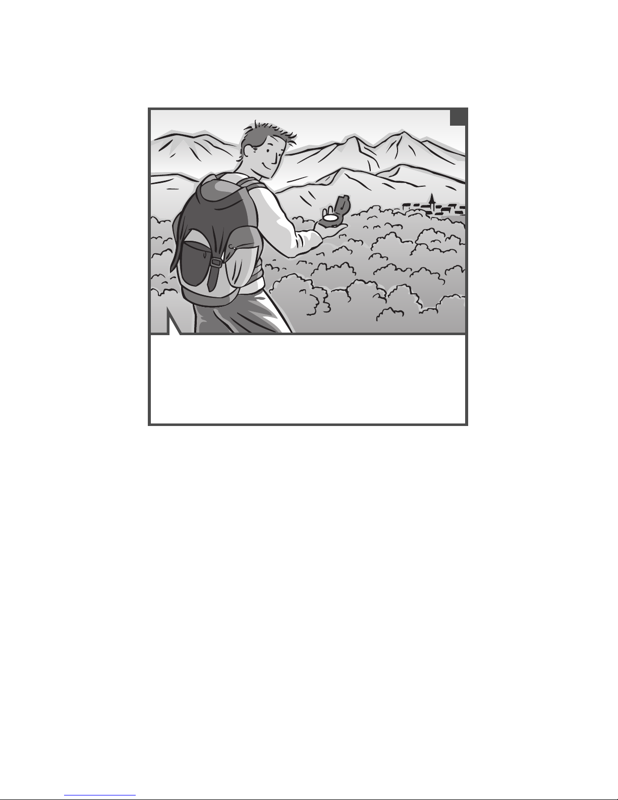
¥To use this compass, you need to have a map. Opt for a map with a scale
available on the compass. For optimal use, also bring along a wooden pencil
and an eraser.
USING THE COMPASS
3operating modes are available for different orienteering needs :
1 -
You know where you are and you have located your destination on the map
(the angular direction in relation to the north)?
2 -
You know where you are and you have taken the bearing (angular direction) to
follow,
3 -
You do not know where you are
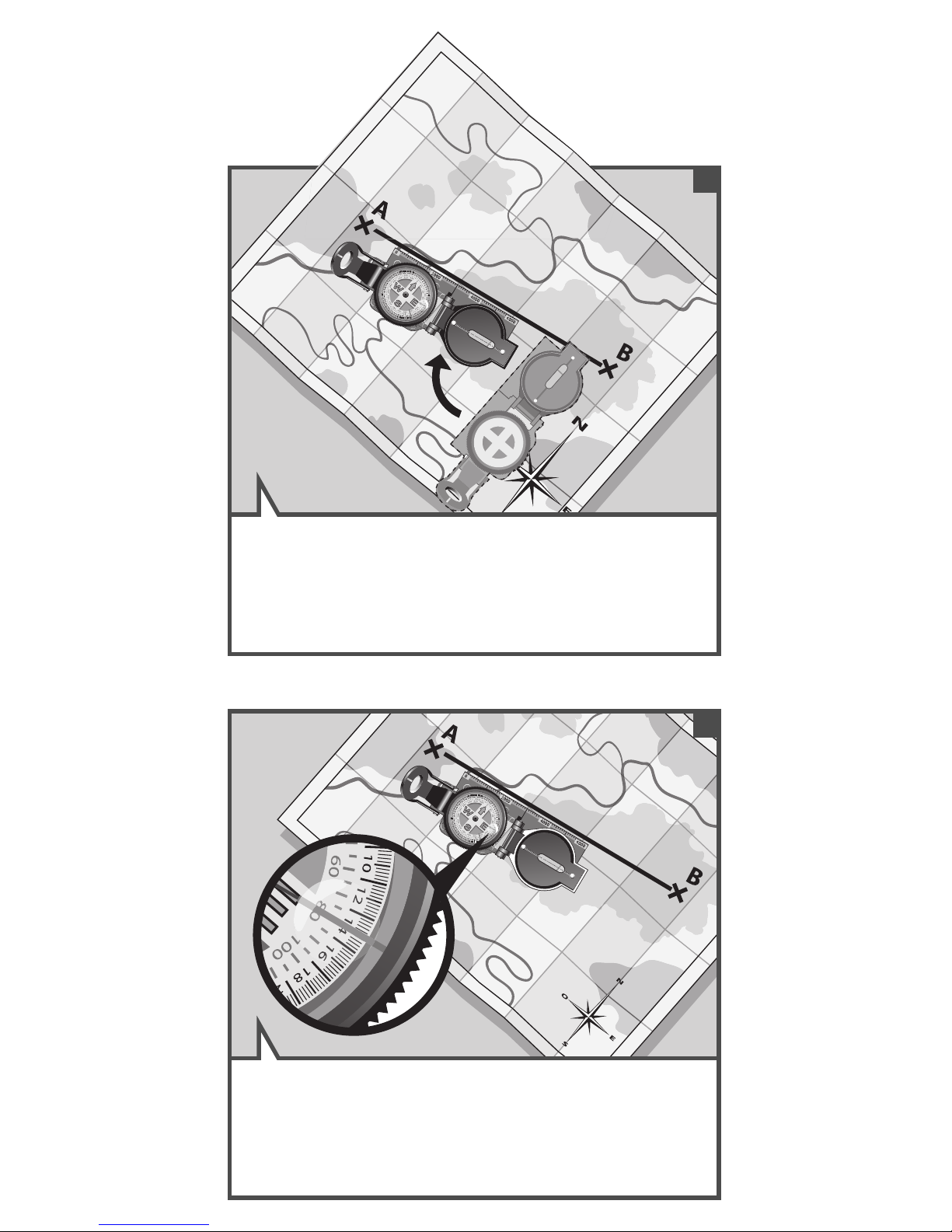
How do you determine your position on the map ?
How do you find your way ?
How do you take a bearing ?
City Declination
Anchorage 22¡E
Atlanta 4¡W
Bombay 1¡W
Boston 16¡W
Calgary 18¡W
Chicago 3¡E
Denver 4¡W
Jerusalem 3¡E
London 4¡W
Munich 14¡W
City Declination
New York 1¡E
Oslo 14¡W
Paris 2¡W
Rio de Janeiro 21¡W
San Francisco 15¡E
Seattle 19¡E
Shanghai 5¡W
Toronto 11¡W
Vancouver 20¡W
Washington 10¡W

22
EXPLANATION OF EACH OPERATING MODE
Position yourself on a flat, level spot. Mark the departure point (A)
and the arrival point (B) on the map and draw a straight line between
the two points (AB).
You are at point A and you want to go to point B. Which bearing
should you follow?
1
2
Determining an angular direction
(Bearing) on a map
1

23
Orient the compass towards the north by aligning the yellow line,
north (0¡) of the mobile magnetic disc (inner scale) with the
direction-of-travel arrow.
3
4
Place the compass on the map. Turn the map and orient the north of
the map towards the magnetic north indicated by the compass.

24
Read the bearing (angle formed by the direction to be measured and
the magnetic north) at the point indicated by the direction-of-travel
arrow.
Keeping the map towards the north, turn the compass, lining up the
direction-of-travel arrow (parallel to the long edges) with direction AB
to be measured.
5
6

25
Forward march! Now you know which direction to take.
7

26
Orient the compass towards the north by aligning the yellow line with
the north (0¡) of the mobile magnetic disc (inner scale) and the
direction-of-travel arrow.
You know your position and the angular direction to follow (e.g.
bearing taken using the preceding method). How do you find the right
direction to take?
1
2
Determining a direction of travel
outdoors (determining a landmark
situated at bearing 80°) in relation to your
position
2

27
Bring your eye to within about 1 cm of the small black sighting
magnifier so that you can read the figures on the inner mobile dial.
3
4
Turn around while looking through the magnifier until the red line is
positioned on the correct bearing (inner scale).
1 in

28
You can use this landmark to guide your travel, taking any path.
When you have reached it, you will have traveled in the approximate
direction of the bearing you chose (in this example 80¡) (fig 8). From
this point, proceed in the same manner until you reach a new
landmark, and so on and so forth, until you have reached your final
objective.
Carefully holding this position (ensuring that the dial does not move),
raise your eye until the hole of the small black part that holds the
magnifier and the hole on the upper plate of the compass line up,
then find a landmark in this direction (bell tower, tree, lighthouse etc.).
5
6

29
Move to a promontory from which you can observe in the landscape
at least 2 landmarks (R1 and R2), also indicated on the map
(mountains, lakes, bell towers). Ideally, the angle of these two points
in relation to your position should be 90¡ (they must never be one
behind the other or in opposite directions).
2
You are lost ; how do you find your position on a map?
1
Determining your position outdoors
using triangulation (I am lost ; how do I
locate my position on the map)
3

30
Sight the first point of landmark R1 by aligning your eye with the hole
on the magnifier holder and the hole in the base plate of the
compass.
Orient the compass towards the north by aligning the yellow line with
the north (0¡) of the mobile magnetic disc (inner scale) and the
direction-of-travel arrow.
3
4

31
Once the needle has stabilized, look through the magnifier to read the
value of bearing Aon the inner mobile scale at the intersection of the
direction-of-travel arrow (e.g. 340¡).
6
Bring your eye to within about 1 cm of the magnifier so that you can
simultaneously read the inner mobile scale and sight the landmark.
5
1 in

32
Find landmark R1 on the map. Orient the compass, starting at
landmark R1 until the direction-of-travel arrow coincides with the
bearing you measured before. Use one of the long edges of the
compass to draw the measured bearing, passing through landmark
R1.
Place the map on a level surface and turn it so that the map’s north
is oriented towards the magnetic north indicated by the compass.
7
8

33
Turn the compass on the map (without moving the latter) until the
direction-of-travel arrow of the compass lines up with bearing B. Draw
astraight line, passing through R2.
10
Locate landmark R2, and then note the value of the bearing you have
measured (B).
9

34
We strongly recommend that you repeat the procedure a 3rd time
with a third landmark (R3) for greater safety.Now you know where
you are...
Your position is thus at the intersection of the two bearings on the
map.
11
12
You are here

35
CONTACT
As we strive to continually improve the products we develop, we are interested
in your feedback regarding the quality, the functionality and the usage of our
products.
¥In France, please call the customer service center at :
0810 080808 (local call rate)
¥For any other country, you can leave a message under the relevant heading
on our website www.decathlon.com
We promise to answer you promptly.
Table of contents
Other GEONAUTE Compass manuals