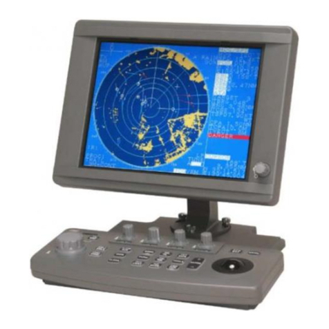
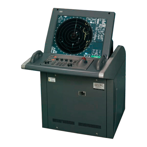
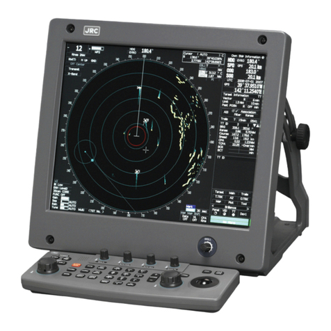
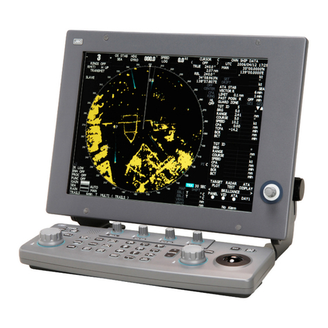
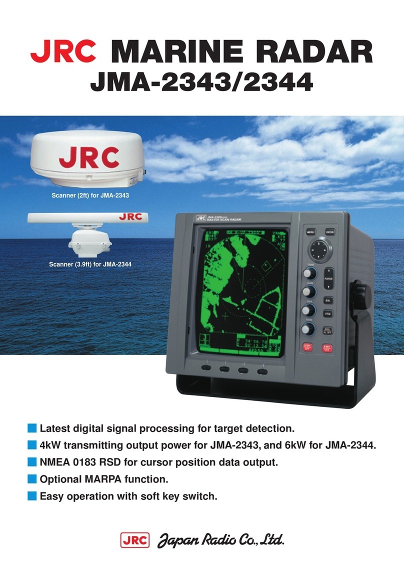
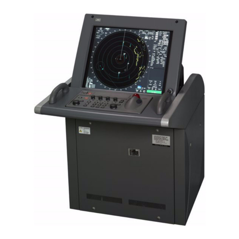
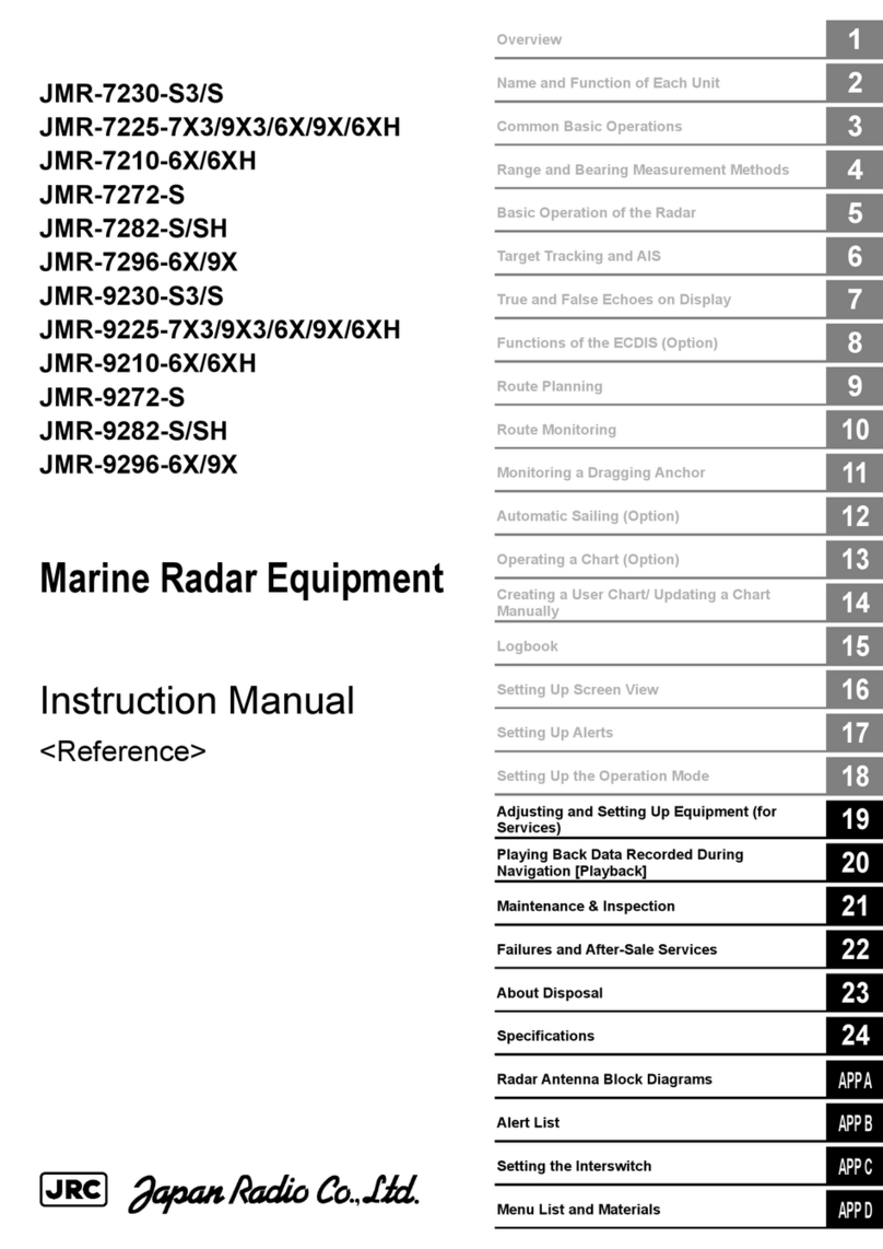
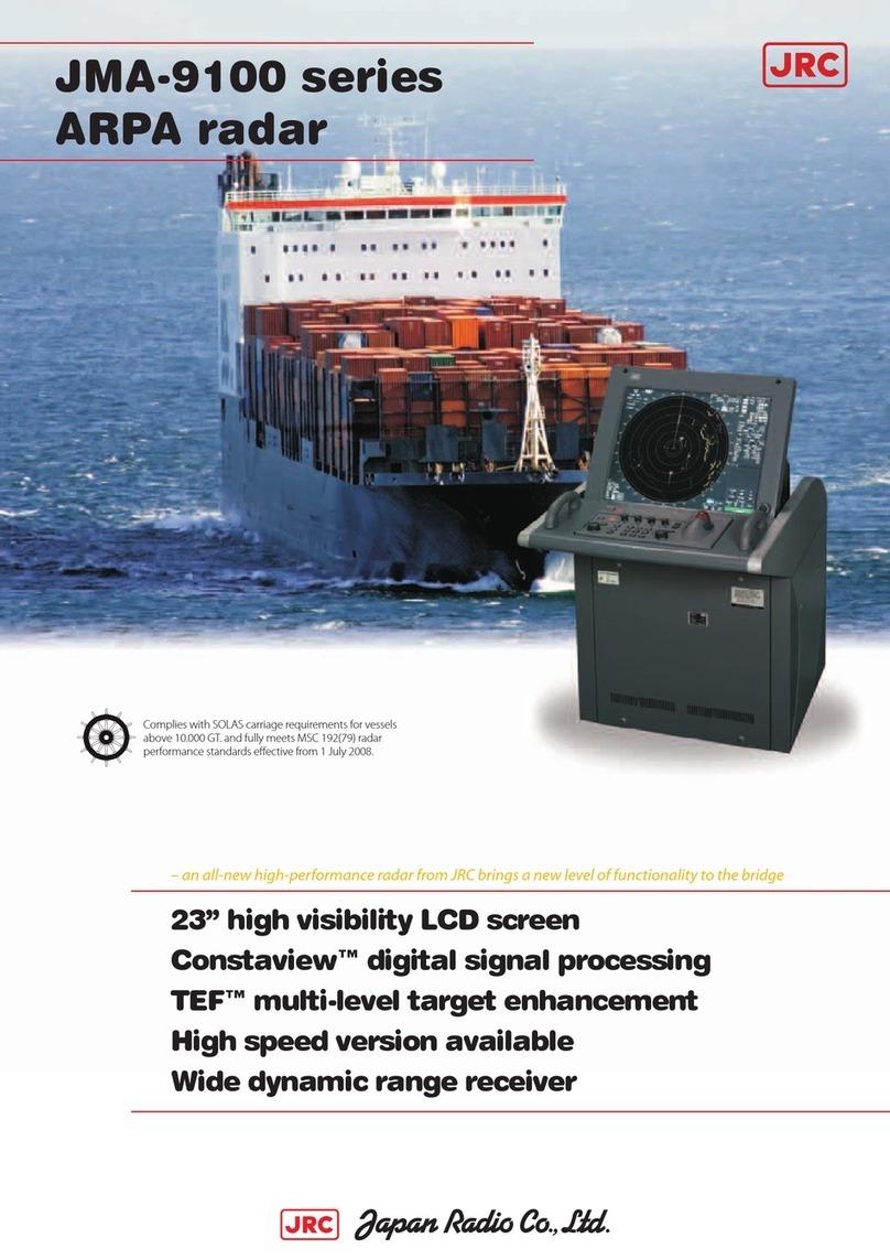
JRC JMR-7230-S User manual

Overview
1
Name and Function of Each Unit
2
Common Basic Operations
3
Range and Bearing Measurement Methods
4
Basic Operation of the Radar
5
Target Tracking and AIS
6
True and False Echoes on Display
7
Functions of the ECDIS
8
Route Planning
9
Route Monitoring
10
Monitoring a Dragging Anchor
11
Automatic Sailing
12
Operating a Chart
13
Creating a User Chart/ Updating a Chart
Manually
14
Logbook
15
Setting Up Screen View
16
Setting Up Alerts
17
Setting Up the Operation Mode
18
Adjusting and Setting Up Equipment (for
Services)
19
Playing Back Data Recorded During
Navigation [Playback]
20
Maintenance & Inspection
21
Failures and After-Sale Services
22
About Disposal
23
Specifications
24
Radar Antenna Block Diagrams
APP A
Alert List
APP B
Setting the Interswitch
APP C
Menu List and Materials
APP D
JMR-7230-S3/S
JMR-7225-7X3/9X3/6X/9X/6XH
JMR-7210-6X/6XH
JMR-7272-S
JMR-7282-S/SH
JMR-7296-6X/9X
JMR-9230-S3/S
JMR-9225-7X3/9X3/6X/9X/6XH
JMR-9210-6X/6XH
JMR-9272-S
JMR-9282-S/SH
JMR-9296-6X/9X
Marine Radar Equipment
Instruction Manual
<Function>


㻌
㻌
㻌(1) Contents
2
3
4
5
6
7
8
9
10
11
12
13
14
15
16
17
18
19
20
21
22
23
24
25
26
27
Contents
Function
Section 5 Basic Operation of the Radar....................................................... 5-1
5.1 Overview Flowchart............................................................................................................... 5-1
5.2 Starting and Shutting Down the Radar ................................................................................. 5-3
5.2.1 Powering on and starting .............................................................................................. 5-3
5.2.2 Exiting radar operation.................................................................................................. 5-6
5.3 Observation Environment and Image Adjustment ................................................................ 5-7
5.3.1 Adjusting screen brightness.......................................................................................... 5-7
5.3.2 Changing the observation range................................................................................... 5-7
5.3.3 Adjusting tune ............................................................................................................... 5-9
5.3.4 Adjusting gain ............................................................................................................. 5-10
5.3.5 Rejecting sea clutter (Sea) ......................................................................................... 5-12
5.3.6 Rejecting rain/snow clutter.......................................................................................... 5-14
5.3.7 Adjusting to optimal images (Selection of observation scenes) ................................. 5-16
5.4 General Radar Operation.................................................................................................... 5-19
5.4.1 Interference Rejection (IRFunction) .......................................................................... 5-19
5.4.2 Changing the transmitter pulse length ........................................................................ 5-20
5.4.3 Enhancing targets....................................................................................................... 5-21
5.4.4 Using video processing (Echo Process)..................................................................... 5-22
5.4.5 Setting the azimuth mode ........................................................................................... 5-23
5.4.6 Setting a motion mode................................................................................................ 5-25
5.4.6.1 Resetting Own Ship to its Initial Position in [TM] (True Motion display) Mode
.......................................................................................................................... 5-26
5.4.7 Setting the Stabilization Mode .................................................................................... 5-27
5.4.8 Moving own ship's display position (Off Center)......................................................... 5-27
5.4.9 Displaying other ship's trails (Trails) ........................................................................... 5-28
5.4.9.1 Trails motion mode............................................................................................ 5-28
5.4.9.2 Changing motion mode of trails ........................................................................ 5-30
5.4.9.3 Setting the length of the trail ............................................................................. 5-30
5.4.9.4 Clearing trails data ............................................................................................ 5-31
5.4.10 Doubling the size of radar image ................................................................................ 5-32
5.4.11 Hiding the heading line (HL OFF) ............................................................................... 5-34
5.4.12 Hiding graphics information on radar display ............................................................. 5-35
5.4.13 Setting true bearing..................................................................................................... 5-35
5.4.14 Setting own ship speed............................................................................................... 5-36
5.4.14.1 Switching own ship speed device ..................................................................... 5-36
5.4.14.2 Entering the ship's heading/own ship's speed manually................................... 5-38
7ZPNA4447H

Contents (2)
Section 6 Target Tracking and AIS ............................................................... 6-1
6.1 Restrictions ........................................................................................................................... 6-2
6.2 Collision Avoidance Issue (Explanation) ............................................................................... 6-3
6.2.1 Collision Avoidance in Navigation................................................................................. 6-3
6.2.2 Marine Accidents and Collisions ................................................................................... 6-3
6.2.3 Basic Concept of Collision Avoidance .......................................................................... 6-4
6.2.4 Relative Vector and True Vector ................................................................................... 6-5
6.2.5 Radar and Collision Avoidance..................................................................................... 6-5
6.3 Displaying Symbols............................................................................................................... 6-6
6.3.1 Displaying/hiding target tracking symbols/AIS target symbols ..................................... 6-6
6.3.2 Types and Definitions of Target Tracking Symbols....................................................... 6-6
6.3.3 Types and Definitions of AIS Target Symbols............................................................... 6-7
6.3.4 About AIS AtoN (Aids to Navigation)........................................................................... 6-12
6.3.5 About AIS-SART Information ...................................................................................... 6-12
6.3.6 About Display Priority of AIS Targets .......................................................................... 6-13
6.3.7 Switching between Ground Vector and Water Vector................................................. 6-14
6.3.8 Association Target Symbols........................................................................................ 6-14
6.4 Preparation.......................................................................................................................... 6-15
6.4.1 Setting the Cursor Mode to AUTO Mode.................................................................... 6-15
6.4.2 Setting Vector.............................................................................................................. 6-15
6.4.2.1 Vector modes .................................................................................................... 6-15
6.4.2.2 Setting vector mode .......................................................................................... 6-17
6.4.2.3 Vector Length (Vector Time).............................................................................. 6-17
6.4.2.4 Setting the Vector Length.................................................................................. 6-18
6.4.3 Setting collision decision criteria................................................................................. 6-18
6.4.3.1 Setting CPA limit................................................................................................ 6-18
6.4.3.2 Setting TCPA limit.............................................................................................. 6-19
6.4.4 Showing the CPA ring (RADAR only) ......................................................................... 6-20
6.5 Setting and Operating Target Tracking ............................................................................... 6-21
6.5.1 Acquiring target........................................................................................................... 6-21
6.5.1.1 Automatic acquisition (automatic acquisition) mode......................................... 6-21
6.5.1.2 ACQ MANUAL (manual acquisition) mode ....................................................... 6-22
6.5.1.3 Using manual acquisition and auto acquisition together................................... 6-23
6.5.2 Setting up the automatic acquisition/activation zone (AZ).......................................... 6-23
6.5.2.1 Using [New Target Warning] dialog box in the [Alert] menu.............................. 6-24
6.5.2.2 Using the cursor ................................................................................................ 6-25
6.5.2.3 Using the EBL/VRM dial for the setting............................................................. 6-26
6.5.3 Tracked target information display.............................................................................. 6-27
6.5.4 Erasing unwanted tracked targets .............................................................................. 6-28
6.5.5 Displaying Target ID No. ............................................................................................. 6-29
6.5.6 Editing tracked target properties................................................................................. 6-31
6.5.6.1 Adding Tracked Target ID Name ....................................................................... 6-31

(3) Contents
2
3
4
5
6
7
8
9
10
11
12
13
14
15
16
17
18
19
20
21
22
23
24
25
26
27
6.5.6.2 Setting track color of tracked target .................................................................. 6-33
6.5.7 Setting target for which ground is fixed to a reference target..................................... 6-34
6.5.8 Operation Test for Target Tracking.............................................................................. 6-36
6.5.8.1 [Test Video]........................................................................................................ 6-37
6.5.8.2 [TT Simulator] (Target tracking simulator)......................................................... 6-38
6.5.8.3 [Gate Display].................................................................................................... 6-40
6.5.8.4 [Status] display.................................................................................................. 6-42
6.6 Setting and Operating AIS................................................................................................... 6-43
6.6.1 Enabling AIS Function ................................................................................................ 6-43
6.6.2 Activating AIS targets (Activate AIS)........................................................................... 6-43
6.6.2.1 Manual activation .............................................................................................. 6-43
6.6.2.2 Automatic activation .......................................................................................... 6-44
6.6.3 Deactivating AIS targets ............................................................................................. 6-44
6.6.4 Displaying AIS information.......................................................................................... 6-45
6.6.5 Displaying Target ID No. ............................................................................................. 6-53
6.6.6 Checking and setting AIS target property ................................................................... 6-54
6.6.6.1 Setting track color of AIS target......................................................................... 6-54
6.6.7 Conditions for deciding AIS target to be lost............................................................... 6-55
6.7 Alert Display ........................................................................................................................ 6-56
6.7.1 Danger target alarm (CPA/TCPA)............................................................................... 6-57
6.7.2 Alarm for new target acquired in automatic acquisition guard zone (New target)...... 6-58
6.7.3 Lost target notification (Lost) ...................................................................................... 6-59
6.7.4 Target Tracking function alarm (TT Data) ................................................................... 6-60
6.7.5 Gyro set notification (Set Gyro) .................................................................................. 6-60
6.8 Track Function..................................................................................................................... 6-61
6.8.1 Setting the Past position ............................................................................................. 6-61
6.8.2 Setting the other ship's tracks..................................................................................... 6-61
6.8.2.1 Setting track color ............................................................................................. 6-62
6.8.2.2 Turning on/off other ship's track function .......................................................... 6-62
6.8.2.3 Setting other ship's track colors ........................................................................ 6-62
6.8.2.4 Turning on/off other ship's track display............................................................ 6-62
6.8.2.5 Setting up the display interval of other ship’s track........................................... 6-63
6.8.2.6 Clearing other ship's track................................................................................. 6-63
6.8.2.7 Saving and loading other ship's track data ....................................................... 6-63
6.9 Entering Own Ship's AIS Voyage Data ............................................................................... 6-64
6.10 Editing and Sending AIS Messages.................................................................................... 6-65
6.11 AIS Message Tray............................................................................................................... 6-68
6.11.1 Displaying the AIS message tray ................................................................................ 6-68
6.11.2 Switching message display......................................................................................... 6-70
6.11.3 Sending a message in the message tray after editing................................................ 6-71
6.12 Highlighting TT/AIS Symbols .............................................................................................. 6-72
6.13 Trial Maneuvering................................................................................................................ 6-74

Contents (4)
6.13.1 Outline of Trial Maneuvering....................................................................................... 6-74
6.13.2 Performing a trial maneuver ....................................................................................... 6-77
6.14 Displaying the TT/AIS Target List........................................................................................ 6-79
6.14.1 Displaying TT/AIS List................................................................................................. 6-79
6.14.1.1 Switching between a standard window and an extended window .................... 6-80
6.14.2 TT List ......................................................................................................................... 6-82
6.14.3 AIS List........................................................................................................................ 6-83
6.15 Confirming Own Ship's AIS Information.............................................................................. 6-85
6.16 Displaying the Last Lost AIS Target .................................................................................... 6-86
Section 7 True and False Echoes on Display .............................................. 7-1
7.1 Radar Wave with the Horizon ............................................................................................... 7-1
7.2 Intensity Reflected from the Target ....................................................................................... 7-3
7.3 Sea Clutter and Rain/Snow Clutter ....................................................................................... 7-5
7.3.1 Sea clutter..................................................................................................................... 7-5
7.3.2 Rain and snow clutter ................................................................................................... 7-6
7.3.3 Coping with sea clutter and rain/snow clutter ............................................................... 7-8
7.4 False Echoes ........................................................................................................................ 7-9
7.4.1 Shadow ......................................................................................................................... 7-9
7.4.2 Side lobe effect ............................................................................................................. 7-9
7.4.3 False echo by secondary reflection ............................................................................ 7-10
7.4.4 False echo by multiple reflection ................................................................................ 7-11
7.4.5 Second time echoes ................................................................................................... 7-11
7.4.6 Radar interference ...................................................................................................... 7-12
7.5 Radar Transponder (SART) Screen Display....................................................................... 7-13
7.6 Display of AIS-SART ........................................................................................................... 7-15
7.6.1 Radar screen display example ................................................................................... 7-15
7.6.2 Numeric data display example.................................................................................... 7-16
Section 8 Functions of the ECDIS (Option) ........................................................... 8-1
8.1 General Flowchart................................................................................................................. 8-1
8.1.1 Work Flowchart While Sailing ....................................................................................... 8-2
8.2 Starting and Preparing the ECDIS ........................................................................................ 8-3
8.2.1 Powering on and starting .............................................................................................. 8-3
8.2.2 Starting the ECDIS........................................................................................................ 8-4
8.2.2.1 Starting the ECDIS from the Task Menu ............................................................. 8-4
8.2.2.2 Starting ECDIS from a non-ECDIS task screen.................................................. 8-5
8.2.3 Entering an ARCS PIN Number (ARCS Only).............................................................. 8-6
8.3 Moving the Chart................................................................................................................... 8-7
8.3.1 Moving the chart with the [HOME] button..................................................................... 8-7
8.3.2 Moving the chart with the cross-hair cursor.................................................................. 8-8
8.3.3 Moving the chart with the hand cursor.......................................................................... 8-9
8.3.4 Switching a chart to be displayed by [My Port List] .................................................... 8-10

(5) Contents
2
3
4
5
6
7
8
9
10
11
12
13
14
15
16
17
18
19
20
21
22
23
24
25
26
27
8.3.5 Displaying the chart by entering the position.............................................................. 8-11
8.4 Zooming In/Out the Chart.................................................................................................... 8-12
8.4.1 Enlarging a Selected Area (S-57/C-MAP Only) .......................................................... 8-12
8.4.2 Enlarging/reducing a chart with the Zoom function .................................................... 8-14
8.4.2.1 Enlarging/reducing with the [ZOOM IN]/[ZOOM OUT] key on the trackball
operation unit (S-57/C-MAP only) ..................................................................... 8-14
8.4.2.2 Enlarging/reducing with the zoom slider (S-57/C-MAP only)............................ 8-14
8.4.2.3 Enlarging/reducing with the [Large]/[Small] buttons (RNC only)....................... 8-16
8.4.3 Switching between scale and range (S-57/C-MAP only)............................................ 8-17
8.5 Changing the Object Category (S-57/C-MAP Only)............................................................ 8-18
8.5.1 Switching object display.............................................................................................. 8-19
8.5.2 Customizing object display ......................................................................................... 8-20
8.6 Selecting Motion/Bearing Mode .......................................................................................... 8-22
8.6.1 Setting motion mode................................................................................................... 8-23
8.6.2 Setting Bearing mode (S-57/C-MAP only) .................................................................. 8-25
8.7 Registering and Displaying My Port List ............................................................................. 8-27
8.7.1 Registering to My Port List.......................................................................................... 8-27
8.7.2 Deleting a port............................................................................................................. 8-28
8.8 Selecting a S-57 chart......................................................................................................... 8-29
8.9 Selecting an ARCS chart..................................................................................................... 8-30
8.9.1 Selecting charts from all ............................................................................................. 8-30
8.9.2 Changing active panels (ARCS only) ......................................................................... 8-31
8.9.3 Changing a low resolution chart (ARCS only) ............................................................ 8-32
8.9.4
Changing a high resolution chart (ARCS only)
............................................................... 8-33
8.9.5 Displaying the note and diagram
(ARCS only)
............................................................ 8-34
8.10 Multi View Display and Wide Range View Window Display of Charts................................ 8-35
8.10.1 Display of multi view ................................................................................................... 8-36
8.10.1.1 Displaying multi view......................................................................................... 8-36
8.10.1.2 Multi view operation procedure ......................................................................... 8-38
8.11 Verifying Object Information (Pick Report Function)........................................................... 8-42
8.11.1 Pick Report of the S-57 chart...................................................................................... 8-42
8.11.1.1 Displaying a Pick Report of the S-57 chart ....................................................... 8-42
8.11.1.2 Verifying Object Information .............................................................................. 8-44
8.11.1.3 Verifying Chart Information................................................................................ 8-49
8.11.1.4 Verifying Chart Update History.......................................................................... 8-50
8.11.2 Pick report of the C-MAP chart ................................................................................... 8-51
8.11.3 Pick report of the ARCS chart..................................................................................... 8-52
8.12 Marking the Position of Own Ship with an Event Mark ....................................................... 8-53
8.13 Displaying Radar Images on a Chart by Overlaying........................................................... 8-54
8.13.1 Turning On/Off overlay display ................................................................................... 8-55
8.13.2 Turning On/Off range ring display............................................................................... 8-57
8.13.3 Turning On/Off bearing scale...................................................................................... 8-58
Contents (6)
8.13.4 Radar image adjustment............................................................................................. 8-59
8.14 Setting a true bearing.......................................................................................................... 8-60
8.15 Setting an own ship's speed ............................................................................................... 8-61
8.15.1 Switching an own ship's speed sensor....................................................................... 8-61
8.15.2 Entering the ship's heading/own ship's speed manually ............................................ 8-62
Section 9 Route Planning.............................................................................. 9-1
9.1 Overview of the Route Planning Function............................................................................. 9-2
9.2 Setting Route Display............................................................................................................ 9-3
9.2.1 Setting [Route] after selecting [View] - [Options] on the menu..................................... 9-3
9.2.2 Setting [Settings] - [Route] on the menu....................................................................... 9-5
9.3 Starting and Ending the [Route Planning] Dialog Box .......................................................... 9-9
9.3.1 Starting the [Route Planning] dialog box ...................................................................... 9-9
9.3.2 Ending the [Route Planning] dialog box........................................................................ 9-9
9.4 Name and Function of Each Section of the [Route Planning] dialog Box........................... 9-10
9.4.1 Route Planning bar ..................................................................................................... 9-10
9.4.2 Route planning tab...................................................................................................... 9-15
9.5 Saving a Route.................................................................................................................... 9-17
9.6 Planning a Route by Using Table Editing............................................................................ 9-21
9.6.1 Table editing operation flow ........................................................................................ 9-21
9.6.1.1 Creating a new route file ................................................................................... 9-21
9.6.1.2 Editing a route ................................................................................................... 9-22
9.6.2 Creating a new route file by table editing ................................................................... 9-23
9.6.3 Deleting WPT data...................................................................................................... 9-26
9.6.4 Editing a route by table editing ................................................................................... 9-26
9.6.4.1 Inserting WPT.................................................................................................... 9-29
9.6.4.2 Deleting WPT .................................................................................................... 9-29
9.6.4.3 Dividing a leg..................................................................................................... 9-30
9.6.4.4 Copying the entire route.................................................................................... 9-30
9.6.4.5 Pasting the copied route ................................................................................... 9-31
9.6.4.6 Inserting the other route .................................................................................... 9-31
9.6.4.7 Insert the same WPT as the last WPT .............................................................. 9-32
9.7 Planning a New Route by Graphic Editing.......................................................................... 9-33
9.7.1 Graphic editing operation flow .................................................................................... 9-33
9.7.1.1 Creating a new route file ................................................................................... 9-33
9.7.1.2 Editing a route file ............................................................................................. 9-34
9.7.2 Creating a new route file by graphic editing ............................................................... 9-35
9.7.2.1 Creating a route by using EBL/VRM ................................................................. 9-37
9.7.2.2 Creating a route by using the assistant circle function...................................... 9-39
9.7.3 Editing a route by graphic editing ............................................................................... 9-41
9.7.3.1 Inserting a WPT between WPTs ....................................................................... 9-43
9.7.3.2 Moving a WPT................................................................................................... 9-44
9.7.3.3 Changing XTD (cross track limit) ...................................................................... 9-46

(7) Contents
2
3
4
5
6
7
8
9
10
11
12
13
14
15
16
17
18
19
20
21
22
23
24
25
26
27
9.7.3.4 Adding WPT on the context menu .................................................................... 9-47
9.7.3.5 Moving WPT on the context menu.................................................................... 9-48
9.7.3.6 Deleting WPT on the context menu .................................................................. 9-49
9.7.3.7 Copying and pasting a route on the context menu ........................................... 9-50
9.7.3.8 Rotating a route on the context menu............................................................... 9-51
9.7.3.9 Moving a route on the context menu................................................................. 9-52
9.7.3.10 Inserting other route on the context menu ........................................................ 9-53
9.7.3.11 Inserting WPT between WPTs on the context menu......................................... 9-54
9.7.3.12 Dividing a leg on the context menu................................................................... 9-56
9.7.3.13 Changing XTD (cross track limit) on the context menu..................................... 9-57
9.8 Creating an Alternate Route................................................................................................ 9-59
9.8.1 Creating an alternate route ......................................................................................... 9-61
9.8.2 Saving an alternate route............................................................................................ 9-62
9.8.2.1 Overwriting without changing the file name ...................................................... 9-62
9.8.2.2 Saving the file by naming.................................................................................. 9-63
9.9 Checking Route Data .......................................................................................................... 9-64
9.9.1 Checking a route based on the safety standards ....................................................... 9-64
9.9.2 Checking a route based on the limits.......................................................................... 9-68
9.10 Navigation Calculation Function ......................................................................................... 9-70
9.10.1 ROT (Rate of Turn) ..................................................................................................... 9-70
9.10.2 ETA (Estimated Time of Arrival) .................................................................................. 9-70
9.10.3 TWOL (Time to Go)..................................................................................................... 9-71
9.11 Importing/Exporting a Route File ........................................................................................ 9-72
9.11.1 Importing a route file ................................................................................................... 9-72
9.11.2 Exporting a route file................................................................................................... 9-73
9.12 Error Messages that are Displayed when a Route is Created............................................ 9-74
Section 10 Route Monitoring ........................................................................ 10-1
10.1 Route Monitoring................................................................................................................. 10-1
10.1.1 Starting route monitoring ............................................................................................ 10-1
10.1.2 Ending route monitoring.............................................................................................. 10-2
10.2 Selecting and Deleting Route Files..................................................................................... 10-3
10.2.1 Selecting a route to be displayed................................................................................ 10-3
10.2.2 Deleting a route file..................................................................................................... 10-4
10.3 [Voyage Information] (Voyage Monitoring Information) Dialog Box .................................... 10-5
10.4 [Voyage Calculation] Dialog Box....................................................................................... 10-11
10.4.1 Calculating a schedule.............................................................................................. 10-13
10.4.2 Calculating a distance............................................................................................... 10-14
10.4.3 Example of distance calculation ............................................................................... 10-16
10.5 Comparing the Data between the Planned Route and the Actual Route.......................... 10-18
10.6 Verifying Detail Information of WPT .................................................................................. 10-20

Contents (8)
Section 11 Monitoring a Dragging Anchor .................................................. 11-1
11.1 Setting a Dragging Anchor Monitoring Area........................................................................ 11-2
11.1.1 Setting a dragging anchor monitoring circle ............................................................... 11-2
11.1.2 Setting a dragging anchor monitoring polygon ........................................................... 11-4
11.2 Starting and Ending Dragging Anchor Monitoring............................................................... 11-5
11.2.1 Starting dragging anchor monitoring........................................................................... 11-5
11.2.2 Ending dragging anchor monitoring............................................................................ 11-6
11.3 Editing/Deleting a Dragging Anchor Monitoring Area on the Chart..................................... 11-7
11.3.1 Changing a size of a dragging anchor monitoring circle on the chart ........................ 11-7
11.3.2 Changing a size of a dragging anchor monitoring circle on the context menu........... 11-8
11.3.3 Changing a shape of a dragging anchor monitoring polygon on the chart................. 11-8
11.3.4 Changing a shape of a dragging anchor monitoring polygon on the context menu ... 11-9
Section 12 Automatic Sailing (Option)................................................................. 12-1
12.1 Flow of Starting Automatic Sailing ...................................................................................... 12-2
12.2 Selecting a Route................................................................................................................ 12-6
12.2.1 Using the existing planned route ................................................................................ 12-6
12.2.2 Creating a new route .................................................................................................. 12-8
12.3 Selecting a Waypoint at which Automatic Sailing Starts ................................................... 12-10
12.4 Starting Automatic Sailing ................................................................................................. 12-12
12.5 Stopping Automatic Sailing ............................................................................................... 12-14
12.6 Alerts at Automatic Sailing ................................................................................................ 12-15
Section 13
Operating a Chart (option)
.............................................................. 13-1
13.1 Updating a Chart Manually.................................................................................................. 13-3
13.2 Displaying/Searching an S-57 Chart [Select S-57 Chart] ................................................... 13-4
13.2.1 Displaying a chart ....................................................................................................... 13-4
13.2.2 Search a chart............................................................................................................. 13-5
13.2.2.1 Searching the position that is clicked on by the cursor..................................... 13-5
13.2.2.2 Searching by using a chart name...................................................................... 13-6
13.3 Displaying a Chart by Inputting a Position .......................................................................... 13-7
13.4 Confirming/Accepting/Rejecting an S-57 Updated Chart.................................................... 13-8
13.5 Displaying a Date-dependent Object ................................................................................ 13-10
13.6 Displaying a Chart Boundary ............................................................................................ 13-12
13.6.1 Setting a boundary to be displayed on the chart ...................................................... 13-12
13.6.2 Displaying chart information ..................................................................................... 13-13
13.7 Confirming Temporary/Preliminary Information of an ARCS Chart................................... 13-14
13.8 Adjusting an ARCS Chart Position.................................................................................... 13-15
13.8.1 Offsetting an ARCS chart.......................................................................................... 13-15
13.8.2 Transforming a geodetic datum of an ARCS chart to WGS-84 ................................ 13-17
13.9 Displaying a Chart Abbreviation List ................................................................................. 13-21
13.10
Displaying an ENC Update Status Report
............................................................................ 13-22

(9) Contents
2
3
4
5
6
7
8
9
10
11
12
13
14
15
16
17
18
19
20
21
22
23
24
25
26
27
13.11 Displaying update data of the C-MAP chart...................................................................... 13-27
13.12 Displaying license information of C-MAP.......................................................................... 13-29
13.12.1 Setting license information display to ON................................................................. 13-29
13.12.2 C-MAP license information ....................................................................................... 13-30
13.12.2.1 License information display timing .................................................................. 13-30
13.12.2.2 License information ......................................................................................... 13-32
13.13 Displaying ECDIS Chart 1................................................................................................. 13-33
13.13.1 Import ECDIS Chart 1............................................................................................... 13-33
13.13.2 Confirm display of ECDIS Chart 1 ............................................................................ 13-34
13.14 Displaying differences at chart update.............................................................................. 13-36
13.14.1 Displaying differences at S-57 chart update............................................................. 13-36
13.14.2 Displaying differences at C-MAP chart update ......................................................... 13-37
13.15 Chart pick report................................................................................................................ 13-38
13.16 Maintaining a Chart ........................................................................................................... 13-39
Section 14 Creating a User Chart/ Updating a Chart Manually .................. 14-1
14.1 Creating/Editing a User Chart ............................................................................................. 14-3
14.1.1 Display the "User Chart" menu. .................................................................................. 14-4
14.1.2 Display the File Operation submenu........................................................................... 14-5
14.1.2.1 [File Operation] dialog box ................................................................................ 14-5
14.1.3 Creating a new user chart........................................................................................... 14-7
14.1.4 Editing the existing user chart..................................................................................... 14-8
14.1.4.1 Editing the user chart that is currently displayed .............................................. 14-8
14.1.5 Displaying a user chart ............................................................................................... 14-9
14.1.6 Operating a user chart file ........................................................................................ 14-10
14.1.6.1 Deleting a user chart file ................................................................................. 14-10
14.1.6.2 Copying a user chart file ................................................................................. 14-10
14.1.6.3 Importing a user chart file................................................................................ 14-11
14.1.6.4 Exporting a user chart file ............................................................................... 14-11
14.1.6.5 Merging multiple user chart files ..................................................................... 14-12
14.1.6.6 Performing geodetic datum conversion .......................................................... 14-13
14.2 Using Map Creation Tools (User Chart Creation/Editing) ................................................. 14-14
14.2.1 User chart information bar ........................................................................................ 14-14
14.2.1.1 Displaying a user chart information bar .......................................................... 14-14
14.2.2 Drawing toolbar......................................................................................................... 14-15
14.2.3 Selecting an object type............................................................................................ 14-16
14.2.3.1Using a user chart object ................................................................................ 14-17
14.2.4 Selecting a color of an object.................................................................................... 14-18
14.2.5 Creating an object in the EBL/VRM mode................................................................ 14-19
14.2.6 Creating an object by specifying latitude and longitude ........................................... 14-19
14.2.6.1 Creating an object of symbol/circle/ellipse/arc/arrow/text............................... 14-20
14.2.6.2 Creating an object of simple line/polygon/highlight......................................... 14-20
14.2.7 Deleting an object ..................................................................................................... 14-20

Contents (10)
14.2.8 Object property dialog box........................................................................................ 14-21
14.2.8.1 Selecting an object.......................................................................................... 14-21
14.2.8.2 Setting a comment .......................................................................................... 14-22
14.2.9 Changing an object display scale range................................................................... 14-23
14.2.10 Moving an object....................................................................................................... 14-23
14.3 Updating a Chart Manually (ARCS) (ECDIS Screen Only)............................................... 14-25
14.3.1 Displaying the Manual Update submenu.................................................................. 14-26
14.3.2 Selecting a chart to be updated................................................................................ 14-27
14.3.2.1 Searching the position that is clicked on with the cursor ................................ 14-28
14.3.2.2 Searching a chart with the chart name ........................................................... 14-28
14.3.2.3 Displaying the chart screen that is selected from the list................................ 14-28
14.3.3 Updating a chart manually ........................................................................................ 14-29
14.3.4 Displaying the selected chart only ............................................................................ 14-30
14.3.5 Displaying the object/redisplaying the hidden object................................................ 14-30
14.4 How to Use the Map Creation Tools (At Manual Update of ARCS) .................................. 14-31
14.4.1 Deleting or hiding an object ...................................................................................... 14-31
14.4.2 Selecting an object type............................................................................................ 14-32
14.5 Creating an Object(At Manual Update of ARCS).............................................................. 14-33
14.5.1 Creating a symbol object (Symbol)........................................................................... 14-34
14.5.1.1 Creating an object by specifying the latitude and longitude............................ 14-34
14.5.1.2 Creating an object with EBL/VRM operation................................................... 14-35
14.5.2 Creating a simple line and Alerts line (Line object)................................................... 14-36
14.5.2.1 Creating a vertex by entering the position ...................................................... 14-39
14.5.2.2 Creating an object with EBL/VRM operation................................................... 14-39
14.5.3 Creating a circle, ellipse, and an arc (Line object).................................................... 14-41
14.5.3.1 Creating an object by specifying a position for the center and size of the
object............................................................................................................... 14-43
14.5.4 Creating a polygon and Alerts area (Area object)..................................................... 14-44
14.5.4.1 Creating a vertex by entering the position ...................................................... 14-46
14.5.4.2 Creating an object with EBL/VRM operation................................................... 14-47
14.5.5 Creating circle, ellipse, and fan areas (Area object)................................................. 14-49
14.5.5.1 Creating an object by specifying the center position and the object size ....... 14-51
14.5.6 Creating a text (Text object)...................................................................................... 14-52
14.5.6.1 Creating a text by specifying the latitude and longitude.................................. 14-53
14.5.6.2 Creating a text with EBL/VRM operation ........................................................ 14-53
14.5.6.3 Editing a text.................................................................................................... 14-54
14.5.6.4 Editing a template ........................................................................................... 14-54
14.5.6.5 Changing a text angle ..................................................................................... 14-56
14.5.7 Creating an arrow (Line object) ................................................................................ 14-57
14.5.7.1 Creating an object by specifying the starting point/ending point position
coordinates...................................................................................................... 14-58
14.5.7.2 Drawing an object with EBL/VRM operation ................................................... 14-59
14.5.8 Creating Mariner's Mark/Line drawing objects (ECDIS screen only)........................ 14-60

(11) Contents
2
3
4
5
6
7
8
9
10
11
12
13
14
15
16
17
18
19
20
21
22
23
24
25
26
27
14.5.8.1 Information mark ............................................................................................. 14-60
14.5.8.2 Clearing line .................................................................................................... 14-62
14.5.8.3 Tidal Stream mark ........................................................................................... 14-65
14.5.8.4 Highlighted display .......................................................................................... 14-67
14.6 Collective Deletion of Objects [Delete by Type/Color] ...................................................... 14-73
14.7 Managing/Editing Objects [Mark Line/List]........................................................................ 14-74
14.7.1 Displaying the [Mark/Line List] dialog box ................................................................ 14-74
14.7.2 Displaying a user chart list........................................................................................ 14-75
14.7.2.1 Displaying an object on a chart....................................................................... 14-75
14.7.2.2 Deleting an object ........................................................................................... 14-75
14.7.3 Displaying a Mariner's Mark/Line List (ECDIS screen only) ..................................... 14-76
14.7.3.1 Displaying an object on a chart....................................................................... 14-76
14.7.3.2 Deleting an object ........................................................................................... 14-76
14.7.3.3 Deleting objects collectively from an object list............................................... 14-77
14.8 Updating a Chart Manually (S-57/S-63/C-MAP) ............................................................... 14-78
14.8.1 Displaying the Manual Update submenu.................................................................. 14-79
14.8.2 Selecting a chart to be updated ................................................................................ 14-81
14.8.2.1 Displaying a chart list for the C-MAP chart ..................................................... 14-82
14.8.2.2 Searching the position that is clicked on with the cursor ................................ 14-82
14.8.2.3 Searching a chart with the chart name ........................................................... 14-83
14.8.2.4 Absence/expiration of the C-MAP chart license.............................................. 14-83
14.8.3 Updating a chart manually ........................................................................................ 14-83
14.8.4 Displaying selected chart only .................................................................................. 14-83
14.8.5 Entering an editor of the manual update .................................................................. 14-84
14.9 How to Use the Map Creation Tools (at Manual Update of S-57/S-63/C-MAP)............. 14-85
14.9.1 Deleting or hiding an object ...................................................................................... 14-85
14.9.2 Selecting an object type............................................................................................ 14-86
14.10 Creating an Object(S-57/S-63/C-MAP)............................................................................ 14-87
14.10.1 Creating a symbol object (Symbol)........................................................................... 14-88
14.10.1.1 Creating an object by specifying the latitude and longitude............................ 14-89
14.10.1.2 Creating an object with EBL/VRM operation................................................... 14-89
14.10.2 Creating a simple line and Alerts line (Line object)................................................... 14-91
14.10.2.1 Creating a vertex by entering the position ...................................................... 14-94
14.10.2.2 Creating an object with EBL/VRM operation................................................... 14-94
14.10.3 Creating a circle, ellipse, and an arc (Line object).................................................... 14-95
14.10.3.1 Creating an object by specifying a position for the center and size of the
object............................................................................................................... 14-97
14.10.4 Creating a polygon and Alerts area (Area object)..................................................... 14-98
14.10.4.1 Creating a vertex by entering the position .................................................... 14-100
14.10.4.2 Creating an object with EBL/VRM operation................................................. 14-101
14.10.5 Creating circle, ellipse, and fan areas (Area object)............................................... 14-102
14.10.5.1 Creating an object by specifying the center position and the object size ..... 14-104
14.10.6 Creating a text (Text object).................................................................................... 14-105

Contents (12)
14.10.6.1 Creating a text by specifying the latitude and longitude................................ 14-106
14.10.6.2 Creating a text with EBL/VRM operation ...................................................... 14-106
14.10.6.3 Editing a text.................................................................................................. 14-107
14.10.6.4 Editing a template ......................................................................................... 14-107
14.10.6.5 Changing a text angle ................................................................................... 14-109
14.10.7 Creating an arrow (Line object) .............................................................................. 14-110
14.10.7.1 Creating an object by specifying the starting point/ending point position
coordinates.....................................................................................................14-111
14.10.7.2 Drawing an object with EBL/VRM operation ................................................. 14-112
14.10.8 Property of a Sounding object ................................................................................ 14-113
14.10.9 Editing attributes of an object ................................................................................. 14-114
14.10.9.1 Type E ........................................................................................................... 14-114
14.10.9.2 Type L............................................................................................................ 14-115
14.10.9.3 Type F ........................................................................................................... 14-115
14.10.9.4 Type I............................................................................................................. 14-116
14.10.9.5 Type A/S ........................................................................................................ 14-116
14.10.10 Highlighted display of an object .................................................................... 14-117
14.10.11 Reviewing manual update............................................................................. 14-120
14.10.12 Object Delete function................................................................................... 14-124
14.10.13 Object Remove function................................................................................ 14-125
14.11
Displaying a Pick Report of Manual Update Objects
.......................................................... 14-126
Section 15 Logbook....................................................................................... 15-1
15.1 Browsing a Logbook............................................................................................................ 15-1
15.1.1 Event detail information .............................................................................................. 15-3
15.2 Editing a Logbook ............................................................................................................... 15-5
15.2.1 Adding an event.......................................................................................................... 15-5
15.2.2 Editing event detail information................................................................................... 15-6
15.3 Outputting Event Data......................................................................................................... 15-7
15.3.1 Outputting a logbook as a file ..................................................................................... 15-7
Section 16 Setting up Screen View .............................................................. 16-1
16.1 Setting Chart Display Mode (Multi View Mode) (ECDIS only) ............................................ 16-3
16.1.1 Setting Multi-Screen.................................................................................................... 16-3
16.2 Setting Screen Display Options .......................................................................................... 16-4
16.2.1 Setting up the display of Own Ship symbol ................................................................ 16-7
16.2.2 Setting up the display of ECDIS own ship's track..................................................... 16-11
16.2.3 Setting up the display of RADAR own ship's track ................................................... 16-13
16.2.4Setting up the display of Route Monitoring............................................................... 16-15
16.2.5 Changing the color of the alternative route............................................................... 16-17
16.2.6 Setting up the display of User Chart......................................................................... 16-18
16.2.7 Setting up the display of Mariner's Mark/Line........................................................... 16-20
16.2.8 Setting up Radar Overlay and Transparency of Echo/Trails .................................... 16-21

(13) Contents
2
3
4
5
6
7
8
9
10
11
12
13
14
15
16
17
18
19
20
21
22
23
24
25
26
27
16.2.9 Setting up the display of TT/AIS Target .................................................................... 16-22
16.2.10 Setting up the display of Other Ship's Track............................................................. 16-25
16.2.11 Setting up the display of Chart Common.................................................................. 16-30
16.2.12 Setting up the display of RADAR Chart.................................................................... 16-39
16.2.13 Setting up the display of ECDIS Chart...................................................................... 16-42
16.2.14 Setting up AIO/T&P display ...................................................................................... 16-52
16.2.15 Set display of danger detection highlight.................................................................. 16-53
16.2.16 Setting up the display of range/bearing measurement function ............................... 16-54
16.2.17 Setting up the display of Unit of Setting Value.......................................................... 16-55
16.2.18 Setting up display of Own Ship Track Control, display format of Own Ship/Cursor
Position and display of Sub-Information dialog ........................................................ 16-57
16.2.19 Setting up the Water Depth display .......................................................................... 16-58
16.2.20 Setting up the Rudder graph..................................................................................... 16-59
16.2.21 Setting up the Gyro/Rudder graph............................................................................ 16-60
16.2.22 Setting up the Engine Graph .................................................................................... 16-61
16.2.23 Setting up the graph range of the ROT slide bar...................................................... 16-62
Section 17 Setting up Alerts ......................................................................... 17-1
17.1 Selecting Setting Items ....................................................................................................... 17-1
17.1.1 Displaying the [Alert] dialog box ................................................................................. 17-1
17.1.2 Selecting a setting item............................................................................................... 17-2
17.2 Collision Avoidance Alert Generation Conditions................................................................ 17-4
17.2.1 Setting the CPA/TCPA limit values ............................................................................. 17-4
17.2.2 Setting the status of the AIS target that is targeted for lost warning........................... 17-5
17.3 New Target Warning Generation Conditions....................................................................... 17-6
17.3.1 Switching AZ1/AZ2 to enable/disable ......................................................................... 17-7
17.3.1.1 Enabling AZ1 or AZ2 ......................................................................................... 17-7
17.3.1.2 Disabling AZ1 or AZ2 ........................................................................................ 17-7
17.4 Depth/Safety Contour Alert Generation Conditions ............................................................ 17-8
17.5 Setting Up Look-ahead ..................................................................................................... 17-10
17.5.1 Switching to enable/disable a danger detection vector/sector ................................. 17-11
17.5.2 Setting up the size of a danger detection vector ...................................................... 17-11
17.5.3 Setting up the size of a danger detection sector ...................................................... 17-11
17.6 Special Condition Area Generation Conditions................................................................. 17-12
17.7 Position Integrity Check Conditions .................................................................................. 17-14
17.7.1 Setting up the condition of the Position Integrity Check ........................................... 17-14
17.7.2 Setting up the generation condition of the HDOP exceeded Maintenance
Information ................................................................................................................ 17-15
17.8 Setting up Alert Processing............................................................................................... 17-16
Section 18 Setting up the Operation Mode.................................................. 18-1
18.1 Basic Operation of the [Settings] Dialog Box...................................................................... 18-1
18.2 Basic Settings for Radar Signal Processing ....................................................................... 18-4

Contents (14)
18.3 Setting Radar Signal Processing ........................................................................................ 18-6
18.4 Presetting Each Observation Scene ................................................................................... 18-8
18.5 Setting Other Ship's Radar Trails...................................................................................... 18-14
18.6 Setting Radar Antennas .................................................................................................... 18-15
18.6.1 Setting radar antennas ............................................................................................. 18-15
18.7 Setting Associations .......................................................................................................... 18-16
18.8 Setting Own Ship's Dynamic Trait..................................................................................... 18-18
18.9 Setting Operation Tests..................................................................................................... 18-19
18.10 Setting AIS/TT Filters ....................................................................................................... 18-21
18.11 Setting the Target Track Function to ON/OFF................................................................... 18-23
18.12 Setting Parameter Values at Route Plan Creation............................................................ 18-24
18.13 Setting Automatic Sailing Parameter Values..................................................................... 18-26
18.14 Setting the Temporary Route Setting Values .................................................................... 18-29
18.15 Setting Chart Operation .................................................................................................... 18-31
18.16 Setting Logbook ................................................................................................................ 18-34
18.17 Setting NAVTEX................................................................................................................ 18-37
18.18 Setting Navigation Equipment........................................................................................... 18-42
18.19 Setting Colors and Brightness .......................................................................................... 18-43
18.20 Setting Sounds.................................................................................................................. 18-47
18.21 Setting Key Assignment .................................................................................................... 18-49
18.22 Setting Preferences Information ....................................................................................... 18-53
18.23 Setting Screen Capture..................................................................................................... 18-64

5-1 Section 5 Basic Operation of the Radar
1
2
3
4
5
5
7
8
9
10
11
12
13
14
15
16
17
18
19
20
21
22
23
24
25
APP A
APP B
1
Section 5 Basic Operation of the
Radar
Use the radar as your navigation aid.
Final decision on the ship operation must be made by the ship operator himself.
If you depend entirely on the radar information for the final decision on the ship
operation, such an accident as collision and stranding may occur.
If momentary power interruption has occurred on the ship during the radar operation,
the image may distort or may not appear. If this occurs, turn on the power again.
5.1 Overview Flowchart
• Do no put anything on the operation section.
In particular, if a hot object is placed on the operation section, deformation is likely
to occur.
• Do not allow a heavy impact to be applied to the operation section, trackball or
dial.
A trouble may occur.

Section 5 Basic Operation of the Radar 5-2
Power ON this system and start the radar.
Adjust reception gain, sea clutter and rain/snow
clutter so that the observation range as well as the
target display become the clearest.
Acquire data, and then measure the range and
bearing of the target.
Exit the operation of the Radar.
Refer to "5.2.1 Powering on and starting".
Refer to "5.3 Observation Environment and
Image Adjustment".
Refer to "5.4 General Radar Operation".
Refer to "5.2.2 Exiting radar operation".

5-3 Section 5 Basic Operation of the Radar
1
2
3
4
5
5
7
8
9
10
11
12
13
14
15
16
17
18
19
20
21
22
23
24
25
APP A
APP B
1
5.2 Starting and Shutting Down the
Radar
5.2.1 Powering on and starting
Note
• Wait for about 2 seconds before turning on the power again.
• Immediately after the radar is installed, at start of the system after it has not been used for a
long time, or after the magnetron is replaced, preheat the equipment in the standby state for 20
to 30 minutes before setting it into the transmit state.
If the preheating time is short, the magnetron causes sparks, resulting in its unstable oscillation.
• Start transmission on a short pulse range and change the range to the long pulse ranges in
turn. If the transmission is unstable in the meantime, immediately place the system back into
the standby state and maintain it in the standby state for 5 to 10 minutes before restarting the
operation. Repeat these steps until the operation are stabilized.
1 Check that the ship's mains are turned on.
2 Press the Power button on the operation unit.
This equipment starts and Task Menu appears on the screen.

Section 5 Basic Operation of the Radar 5-4
3 Click on the [Collision Avoidance (RADAR)] button on Task Menu.
The RADAR screen appears.
The preheating time is displayed at the center of the screen.
Preheating time
This manual suits for next models
28
Table of contents
Other JRC Marine Radar manuals

JRC
JRC JMA-3400 Series User manual

JRC
JRC JMR-5410-6X User manual

JRC
JRC JMA-5312-6HS User manual

JRC
JRC JMR-92 Series Quick start guide

JRC
JRC JMA-5212-4/6 User manual

JRC
JRC JMA-5312-6 User manual

JRC
JRC JMA-9922-6XA User manual

JRC
JRC JMA-5208 User manual

JRC
JRC JMA-932B-SA User manual

JRC
JRC JMA-5312-6 User manual

JRC
JRC JMA-5912-6 User manual

JRC
JRC JMA-5322-6HS User manual

JRC
JRC JMR-7230-S3 User guide

JRC
JRC JMA-3806 User manual

JRC
JRC JAN-701B - User manual

JRC
JRC JMA-5212-4 User manual

JRC
JRC JMA-3400 Series User manual

JRC
JRC JMR-5406-X User manual

JRC
JRC JUE-250 - Operator's manual

JRC
JRC JMA-922B-6XA User manual