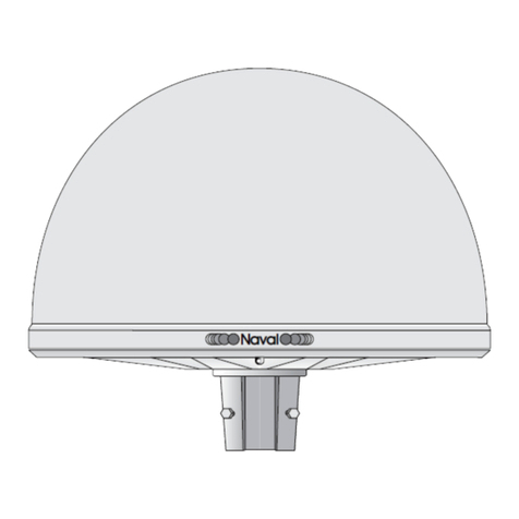
Ag Leader GPS 6000 User manual

GPS 6000
Operator Manual
Ag Leader PN 2006238 Rev. A

© 2014 Ag Leader Technology
2202 South Riverside Drive
Ames, Iowa 50010 USA
All Rights Reserved

1
T
ABLE
OF
C
ONTENTS
Table of Contents
GPS 6000 User Manual
Warranty...................................................................................................................3
Proprietary Notice.....................................................................................................3
Notice
FCC Notices .............................................................................................................4
Industry Canada .......................................................................................................4
CE.............................................................................................................................5
WEEE .......................................................................................................................5
REACH .....................................................................................................................5
Customer Support
Contact Information ..................................................................................................5
Service......................................................................................................................6
Conventions Used In This Manual............................................................................6
Cautions and Warnings ............................................................................................6
Cross-references and Web Links .............................................................................6
Viewing this Manual Online ......................................................................................6
Product Registration.................................................................................................7
Introduction
Models and Features................................................................................................7
Scope .......................................................................................................................7
Installation and Setup
GPS 6000 Setup .................................................................................................8
Power Supply Requirements...............................................................................9
Mounting the GPS 6000......................................................................................9
Additional Features and Information.........................................................................9
Status Indicators ...............................................................................................10
Emulated Radar (ER)........................................................................................10
Controller Area Network (CAN).........................................................................11
Getting Started .......................................................................................................11
Starting the Receiver.........................................................................................11
Emulated Radar (ER) .............................................................................................11
Firmware Updates ..................................................................................................11
Authorization Code.................................................................................................12
Updating or Upgrading Using the WinLoad Utility ..................................................12
Transferring Firmware Files ..............................................................................12
Types of Firmware Files ..............................................................................12
GPS 6000 Application Software........................................................................12
Using the WinLoad Utility ..................................................................................12
Open a File to Download .............................................................................13
Communications Settings ............................................................................13
Downloading Firmware ................................................................................13
2
Upgrading Using the AUTH Command.................................................................. 13
Upgrade Procedure .......................................................................................... 14
Technical Specifications ........................................................................................ 15
GPS 6000 Receiver Performance ................................................................... 15
GPS 6000 Specifications ................................................................. 16
GPS 6000 Strobes ........................................................................................... 17
GPS 6000 Input/Output Electrical Specifications ............................................ 17
Dimensions....................................................................................................... 18
Replacement Parts
GPS 6000 Product ........................................................................................... 19

3
GPS 6000 USER MANUAL
WARRANTY
Ag Leader warrants that its GNSS products are free from defects in materials and workmanship, subject
to the conditions set forth on our web site: www.agleader.com and for the following time periods:
GPS 6000 Receiver 2 years
PROPRIETARY NOTICE
Information in this document is subject to change without notice and does not represent a commitment
on the part of Ag Leader. The software described in this document is furnished under a licence
agreement or non- disclosure agreement. The software may be used or copied only in accordance with
the terms of the agreement. It is against the law to copy the software on any medium except as
specifically allowed in the license or non-disclosure agreement.
No part of this manual may be reproduced or transmitted in any form or by any means, electronic or
mechanical, including photocopying and recording, for any purpose without the express written
permission of a duly authorized representative of Ag Leader.
The information contained within this manual is believed to be true and correct at the time of publication.
NovAtel, and OEMStar are registered trademarks of NovAtel Inc.
Manufactured and protected under U.S. Patent:
#5,101,416* #5,734,674 #6,243,409 B1
#5,390,207* #5,736,961 #6,608,988 B1
#5,414,729* #5,809,064 #6,664,923 B1
#5,495,499* #6,184,822 B1 #6,728,637 B2
© Copyright 2014 Ag Leader. All rights reserved. Unpublished rights reserved under International
copyright laws.

4
NOTICE
The following notices apply to the GPS 6000.
WARNING: Changes or modifications to this equipment not expressly approved by NovAtel Inc.
could result in violation of FCC, Industry Canada and CE Marking rules and void the user’s
authority to operate this equipment.
FCC NOTICES
This device complies with part 15 of the FCC Rules. Operation is subject to the following two conditions:
(1) this device may not cause harmful interference, and (2) this device must accept any interference
received, including interference that may cause undesired operation.
GPS 6000 has been tested and found to comply with the emission limits for a Class B digital device,
pursuant to part 15 of the FCC Rules. The Class B limits are designed to provide reasonable protection
against harmful interference in a residential installation.
This equipment generates, uses, and can radiate radio frequency energy and, if not installed and used in
accordance with the instructions, may cause harmful interference to radio communications. However,
there is no guarantee that interference will not occur in a particular installation. If this equipment does
cause harmful interference to radio or television reception, which can be determined by turning the
equipment off and on, the user is encouraged to try to correct the interference by one or more of the
following measures:
• Re-orient or relocate the GPS 6000
• Increase the separation between the equipment and the GPS 6000
• Connect the equipment to an outlet on a circuit different from that to which the GPS 6000 is connected
• Consult the dealer or an experienced radio/TV technician for help
CAUTION: Changes or modifications not expressly approved by the party responsible for
compliance could void the user's authority to operate the equipment.
CAUTION: In order to maintain compliance as a Class “B” digital device, shielded cables should be
used for the RS-232 serial data ports (Belden 1036A or equivalent) and twisted pair cable should
be used for the CAN port (shielded twisted pair will improve CAN performance in electrically harsh
environments). I/O signals should be referred to signal ground (connector pin 5) and not power ground
(connector pin 9). If I/O signals route to different areas of the vehicle, dedicated signal grounds for I/O
should be spliced into a common connection to connector pin 5 at a point close to the GPS 6000.
INDUSTRY CANADA
GPS 6000 Class B digital apparatuses comply with Canadian ICES-003.
GPS 6000 appareils numérique de la classe B sont conforme à la norme NMB-003 du Canada.
This device complies with Industry Canada license-exempt RSS standard(s). Operation is subject to the
following two conditions: (1) this device may not cause interference, and (2) this device must accept any
interference, including interference that may cause undesired operation of the device.

5
Le présent appareil est conforme aux CNR d'Industrie Canada applicables aux appareils radio exempts
de licence. L'exploitation est autorisée aux deux conditions suivantes : (1) l'appareil ne doit pas produire
de brouillage, et (2) l'utilisateur de l'appareil doit accepter tout brouillage radioélectrique subi, même si le
brouillage est susceptible d'en compromettre le fonctionnement.
CE
The enclosures carry the CE mark.
"Hereby, NovAtel Inc. declares that this GPS 6000 is in compliance with the essential requirements and
other relevant provisions of the R&TTE Directive 1999/5/EC, EMC Directive 2004/108/EC and the RoHS
Recast Directive 2011/65/EU."
WEEE
If you purchased your GPS 6000 in Europe, please return it to your dealer or supplier at the end of its
life. The objectives of the European Community's environment policy are, in particular, to preserve,
protect and improve the quality of the environment, protect human health and utilize natural resources
prudently and rationally. Sustainable development advocates the reduction of wasteful consumption of
natural resources and the prevention of pollution. Waste electrical and electronic equipment (WEEE) is a
regulated area. Where the generation of waste cannot be avoided, it should be reused or recovered for
its material or energy.
WEEE products may be recognized by their wheeled bin label ( ).
REACH
NovAtel strives to comply with the EU Directive EC 1907/2006 on chemicals and their safe use as per
the Registration, Evaluation, Authorization and Restriction of Chemical substances (REACH) for its
products, including the GPS 6000 product. Since REACH SVHC lists are updated occasionally, please
contact NovAtel Customer Support if you require further information.
WARNING: Cables may contain DEHP (CAS Number 117-81-7) in concentrations above 0.1% w/w.
CUSTOMER SUPPORT
CONTACT INFORMATION
Use one of the following methods to contact Ag Leader Support:
ph: (515) 232-5363
fax: (515) 232-3595
e-mail: [email protected]

6
SERVICE
There are no user-serviceable parts inside the receiver. Contact the manufacturer for a Return Material
Authorization (RMA).
ph: (515) 232-5363
fax: (515) 232-3595
e-mail: [email protected]
CONVENTIONS USED INTHIS MANUAL
CAUTIONS AND WARNINGS
The operators manual uses the following text formatting schemes to call attention to information related
to simplifying system operation and proper operating practices to prevent accidental data loss. If in doubt
about the results of performing an action or deleting an item from the system, back up all system files to
the USB external drive prior to proceeding with the action.
Note: Provides informative tips to assist with system setup, calibration, and operation.
CAUTION: Indicates specific settings, calibrations, and procedures that mustbe followed for proper system
performance and operation.
WARNING: Indicates specific instructions to avoid accidental loss of data and system configurations
settings.
CROSS-REFERENCES AND WEB LINKS
Throughout this manual, numerous cross-references are provided to other pages or sections. These
cross-references are always shown in blue, italic text; and list the title and page number as in the
following example: To find the information you’re looking for, see “Conventions Used In This Manual” on
page 6. If you are viewing this manual in PDF format, you can click on this blue text and go directly to the
link.
Links to web sites are shown in blue, italicized, and underlined text, as in the following example: To view
the web site, go to: www.agleader.com.
VIEWING THIS MANUAL ONLINE
This operators manual can be viewed online at Ag Leader’s Web site. To view an online version, go to
the Ag Leader Web site and click the Customer Support link. You will see a page titled “Product
Manuals.”
To view and/or print the Operators Manual online, you will need the Adobe Acrobat or Adobe Reader.
The Adobe Reader software comes pre-installed on most personal computers. If Adobe Reader is not
installed on your computer the program is available for download at no charge. A link to the Adobe
download site is located at the Ag Leader Web site.

7
PRODUCT REGISTRATION
When registering your Ag Leader Technology products by one of the following methods, you can elect to
receive notice of any new product updates or features.
Register by mail: Ag Leader Technology
2202 South Riverside Dr.
Ames, IA 50010
Register by Fax: 515-232-3595
Register at the Ag Leader Web site at http://www.agleader.com
INTRODUCTION
The GPS 6000 is a high-performance GNSS receiver and
antenna, capable of receiving and tracking different
combinations of GPS L1 and GLONASS L1 code and
carrier signals on a maximum of 14 channels. SBAS
(Satellite Based Augmentation Systems) support, which
includes WAAS, EGNOS, and MSAS, is standard. The
GPS 6000 rear panel also features light emitting diodes
(LEDs) for status indication.
Once properly powered, the GPS 6000 begins operating
as a fully functional GNSS system.
MODELS AND FEATURES
The main features of the GPS 6000 are:
• a high performance GPS+GLONASS L1 receiver
• a high performance GPS+GLONASS L1 antenna
• emulated radar output
• a CAN port
• two (2) RS-232 COM ports
• three (3) LED status indicators
• a water and dust tight enclosure
SCOPE
This manual contains information about the installation and operation of the GPS 6000 system. It is
beyond the scope of this manual to provide details on service or repair. Contact your local Ag Leader
dealer for any customer-service related inquiries.
The following conventions are used in this manual:
Note: Information that supplements or clarifies text.

8
CAUTION: A caution that actions, operation or configuration may lead to incorrect or improper use
of the hardware.
WARNING: A warning that actions, operation or configuration may result in regulatory
noncompliance, safety issues or equipment damage.
INSTALLATION AND SETUP
This chapter contains instructions and tips to set up your GPS 6000 to create a GNSS receiver system.
GPS 6000 SETUP
Complete the following steps to connect and power the GPS 6000.
1. Mount the GPS 6000 on a secure, stable structure with an unobstructed view of the sky from horizon
to horizon.
2. Connect the Ag Leader interface cable to the COM and Power port on the back of the GPS 6000.
3. Connect the serial port to your display.
Note: Minimum conductor size for all wiring is 0.5 mm / 20 AWG.
Pin Use Pin Use
1 COM1 TxD 8 RESERVED (Do not connect)
2 COM1 RxD 9 Power Negative/Return
3 COM2 TxD 10 Emulated Radar Output
4 COM2 RxD 11 MKI (Mark Input)
5 Signal Ground (COM/ER/MKI/PPS) 12 PPS (Pulse Per Second) Output
6 CAN+ 13 RESERVED (Do not connect)
7 CAN- 14 Power Positive/Source

9
POWER SUPPLY REQUIREMENTS
The GPS 6000 requires +8 to +36 VDC for the input power to the receiver. See “GPS 6000 Specifications”
on page 16 for additional power supply specifications.
WARNING: The GPS 6000 power source must be protected by a 5A fast blow fuse (user supplied) or
damage to wiring may result (not covered by warranty).
MOUNTING THE GPS 6000
Mount the GPS 6000 on a secure, stable structure capable of safe operation in the specific environment.
• If installing on a vehicle, mount the GPS 6000 on the vehicle roof, ideally close to the pivot point of the
vehicle. The GPS 6000 must be mounted with the connector facing the rear of the vehicle.
Note: The GPS 6000 must be rigidly secured to the vehicle to avoid errors caused by vibration and motion.
• If installing in a stationary location, mount the GPS 6000 in a location that has a clear view of the sky so
that each satellite above the horizon can be tracked without obstruction.
ADDITIONAL FEATURES AND INFORMATION
This section contains information on the additional features of the GPS 6000, which may affect the
overall design of your receiver system.
Route cable
toward back
of vehicle
Orient toward
the front of
vehicle

10
STATUS INDICATORS
GPS 6000 LED Status Indicators provide the status of the receiver. The table below shows the meaning
of the LED states in the expected sequence after power is applied.
Note: Flashing means that the LED is turning on and off at a 1 Hz rate - 0.5 seconds on and 0.5 seconds off.
Troubleshooting:
• If the power is on but the yellow LED does not flash within one minute, then no satellites are being tracked.
There may be excessive blockage or the GPS 6000 may be defective. Make sure the GPS 6000 has an
unobstructed view of the sky. Try power cycling the GPS 6000.
• If the yellow LED is flashing but doesn’t progress to solid yellow within one minute, then insufficient
satellites are being tracked or the signal quality is poor and ephemeris data cannot be received.
Normally, four satellites are sufficient for a valid position as long as they are widely distributed in the sky.
If LED is stuck on blinking yellow, there may be excessive signal blockage or the GPS 6000 may be
defective. Make sure the GPS 6000 has an unobstructed view of the sky. Try power cycling the GPS
6000.
• If the yellow LED is on, but the green doesn’t turn on within five minutes than no SBAS or DGPS positions
are available. If you are using SBAS, make sure SBAS is available in your area and that the GPS 6000
is configured to enable SBAS positions (SBASCONTROL ENABLE and SELECTCHANCONFIG). For
DGPS, make sure the GPS 6000 is configured with the correct serial port parameters and to accept the
DGPS protocol your area is using and that your data modem is connected and working.
• The green LED blinks when SBAS is detected then it comes on solid when SBAS is enabled. The LED
will stay dark if SBAS is not detected.
EMULATED RADAR (ER)
The GPS 6000 outputs an emulated RADAR signal on the GPS 6000 cable.
The ER outputs a logic high of supply voltage minus 0.5 V minimum and logic low of 0.5 V maximum with
a rise and fall time of less than 1 ms. The ER output references signal GND and provides logic low
output until the receiver’s speed is greater than 1 km/Hr. ER can be configured to operate at one of three
distinct frequencies (26.11, 28.12 or 36.11 Hz/km/Hr, with 26.11 Hz/km/Hr being the default value) and
with an effective range from 1 km/Hr to 55 km/Hr for near-horizontal applications.
Red
Yellow Green Condition
Off Off Off Power is not available.
On Off Off Power is available but no satellites are being tracked yet
On Flashing Off Tracking at least one satellite but not a valid position.
On On Off Position valid in basic autonomous mode.
On On Flashing SBAS tracking, but not enough data for enhanced solution.
On On On Position valid in an enhanced accuracy mode
(WAAS/EGNOS/MSAS/DGPS).

11
See “Emulated Radar (ER)” on page 11 for more information.
CONTROLLER AREA NETWORK (CAN)
NMEA 2000 is a CAN standard created by the National Marine Electronics Association and designed to
support networking in marine applications. It functions over a longer physical distance, and supports
more physical nodes than ISO 11783. The relationship between NMEA2000 and SAE J1939 is that
J1939 is the standard, while the NMEA 2000 group has added some new messages (called PGNs or
Parameter Group Numbers) and added a new, additional transport protocol called FastPacket.
NMEA2000 compliant, for all intents and purposes, means J1939 compliant plus support for new
NMEA2000 messages. J1939 is additionally “harmonized” with ISO 11783, a standard for the agriculture
industry.
The CAN module is generally not user-interactive. The module supports the following NMEA2000
Parameter Group Number (PGN) message:
• PGN 129029 GNSSPositionData (1 Hz)
• PGN 129025 GNSSPositionRapidUpdate (10 Hz)
• PGN 129026 COGandSOGRapidUpdate (10 Hz)
Note: Details about the PGN messages are found in the NMEA2000 specification which can be purchased
directly from the National Marine Electronics Association (www.nmea.org/).
Available CAN Signals on the GPS 6000
GETTING STARTED
STARTING THE RECEIVER
When first powered, the GPS 6000 undergoes a complete self-test.
EMULATED RADAR (ER)
A typical radar sensor emits radio beams that bounce off the ground and computes ground speed based
on the speed at which objects are passing in front of the sensor. The output of the sensor is a digital
pulse, the frequency of which is proportional to the vehicle’s ground speed. This is often used in
agricultural applications such as planting and spraying. The GPS 6000 eliminates the need for separate
ground-sensing radar equipment by converting the GPS-derived velocity to proportional frequency
output.
FIRMWARE UPDATES
Firmware updates are firmware releases that include fixes and enhancements to the receiver
functionality. Firmware updates are released on the Ag Leader web site as they become available. New
CAN
Pins
CAN+ Pin 6
CAN- Pin 7

12
firmware must be loaded into the receiver through the Ag Leader display. Once loaded, the receiver
reboots and begins operating with the new firmware.
Note: Direct access to a serial COM port on the GPS 6000 is required.
AUTHORIZATION CODE
An authorization code, commonly known as an auth-code, is required to upgrade and possibly update an
GPS 6000 receiver. Auth-codes are obtained by contacting Ag Leader sales.
UPDATING OR UPGRADING USING THE WINLOAD
UTILITY
WinLoad is the simplest and most common way to update or upgrade an GPS 6000 receiver.
TRANSFERRING FIRMWARE FILES
To proceed with an update or possibly an upgrade, obtain the latest version of firmware from the Ag
Leader Website.
Types of Firmware Files
• OEM Version - Use the OEM version if the receiver or model upgrade was purchased after the cut- off
date. When the OEM version is used, Ag Leader sales must generate and provide the required
authorization code. Authorization codes are obtained by contacting Ag Leader sales.
The OEM version is named OEMXXXX.EXE, where XXXX is the firmware version.
GPS 6000 APPLICATION SOFTWARE
The GPS 6000 receiver has two types of software loaded, the OEMStar firmware and the GPS 6000
Application Software. The OEMStar firmware provides the features that are common to all OEMStar
receiver.
The Application Software provides the special features available on the GPS 6000, such as Emulated
Radar.
The Application Software is available from the Ag Leader website at http://www.agleader.com/.
It is loaded onto the GPS 6000 receiver using the same procedures used for the OEMStar firmware. An
authorization code is not required for Application Software updates.
USING THE WINLOAD UTILITY
If opening WinLoad for the first time, ensure the file and communications settings are correct.

13
Open a File to Download
Select File. Open. Navigate to the file to open.
WinLoad’s Open Window
When a file is selected, the filename appears in the main
WinLoad display area and in the title bar
Open File in WinLoad
Communications Settings
To set the communications port and baud rate, select Settings COM Settings.
Choose the computer port to use from the Com Port drop down list and the baud
rate from the Download Baudrate drop down list. Set the baud rate as high as
possible (the default of 115200 is preferred).
Downloading Firmware
1. Select the file to download.
2. Ensure the file path and name are displayed in main display area.
3. Click Write Flash to download the firmware.
4. When Searching for card appears in the main display, power cycle the receiver.
5. If the Authorization Code window appears, enter the auth-code and click OK.
6. The receiver finishes the download and then resets. The process is complete
when Done appears in the main display area.
7. Close WinLoad. Upgrade Process Complete
UPGRADING USING THE AUTH COMMAND
The AUTH command authorizes the enabling (unlocking) of model features. The AUTH command is
used to upgrade a new receiver model, available with the same firmware version as the current model.
This command only functions with a valid auth-code assigned by Ag Leader.

14
The upgrade can be performed directly through the Ag Leader display.
UPGRADE PROCEDURE
Example:
7WBMBK,887CB6,K5J3FH,5DF5P2,42PW8G,D1SB0GTT0,121211
When the AUTH command is executed, the receiver reboots.

15
TECHNICAL SPECIFICATIONS
GPS 6000 RECEIVER PERFORMANCE
a. Satellite Based Augmentation Systems (SBAS) include WAAS (North America), EGNOS (Europe)
and MSAS (Japan).
b. Typical values. Performance specifications subject to GPS system characteristics, US DOD
operational degradation, ionospheric and tropospheric conditions, satellite geometry, baseline
length, multipath effects and the presence of intentional or unintentional interference sources.
c. Typical value. No almanac or ephemerides and no approximate position or time.
d. Typical value. Almanac and recent ephemerides saved and approximate time entered.
e. Export licensing restricts operation to a maximum velocity of 515 metres per second.
PERFORMANCE
Channel Configuration 14 GPS L1
12 GPS L1 + 2 SBASa
10 GPS L1 + 4 GLONASS L1
8 GPS L1 + 6 GLONASS L1
8 GPS L1 + 4 GLONASS L1 + 2 SBASa
10 GPS L1 + 2 GLONASS L1 + 2 SBASa
7 GPS L1 + 7 GLONASS L1
14 GLO L1
Horizontal Position Accuracy (RMS)bAbsolute
Autonomous 1.5 m
SBASa0.9 m
DGPS 0.5 m
Measurement Precision (RMS) GPS GLONASS
L1 C/A Code 5 cm 35 cm
L1 Carrier Phase 0.6 mm 1.5 mm
Maximum Data Rate Measurements 10 Hz Position 10 Hz
Time to First Fix Cold Startc85 s Hot Startd 55 s
Signal Reacquisition L1 <1.0 s (typical)
Time Accuracy (RMS) GPS 20 ns GLONASS 40 ns
Velocity Accuracy e(RMS) 0.05 m/s

16
GPS 6000 SPECIFICATIONS
a. When tracking GPS satellites.
b. Φdenotes diameter
c. See “Notice” on page 4.
INPUT/OUTPUT CONNECTORS
GPS 6000 COM/PWR +8 to +36 V DC at 2.5 W (typical while logging) a
Serial Com Ports RS-232 F Compliant (Rx and Tx signals only)
CAN SAE J1939/ ISO 11783/ ISO 11898 Compatible
Emulated Radar Output High = Supply Voltage -0.5V Minimum
Low = 0.5V Maximum
Load > 3k Ohm
PPS Output 3.3V CMOS Logic Compatible
MKI Input 3.3V CMOS Logic / 5V Tolerant
INPUT/OUTPUT CONNECTOR PROTECTION
Electrical Conducted/ Coupled
disturbance tolerance
ISO 7637-2:2004
Functional Class A: Pulses 2a, 3a, 3b, 4
Functional Class C: Pulses 1, 2b
LED INDICATORS
See “Status Indicators” on page 10
PHYSICAL
Size 155.3 x 66.8 x Φ155 mmb
Weight 495 g maximum
ENVIRONMENTAL
Operating Temperature -40C to +75C
Storage Temperature -55C to +90C
Humidity MIL-STD-810G-Method 507.5
Immersion MIL-STD-810G Method 512.5
VibrationcRandom MIL-STD-810G 514.6E-1
Sinusoidal ASAE EP455, Section 5.15.2 Level 1 & 2
Shock MIL-STD-810-G Method 516.6

17
GPS 6000 STROBES
GPS 6000 INPUT/OUTPUT ELECTRICAL SPECIFICATIONS
a. The above characteristics are applicable over the operating temperature range.
Strobes Default
Behavior Input/
Output Factory
Default Comment
Event
Mark In
(MKI)
Dedicated
pin
Input
Leading
edge
triggered
Active low An input mark for which a pulse greater than 150 ns
triggers certain logs to be generated.
PPS Dedicated
pin
Output Active low A time synchronization output. This is a pulse where the
leading edge is synchronized to receiver-calculated GPS
time.
I/O Line Sym Mininum
(V) Typical
(V) Maximum
(V) Current
(mA) Conditions
a
PPS
VOL 0.8 V -4 mA
With on-board I/O supply, VDDIO=3.3V
VOH 2.3 V -8 mA
MKI
VIL 0.8 V 0.25 mA
VIH 2.0 V 0.30 mA

18
DIMENSIONS
All dimension are in millimeters.
Φ155
Front of Receiver
155.3
66.8
Back of Receiver
26.94
26.94
26.94
26.94
21.85
31.21
M4 Threaded
Insert (4 places)
Table of contents
Other Ag Leader Antenna manuals
Popular Antenna manuals by other brands

RCA
RCA ANT1000 - Digital Flat Passive Ultra-Slim-Profile... Assembly and usage instructions

Ciro Mazzoni
Ciro Mazzoni I3VHF LOOP ANTENNA instruction manual

Chauvin Arnoux
Chauvin Arnoux ORITEL SAN 100 user manual

Xtreme Signal
Xtreme Signal HDB91X Assembly and installation manual

C. Crane
C. Crane Twin Coil Ferrite operating instructions

Channel Master
Channel Master STEALTHtenna instruction sheet