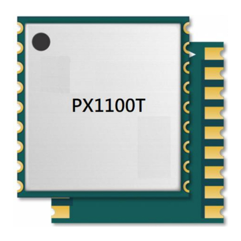
SkyTraq PX1175RDP User manual

1
PX1175RDP
Features
⚫Centimeter accuracy RTK dead-reckoning receiver
⚫3-axis accelerometer & gyroscope
⚫Barometric pressure sensor altitude sensing
⚫Automatic sensor calibration
⚫230 Channel receiver
⚫GPS/Galileo/Beidou/QZSS/NavIC receiver
⚫17mm x 22mm size
⚫NMEA-0183 and RTCM 3.x protocol
⚫Easy to integrate
⚫Operating temperature -40 ~ +85ºC
⚫RoHS compliant
Applications
⚫4 Wheel Vehicle RTK Navigation
L1/L5 GNSS RTK
Dead Reckoning Receiver
The PX1175RDP GNSS RTK Dead-Reckoning receiver
module combines RTK position data, gyroscope data
(measuring turning angle), and odometer data
(measuring distance traveled) to formulate position
solution. This enables accurate navigation solution in
poor signal environment or signal blocked area. The
PX1175RDP is ideal for 4-wheel vehicle applications
requiring accurate continuous navigation.
PX1175RDP can operate in Automotive Dead Reckoning
(ADR) mode if the vehicle wheel-tick odometer signal is
connected; or operate in Odometer-less Dead Reckoning
(ODR) mode if the odometer signal is not connected.
The barometric pressure sensor provides superior
altitude sensing performance.
The Extended Kalman Filter algorithm combines GNSS
and sensor data with weighting function dependent on
GNSS signal quality. In poor signal reception area, the
position error is reduced by dead reckoning.
The PX1175RDP with dead-reckoning feature, position is
output as soon as power is applied to the module
without the need of getting GPS/GNSS position fix.
The receiver is suitable for RTK applications that require
high performance continuous positioning and velocity
data.

2
TECHNICAL SPECIFICATIONS
Receiver Type 230-channel PHOENIX engine
GPS/QZSS L1/5, BeiDou B1I/B2a, Galileo E1/E5a, NavIC L5, SBAS L1
Accuracy Position < 1m CEP autonomous
1cm + 1ppm RTK mode
Velocity 0.05m/sec*1
Time 12ns
Startup Time 1 second hot start under open sky
28 second warm-start under open sky (average)
29 second cold-start under open sky (average)
Reacquisition 1s
Update Rate 1 / 2 / 4 / 5 / 8 / 10 / 20 / 25 / 40 Hz
Operational Limits Altitude < 18,000m and velocity < 515m/s
Serial Interface 3.3V LVTTL level
Protocol NMEA-0183 V4.1
GGA, GLL, GSA, GSV, RMC, VTG
115200 baud, 8, N, 1
RTCM 3.x or SkyTraq raw data binary
115200 baud, 8, N, 1
Datum Default WGS-84 and user definable in stand-alone mode
Depends on base reference frame when in RTK mode
Input Voltage 3.3V +/- 10%
Input Current 240mA @ 3.3V
Dimension 17mm L x 22mm W x 2.9mm H
Weight: 2g
Operating Temperature -40oC ~ +85oC
Storage Temperature -55 ~ +100oC
Humidity 5% ~ 95%
*150% @ 30 m/s for dynamic operation

3
BLOCK DIAGRAM
Module block schematic
Active antenna is required to use with PX1175RDP. The received signal goes through a signal
splitter, to individual L1 and L2/L5 SAW filters to remove out-band interference, then to the
PX100-5R-01A GNSS receiver chip for RTK signal processing. Using correction data from an RTK
base station, the PX1175RDP computes the antenna position to centimeter-level accuracy relative
to the base station. The PX100-0D-01A chip uses 3-axis accelerometer, 3-axis gyroscope,
barometric pressure sensor, and RTK receiver data to formulate more robust sensor-fusion
solution.

4
SUPPORTED RTCM MESSAGES
When operating in rover mode, PX1175RDP can decode following RTCM 3.3 messages:
RTCM Message Type
Description
1005
Stationary RTK reference station antenna reference point
1006
Stationary RTK reference station ARP with antenna height
1033
Receiver and antenna description
1074
GPS MSM4
1075
GPS MSM5
1076
GPS MSM6
1077
GPS MSM7
1094
Galileo MSM4
1095
Galileo MSM5
1096
Galileo MSM6
1097
Galileo MSM7
1114
QZSS MSM4
1115
QZSS MSM5
1116
QZSS MSM6
1117
QZSS MSM7
1124
BeiDou MSM4
1125
BeiDou MSM5
1126
BeiDou MSM6
1127
BeiDou MSM7
1134
NavIC MSM4
1135
NavIC MSM5
1136
NavIC MSM6
1137
NavIC MSM7

5
PINOUT
PINOUT DESCRIPTION
Pin No.
Name
Description
1
GND
Ground
2
RF_IN
RF input
RTK Position: RF_IN antenna position
3
GND
Ground
4,5,6
NC
No connection, empty pin
7
VCC_RF
Voltage for external LNA
8,9,10,11
NC
No connection, empty pin
12
GND
Ground
13
NC
No connection, empty pin
14
GND
Ground
15
NC
No connection, empty pin
16
RXD_R
UART serial data input, 3.3V LVTTL.
UART port for firmware updating of R-chip. Default baud rate 115200.

6
17
TXD_R
UART serial data input, 3.3V LVTTL.
UART port for firmware updating of R-chip. Default baud rate 115200.
18,19
NC
No connection, empty pin
20
RTK_STAT_B
Status signal
0 : RTK Fix for Positioning
Blink : RTK Float for Positioning
1 : otherwise
21
NC
No connection, empty pin
22
ODOMETER
Vehicle odometer wheel-tick speed pulse input, frequency < 4kHz.
23
DIRECTION
Optional forward (LOW) or reverse direction (HIGH) input from vehicle.
24,25
NC
No connection, empty pin
26
RXD2_B
UART serial data input, 3.3V LVTTL.
One simplex asynchronous serial UART port is implemented. This UART input is
normally for sending RTCM-SC104 correction data or base station SkyTraq raw
measurement data to the receiver at 115200 default baud rate. In the idle
condition, this pin should be driven HIGH. If the driving circuitry is powered
independently of PX1175RDP, ensure that this pin is not driven to HIGH when
PX1175RDP is put to sleep, or a 10K-ohm series resistor can be added to
minimize leakage current.
27
TXD2_B
UART serial data output, 3.3V LVTTL.
Not used.
28,29,30,31
NC
No connection, empty pin
32
GND
Ground
33,34
VDD33
Power supply, 3.3V DC
35
NC
No connection, empty pin
36
V_BCKP
Backup supply voltage for internal RTC and backup SRAM, 1.3V ~ 3.6V. V_BCKP
must be applied whenever VCC is applied. This pin should be powered
continuously to minimize the startup time and for keeping DR calibration data.
If VCC and V_BCKP are both removed, the receiver will be in factory default
mode upon power up, all user configuration and calibrated DR parameters are
lost.
37
GND
Ground
38,39,40
NC
No connection, empty pin
41
GND
Ground
42
TXD_B
UART serial data output, 3.3V LVTTL.
One full-duplex asynchronous serial UART port is implemented. This UART
output is normally used for sending position, time and velocity information
from the receiver in NMEA-0183 format at 115200 default baud rate. When
idle, this pin output HIGH.
43
RXD_B
UART serial data input, 3.3V LVTTL.
One full-duplex asynchronous serial UART port is implemented. This UART input
is normally for sending commands or information to the receiver in SkyTraq
binary protocol at 115200 default baud rate. In the idle condition, this pin
should be driven HIGH. If the driving circuitry is powered independently of
PX1175RDP, ensure that this pin is not driven to HIGH when PX1175RDP is put
to sleep, or a 10K-ohm series resistor can be added to minimize leakage
current.
RTCM-SC104 correction data or base station SkyTraq raw measurement data
can also be sent to this UART input.
44
SDA
Not used, leave unconnected
45
SCL
Not used, leave unconnected

7
46,47
NC
No connection, empty pin
48
GND
Ground
49
RSTN
External active-low reset input to the baseband.
Only needed when power supply rise time is very slow or software controlled
reset is desired.
50
BOOT_SEL
No connection for normal use. Pull-low for loading firmware into empty or
corrupted Flash memory from ROM mode.
51,52
NC
No connection, empty pin
53
1PPS
One-pulse-per-second (1PPS) time mark output, 3.3V LV-TTL. The rising edge
synchronized to UTC second when getting 3D position fix. The pulse duration is
about 100msec at rate of 1 Hz.
54
NC
No connection, empty pin
The unshown inner grids on the bottom side of the module are GND pads.
The RTCM correction data can be input from either pin-43 RXD_B or pin-26 RXD2_B, but not both. NMEA result is
output over TXD_B.

8
MECHANICAL DIMENSION
Symbol
Dimension (mm)
A
17.00
B
22.00
C
3.85
D
1.05
E
1.90
F
1.10
G
0.80
H
1.50
K
3.65
L
3.25
M
2.10
N
1.10

9
ELECTRICAL SPECIFICATIONS
ABSOLUTE MAXIMUM RATINGS
Parameter
Minimum
Maximum
Condition
Supply Voltage (VCC)
-0.5
3.6
Volt
Backup Battery Voltage (V_BCKP)
-0.5
3.6
Volt
Input Pin Voltage
-0.5
VCC+0.5
Volt
Input Power at RF_IN
+5
dBm
Storage Temperature
-55
+100
degC
OPERATING CONDITIONS
Parameter
Min
Typ
Max
Unit
Supply Voltage (VDD33)
3
3.3
3.6
Volt
Acquisition Current (exclude active antenna current)
240
mA
Tracking Current (exclude active antenna current)
240
mA
Backup Voltage (V_BCKP)
1.3
3.6
Volt
Backup Current (VDD33 voltage applied)
54
uA
Backup Current (VDD33 voltage off)
13
uA
Output Low Voltage
0.4
Volt
Output HIGH Voltage
2.4
Volt
Input LOW Voltage
0.8
Volt
Input HIGH Voltage
2
Volt
Input LOW Current
-10
10
uA
Input HIGH Current
-10
10
uA
RF Input Impedance (RF_IN)
50
Ohm

10
APPLICATION CIRCUIT

11
AUTOMOTIVE DEAD-RECKONING (ADR)
For ADR type of application where vehicle odometer wheel-tick pulse signal is available, connect pin-22 ODOMETER to
the wheel-tick signal through appropriate level shifter such that the wheel-tick signal level is within range of LVTTL (0V
~ 3.3V). Similarly connect pin-23 DIRECTION to the vehicle forward/reverse signal. For ADR applications that has no
forward/reverse indication signal, simply ground the DIRECTION input. Below is a level shifter example circuitry.
ODOMETER-LESS DEAD-RECKONING (ODR)
If the vehicle odometer wheel-tick pulse signal is not available, then PX1175RDP can operate in odometer-less
dead-reckoning mode without the need of external connection to ODOMETER and DIRECTION pins.
When changing between ADR and ODR mode of operation, cold start command should be issued, or the V_BCKP
power should be removed such that internal DR state will be cleared and PX1175RDP will re-do DR calibration.
CALIBRATION of DR
PX1175RDP performs calibration of gyro bias and odometer scale automatically using GNSS. Customer is not required
to perform calibration at installation.
For product testing or benchmarking, the following procedure steps can achieve efficient calibration quickly after a
short period of time:
1. Find a open sky place.
2. Start PX1175RDP and stand still for 60 seconds until position fix is achieved.
3. Drive straight for 500m at speed of at least 40km/hr.
4. For next 3 minutes, drive straight and make at least 360-deg turns (either two 90-degrees left turns and right turns,
or four left turns, or four right turns) then drive straight for at least another 300m.

12
RECOMMANDED REFLOW PROFILE
The reflow profile shown above should not be exceeded, since excessive temperatures or transport times during
reflow can damage the module. Cooling temperature fall rate: max 3°C / sec
ANTENNA CONSIDERATIONS
The PX1175RDP is designed to be used with GPS/QZSS L1/L5, Beidou B1I/B2a, Galileo E1/E5a, NavIC L5
multi-frequency active antenna. Antenna with gain up to 40dB and noise figure less than 2dB can be used. It is
important to select a high-performance antenna to achieve optimal RTK performance.
POWER SUPPLY REQUIREMENT
PX1175RDP requires a stable power supply, avoid ripple on VCC pin (<50mVpp). Power supply noise can affect the
receiver’s sensitivity. Bypass capacitors should be placed close to the module VCC pin, with values adjusted depending
on the amount and type of noise present on the supply line.
BACKUP SUPPLY
The purpose of backup supply voltage pin (V_BCKP) is to keep the SRAM memory and the RTC powered when the
module is powered down. This enables the module to have a faster time-to-first-fix when the module is powered on
again. DR calibration data is also kept in this SRAM. If V_BCKP is not maintained when main power is removed, the
receiver will need to go through auto calibration process before DR could take effect every time it’s powered on. The
backup current drain is less than 35μA. In normal powered on state, the internal processor access the SRAM and
current drain is higher in active mode

13
1PPS OUTPUT
A 1 pulse per second signal (100msec HIGH duration) is generated on 1PPS pin when the receiver has 3D position fix
using 4 or more satellites. The rising edge of the pulse is aligned with UTC second, with accuracy of about 10nsec. It
outputs constant LOW when no position fix is available initially.
LAYOUT GUIDELINES
Separate RF and digital circuits into different PCB regions.
It is necessary to maintain 50-ohm impedance throughout the entire RF signal path. Try keeping the RF signal path as
short as possible.
Do not route the RF signal line near noisy sources such as digital signals, oscillators, switching power supplies, or other
RF transmitting circuit. Do not route the RF signal under or over any other components (including PX1175RDP), or
other signal traces. Do not route the RF signal path on an inner layer of a multi-layer PCB to minimize signal loss.
Avoid sharp bends for RF signal path. Make two 45-deg bends or a circular bend instead of a single 90-degree bend if
needed.
Avoid vias with RF signal path whenever possible. Every via adds inductive impedance. Vias are acceptable for
connecting the RF grounds between different layers. Each of the module’s ground pins should have short trace tying
immediately to the ground plane below through a via.
The bypass capacitors should be low ESR ceramic types and located directly adjacent to the pin they are for.
HANDLING GUIDELINE
The PX1175RDP modules are rated MSL4, must be used for SMT reflow mounting within 72 hours after taken out from
the vacuumed ESD-protective moisture barrier bag in factory condition < 30degC / 60% RH. If this floor life time is
exceeded, or if the received ESD-protective moisture barrier bag is not in vacuumed state, then the device need to be
pre-baked before SMT reflow process. Baking is to be done at 85degC for 8 to 12 hours. Once baked, floor life counting
begins from 0, and has 72 hours of floor life at factory condition < 30degC / 60% RH.
PX1175RDP module is ESD sensitive device and should be handled with care.

14
RTK Usage Guideline
Below conditions are required for getting RTK fix solution. If the conditions are not met, PX1175RDP will only have
float or DGPS/3D solution and behave like a normal GNSS receiver.
* Base and rover distance under 30Km
* Open sky environment without interference
* Signal over 37dB/Hz
* 8 or more satellites above 15 degree elevation angle with good satellite geometry or low DOP value; generally more
satellites will have faster RTK fix

15
NMEA Output Description
The output protocol supports NMEA-0183 standard. The implemented messages include GGA, GLL, GSA, GSV, VTG,
RMC, ZDA and GNS messages. The NMEA message output has the following sentence structure:
$aaccc,c–c*hh<CR><LF>
The detail of the sentence structure is explained in Table 1.
Table 1: The NMEA sentence structure
character
HEX
Description
“$”
24
Start of sentence.
Aaccc
Address field. “aa” is the talker identifier. “ccc” identifies the sentence type.
“,”
2C
Field delimiter.
C–c
Data sentence block.
“*”
2A
Checksum delimiter.
Hh
Checksum field.
<CR><LF>
0D0A
Ending of sentence. (carriage return, line feed)
Table 2: Overview of SkyTraq receiver’s NMEA messages
$GPGGA
Time, position, and fix related data of the receiver.
$GNGLL
Position, time and fix status.
$GNGSA
Used to represent the ID’s of satellites which are used for position fix. When GPS satellites are used for
position fix, $GNGSA sentence is output with system ID 1. When GLONASS satellites are used for
position fix, $GNGSA sentence is output with system ID 2. When Galileo satellites are used for position
fix, $GNGSA sentence is output with system ID 3. When BDS satellites are used for position fix,
$GNGSA sentence is output with system ID 4. When NAVIC satellites are used for position fix, $GNGSA
sentence is output with system ID 6.
$GPGSV
$GLGSV
$GAGSV
$GBGSV
$GIGSV
Satellite information about elevation, azimuth and CNR, $GPGSV is used for GPS satellites, $GLGSV is
used for GLONASS satellites, $GAGSV is used for GALILEO satellites, while $GBGSV is used for BDS
satellites, while $GIGSV is used for NAVIC satellites
$GNRMC
Time, date, position, course and speed data.
$GNVTG
Course and speed relative to the ground.
$GNZDA
UTC, day, month and year and time zone.
$GNTHS
True Heading and Status.

16
The formats of the supported NMEA messages are described as follows:
GGA –Global Positioning System Fix Data
Time, position and fix related data for a GPS receiver.
Structure:
$GPGGA,hhmmss.sss,ddmm.mmmmmmm,a,dddmm.mmmmmmm,a,x,xx,x.x,x.x,M,x.x,M,x.x,xxxx*hh<CR><LF>
1 2 3 4 5 6 7 8 9 10 11 12
Example:
$GPGGA,072120.000,2447.0913289,N,12100.5212111,E,4,27,0.5,94.715,M,19.600,M,2.000,0000*49<CR><LF>
Field
Name
Example
Description
1
UTC Time
072120.000
UTC of position in hhmmss.sss format, (000000.000 ~ 235959.999)
2
Latitude
2447.0913289
Latitude in ddmm.mmmmmmm format
Leading zeros transmitted
3
N/S Indicator
N
Latitude hemisphere indicator, ‘N’ = North, ‘S’ = South
4
Longitude
12100.5212111
Longitude in dddmm.mmmmmmm format
Leading zeros transmitted
5
E/W Indicator
E
Longitude hemisphere indicator, ‘E’= East, ‘W’= West
6
GPS quality
indicator
4
GPS quality indicator
0: position fix unavailable
1: valid position fix, SPS mode
2: valid position fix, differential GPS mode
3: GPS PPS Mode, fix valid
4: Real Time Kinematic. System used in RTK mode with fixed integers
5: Float RTK. Satellite system used in RTK mode., floating integers
6: Estimated (dead reckoning) Mode
7: Manual Input Mode
8: Simulator Mode
7
Satellites Used
27
Number of satellites in use, (00 ~ 12)
8
HDOP
0.5
Horizontal dilution of precision, (0.0 ~ 99.9)
9
Altitude
94.715
mean sea level (geoid), (-9999.9 ~ 17999.9)
10
Geoidal Separation
19.600
Geoidal separation in meters
11
Age pf Differential
GPS data
2.000
Age of Differential
NULL when not in RTK fix or RTK float
12
DGPS Station ID
0000
Differential reference station ID, 0000 ~ 1023
13
Checksum
49

17
GLL –Latitude/Longitude
Latitude and longitude of current position, time, and status.
Structure:
$GNGLL,ddmm.mmmmmmm,a,dddmm.mmmmmmm,a,hhmmss.sss,A,a*hh<CR><LF>
1 2 3 4 5 6 7 8
Example:
$GNGLL,2447.0913289,N,12100.5212111,E,072120.000,A,D*4E<CR><LF>
Field
Name
Example
Description
1
Latitude
2447.0913289
Latitude in ddmm.mmmmmmm format
Leading zeros transmitted
2
N/S Indicator
N
Latitude hemisphere indicator
‘N’ = North
‘S’ = South
3
Longitude
12100.5212111
Longitude in dddmm.mmmmmmm format
Leading zeros transmitted
4
E/W Indicator
E
Longitude hemisphere indicator
‘E’= East
‘W’= West
5
UTC Time
072120.000
UTC time in hhmmss.sss format (000000.000 ~ 235959.999)
6
Status
A
Status, ‘A’ = Data valid, ‘V’ = Data not valid
7
Mode Indicator
D
Mode indicator
‘A’ = Autonomous mode
‘D’ = Differential mode
‘E’ = Estimated (dead reckoning) mode
‘M’= Manual input mode
‘S’ = Simulator mode
‘N’ = Data not valid
8
Checksum
4E

18
GSA –GNSS DOP and Active Satellites
GNSS receiver operating mode, satellites used in the navigation solution reported by the GGA or GNS sentence and
DOP values.
Structure:
$GNGSA,A,x,xx,xx,xx,xx,xx,xx,xx,xx,xx,xx,xx,xx,x.x,x.x,x.x,x*hh<CR><LF>
1 2 3 3 3 3 3 3 3 3 3 3 3 3 4 5 6 7 8
Example:
$GNGSA,A,3,02,05,06,12,13,19,20,193,195,199,,,1.0,0.5,0.9,1*01<CR><LF>
$GNGSA,A,3,03,05,09,36,,,,,,,,,1.0,0.5,0.9,3*34<CR><LF>
$GNGSA,A,3,06,07,08,09,10,19,22,29,35,38,39,40,1.0,0.5,0.9,4*38<CR><LF>
$GNGSA,A,3,44,,,,,,,,,,,,1.0,0.5,0.9,4*39<CR><LF>
$GNGSA,A,3,02,03,,,,,,,,,,,1.1,0.5,1.0,6*33<CR><LF>
Field
Name
Example
Description
1
Mode
A
Mode
‘M’ = Manual, forced to operate in 2D or 3D mode
‘A’ = Automatic, allowed to automatically switch 2D/3D
2
Mode
3
Fix type
1 = Fix not available
2 = 2D
3 = 3D
3
Satellite used 1~12
02,05,06,12,13,1
9,20,193,195,19
9
01 ~ 32 are for GPS; 33 ~ 64 are for WAAS (PRN minus 87); 193
~ 197 are for QZSS; 65 ~ 88 are for GLONASS (GL PRN) ; 01 ~ 36
are for GALILEO (GA PRN); 01 ~ 37 are for BDS (BD PRN). GPS,
GLONASS, GALILEO and BDS satellites are differentiated by the
GNSS system ID in table 3. Maximally 12 satellites are included
in each GSA sentence.
4
PDOP
1.0
Position dilution of precision (0.0 to 99.9)
5
HDOP
0.5
Horizontal dilution of precision (0.0 to 99.9)
6
VDOP
0.9
Vertical dilution of precision (0.0 to 99.9)
7
GNSS System ID
1
GNSS system ID*
1 = GPS
2 = GLONASS
3 = GALILEO
4 = BDS
5 = IRNSS
8
Checksum
01
*GNSS System ID identifies the GNSS system ID according to Table 3.

19
*GNSS Signal ID identifies the GNSS signal name according to Table 3.
Table 3: GNSS Identification Table for GSA, GSV
System
System ID (Talker)
Signal ID
Signal Name
GPS
1 (GP)
0
1
2
3
4
5
6
7
8
All signals
L1 C/A
L1 P(Y)
L1C
L2 P(Y)
L2C-M
L2C-L
L5-I
L5-Q
GLONASS
2 (GL)
0
1
2
3
4
All signals
G1 C/A
G1P
G2 C/A
GLONASS (M) G2P
GALILEO
3 (GA)
0
1
2
3
4
5
6
7
All signals
E5a
E5b
E5 a+b
E6-A
E6-BC
L1-A
L1-BC
BDS
4 (BD)
0
1
5
B
8
3
All signals
B1
B2A
B2
B3
B1C
IRNSS
6 (GI)
0
1
All signals
L5

20
GSV –GNSS Satellites in View
Number of satellites (SV) in view, satellite ID numbers, elevation, azimuth, and SNR value. Four satellites maximum per
transmission.
Structure:
$GPGSV,x,x,xx,xx,xx,xxx,xx,…,xx,xx,xxx,xx,x *hh<CR><LF>
1 2 3 4 5 6 7 4 5 6 7 8 9
Example:
$GPGSV,3,1,11,195,73,125,46,193,71,078,46,199,60,166,41,02,56,002,46,1*59<CR><LF>
$GPGSV,3,2,11,11,54,011,45,20,53,298,47,06,46,061,45,05,40,268,45,1*6F<CR><LF>
$GPGSV,3,3,11,19,36,148,45,13,27,186,41,12,23,260,43,1*59<CR><LF>
$GPGSV,1,1,04,195,73,125,44,193,71,078,43,199,60,166,45,06,46,061,45,8*56<CR><LF>
$GAGSV,2,1,07,05,74,099,45,18,58,157,48,36,48,080,43,03,39,201,43,7*70<CR><LF>
$GAGSV,2,2,07,09,29,043,36,02,10,211,,11,07,112,,7*40<CR><LF>
$GAGSV,2,1,05,05,74,099,43,18,58,157,46,36,48,080,42,03,39,201,43,1*7D<CR><LF>
$GAGSV,2,2,05,09,29,043,37,1*41<CR><LF>
$GBGSV,4,1,13,35,78,358,50,22,60,245,50,19,58,025,48,38,53,351,46,1*75<CR><LF>
$GBGSV,4,2,13,08,49,356,41,29,43,129,47,06,36,170,42,40,35,211,44,1*74<CR><LF>
$GBGSV,4,3,13,10,35,224,43,39,31,181,44,07,28,198,42,44,25,322,40,1*7C<CR><LF>
$GBGSV,4,4,13,09,16,189,37,1*4E<CR><LF>
$GBGSV,2,1,08,35,78,358,43,22,60,245,45,19,58,025,44,38,53,351,42,5*73<CR><LF>
$GBGSV,2,2,08,29,43,129,42,40,35,211,41,39,31,181,40,44,25,322,36,5*7A<CR><LF>
$GIGSV,2,1,07,03,37,239,44,02,25,278,41,04,00,000,44,09,00,000,33,1*76<CR><LF>
$GIGSV,2,2,07,07,00,000,46,05,00,000,45,01,00,000,39,1*40<CR><LF>
Field
Name
Example
Description
1
Number of message
3
Total number of GSV messages to be transmitted (1-5)
2
Sequence number
1
Sequence number of current GSV message
3
Satellites in view
11
Total number of satellites in view (00 ~ 20)
4
Satellite ID
195
01 ~ 32 are for GPS; 33 ~ 64 are for WAAS (PRN minus 87); 193
~ 197 are for QZSS; 65 ~ 88 are for GLONASS (GL PRN) ; 01 ~ 36
are for GALILEO (GA PRN); 01 ~ 37 are for BDS (BD PRN). GPS,
GLONASS, GALILEO and BDS satellites are differentiated by the
GNSS system ID in table 3. Maximally 4 satellites are included in
each GSV sentence.
5
Elevation
73
Satellite elevation in degrees, (00 ~ 90)
6
Azimuth
125
Satellite azimuth angle in degrees, (000 ~ 359 )
7
SNR
46
C/No in dB (00 ~ 99)
Null when not tracking
8
Signal ID
1
Signal ID*
9
Checksum
59
RMC –Recommended Minimum Specific GNSS Data
Table of contents
Other SkyTraq Receiver manuals
