GeoSlam ZEB-REVO User manual

© 2017 GeoSLAM Ltd 1ZEB-REVO User Manual v3.0.0
Copyright
ZEB-REVO™ User’s Manual © 2017 GeoSLAM Ltd. All rights reserved.

© 2017 GeoSLAM Ltd 2ZEB-REVO User Manual v3.0.0

© 2017 GeoSLAM Ltd 3ZEB-REVO User Manual v3.0.0
CONTENTS
Introduction ................................................................................................................. 5
1.1 Specification .......................................................................................................... 5
1.2 Principal of operation............................................................................................ 6
1.3List of parts............................................................................................................ 7
Safety ........................................................................................................................... 9
2.1 General safety ....................................................................................................... 9
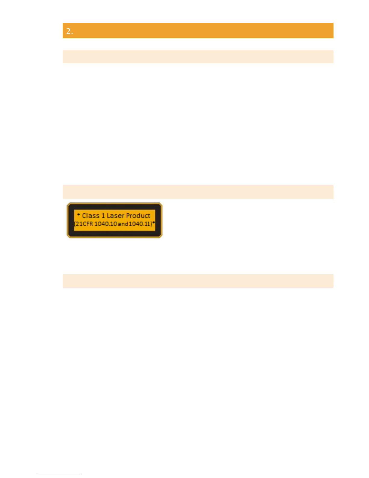
2.2 Laser Safety ........................................................................................................... 9
2.3 Electromagnetic compatability.............................................................................. 9
2.4 Battery safety ...................................................................................................... 10
2.5 System Disposal................................................................................................... 10
2.6 Installation........................................................................................................... 10
2.7 Further help and information.............................................................................. 10
Data capture .............................................................................................................. 11
3.1 Connecting the hardware.................................................................................... 11
3.2 Collecting data..................................................................................................... 11
3.3 Downloading the raw scan data .......................................................................... 13
3.4 File naming .......................................................................................................... 13
3.5 Shutting down ..................................................................................................... 13
Usage Guidelines........................................................................................................ 15
4.1 The environment ................................................................................................. 15
4.2 Loop closure ........................................................................................................ 15
4.3 Transitioning between environments ................................................................. 16
4.4 Walking speed ..................................................................................................... 16
4.5 Minimum and maximum range ........................................................................... 16
4.6 Duration of scanning ........................................................................................... 17
4.7 Survey areas with restricted or difficult access ................................................... 17
4.8 Moving objects in the environment .................................................................... 17
Data Processing.......................................................................................................... 19
5.1 GeoSLAM Hub Software ...................................................................................... 19
5.2 Flag for Support................................................................................................... 20
Output and Processing Options Tab........................................................................... 23
6.1 Output Options Tab............................................................................................. 23
6.2 Output File Configuration.................................................................................... 23
6.3 Point Colouriser................................................................................................... 25
6.4 Processing Options Tab ....................................................................................... 27
GeoSLAM Viewer ....................................................................................................... 31
7.1 2D Mode.............................................................................................................. 31
7.2 3D Mode.............................................................................................................. 32
7.3 Viewer Annotation .............................................................................................. 32
Results folder ............................................................................................................. 35
More Files .................................................................................................................. 39
Data Set Merger......................................................................................................... 41
10.1 Selecting data sets to merge ............................................................................... 41
10.2 Manual coarse alignment .................................................................................... 42

© 2017 GeoSLAM Ltd 4ZEB-REVO User Manual v3.0.0
GeoSLAM Draw .......................................................................................................... 47
Advanced settings...................................................................................................... 51
12.1 Setup page........................................................................................................... 51
12.2 Virtual Machine Optimization ............................................................................. 53
12.3 Further help and information.............................................................................. 56
Battery ....................................................................................................................... 57
13.1 Specification ........................................................................................................ 57
13.2 Recharging........................................................................................................... 57
13.3 Charge Indicator .................................................................................................. 57
13.4 Battery care......................................................................................................... 57
13.5 Transportation..................................................................................................... 58
APPENDICES ............................................................................................................... 59
14.1 Appendix 1 –GeoSLAM Data Set Flagging........................................................... 59
14.2 Appendix 2 - USB Prepare tool ............................................................................ 63
14.3 Appendix 3 –Dimensional drawings ................................................................... 65
14.4 Appendix 4 –End User License Agreement......................................................... 67

© 2017 GeoSLAM Ltd 5ZEB-REVO User Manual v3.0.0
INTRODUCTION
The ZEB-REVO portable laser scanner provides a rapid and simple means of capturing 3D
point cloud data. Data is captured as the user walks through the area of interest. The ZEB-
REVO negates the need for time consuming scanner set-ups and data registration
associated with traditional terrestrial laser scanning methods.
Provided the simple guidelines set out in this manual are adhered to accurate 3D point
clouds can be generated in a fraction of the time taken with traditional terrestrial laser
scanning methods.
1.1 SPECIFICATION
Maximum range
Up to 30m in optimal conditions
Typical max range 15-20m
Points per scan line
432 (0.625ointerval)
Field of view
270o x 360o
Scan rate
100 lines/s
43200 points/s
Scan range noise
±30mm
Laser safety classification
CLASS I Laser Product
(21 CFR 1040.10 and 1040.11)
Laser wavelength
905nm
Operating conditions
Temperature 0o C to +50o C
Humidity <85% RH
Power supply
12VDC ±10% approx. 1.5A
Weight
Scanning head 1.0kg
Carry case and contents 4.1kg
Dimensions
Scanning head 80x113x140mm (287mm incl handle)
Carry case and contents 470x220x180mm
Battery life
Approximately 4 hours continuous use
Table 1-1: Specification

© 2017 GeoSLAM Ltd 6ZEB-REVO User Manual v3.0.0
1.2 PRINCIPAL OF OPERATION
The ZEB-REVO consists of a 2D time-of-flight laser range scanner rigidly coupled to an
inertial measurement unit (IMU) mounted on a motor drive. The motion of the scanning
head on the motor drive provides the third dimension required to generate 3D information.
A novel 3D simultaneous localization and mapping (SLAM) algorithm is used to combine
the 2D laser scan data with the IMU data to generate accurate 3D point clouds.
The ZEB-REVO captures raw laser range measurement and inertial data. This data must be
processed using GeoSLAM’s SLAM algorithm to covert the raw data into a 3D point cloud.
The data is processed using the GeoSLAM Hub processing application.

© 2017 GeoSLAM Ltd 7ZEB-REVO User Manual v3.0.0
1.3 LIST OF PARTS
Part no.
Description
1 GS_610042
ZEB-REVO hand held laser scanner
2 GS_610048
ZEB-DL2600 data logger
3 GS_610008
ZEB-REVO main cable
4 GS_610024
ZEB-DL2600 download cable
5 GS_USB
USB memory stick
6 MAX_KEY_942000072007
GeoSLAM Hub licence dongle
7 DEB_BAT_CH
Battery Charger and adapters
8 DEB_CAR
12V Auto socket charger
9 SWA_138576
Backpack
Table 1-2: List of parts
Figure 1-1

© 2017 GeoSLAM Ltd 8ZEB-REVO User Manual v3.0.0

© 2017 GeoSLAM Ltd 9ZEB-REVO User Manual v3.0.0
SAFETY
2.1 GENERAL SAFETY
The ZEB-REVO Portable Mapping System should only be used by trained operators. Always
follow basic safety precautions when operating the ZEB-REVO Portable Mapping System to
reduce the risk of personal injury and to prevent damage to the equipment. Do not operate
the equipment with suspected defects or obvious mechanical damage. Please refer all
servicing of the equipment to qualified service personnel. Only use the components and
accessories supplied with your system or other accessories recommended by GeoSLAM
Ltd. Before operating the system for the first time please read this manual in full.
The equipment contains sensitive electrical and mechanical parts and thus requires
appropriate handling. Do not bend or pull the cables forcibly. Never push objects of any
kind into the connectors or sockets. Keep the equipment out of the reach of children.
Under no circumstances should any modifications be made to the ZEB-REVO Portable
Mapping System without prior written permission from GeoSLAM Ltd.
2.2 LASER SAFETY
The ZEB-REVO incorporates a Hokuyo UTM-30LX-F
laser scanner. The UTM-30LX-F is classified as a CLASS
1 Laser Product in accordance with IEC 60825-1: 2007
(2nd Edition) Safety of laser products. Equipment
classification and requirements. Class 1 Laser Products
are safe under reasonably foreseeable conditions of operation, including the use of optical
instruments for intra-beam viewing.
2.3 ELECTROMAGNETIC COMPATABILITY
The ZEB-REVO Portable Mapping System meets or exceeds the following standards:
EN61326-1:2013 Electrical equipment for measurement, control and laboratory use - EMC
requirements - Industrial Location Immunity - (immunity section only)
EN61326-1:2013 Electrical equipment for measurement, control and laboratory use - EMC
requirements - Group 1, Class A equipment - (emissions section only)
CFR 47 Code of Federal Regulations: Pt 15 Subpart B- Radio Frequency Devices - Class A
Unintentional Radiators
This equipment has been tested and found to comply with the limits for a Class A digital
device, pursuant to part 15 of the FCC Rules. These limits are designed to provide
reasonable protection against harmful interference when the equipment is operated in a
commercial environment. This equipment generates, uses, and can radiate radio frequency
energy and, if not installed and used in accordance with the instruction manual, may cause
harmful interference to radio communications. Operation of this equipment in a residential
area may cause interference.

© 2017 GeoSLAM Ltd 10 ZEB-REVO User Manual v3.0.0
2.4 BATTERY SAFETY
DO NOT attempt to dismantle the battery.
DO NOT short circuit the battery.
ONLY use the charger supplied with the system.
Excess heat will degrade the battery rapidly. Always store the battery in a cool dry place.
DO NOT leave for long periods in the sun or in a hot vehicle.
The battery is splash proof but not water proof –do not immerse in water.
2.5 SYSTEM DISPOSAL
When the ZEB-REVO Portable Mapping System reaches the end of its
life-cycle please dispose of the equipment in accordance with Directive
2002/96/EC on Waste Electrical and Electronic equipment (WEEE).
GeoSLAM Ltd is prepared to take back the waste equipment and
accessories free of charge at the manufacturing unit in Bingham, UK for
proper treatment with the objectives of the WEEE.
2.6 INSTALLATION
The ZEB-REVO can be used as a handheld device using the supplied removable handle or
can be mounted to mobile platform using the supplied mounting plate (see Section 14.3).
2.7 FURTHER HELP AND INFORMATION
Contact GeoSLAM by any of the following methods:
Phone: +44 1949 831814
Website:www.geoslam.com

© 2017 GeoSLAM Ltd 11 ZEB-REVO User Manual v3.0.0
DATA CAPTURE
This chapter describes how to connect the ZEB-REVO hardware, how to collect raw scan
data and how to download the raw scan data from the data logger.
3.1 CONNECTING THE HARDWARE
Connect the ZEB-REVO main cable to the socket on the side of ZEB-REVO scanner head.
Connect the other end of the ZEB-REVO cable to the ZEB (white) socket on the DL2600 data
logger.
DO NOT attempt to connect the ZEB-REVO cable (12 pin) to the AUX socket (14 pin- with
blue marker)
Connect the DL2600 battery connector to the external battery.
3.2 COLLECTING DATA
The process of collecting data using the ZEB-REVO scanning system is highly automated.
However, care must be taken to ensure that the collected data can be successfully
processed into a 3D point cloud using GeoSLAM’s unique SLAM algorithm. It is strongly
recommended that the user conducts a survey plan, taking into account the
recommendations set out in the Usage Guidelines in chapter 4, before commencing data
collection.
When you are ready to start collecting data follow the steps in the table below:
Step
1
Position the ZEB-REVO scanner on a flat stationary surface.
Turn on the ZEB-DL2600 data logger by pressing the on/off
button. The LED’s on the data logger may flash briefly and
then cycle green-orange-red whilst the data logger boots up
and connects to the scanner.
ZEB LED
Step
2
Once booted the ZEB LED will switch to pulsing red–
Standby mode.
Step
3
To initiate a scan the user must manually rotate scanner
head through 90 degrees or more. The ZEB LED will switch
to constant red –Preparing to scan mode.
Step
4
After approximately 3 seconds the LED on the scanner will
switch to flashing orange –Initialisation mode.
The scanner must remain stationary during initialisation. If
the scanner is disturbed during initialisation the system will
revert to Preparing to scan mode (step 3). The ZEB LED will
revert to red and wait to start initializing again.

© 2017 GeoSLAM Ltd 12 ZEB-REVO User Manual v3.0.0
Step
5
After the ZEB-REVO scanner has been in initialisation mode
for 15 seconds the LED will switch to green –Scanning
mode.
Press the motor start/stop button on the side of the
scanner head to start the scanner rotation and commence
the survey.
Step
4
When the survey is complete position the ZEB-REVO
scanner in approximately the same position as used for
initialisation (Step 2) and press the motor start/stop button
to stop the scanner rotation. After the scanner has been
stationary for approximately 5 seconds the LED will switch
back to flashing orange - De-initialisation mode.
If the scanner is disturbed during de-initialisation the ZEB
LED will revert to green and wait to start de-initialising again
Step
5
After the ZEB-REVO scanner has been in de-initialisation
mode for 15 seconds the LED will switch to pulsing red–
Standby mode.
When the ZEB-REVO scanner enters standby mode the AUX
LED will flash orange for a short period whilst the recorded
data is compressed into a single data file ready for
downloading.
! Do not turn the data logger off until the AUX LED is off
To download the raw scan data, see section 3.3
Step
6
To repeat the scan, or start a new scan, simply rotate the
scanner head through 90 degrees. The LED will change to
red, preparing to scan mode and the sequence will repeat
from Step 3
To shut down the system, press and hold the data logger
power button for 1 second.
! Do not turn the data logger off until the AUX LED is off
Disconnect the battery connector to prevent battery
discharging whilst in storage.
!The scanner must remain static during initialisation and de-initialisation
During data capture the data logger can either be carried in your spare hand or placed in
the backpack carry case.

© 2017 GeoSLAM Ltd 13 ZEB-REVO User Manual v3.0.0
3.3 DOWNLOADING THE RAW SCAN DATA
To download the raw scan data, switch on the ZEB-DL2600 data logger. Connect the DL2600
download cable to the AUX socket (with blue socket marker) and connect the supplied USB
memory stick to the download cable. The AUX LED light will light green whilst the data is
transferring to the memory stock. The USB stick must not be removed when the AUX LED
is lit green. After a few seconds (dependent on the size of the data files to be transferred)
the AUX LED will turn off. All data that has not previously been transferred will be
transferred and the USB memory stick can be removed.
!Do not remove the USB memory stick while the green AUX LED is lit
If there is a problem with the USB memory stick, for example there is insufficient capacity
or the format is not recognised the AUX LED will flash red. The raw data will remain on the
internal memory of the data logger. The following memory stick file formats are supported,
exFAT, FAT16, FAT32 and NTFS.
Downloading data is an automatic process whereby only data that has not previously been
downloaded will be transferred
3.4 FILE NAMING
Files are automatically named in accordance with the start date and time of the dataset
recording (with respect to the time/date set on the data logger clock).
An example file name for a dataset recorded at 13:41 on 31st August 2015 is:
2015-08-31_13-41-26.ZIP
The system date/time can be changed using the Prepare USB tool described in chapter
14.2.
3.5 SHUTTING DOWN
To shut the DL2600 data logger down press and hold the power button for 1 second. After
the data logger is shut down the battery cable should be disconnected from the battery to
prevent the battery from being drained.
!Disconnect the battery when not in use

© 2017 GeoSLAM Ltd 14 ZEB-REVO User Manual v3.0.0
ZEB-REVO LED
Description
Red-orange-green
System booting
Red pulse
Standby mode
Red
Preparing to scan
Orange flash
Initialising or de-initialising –data is being
logged
Green
Scanning - data is being logged
Red flash/ green
Warning –low battery voltage
Red flash x 1
Error –scanner not detected
Red flash x 2
Error –IMU not detected
Red flash x 3
Error –neither scanner or IMU detected
Table 3-1: ZEB-REVO LED status summary
AUX LED
Description
Green
Copying data to USB memory stick
Orange flash
Compressing files
Red flash
USB memory stick error (format error or disk full)
Table 3-2: AUX LED status summary

© 2017 GeoSLAM Ltd 15 ZEB-REVO User Manual v3.0.0
USAGE GUIDELINES
This chapter provides guidelines for how the ZEB-REVO Portable Mapping System should
be used to achieve the best possible results. Prior to conducting a survey, the user should
plan the proposed survey path in order to identify potential problem areas, e.g. feature
poor environments, doorway transitions and stairwells. In these areas, the user should plan
how to conduct the survey taking into account the recommendations in this chapter. The
plan should also make provision for “closing loops” where ever possible. Please adhere to
these guidelines in order to achieve the best results. It is recommended that users also
watch the accompanying training videos provided on the GeoSLAM YouTube channel.
4.1 THE ENVIRONMENT
The SLAM algorithm used to process the raw laser scan data into a 3D point cloud relies on
there being features in the scanned environment that are repeatedly scanned as the
operator passes through the scanned environment. For a feature to be significant the ratio
of its size to its range must be approximately 1:10, e.g. at 5m range for a feature to be
significant it must be >0.5m in size. ‘Feature poor’ environments include open spaces and
smooth walled passageways. In smooth walled passageways there may not be sufficient
features in the direction of travel for the SLAM algorithm to determine forward motion. In
feature poor environments we recommend the following steps are taken:
•If possible augment the environment with additional features (e.g. boxes in a
corridor or a parked vehicle in an open field.
•Ensure that whatever limited features are available are scanned repeatedly as
you move through the environment by pointing the ZEB-REVO in the direction of
the feature. By doing so more measurement points are made of the feature
increasing the likelihood that it will be used by the SLAM algorithm. This is
particularly important when the feature is at long range (>10m), e.g. when
scanning a smooth walled passageway where the only feature in the direction of
travel is the end wall or door.
•Avoid scanning moving objects (e.g. passing pedestrians or vehicles) as the SLAM
algorithm may lock on to these objects as static features.
4.2 LOOP CLOSURE
The SLAM algorithm used to process the raw scan data into a point cloud uses a method
analogous to the Traverse technique used in survey practice, in that a previously known
position is used to determine its current position. This method can result in the
compounding of any error introduced causing measure position to “drift”. It is good survey
practise to “close the loop” by re-surveying a known position so that the compounded error
can be spread around the loop.
As a minimum, it is required that the operator must start and end the survey in the same
position to ensure at least one loop closure. However, it is recommended where possible
that the operator closes the loop as often as possible in order to minimise error and
improve the accuracy of the resulting point cloud.

© 2017 GeoSLAM Ltd 16 ZEB-REVO User Manual v3.0.0
In general, it is better to do circular loops rather than “there and back” loops where the
survey path simply doubles back on itself. This applies to horizontal and vertical loops, i.e.
if possible enter and exit through different doors, move between floors via different stair
wells.
It is important to scan the closed loop regions carefully to ensure the key features are
scanned from a similar perspective. It may be necessary to turn around if you return to a
region from a different direction. This is particularly important in feature poor
environments.
4.3 TRANSITIONING BETWEEN ENVIRONMENTS
Extra care must be taken when transitioning between environments, for example passing
through a doorway or turning through a tight bend to avoid introducing errors. When
transitioning between environments the local view may change abruptly and the SLAM
algorithm may have difficulty placing the new environment relative to the previous
environment. This may result in rooms either side of a doorway being slightly misaligned.
Transition through doorways slowly and ensure that there is a period when the scanner
can view features on both sides of the doorway (i.e. into both rooms).
Try to open all doors before starting the survey. Avoid scanning doors as they are being
opened. If necessary, face away from the door and open from behind then pass through
the doorway backwards.
Transition around tight bends slowly and ensure that there is a period when the scanner
can view features on both sides of the bend.
Take care when transitioning from an enclosed feature rich environment to an open
feature poor environment, for example exiting a building. It may be necessary to turn and
face the exit and the exterior of the building if no other features are within range.
Avoid scanning any other moving objects (e.g. walking pedestrians) as you pass through a
transition.
4.4 WALKING SPEED
It is recommended that data is captured at a slow walking pace to ensure good coverage
and high-resolution data. If the forward movement is too fast there may not be enough
repeat scans of features for the SLAM algorithm to be able to process the raw laser data
into a point cloud.
4.5 MINIMUM AND MAXIMUM RANGE
Data within a small range value is not processed (by default) to eliminate data from the
scanner operator being included in the final point cloud. Avoid close proximity to walls and
ceilings.
The maximum range of the scanner is 30m. This range will only be achieved in optimal
conditions (indoors with good target reflectivity). The typical maximum range will be 15-
20m in most conditions. It is recommended that the range is kept to less than 10m where
possible to ensure good point density and to assist the SLAM algorithm.

© 2017 GeoSLAM Ltd 17 ZEB-REVO User Manual v3.0.0
4.6 DURATION OF SCANNING
For very large surveys the project should be broken down into more than one scan mission.
This is to avoid very large file sizes as well as reduce any drift that might be created in the
data. It is recommended that each survey is limited to 30 minutes. At slow walking pace, it
is possible to cover 1000-3000m of survey distance.
4.7 SURVEY AREAS WITH RESTRICTED OR DIFFICULT ACCESS
The scanning head can remain stationary for short periods of time whilst the operator
negotiates difficult access points (e.g. tight squeezes in cave systems). The scanning head
can also be held in the hand and moved up and down to mimic the normal oscillating
motion for short periods of time to assist transition through survey areas with restricted or
difficult access.
4.8 MOVING OBJECTS IN THE ENVIRONMENT
In most case the SLAM algorithm is able to handle moving objects in the environment. In
order to estimate the scanner motion the algorithm must assume a large proportion of the
environment is static. However, in some feature poor environments where 3D structure is
lacking in some dimensions, moving objects can have a greater impact on the solution. In
particular, moving objects should be avoided in long tunnel-like environments (e.g.
corridors), relatively open spaces and when transitioning through doorways.
It is best practice not to have other people closely accompany the operator during the scan
acquisition as they will be scanned throughout the map leaving streaks of data and
potentially corrupting the solution in feature poor environments. If people are required to
follow the operator they should ideally maintain a distance of 20m or more from the
operator.

© 2017 GeoSLAM Ltd 18 ZEB-REVO User Manual v3.0.0

© 2017 GeoSLAM Ltd 19 ZEB-REVO User Manual v3.0.0
DATA PROCESSING
It is necessary to process the raw data collected by the ZEB-REVO portable mapping system
using GeoSLAM’s novel 3D SLAM algorithm to generate a 3D point cloud of the
environment that has been mapped. This is done using the GeoSLAM Hub processing
software.
5.1 GEOSLAM HUB SOFTWARE
Installation of GeoSLAM Hub software is described in a separate User Guide.
Start the GeoSLAM Hub application and click on the PROCESS DATA button. The application
will switch from the START page to the DATA page as shown in Figure 5-1.
Figure 5-1
Open Windows Explorer and navigate to the location of the data set zip file to be processed.
Drag and drop the zip file in the “Drop datasets here…” field on the user interface. The
application will copy the dataset into a processing folder and then open the Options
dialogue page shown in Figure 5-2. The Options dialogue page presents the user with two
option settings tabs: OUTPUT tab and PROCESSING OPTIONS tab. These configuration
options are described in more detail in Chapter 6. In general, the default settings can be
used unless you need a specific output file format or you need to re-process the data with
non-standard processing parameters. Once the output and processing options have been
set, click the PROCESS button.
The display will switch back to the DATA page and a processing progress bar is displayed
against the data set being processed. The data will take approximately as long to process
as it did to capture (using default output and processing options). Data processing may
take considerably longer if none default settings are selected. In particular, processing of

© 2017 GeoSLAM Ltd 20 ZEB-REVO User Manual v3.0.0
video data from ZEB-CAM can add considerably to the data processing time. Once the data
has completed processing the user is presented with the options shown in Figure 5-3. The
user can either:
-Save the results folder to another location (in order to access the point cloud
data files). The results files are described in more detail in Chapters 6 and 8.
-View the data in GeoSLAM Viewer (provided this option was enabled before
processing). The GeoSLAM Viewer is described in more detail in Chapter 7.
-Reprocess the data using different output and processing options.
Figure 5-2
Figure 5-3
5.2 FLAG FOR SUPPORT
Other manuals for ZEB-REVO
1
This manual suits for next models
1
Table of contents
Other GeoSlam Scanner manuals