Hema HN5i User manual

HEMA Navigator Ezi-Ozi User
Guide


iii
Table of Contents
HEMA Navigator Ezi-Ozi User Guide ......................................................................... 1
Introduction....................................................................................................... 2
Starting OziExplorer............................................................................................ 2
Screen Layout.................................................................................................... 3
Acquiring a GPS Satellite Fix ................................................................................ 4
Standard Program Toolbar ................................................................................... 5
Page Selection................................................................................................. 5
Page Back button ............................................................................................ 6
GPS OFF / ON button ....................................................................................... 6
Exiting OziExplorer .......................................................................................... 7
Map Overlay information / buttons ....................................................................... 7
Page Selection ................................................................................................... 8
Main Toolbar button............................................................................................ 8
Object Dragging button .................................................................................... 9
Detailed Map button......................................................................................... 9
Show Full Map button..................................................................................... 10
Zoom 100% button........................................................................................ 10
Screen Brightness buttons .............................................................................. 10
Waypoint Auto Properties button ..................................................................... 10
Route Waypoint Auto Properties button ............................................................ 11
About button................................................................................................. 11
Close Window button ..................................................................................... 11
Pages and their Functions.................................................................................. 12
MAP VIEW Page................................................................................................ 13
MAPS page ...................................................................................................... 13
Maps page toolbar ......................................................................................... 14
NAME SEARCH button .................................................................................... 14
Opening a map.............................................................................................. 19
OPEN MAP button .......................................................................................... 20
FIND MAPS button ......................................................................................... 21
MAP INFO button ........................................................................................... 22
3D MODE button............................................................................................ 22
COURSE UP button ........................................................................................ 23
MAP VIEW button .......................................................................................... 23

HEMA Navigator Ezi-Ozi User Guide
iv
MAP SCALE button ......................................................................................... 24
INDEX MAPS button ....................................................................................... 25
Waypoints ....................................................................................................... 25
Waypoints .................................................................................................... 25
Adding Waypoints.......................................................................................... 26
Waypoints page............................................................................................. 27
Waypoint toolbar ........................................................................................... 39
Waypoint Nav page........................................................................................... 41
Tracks............................................................................................................. 43
Tracks .......................................................................................................... 43
Tracks page .................................................................................................. 44
Track toolbar................................................................................................. 47
Area Estimator page ......................................................................................... 54
Routes ............................................................................................................ 55
Routes ......................................................................................................... 55
ROUTES page................................................................................................ 56
Route Create toolbar ...................................................................................... 61
Route Nav toolbar.......................................................................................... 66
ROUTE NAV page.............................................................................................. 68
ALTITUDE Page ................................................................................................ 70
METERS page................................................................................................... 71
STATISTICS page ............................................................................................. 72
PROFILES page ................................................................................................ 74
Settings Page................................................................................................... 74
SETTINGS page ............................................................................................. 74
General Settings............................................................................................ 75
Map & Data Paths Settings.............................................................................. 78
Map Image Paths Settings .............................................................................. 80
GPS Config settings ....................................................................................... 80
Moving Map settings ...................................................................................... 82
Tracks Settings ............................................................................................. 84
Units settings ................................................................................................ 87
Waypoints Settings ........................................................................................ 88
Route ........................................................................................................... 89
Navigation .................................................................................................... 91

Table of Contents
v
Speed Monitor............................................................................................... 92
Load Layout .................................................................................................. 93
Display Pages................................................................................................ 93
Help............................................................................................................. 94
Appendices ...................................................................................................... 94
Appendices ................................................................................................... 94
Appendix 1 - About OziExplorer map files ......................................................... 95
Appendix 2 - Altitude Readings in Vehicle GPS units........................................... 96
Appendix 3 - Changing OziExplorer interface ..................................................... 97
On Screen Keyboard (or Input Panel) ............................................................. 100


1
HEMA Navigator Ezi-Ozi User Guide

HEMA Navigator Ezi-Ozi User Guide
2
Introduction
OziExplorerCE is a mobile version of OziExplorer designed to run on mobile devices
such as the HEMA NAVIGATOR 5i.
A PC version of OziExplorer is also available (for Windows PCs only) which has
slightly more functionality than the mobile version.
There is also a custom version of OziExplorer for Windows PCs called HEMA Explorer.
This software is available for existing HEMA NAVIGATOR 5” customers, and allows
easy transfer of waypoints, tracks, and routes between the HEMA NAVIGATOR 5” and
the PC. This software is available on the HEMA NAVIGATOR website
(http://www.hemanavigator.com.au) under the Support section.
The OziExplorer software operates in a different fashion to that installed on a typical
“street only” vehicle GPS unit.
OziExplorer can be described as moving-map software using raster maps.
Typical street navigation systems and/or software are turn-by-turn systems utilising
vector graphics.
A key difference between the two systems is that vector based systems are
“scalable”. i.e. As you zoom into the map, it is redrawn at the new scale, whereas the
raster system simply “magnifies” the map image as you zoom in. Another side effect
of this is that the raster map has fixed colours (set when the map image is created),
whereas the vector based map can be recoloured during drawing of the map, so often
vector based software will give you the option of multiple colour choices for your
maps.
Starting OziExplorer
To begin 4WD Navigation, select the 4WD button from the Main Menu.
The OziExplorer application is used primarily for off-road navigation.
OziExplorer will display a splash screen with status messages appearing in the lower
left of the screen during startup, as shown below

HEMA Navigator Ezi-Ozi User Guide
3
Please note that the interface used for OziExplorer on the HEMA NAVIGATOR HN5i
has been customised using the OziExplorer Screen Designer software.
The new interface layout is known as HEMA EziOzi.
It is designed to make OziExplorer easier to use on the NAVIGATOR by grouping
related functions together on screens (or pages), For example, operations relating to
waypoints are all together in one place on the Waypoints page.
Screen Layout
This is a typical screen layout within the OziExplorer program.
All pages have some standard features, such as:
Page Title, located in the upper-left of the screen
Standard Toolbar located along the right-hand border of the page. See the
section on the Standard Program Toolbar for a complete description.
Pages may also have a Page Specific Toolbar located along the lower edge of
the page.
HEMA Navigator Ezi-Ozi User Guide
4
The Page Specific Toolbar will contain buttons which perform functions related directly
to the page that they are on.
Acquiring a GPS Satellite Fix
In order for the NAVIGATOR to find your current location, it requires a GPS satellite
fix. To acquire a GPS fix, it is important that you are in an area open to the sky, (not
inside an enclosed building) and away from tall buildings and trees. The initial fix may
take anywhere from 2 to 5 minutes. The length of time to obtain a fix will be reduced
the next time the navigation software is started in a similar location.
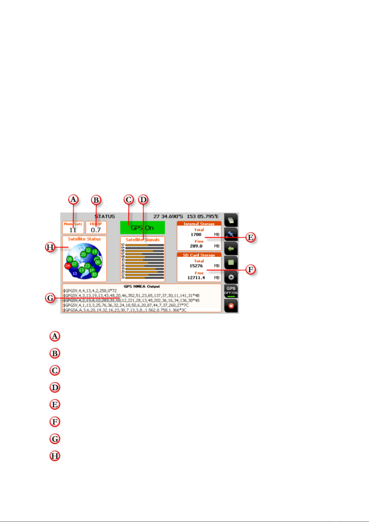
When OziExplorer starts, the STATUS page will appear, and remain until a satellite
fix is obtained. The STATUS page displays the GPS status and the number of currently
visible satellites and their relative signal strengths. Once a fix is acquired,
OziExplorer will switch to the MAP VIEW page showing your location plotted on the
most recently used map. It is then possible to select a more or less detailed map as
required.
The information displayed on the STATUS page includes:
Num Sats - The Number of satellites currently visible by the GPS receiver
HDOP - An indicator of the positional accuracy of the GPS receiver.
GPS Status Indicator (ON / OFF)
Signal strength indicators of individual numbered satellites
Total / Free internal storage capacity
Total / Free SD Card storage capacity
Log of NMEA output direct from GPS receiver
Basic sky map showing relative positions of individual numbered satellites
HEMA Navigator Ezi-Ozi User Guide
5
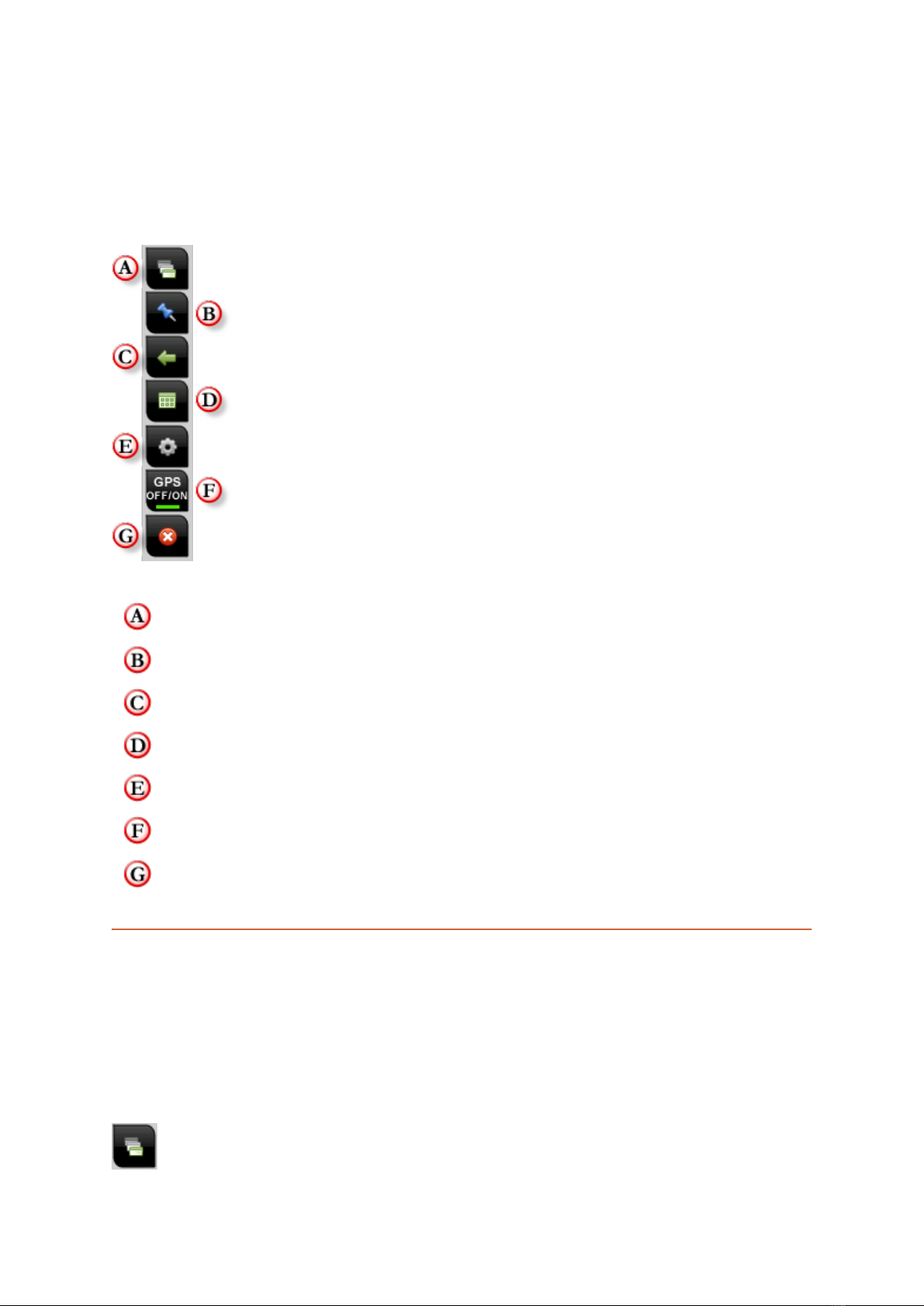
Standard Program Toolbar
The standard toolbar appears on every page within OziExplorer on your
NAVIGATOR.
The functions contained on the toolbar are described in the following sections.
Click the links to jump to the section describing that function.
Page Selection
Adding Waypoints
Page Back function
Show/Hide Main Toolbar
Settings
Toggle GPS Suspend
Exit OziExplorer
Page Selection
Within OziExplorer, there are multiple screens (referred to as pages) which you can
access. These pages provide specific views and /or functions while using
OziExplorer.
Every page has the standard toolbar located on the right-hand side of the screen, but
each page will have a page-specific toolbar located at the bottom of the screen.

HEMA Navigator Ezi-Ozi User Guide
6
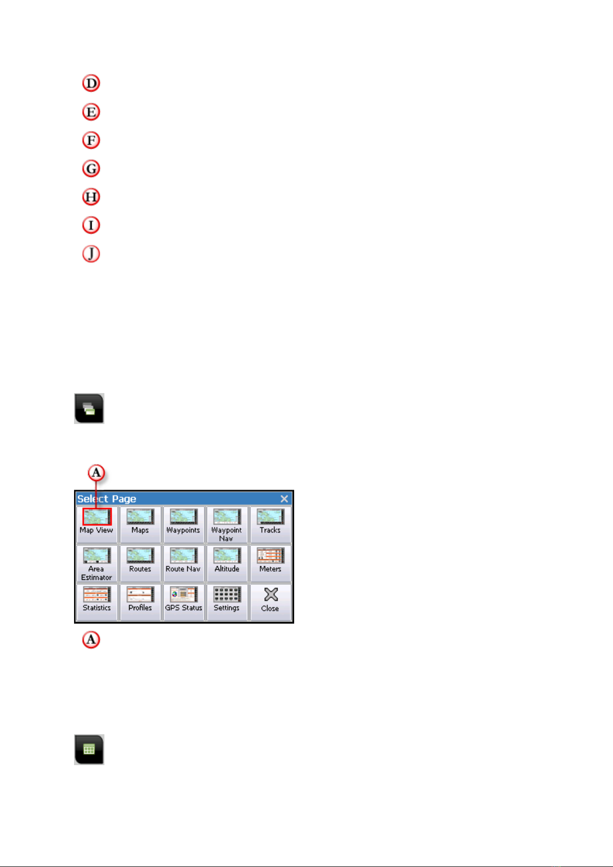
Tapping the Select Page button on the right-hand toolbar will pop up the Select
Page window.
The currently selected page is indicated by a red border on the current page on
the Select Page window.
Page Back button
The Page Back button allows you to quickly return to the previous page you were
on.
ie. if you were on the Waypoints page, then changed to the Routes page, then to
the Settings page, you could quickly return to the Waypoints page by tapping the
Page Back button twice.
The Page Back function will remember up to 9 (nine) pages.
GPS OFF / ON button
The GPS OFF / ON button will toggle the suspension of GPS tracking.
There are times in OziExplorer where it is necessary to suspend tracking your
current position.
Here are some reasons why it might be required to suspend GPS tracking
temporarily:
1. You are in location A, but wish to open a map file for another location entirely,
i.e. you are in Cape York, but wish to open a map showing the Kimberley region.
2. You have used the Name Search function to locate a particular place, and wish
to show it on the map. OziExplorer will not jump you to the named location you
found without first suspending GPS tracking.

HEMA Navigator Ezi-Ozi User Guide
7
Exiting OziExplorer
The Exit button is accessible from all pages within OziExplorer.
It is located at the bottom of the Standard Program Toolbar.
Tapping the Exit button will prompt for confirmation before exiting the program.
Map Overlay information / buttons
In addition to the standard tool bar on the right-hand side of the screen, the following
information and buttons are accessible on all pages containing the map display panel.
Speed Indicator
Page Name
Vehicle Position / Cursor Indicator
HEMA Navigator Ezi-Ozi User Guide
8
Current GPS Coordinates
Scale + button (go to next higher scale map)
Current Magnification Level
Scale - button (go to next lower scale map)
Zoom + button - Increase magnification level
Zoom - button - Decrease magnification level
Current Map Name
Page Selection
Within OziExplorer, there are multiple screens (referred to as pages) which you can
access. These pages provide specific views and /or functions while using
OziExplorer.
Every page has the standard toolbar located on the right-hand side of the screen, but
each page will have a page-specific toolbar located at the bottom of the screen.
Tapping the Select Page button on the right-hand toolbar will pop up the Select
Page window.
The currently selected page is indicated by a red border on the current page on
the Select Page window.
Main Toolbar button
Tapping the Main Toolbar button will display the Main Toolbar window.

HEMA Navigator Ezi-Ozi User Guide
9
The Main Toolbar is designed to allow quick access to some commonly used functions
within OziExplorer. The button is located on the standard toolbar located at the
right-hand side of all pages.
The Main Toolbar window looks like this:
Active items are shown indented (or “pressed in”)
Each function is described in the following sections. You can click the buttons on the
image above to jump to the relevant section.
Object Dragging button
This option is OFF by default
The Object Dragging button activates Object Drag mode. This allows you to drag
objects such as waypoints around the display.
Normally (when object dragging mode is switched OFF), tapping and dragging on an
object such as a waypoint does nothing. That is; dragging the stylus around on a map
will drag the map around.
Detailed Map button
This option is OFF by default.
The Detailed Map button switches on automatic searching for the most detailed
map.
Be aware that this is not always what you might expect, as OziExplorer might not
always load what you expect to be the most detailed map for a specific area.
This button performs the same function as the Load Detailed Map option in the
Moving Map section of the OziExplorer Settings.
HEMA Navigator Ezi-Ozi User Guide
10
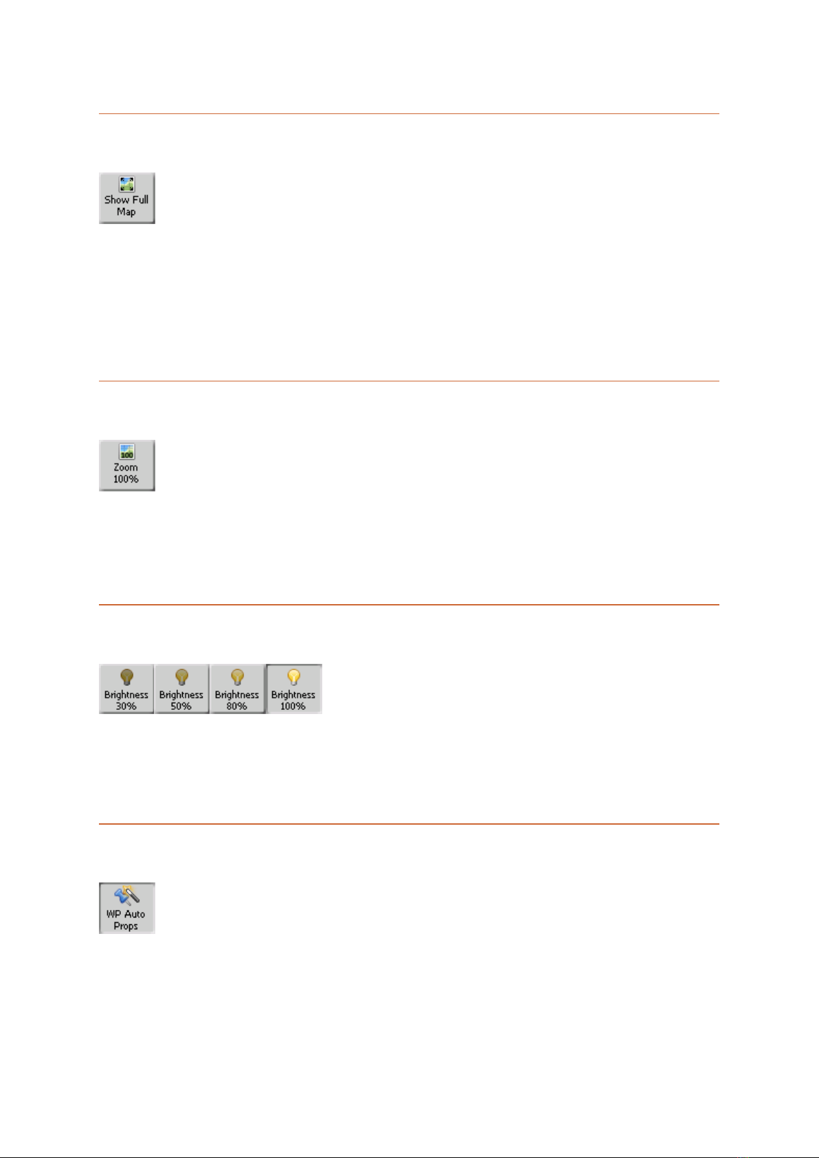
Show Full Map button
The Show Full Map button will instantly shrink the currently loaded map so that it
fits vertically within the map display.
It is a quick way to get an overview of the currently selected map in its entirety.
The scale which the map is set to will vary according to the absolute dimensions of
the map itself.
Zoom 100% button
The Zoom 100% button will instantly set the current map to 100% zoom.
It is a quick way to zoom your map back to a readable form after using the Show Full
Map function.
Screen Brightness buttons
The Brightness buttons allow you to modify the brightness of the OziExplorer
display.
This can be useful when driving at night.
Waypoint Auto Properties button
This option is ON by default.
The WP Auto Props button will switch on the Waypoint Auto Properties feature.
When this feature is active, it means that OziExplorer will automatically open the
Waypoint Properties window whenever a waypoint is created.
HEMA Navigator Ezi-Ozi User Guide
11
The WP Auto Props button provides the same function as the Auto Show Waypoint
Properties button on the Waypoints Toolbar.
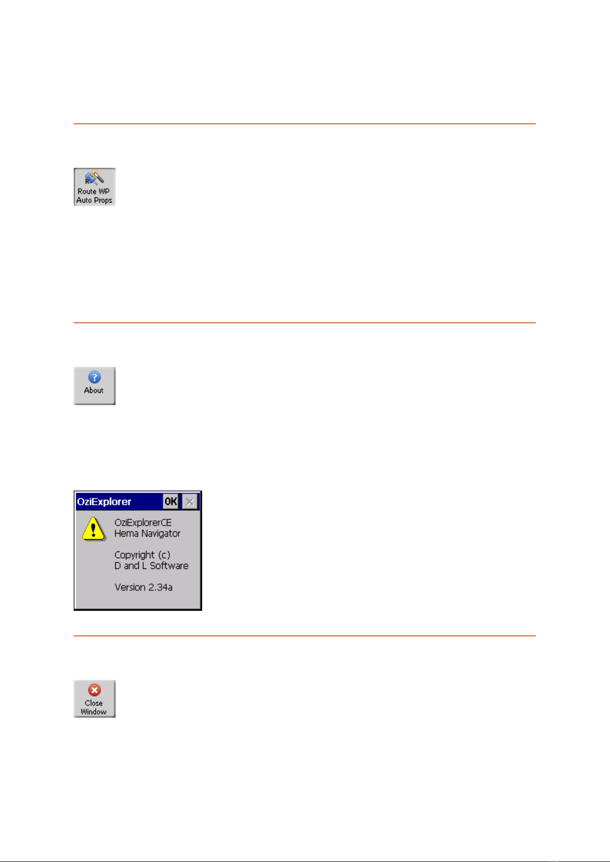
Route Waypoint Auto Properties button
This option is ON by default.
The Route WP Auto Props button will switch on the Route Waypoint Auto
Properties feature.
When this feature is active, it means that OziExplorer will automatically open the
Route Waypoint Properties window whenever a route waypoint is created.
About button
The About button will open a popup window showing the version number of the
OziExplorer software currently installed on the NAVIGATOR.
Note that the version number is also displayed in the upper-left part of the Settings
window.
Close Window button
The Close Window button will close the Main Toolbar window.
You can also tap the Xin the upper-right corner of the Main Toolbar window to close
it.

HEMA Navigator Ezi-Ozi User Guide
12
Pages and their Functions
Tap the headings to jump to that topic in this User Guide
Map View
The main view within OziExplorer which gives the largest amount of screen real
estate to the display of the currently selected map.
Maps
Similar to Map View page, but has a toolbar allowing access to functions related to
Maps.
Waypoints
Similar to Map View page, but has a toolbar allowing access to functions related to
Waypoints
Waypoint Nav
Similar to Map View page, but has information about the next Waypoint at the bottom
of the screen for use during Waypoint navigation
Tracks
Similar to Map View page, but has a toolbar allowing access to functions related to
Tracks.
Area Estimator
Displays map, but will also show the area in Hectares of the Track Tail and Track 1.
Routes
Similar to Map View page, but has a toolbar allowing access to functions related to
Routes.
Route Nav
Similar to Map View page, but has information about the next Waypoint at the bottom
of the screen for use during Route navigation.
Altitude
Similar to Map View page, but has a number of altitude related parameters at the
bottom of the screen.
Meters
Displays include a trip meter, multiple odometers, and altitude information.
Statistics
Displays some additional parameters related to Time, Speed and Acceleration
Profiles
Displays graphs showing Speed and Altitude over time
Status
Displays the current status of the GPS and satellites, along with information on
internal and SD card storage usage

HEMA Navigator Ezi-Ozi User Guide
13
Settings
Contains icons and functions allowing the customisation of OziExplorer
MAP VIEW Page
The Map View page is designed to give you the largest map view of the pages within
OziExplorer.
This page has no additional toolbars, or other items to obscure your view of the
current map.
To change to the Map View page, tap the Map View button on the Select Page
window
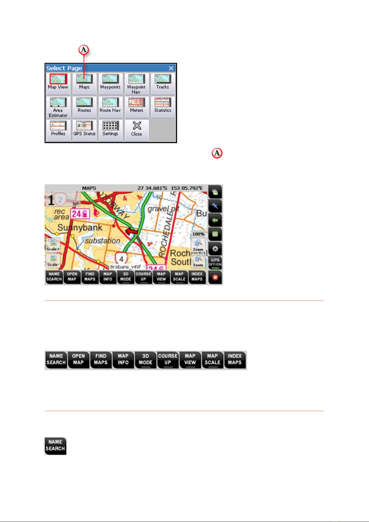
MAPS page
The Maps page is designed to group all the functions you require related to maps on
the same page.
HEMA Navigator Ezi-Ozi User Guide
14
To change to the Maps page, tap the Maps button on the Select Page window
The image below shows the MAPS page, with the Maps Page specific toolbar
located along the bottom of the screen.
Maps page toolbar
The Maps page toolbar allows you to access functions related to map operations
within OziExplorer.
Each function is described in the following sections. You can click the buttons on the
image above to jump to the relevant section.
NAME SEARCH button
Other manuals for HN5i
1
Table of contents
Other Hema GPS manuals


