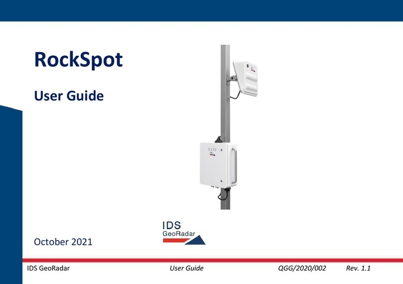
IDS GeoRadar RockSpot User manual

Mod: MDM/011/M4 Rev 1
IDS GeoRadar User Guide QGG/2020/002 Rev. 1.1
RockSpot
User Guide
September 2020

Mod: MDM/011/M4 Rev 2
IDS GeoRadar User Guide QGG/2020/002 Rev. 1.1
1Important Information about your Instrument
Read and follow the Qui k Guide before using the produ t or the a essories delivered
with the produ t.
☞
Keep for future referen e!
Intended use The intended use is the real time dete tion of fast-moving geologi al event, su h as
ro kfall, debris flow, snow avalan he, et . in one of the following possible environments:
•open pit mines and quarries
•natural landslides
•gla iers
•snowy slopes
•tailing dams.
The produ t must not be disposed with household waste.

Mod: MDM/011/M4 Rev 2
IDS GeoRadar User Guide QGG/2020/002 Rev. 1.1
Conformity to
European
regulations
This equipment is ompliant with the essential requirements and other relevant provisions
of Dire tive 2014/53/UE.
The full De laration of its Conformity an be found either on the CD or a separate do ument
in luded with this produ t.
This is a Class A produ t. In a domesti environment it may ause radio interferen e. If so, the
user may need to take adequate measures.
Conformity to
U.S regulations.
FCC Use limits
The Ro kSpot sensor is granted by FCC approved, a ording to the Code of Federal
Regulations, Title 47, Chapter I, Sub hapter D, Part 90, Subpart F, Private land mobile radio
servi es; Radiolo ation Servi e. In order to use the sensor in the US territory, a li ense of
utilization must be obtained by FCC. The li ense appli ation an be submitted to the following
website: http://wireless.fcc.gov/uls/index.htm?job=home
Ele troni
This produ t poses no health and safety risk when operated in the normal manner of the
intended use.
FCC statements:
. This devi e omplies with FCC Part 15. Operation is subje t to the following two
onditions: (1) this devi e may not ause interferen e, and (2) this devi e must a ept any
interferen e, in luding interferen e that may ause undesired operation of the devi e.
. This devi e omplies with Health Canada's Safety Code. The installer of this devi e
should ensure that RF radiation is not emitted in ex ess of the Health Canada's requirement.

Mod: MDM/011/M4 Rev 2
IDS GeoRadar User Guide QGG/2020/002 Rev. 1.1
Information an be obtained at http://www.h
-
s .g . a/ewh
-
semt/pubs/radiation/radio_guide-lignes_dire t-eng.php.
. Changes or modifi ations not expressly approved by the party responsible for
omplian e ould void the user's authority to operate the equipment.
.
. This produ t omplies with FCC and ISED radiation exposure limits set forth for an
un ontrolled environment. The antenna should be installed and operated with minimum
distan e of 30 m between the radiator and your body.
Conformity to
Canada
regulations.
The Ro kSpot sensor is granted by ISED as a li ense exempt low power devi e, a ording to
RSS-210 Issue 10, Annex F, F.1. Operating band is 10.50-10.55 GHz, with a maximum EIRP of
32.7dBm. Within the above mentioned limitation in terms of band and emitted power,
ROCKSPOT an be used in Canada, without any li ense.
For more information about li ensing pro edure onta t IDS GeoRadar personnel.
ISED Statements:
. Cet appareil est onforme à FCC Partie15. Son utilisation est soumise à Les deux
onditions suivantes: (1) et appareil ne peut pas provoquer d'interféren es et (2) et
appareil doit a epter Toute interféren e, y ompris les interféren es qui peuvent auser un
mauvais fon tionnement du dispositif.
. Cet appareil est onforme ave Santé Canada Code de sé urité 6. Le programme
d'installation de et appareil doit s'assurer que les rayonnements RF n'est pas émis au-delà

Mod: MDM/011/M4 Rev 2
IDS GeoRadar User Guide QGG/2020/002 Rev. 1.1
de I'exigen e de Santé Canada. Les informations peuvent être obtenues: http://www.h -
s .g . a/ewh-semt/pubs/radiation/radio_guide-lignes_dire t-eng.php
. Les hangements ou modifi ations non expressément approuvés par la partie
responsable de la onformité pourraient annuler l'autorité de l'utilisateur à utiliser et
équipement.
. This devi e ontains li ense-exempt transmitter(s)/re eiver(s) that omply with
Innovation, S ien e and E onomi Development Canada's li ense-exempt RSS(s). Operation
is subje t to the following two onditions:
1. This devi e may not ause interferen e.
2. This devi e must a ept any interferen e, in luding interferen e that may ause
undesired operation of the devi e.
. L'émetteur/ré epteur exempt de li en e ontenu dans le présent appareil est onforme
aux CNR d'Innovation, S ien es et Développement é onomique Canada appli ables aux
appareils radio exempts de li en e. L'exploitation est autorisée aux deux onditions
suivantes:
1. L'appareil ne doit pas produire de brouillage;
2. L'appareil doit a epter tout brouillage radioéle trique subi, même si le brouillage est
sus eptible d'en ompromettre le fon tionnement.
. Cet appareil est onforme aux limites d'exposition aux rayonnements de l’ISED pour un
environnement non ontrôlé. L'antenne doit être installé de façon à garder une distan e
minimale de 30 entimètres entre la sour e de rayonnements et votre orps.

Mod: MDM/011/M4 Rev 2
IDS GeoRadar User Guide QGG/2020/002 Rev. 1.1
Canadian Representative
Company Name: Lei a Geosystems Ltd
Company Number: 3177B
Company Address: 1-3761 Vi toria Park Ave
City: S arborough
Provin e/State: Ontario
Postal Code: M1W 3S2
Country: Canada
Conta t Name: Sudha Sa hdeva
Phone Number: +1 416 497 2463
Email: sudha.sa hdeva@lei aus. om

Mod: MDM/011/M4 Rev 2
IDS GeoRadar User Guide QGG/2020/002 Rev. 1.1
1.1
Symbols
Warning messages are an essential part of the Safety Con ept of the instrument. They appear wherever hazards or
hazardous situations an o ur.
WARNING
Indi ates an imminently hazardous situation whi h, if not avoided, will result in death or serious injury.
DANGER
Indi ates a potentially hazardous situation or an unintended use whi h, if not avoided, ould result in
death or serious injury.
CAUTION
Indi ates a potentially hazardous situation or an unintended use whi h, if not avoided, may result in
minor or moderate injury.
Supplementary safety information may be pla ed as noti e message with the symbol indi ated below.
Note text/to keep in mind.

Mod: MDM/011/M4 Rev 2
IDS GeoRadar User Guide QGG/2020/002 Rev. 1.1
2Hazard of use
NOTICE: Wat h out for erroneous measurement results if the produ t has been dropped or has been
misused, modified, stored for long periods or transported.
Precautions
Periodi ally arry out test measurements and perform the field adjustments indi ated in the user
manual, parti ularly after the produ t has been subje ted to abnormal use and before and after
important measurements.
NOTICE If the a essories used with the produ t are not properly se ured and the produ t is
subje ted to me hani al sho k, for example blows or falling, the produ t may be damaged.
Precautions
When setting-up the produ t, make sure that the a essories are orre tly adapted, fitted, se ured,
and lo ked in position. Avoid subje ting the produ t to me hani al stress.
NOTICE Only IDS GeoRadar authorized te hni al servi e are entitled to repair this produ t.

Mod: MDM/011/M4 Rev 2
IDS GeoRadar User Guide QGG/2020/002 Rev. 1.1
DANGER
During the setup and the use of the produ t, the user must take are of the danger related to the
environment surrounding the produ t, su h as obsta les, ex avations, traffi et …
Precautions
During the operations of the produ t, the user must be fully aware of the existing dangers.
DANGER
During the setup of the produ t, the user must take are of the danger related to installing
and working at height.
Precautions
During the installation and setup of the produ t, the user must be fully aware of the existing
dangers related to work at height su h as the use of ladders, step-ladders, et .
DANGER Be ause of the risk of ele tro ution, it is dangerous to use poles and extensions near
ele tri al installations su h as power ables or ele tri al railways.
Precautions
Keep at a safe distan e from ele tri al installations. If it is essential to work in this environment,
first onta t the safety authorities responsible for the ele tri al installations and follow their
instru tions.

Mod: MDM/011/M4 Rev 2
IDS GeoRadar User Guide QGG/2020/002 Rev. 1.1
DANGER
If the produ t is used with a essories, you may in rease the risk of being stru k by
lightning.
Precautions
Do not use or maintain the produ t in a thunderstorm.
CAUTION High me hani al stress, high ambient temperatures or immersion into fluids an ause
leakage, fire or explosions of the batteries.
Precautions
Prote t the batteries from me hani al influen es and high ambient temperatures.
Do not drop or immerse batteries into fluids.
DANGER
Inadequate se uring of the working site an lead to dangerous situations, for example in traffi , on
building sites, and at industrial installations.
Precautions
Always ensure that the working site is adequately se ured. Adhere to the regulations governing
safety and a ident prevention and road traffi .
DANGER During the transport, shipping or disposal of batteries, inappropriate me hani al
influen es an reate a fire hazard.
Precautions

Mod: MDM/011/M4 Rev 2
IDS GeoRadar User Guide QGG/2020/002 Rev. 1.1
Before shipping the produ t or disposing of it, dis harge the batteries by running the produ t until
they are flat.
When transporting or shipping batteries, the person in harge of the produ t must ensure that the
appli able national and international rules and regulations are observed. Before transportation or
shipping onta t your lo al passenger or freight transport ompany.
DANGER
During the setup of the produ t, the user must take are of the danger related to installing
and working at height.
Precautions
During the installation and setup of the produ t, the user must be fully aware of the existing dangers
related to work at height su h as the use of ladders, step-ladders, et .
DANGER
Do not install the system in losed or indoor environments and do not point the system
on individuals or animals
Precautions
Install the system only in open spa e environment and point the radar far from individuals and
animals.
DANGER
: Do not install or maintain the system without wearing
Personal Prote tive Equipment
(PPE).
Precautions

Mod: MDM/011/M4 Rev 2
IDS GeoRadar User Guide QGG/2020/002 Rev. 1.1
Install the system using Personal Prote tive Equipment (PPE) as prote tive and high visibility
lothing, hard helmets, rigger gloves safe goggles, safe steel-toe boots.
DANGER
High voltage (110
-
230 VAC) in the CU
Precautions
In order to operate on the internal omponents of the CU for maintenan e purposes swit h OFF the
system, Unplug the AC able and insert the Lo kOut-TagOut (LO-TO) devi e (metal bar) before
opening the CU.
DANGER
sharp
-
utting edges
Precautions
Apply isolating or Dut h tape on the sharp- utting edge of the metalli ties that fix the CU and SU,
after HW installation.
DANGER
: Be ause of the risk of ele tro ution and stati urrents, it is dangerous to use external AC
generator without proper grounding.
Precautions
Ensure proper grounding-earthing system to the AC generator.

Mod: MDM/011/M4 Rev 2
IDS GeoRadar User Guide QGG/2020/002 Rev. 1.1
WARNING the base of the pole is 45 m large and needs a on rete blo k (80 kg of minimum weight)
to be fixed using 8 hemi al an hors, provided with the pole. Make sure pole is well stable and fixed
on its on rete blo k.
DANGER
High voltage (110
-
230 VAC) in the CU
Precautions
In order to operate on the internal omponents of the CU for maintenan e purpose swit h OFF the
system, unplug the AC able and insert the Lo kOut-TagOut (LO-TO) devi e (metal bar) before
opening the CU

Mod: MDM/011/M4 Rev 2
IDS GeoRadar User Guide QGG/2020/002 Rev. 1.1
3SYSTEM SPECIFICATIONS
3.1
PerformanceSpecifications
Intrinsi system spe ifi ations are listed in this paragraph. A tual performan e may strongly depend on external
fa tors listed in Table 4.
3.1.1 Detection
The following spe ifi ations refer to a system operating a single Survey Unit.
Parameter Value
Operating range 50 m - 2000 m
Azimuth FoV 80°
Elevation FoV 40°
Rockfall speed detection > 1 m/s
Table 1– RockSpot detection specifications (single Survey unit configuration)
Ro kSpot radar is able to dete t single ro kfalls with ro k-sizes greater than 2 m at 1000 m. In the following table the
approximative trend of dete table ro k sizes versus the distan e from the radar.

Mod: MDM/011/M4 Rev 2
IDS GeoRadar User Guide QGG/2020/002 Rev. 1.1
Distance from the radar Rock size
500 m 0.6 m
1000 m 2.5 m
2000 m 10 m
Tab. 1 – Rockfalls indicative rock size vs distance from the radar.
It must be stressed that these figures must be intended as pure indi ative values; a tual performan e an greatly
differ, depending on many fa tors su h as the radar-ro k line of sight, ro k material, number of ro ks in the
avalan he, angle of fall and velo ity, weather onditions et .
Event dete tion performan e of Ro kSpot are highly dependent on the
ro k size and on their number (or on the size of the avalan he), distan e,
fall angle, velo ity, maximum emitted power, atmospheri onditions,
et .

Mod: MDM/011/M4 Rev 2
IDS GeoRadar User Guide QGG/2020/002 Rev. 1.1
3.1.2 Tracking
Parameter Value
Tracking range resolution 4 m
Tracking azimuth accuracy Up to 1°
Track update fre uency Up to 2 Hz
Table – RockSpot tracking specifications (single Survey unit configuration)
Tra king azimuth a ura y of Ro kspot are highly dependent on the ro k size and number (or size of
the avalan he), distan e, fall angle, velo ity, maximum emitted power, atmospheri onditions et .
3.1.3 Alarm Activation
Parameter Value
Physical alarm activation Can trigger up to 4 independent externa
a arm devices
Remote alarm notifications e-mai and text-messages
Table 3 - RockSpot alarm activation specifications

Mod: MDM/011/M4 Rev 2
IDS GeoRadar User Guide QGG/2020/002 Rev. 1.1
3.1.4 Environmental Specifications
Parameter Value
Operating Temperature -40 °C ÷ +55 °C
Protection IP65
Operating conditions
Designed to operate in any weather conditions.
Detection, Tracking and A arm activation performance functions may be affected by strong
wind, presence of vegetation, heavy rain or snow fa s.
Dimension Control Unit 62 cm x 47 cm x 22 cm
Dimensions Survey Unit 50 cm x 37 cm x 20 cm
Weight Control Unit 27 kg
Weight Survey Unit 12 kg
Supply 110/230 V AC – 24 V DC
Supply autonomy Continuous AC or DC power input required. Integrated backup batteries prevent sudden
system shut down in case of temporary ack of externa power.
Power Consumption CU 70 W
Power Consumption SU 45 W (sing e unit)
Table 4 – Environmental specifications.

Mod: MDM/011/M4 Rev 2
IDS GeoRadar User Guide QGG/2020/002 Rev. 1.1
3.1.5 Radio-Equipment Specifications
Parameter Value
RF operating band EU:10.50 – 10.60 GHz
USA: 10.40 – 10.50 GHz
Canada: 10.50 – 10.55 GHz
Emission bandwidth EU/USA 100 MHz
Canada 50 MHz
Maximum power at
the antenna
connector
EU: 17 dBm
USA: 31 dBm
Canada: 23.7 dBm
Antenna Gain 9 dB
E uivalent Isotropic
Radiated Power
(EIRP)
EU: 26 dBm
USA: 40 dBm
Canada: 32.7 dBm
Signal modulation FMCW
Certifications CE, FCC, ISED
Table 5 - RockSpot radio-equipment specifications.

Mod: MDM/011/M4 Rev 2
IDS GeoRadar User Guide QGG/2020/002 Rev. 1.1
4System Breakdown
4.1
System Architecture
The Ro kSpot system ar hite ture is depi ted in Fig. A.
Fig. A- RockSpot system architecture

Mod: MDM/011/M4 Rev 2
IDS GeoRadar User Guide QGG/2020/002 Rev. 1.1
The Ro kSpot system is omposed by the following units (Fig. B):
-Control Unit, for system ontrol and management
-Survey Unit, for data olle tion and real time data pro essing
Fig. B – RockSpot system overview
Other manuals for RockSpot
1
Table of contents
Other IDS GeoRadar Radar manuals
Popular Radar manuals by other brands
Hesai
Hesai PandarQT user manual

Endress+Hauser
Endress+Hauser Micropilot S FMR540 Brief operating instructions
Houston Radar
Houston Radar PNL18 Installation and user manual
Metek
Metek MRR-2 user manual
Sensors & Software
Sensors & Software LMX100 quick start guide
Endress+Hauser
Endress+Hauser Levelflex FMP56 technical information
