manuals.online logo
Brands
  1. Home
  2. •
  3. Brands
  4. •
  5. Em-Trak
  6. •
  7. Transceiver
  8. •
  9. Em-Trak B100 Installation guide

Em-Trak B100 Installation guide

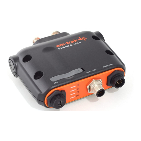
B100
FAQ’S
Our products are designed to be easy to install and use. If however, you have a product question you can
find a list of our most frequently asked questions below:
Number of FAQ's: 46
WHERE CAN I DOWNLOAD THE B100 CD CONTENTS?
It is possible to download the contents of the CD that comes with the B100 by clicking on the following link:
https://srt-marine.sharefile.com/d-sb1c5090eee7432a8
This download contains user manuals, programming software and also USB drivers for the B100. Please note
that USB drivers for this product are updated automatically via Windows update, so if you have access to the
internet, your PC/Laptop should always have the latest drivers installed.
WHAT TYPE OF AIS DEVICE IS A B100?
The marine Automatic Identification System (AIS) is a location and vessel information reporting system. It
allows vessels equipped with AIS to automatically and dynamically share and regularly update their position,
speed, course and other information such as vessel identity with similarly equipped vessels. Position is
derived from the Global Positioning System (GPS) and communication between vessels is by Very High
Frequency (VHF) digital transmissions.
The B100 is a Class AIS Transceiver. Class B transceivers are similar to class A transceivers in many ways,
but are normally lower cost due to the less stringent performance requirements. Class B transceivers like the
B100 transmit at a lower power and at a lower reporting rate than class A transceivers
CAN I CONNECT MY B100 TO A PC/LAPTOP?
Yes. The B100 has a USB connection on its front. Please be aware that we occasionally hear from customers
who have experienced unit failures when a unit has been powered by 12/24V whilst also being connected to a
PC/Laptop.
The reason for this is that the USB port built into this product is not isolated from the vessel power supply,
VHF antenna ground or GPS antenna ground. This being the case, we advise you to observe the following
procedures when connecting the USB port to avoid grounding problems:
–If the computer is permanently installed on the vessel and/ or electrically connected to any other vessel
equipment, including power supplies, it is recommended that connection is made using NMEA0183 or
NMEA2000 connections. These benefit from being specifically designed for use in the marine environment
and provide isolated and robust communication between your devices.
–If a battery powered laptop is being used then it is recommended to switch off the computer, connect the
USB cable, then switch on the laptop. This will help to ensure that all equipment grounds are correctly
referenced before use, minimising any risk of equipment damage.
CAN I CONNECT MY B100 BY NMEA2000?
Yes. The B100 has NMEA2000 connectivity as standard.
WHY AREN’T I SEEING TARGET NAMES WHEN USING NMEA2000 ON THE
B100?
We occasionally get messages from our customers to ask why, when they have their B100 connected to their
Chartplotter/MFD via NMEA200, they are not able to see remote targets vessel names (but they can see
vessel MMSI numbers and locations)
The reason this happens is that AIS name messages were added to the NMEA2000 specification relatively
recently (2010) as it took some time for the NMEA standards organization to define the message structure.
Prior to this, individual manufacturers (Simrad / Garmin / Raymarine etc) adopted their own proprietary
messages for Class B vessel names on an NMEA2000 network. This meant that their own AIS equipment
could communicate with their own displays, but created compatibility problems between manufacturers.
The B100 is fully certified by NMEA for NMEA2000 operation and uses all of the standardized message
structures, including those for Class B vessel data, so will connect to compatible systems via an NMEA2000
backbone.
To resolve the issue, there are a couple of things you can try..
1–You can try contacting the manufacturer of your Chartplotter/MFD to see if there is a software
update available to add support for the new AIS message
2–If no update is available, you should be able to connect the B100 to your chartplotter/MFD via NMEA0183
which is not affected by this issue and should give you full target information.
UTILISATION DE LA CONNECTION USB (FR)
La connection USB de ce produit n’est pas isolée du réseau électrique de votre vaisseau, ni de la masse de
l’antenne VHD, ni de la masse de l’antenne GPS.
Veuillez suivre les procedures suivantes, si vous connectez le port USB pour éviter les problèmes associes
avec la mise à terre.
Si votre PC/MAC est installé en permanence sur votre vaisseau et/ou il est connecté aux autres équipements
installés à bord (sources de courant inclus), il est recommandé que la connexion soit établie par les interfaces
NMEA0183 ou NMEA2000.
Ces connexions sont spécifiquement désignées pour une l’utilisation dans un environment marin et ells
assurent une communication isolé et robuste entre vos appareils.
Si vous utilisez un PC portable alimenté à sa propre pile, il est important d’assurer votre PC soit éteint
qu’avant de connecter / déconnecter le cable USB.
HOW DO I CONNECT A B100 TO PC/LAPTOP BASED CHARTING
SOFTWARE
There are a multitude of charting software applications now available on the market for Laptops, PCs and
Tablets, so we’re often asked about how to integrate our B100 to these setups to allow users to also see AIS
targets on their displays. With this in mind, we thought it might be useful to give you a few “points to note”
when seeking to connect em-trak devices to PCs/Laptops.
1 –USB connection: The USB connection supplied on the B100 is primarily intended for the user to use
during the configuration phase, however this USB connectivity lends itself to use with PCs and laptops as well.
2 –Open connections: With other chart software applications that are compatible with the B100, it is not
possible to connect the device to more than one application at a time. So if you have the unit connected to the
ProAIS2 configuration software, you must disconnect the unit from that application to be able to connect to
another.
3 –Compatibility: Check the specification of your charting software to ensure that it is able to decode AIS
messages (VDMs). Some systems do not incorporate this functionality, so if unsure, check the software user
manual or contact the charting company to confirm if the software is capable of displaying AIS targets. The
B100 conforms to all relevant standards regarding NMEA outputs, so it will be able to provide the raw data
your charting software will require if it is able to use AIS information.
4 –Baud rate: Always check to ensure that your software is configured to accept AIS data at 38400 baud (as
output from the B100s USB).
5 –Product setup: In order for your B100 to provide enough power to operate the GPS antenna, it must be
connected to a 12V power supply as there’s not enough juice in the USB power supply to allow the B100 to
act as anything more than a receiver. If the unit can receive information from other vessels (including their
position), then it will also need to be able to obtain its own GPS fix in order to know where it is in relation to
other vessels. Once it has all of this information, it should then be able to show the location of other vessels in
relation to its own.
The USB power option is only really intended to aid customers with the initial configuration of the unit as the
B100 will require 12V supply in order to be able to transmit and also power the GPS.
WHAT IS SILENT MODE?
Silent mode, also known by some users as pirate mode (when activated) allows your B100 to continue to
receive information from other AIS equipped vessel around you (so you can see where they are on your own
screen), but stops your own B100 from sending information (so nobody can see your position). When
activated, the Blue LED on the front of the B100 is illuminated.
WHY AM I EXPERIENCING USB CONNECTION PROBLEMS BETWEEN THE
B100 AND PC?
If you are experiencing any issues when connecting you Windows PC / Laptop to your PC such as:
–PC not automatically allocating a Comm Port to your device
–Not seeing your B100 on any of your connections on your AIS compatible NAV software
–Intermittent connection “hang-ups” and faults with your USB connection
There is a chance that you may need to apply a software update to both your B100 and also a USB driver
update to your PC. Please contact support for advice on how to resolve this matter.
If this doesn’t update fix the problem, then check the USB cable and connections to ensure the cable and
connectors are serviceable. (If the cable is damaged, then you can use a normal USB-Mini USB cable as a
replacement).
CAN I USE A B100 WITH AN ANTENNA SPLITTER FROM ANOTHER
MANUFACTURER?
We recommend that B100 is only used with the S100 and S300 antenna splitters.
CAN I POWER MY B100 FROM USB?
The B100 can be powered by USB for the purposes of configuration, however it will need to be connected to a
suitable 12/24V power supply in order for it to be able to transmit AIS information and also power the built in
GPS receiver. The B100 will not be able to draw enough power from a USB connection alone for it to operate
normally.
HOW DO I SEND A UNIT IN FOR REPAIR?
If you do wish to return your unit for warranty repair, then please contact your retailer / supplier who will be
able to assist.
WHY CAN’T I SEE OTHER VESSELS?
If you are happy that your B100 is installed and working correctly, but you are not receiving any targets, this
may not necessarily indicate a fault. There could simply be a lack of active/visible AIS targets within range, or
there may be an issue caused by your choice or location of antenna. If there is a fault with the B100, then the
built in self diagnostics will alert you to any problems with the system by changing the LED status on the front
of the unit.
MY B100 ISN’T TRANSMITTING.
The best way to confirm whether or not your B100 is transmitting information is to ask another AIS equipped
vessel (within the near vicinity) if they can see your AIS information on their own display.
Relying on AIS websites to confirm if your vessel is working or not will not always give a clear indication if this
is the case as most websites do not show real-time AIS information.
HOW OFTEN IS MY POSITION REPORTED?
The B100 will send its position once every 3 minutes when moving less than 2 knots and once every 30
seconds when moving any faster.
WHAT DO I DO WHEN SOMETHING ISN’T WORKING?
If you think something isn’t working and have already checked the manual for advice, we would recommend
that you contact the retailer who supplied you with your B100 as they may be able to advise you of a way to
resolve your problem without having to return the unit.
If you have any questions about a problem, you can also contact us by using the support contact form on this
website.
If you do wish to return your unit for warranty repair, then please contact your retailer / supplier.
WHY CAN’T I GET GPS RECEPTION?
Provided you have a suitable and serviceable GPS antenna connected to the B100, lack of GPS signal can be
caused by factors such as installation location or even environmental factors.
The best rule of thumb to remember is that the GPS antenna should be mounted as high as possible (do not
mount on the top of a high mast though as the motion of the vessel will cause the antenna to swing and
potentially reduce the accuracy of the GPS position), with a clear view of the sky above and out of the direct
path of RADAR or satellite communication antennas.
Please also remember that the B100 will only get a position fix when connected to its own GPS antenna. Due
to regulatory reasons, it is not possible to input a GPS signal from another GPS receiver (for instance a GPS
receiver already supplying GPS data on a vessels NMEA network)
HOW DO I PROGRAM MY B100?
The B100 is supplied with a CD that contains a piece of software called ProAIS2. You can use this software to
program vessel information into your B100. Alternatively, if you live in the US where end users are not
permitted to program their own Class B devices, you can either have it programmed by a qualified Marine
Electronics Installer or have your retailer set this up for you.
It is also possible to program the B100 via SD card. Please contact em-trak support for advice about this
service.
HOW DO I CHECK IF MY CHARTPLOTTER/DISPLAY IS AIS COMPATIBLE?
Most modern Chartplotters made in recent years will be AIS compatible.
Provided your Chartplotter/external display has NMEA0183/NMEA2000 connectivity and also the ability to
interpret AIS VDM messages (VDM messages are received from other vessels AIS devices), then it should be
able to display other vessels AIS information.
If in doubt about compatibility then please contact the em-trak support team for advice.
HOW DO I GET AN MMSI NUMBER?
MMSI numbers are issued by local radio regulatory authorities (like the FCC in the US or Ofcom in the UK).
Please contact your relevant local authority for advice on how to obtain an MMSI number in your country.
WHAT IS AN MMSI NUMBER?
An MMSI (Maritime Mobile Service Identifier) is a nine digit number used to identify vessels and coast radio
stations. The MMSI is similar to the phone number for the ships radio and can be used to place a radio call to
a particular vessel. AIS systems also use MMSI numbers to identify vessels. With the exception of an AIS
SART the same MMSI is used for all radio equipment on a vessel, so the AIS should be programmed with the
same MMSI as the VHF radio.
IS THE B100 WATERPROOF?
The B100 is water resistant to IPx2 which means it has some limited protection from water ingress
CAN I CONNECT MY B100 VIA NMEA0183?
Yes. The B100 has two NMEA0183 ports. One set at 38400 baud and the other at 4800 baud. These baud
rates can be changed though if requires
WHAT DO THE CABLES DO?
The B100 is supplied with two cables.
–A USB connection cable to allow you to connect the B100 to a PC.
–A power data cable which contains connections for the Power Supply, NMEA0183 and Silent Mode
switch (switch not supplied)
HOW DO I KNOW THE B100 IS WORKING PROPERLY?
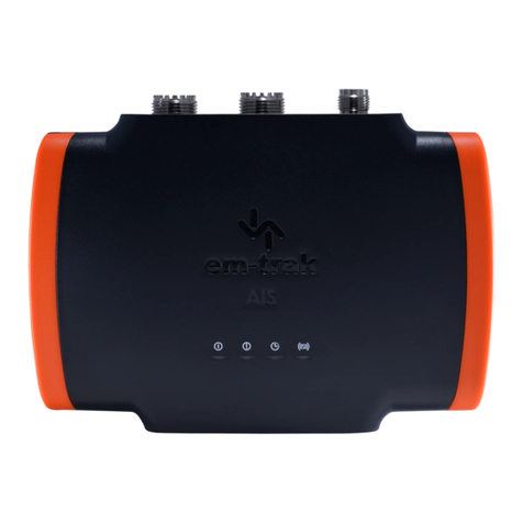
There are a set of four LEDs on the front of the B100. When the unit is working normally (that is to say it has
been connected to a suitable power supply and VHF antenna, has a GPS position fix and has transmitted a
position report, then the Green LED will illuminate.
HOW DO I CHANGE MY MMSI NUMBER?
If you have an em-trak B100 and for some reason you need to change the MMSI number (typical reasons
might be that you’ve “upgraded” to an international MMSI number, perhaps you’ve noticed that your MMSI
number is wrong, or maybe you’ve just bought another boat and want to take your beloved em-trak AIS with
you!) we now have a solution for you that doesn’t involve you having to return your B100 back to the retailer to
be reset!
Simply use the contact form at the bottom of this page with the following information:
–Your contact details (name/email minimum)
–The serial number of your B100 (the long number underneath the barcode on the base of your B100 that
begins with 411)
–The MMSI number you want on the unit
–The reason why you need to change the number.
In return, we’ll email you a configuration file that you can save to an SD card and then apply to the B100
without you needing to connect it to a PC!
WHY IS THE VSWR ALARM SHOWING WHEN I’M CONNECTED TO MY VHF
ANTENNA?
The VSWR alarm usually appears when the connected VHF antenna is not performing well. This could be
caused by a faulty or loose connector and damaged or faulty cable.
It can also be caused when a VHF antenna is mounted parallel to a metal surface or in proximity to a metal
pole/too close to another antenna.
In some instances, the antenna itself may also be faulty. In all instances, we would advise that if you see a
VSWR alarm, you check all antenna cables and connections (starting from the back of the B100), all the way
to the connected antenna and then check the antenna itself to make sure it is installed as per advice in the
manual and is of a suitable type.
WHAT DO THE MESSAGES “TX ATTEMPT FAILED” AND “CP BUSY” MEAN IN
PROAIS2?
We’re often asked by concerned customers if their B100 is faulty as they’re seeing messages like “TX Attempt
failed (msg 18)” appear in the messages screen of ProAIS2. Any confusion is usually confounded by the fact
that the unit appears to be working normally, so what do these messages mean?
Class B AIS (The system on which the B100 operates) is a ‘carrier sense’ system. It has to find a free slot to
transmit in by listening just before transmission to check the slot is empty.
When a transmission is scheduled a block of 10 potential slots is selected. It will attempt to transmit in the first
of these slots. If the slot is busy the ‘CP busy’ (meaning ‘candidate position busy’) message will be output. It
will then try again in the next slot, and so on for the 10 slot block. It is quite normal to see ‘CP busy’ messages
in an area where other AIS vessels are operating. It simply means the first slot selected was busy. 99% of the
time the transmission will be successful in one of the other 9 slots.
So long as the indicator remains green transmissions are occurring on schedule. If transmissions can’t be
made because the AIS environment is simply too busy then the indicator will turn amber (this is incredibly
rare though and extremely unlikely to occur outside of lab conditions)
In summary these messages are normal and can be ignored if the indicator is green. Anything you might see
in the ‘messages’ box is just for info and not a fault or alarm. If there is an active alarm or fault, then the
ProAIS2 will list these in the “Alarms” window of ProAIS2.
WHY CAN’T OTHER SHIPS SEE MY VESSEL NAME?
Class B AIS is required to be fully compatible with Class A AIS to ensure information relevant to safety of
navigation is visible to all AIS users. Class B AIS vessels will always be received by a Class A station and vice
versa. Any filtering of vessels by AIS Class can only be achieved through charting or ECDIS software
configuration which must be made by the vessels crew. In practice this filtering is not regularly applied.
There is a known issue with visibility of Class B vessel names and call signs to older Class A equipment. This
situation arose because Class B AIS was developed 6 years after the introduction of Class A devices. A new
AIS message was introduced for communication of vessel name and call sign from Class B AIS (message
24A and 24B) which was not included in the original Class A specification. It is important to note that this is not
a limitation of em-trak Class B products, but an incompatibility introduced by the international specifications for
Class B and Class A AIS devices.
This results in some older Class A units not displaying vessel name, call sign and dimensions received from
Class B vessels, however critical identification and location information will always be received. This
includes MMSI, Latitude, Longitude, COG and SOG. This problem can only be resolved by software update to
the affected Class A equipment. Our own research has found that all Class A manufactures have an update
available to address this issue. Unfortunately there is no requirement for Class A users to update their
equipment so this situation is likely to persist for some time. Again it is important to note that this is not a
limitation of Class B AIS, or a fault with the operation of a Class B AIS unit.
USING THE USB PORT ON THE B100
We occasionally hear from customers who have experienced unit failures when a unit has been powered by
12/24V whilst also being connected to a PC/Laptop.
The reason for this is that the USB port built into this product is not isolated from the vessel power supply,
VHF antenna ground or GPS antenna ground. This being the case, we advise you to observe the following
procedures when connecting the USB port to avoid grounding problems;
–If the computer is permanently installed on the vessel and/ or electrically connected to any other vessel
equipment, including power supplies, it is recommended that connection is made using NMEA0183 or
NMEA2000 connections. These benefit from being specifically designed for use in the marine environment
and provide isolated and robust communication between your devices.
–If a battery powered laptop is being used then it is recommended to switch off the computer, connect the
USB cable, then switch on the laptop. This will help to ensure that all equipment grounds are correctly
referenced before use, minimizing any risk of equipment damage.
If you have any additional questions on this subject then please feel free to contact em-trak support for advice.
HOW DO I PROGRAM THE B100?
Before your AIS unit can be used, it must first be configured with your vessel details. This information includes
the Vessel name, MMSI number, Call Sign, Vessel Type and Dimensions)
The method available to you to set your unit up will depend on where you live. If you are installing the unit in
the USA, then the FCC has stated that only approved Marine Installers are permitted to configure AIS devices.
The good news is that we appreciate that not everyone is an accredited installer, so we offer a free SD card
configuration service that allows US users to apply for an SD card with their configuration files on. Simply fill in
the online form, found at http://em-trak.com/class-b-registration, and we’ll send you a card within 5 working
days. Alternatively, you can ask your local installer to set the configuration of your B100, using the ProAIS2
software that comes with the CD in the box.
If you are installing your B100 outside of the US, then you are permitted to configure your AIS transceiver
yourself. You can do this by connecting your B100 to a PC/Laptop via the USB connection and running the
ProAIS2 software that is included on the CD that comes with your B100. Simply connect to the software, fill in
the blanks and click “write configuration” and you’re done! A word of warning though. Once the MMSI number
is entered and written to a unit, it cannot be changed by the end user and must be sent back to the supplier to
be reset, so be careful not to make any mistakes when entering your vessel data.
WILL MY CHARTPLOTTER DISPLAY AIS IF I CONNECT IT TO MY B100?
This very much depends on the features on your Chartplotter. Most modern Chartplotters made in recent
years should be AIS compatible. Provided your Chartplotter/external display has NMEA0183/NMEA2000
connectivity and also the ability to interpret AIS VDM messages (VDM messages are received from other
vessels AIS devices), then it should be able to display other vessels AIS information.
If in doubt about compatibility then please contact the em-trak support team for advice.
WHAT IS THE RANGE OF THE B100?
There are many factors that will affect the range of the B100, not all of which are within the control of any
installer. Things like atmospheric conditions and local geography, sea conditions etc. can all have an impact
on the range of any radio based technology.
In addition to these factors, thinks like choice of antenna and height/ location of installed antennas can also
adversely affect the range of any device. Also, the strength and quality of an inbound signal will also mean
that range from other vessels will be hard to reliably predict. To better your chances as getting the best range
performance, the user manual for the B100 lists all things that need to be taken into consideration as part of
the installation process. Assuming though, that a correctly setup B100 is connected to a suitable, well serviced
and correctly installed antenna, in ideal line of site conditions, users can expect ranges of at least 15-20 miles,
if not much more.
WHAT DOES THE RX 1 / RX 2 DSC START / STOP MESSAGE MEAN?
The RX 1 / RX 2 DSC start / Stop message is a completely normal message and is not an indication of a fault
or problem.
Essentially, it’s just a text message indicating when one of the AIS receivers has started/stopped a DSC
channel management listening period. Class B equipment (like the B100 and B300) is required to listen to
channel 70 (The DSC channel) periodically at specific times defined in the standards, for DSC channel
management commands. As Class B lacks the third receiver necessary to do this full time it is achieved by
occasionally switching an AIS receiver to this channel.
WHAT DOES THE BLUE LED MEAN?
The Blue LED indicates that the unit is in “Silent Mode”. The unit will continue to receive information from
other AIS sources, but will not send/transmit anything itself.
WHAT DOES A RED AND AMBER LED MEAN?
A red and amber LED indicates that there is no MMSI number programmed and/or there is no DC power
supply detected. This is often seen when a B100 is new pout of the box and connected to a PC by USB.
WHAT DOES A FLASHING RED LED MEAN?
A flashing red LED indicates that there is a VSWR fault. This means that there is potentially a fault with your
VHF antenna and/or associated connections and cables.
WHAT DOES THE GREEN LED MEAN?
The green LED is your indication that the B100 is working correctly. It means that it has been programmed,
connected to a suitable power supply and VHF antenna, has received a position fix from its own GPS and has
successfully transmitted a position report.
WHERE CAN I GET PROAIS2 CONFIGURATION SOFTWARE?
proAIS2 is a piece of configuration software intended for use with the em-trak B100 and B300 series of Class
B AIS Transceivers.
A copy of this software is provided in the CD that accompanies each B100, however if you need to download
a copy, then you can do so by clicking on the following link:
https://srt-marine.sharefile.com/d-s3050118b5b44f868
Please note that current FCC regulation prohibits end users in the USA from programming their own Class B
Transceivers.
If you have purchased a B100 and are unsure as to whether or not you are permitted to use this software,
then please contact the support team and we’ll be glad to advise you on how to proceed.
WHY IS MY CHARTPLOTTER NOT DISPLAYING ANY AIS TARGET
INFORMATION WHEN CONNECTED TO A B100 VIA NMEA0183?
Chartplotters / MFDS / Radar displays. Whatever you want to call them, they’re often the focal point of any
navigational setup on a vessel so it makes sense to connect AIS receiver or transceiver to get an idea of the
bigger picture around you. That being the case, we’re often asked if certain plotters are compatible with
our AIS devices and if so, how do you go about connecting one of our devices to an existing plotter.
The first point to note is that most modern chartplotters (made in recent years) will have the ability to accept
AIS information sent via NMEA connections, however older models may not have this ability. This isn’t
necessarily a fault of the plotter, more a case of technology changing and new features and capabilities not
being available on older product. If you have any doubts as to whether or not your own plotter is compatible
with our AIS products, please contact us and we’ll be glad to help.
With regards to how to connect your B100 to your plotter (assuming it is able to interpret the AIS information
sent from the connected device), simply connect the NMEA0183 Transmit wires on the B100 (Brown is
positive, Blue is negative) to the NMEA0183 Receive wires on your compatible device. If you get these wires
mixed up, don’t worry. As long as you don’t connect the wires to any wires providing a power supply, then you
won’t damage the B100 or the Chartplotter. The user manual details which cables do what, but for your
reference, please see below for a table explaining the connections on the B100.
Once again, if you are unsure of how to connect the wires up, then contact us and we’ll be glad to advise you
on how to hook everything up.
If you have your B100 up and running (Green LED on) and successfully connected to your plotter and you still
can’t see any AIS targets on your Chartplotter, this could just be down to their not being any AIS traffic within
range or perhaps your VHF antenna range is being affected by nearby buildings / obstructions / installation
height. There may just not be any other AIS equipped vessels within range! You might also need to check that
the chartplotters NMEAs port is configured to receive AIS data and that the display is configured to display
AIS targets (some will allow users to filter displayed information) As always though, if in doubt, please feel free
to get in touch and we’ll be glad to help.
HOW DO I OUTPUT GPS DATA FROM THE B100 TO EXTERNAL DEVICES
(LIKE VHF DSC RADIOS) ?
As you will no doubt be aware (Most likely from your efforts in installing the extra GPS antenna!), the em-trak
B100 incorporates it’s own GPS receiver. As well as providing the location information that is essential to its
normal use, this GPS information can also be shared with other devices via the unit’s NMEA0183 ports.
The default setup for the unit is to “multiplex” any received sentences from the NMEA0183 “High Speed Port”
(38400 baud) to the NMEA0183 “Low Speed Port” (4800 baud). However it is possible to output GPS info
directly from the B100 itself without needing to rely on data being input and duplexed from an external source.
Step 1: Click on the aisb folder link below and download the aisb file.
aisb
Step 2: Extract and save the “aisb.cfg” file from the zip folder to a blank 2GB SD card (if you were sent a card
to configure your B100, you can use this but any make of SD card up to 2GB in size will do)
Step 3: Turn the B100 off, insert the SD card containing the aisb.cfg file and then power on the unit again.
Step 4: The LEDs will flicker for a short while and once the Green LED flashes 3 times, the new configuration
is completed. (We suggest you turn the unit off and on again at this point)
Step 5: Connect the B100 to the ProAIS2 software included on the product CD and select which GPS
sentences you want to output on the configuration page and then select “write configuration”
Your B100 should now be outputting the requested sentences from both High and Low speed NMEA ports!
Please be assured that by applying this config file, your vessel identification data (such as MMSI, Name,
dimensions etc.) will not be altered.
HOW DO I OUTPUT GPS INFORMATION FROM MY B100 TO MY PC/MAC?
With the growing popularity of PC/MAC based navigation and charting software (like Rosepoint / OpenCPN for
example), we’re often asked how to output GPS data from the B100 to the customers Nav software.
The first thing to establish is a connection between the B100 and the PC. This can be done by using the USB
connection, but for long term installations, we recommend the use of an NMEA to USB converter or even and
NMEA to WiFi adaptor.
If you are using the USB connection, make sure that the USB drivers for your PC are up to date. If your PC is
connected to the Internet, then it will receive the updated drivers automatically as part of the Windows Update
system. Alternatively, you can click on the following link to manually download the latest drivers:
https://www.dropbox.com/s/q0ree4hzep3jmes/B100%20USB%20Drivers.zip
To output GPS information to your PC/MAC, you’ll now need to connect the B100 to proAIS2 and select which
GPS sentence types you need. To do this, simply connect the B100 to your PC, run proAIS2 and connect
to “AIS Class B Transceiver”. Then tick the boxes of the GPS sentence types that you need and then press
“Write Configuration” (See below for an example)
Your B100 should now be outputting the required GPS data on its USB and NMEA0183 1 (High Speed)
connections. If you need to output GPS from your low speed NMEA0183 port, then please search for “output
GPS from the B100 to external devices” to learn more about how the unit can be configured to achieve this.
IS IT POSSIBLE TO INPUT A GPS SIGNAL FROM AN EXTERNAL GPS
SOURCE?
One of the most regular questions we get asked here is: “Is it possible to input a GPS signal into a B100 from
an external GPS source”. The issue here being that the idea of running another 10 meters of cable and
installing another GPS antenna brings most people out in a cold sweat!
The bad news is that, as with all Class B AIS devices, the B100 must receive its own GPS signal from its own
antenna and it is not permitted to receive its location via NMEA connection to external devices (like a
chartplotter or similar MFD). This is an industry standard and I’m afraid that whilst we sympathize, there’s no
way around this.
If the idea of installing the GPS antenna that is provided with the B100 is causing you a few headaches, then
please bear in mind the following tips:
1 –Whilst giving the GPS antenna a “High and Clear” view of the sky is ideal, you can also try installing the
GPS antenna in a “below decks” installation. Just ensure that there is no metal or cabling between the GPS
and the outside of your vessel (Plastics/Fibreglass etc should be fine) and you should still be able to receive a
GPS signal. To confirm that you can receive GPS signal below deck, connect your B100 to a Laptop via the
USB connection and run the ProAIS2 software (this is provided on the CD that comes with the B100). There is
a GPS signal strength screen on this software that will let you see if you are able to receive enough GPS
signal to allow your B100 to operate correctly.
2 –If you are able to install the GPS antenna in a “High and Clear” location, but you don’t want to pay to have
another GPS antenna installed for other devices, it is possible to output GPS information from the B100 to
other devices on its NMEA 0183/2000/USB connections. Once again, you need to use the ProAIS2 software
to do this.
3 –If you’re thinking about using an existing Passive GPS antenna to connect to the B100, please be aware
that whilst similar in appearance, not all GPS antenna perform in the same way! It’s perfectly safe to try
connecting a passive GPS antenna to the B100 to see if it will work (you can even use the ProAIS2 software
here again to check for signal strength). If in doubt though, drop us a line and we’ll be happy to advise.
4 –Whilst a good location is important, it’s also worth remembering a couple of other key points when it
comes to selecting a suitable spot to install your GPS antenna. For instance; It is not recommended that the
GPS antenna is mounted up a mast where the motion of the vessel will cause the antenna to swing and
potentially reduce the accuracy of the GPS position. Likewise we recommend that you do not mount your
antenna in the direct path of a radar transmitter. GPS performance can also be affected if a VHF antenna is
mounted on a horizontal metal bar that is located very close to the GPS antenna. If you experience any issues
with GPS performance, then try moving your GPS or VHF antenna to see if it has any affect on your GPS
reception.
Figure1: Ideal GPS Antenna installation location
WHERE SHOULD I INSTALL MY B100?
Please note the following guidelines when selecting a location for your AIS transceiver:
• The B100 must be fitted in a location where it is at least 0.2m from a compass or any magnetic device.
• There should be adequate space around the B100 for routing of cables.
• The ambient temperature around the B100 should be maintained between -10°C and +55°C.
• The B100 should not be located in a flammable or hazardous atmosphere such as in an engine
room or near to fuel tanks.
• The B100 is not waterproof and must not be exposed to any spray or submersion.
• It is recommended that the B100 is installed in a ‘below decks’ environment.
• It is acceptable to mount the B100 either vertically or horizontally.
• The B100 is supplied with four self- tapping screws for attachment of the AIS transceiver to a
suitable surface.
• The B100 should be mounted in a location where the indicators are readily visible as these provide
important information on the status of the AIS transceiver
WHAT ANTENNA SHOULD I USE WITH THE B100?
One of the most essential parts of an effective AIS system is a well-suited, well installed and fully functional
VHF antenna, so it’s no surprise that we’re often asked for advice about how to ensure that this part of the
system is setup properly. To try and simplify things, we’d advise that when selecting an appropriate antenna
or considering using an existing antenna, you consider the following points:
1 –If an antenna works well with a VHF/DSC voice radio, this is no guarantee that it will also work well with an
AIS transceiver. This is because Class B AIS only operates at 2W output, whereas a VHF DSC voice radio
operates at 25W output and so will still radiate a signal of some type. AIS Class B devices like the B100 do
not have the power to “push through” and may not work on such an antenna (even if a VHF Voice radio can
use the same antenna)
2 –Use of narrow band AIS ‘tuned’ antennas are not recommended as they are optimised at the standard
AIS1 and AIS2 frequencies and may not give optimum performance when regional channel settings are used.
3 –AIS optimised ‘broadband’ antennas are suitable for use; these antennas typically have a wider bandwidth
to give improved performance at the top end of the VHF band where AIS usually operates.
4 –Siting of an antenna is crucial as even a well suited antenna may not radiate a good signal if installed in a
poor location. Put simply, keep the antenna upright, clear of anything that could touch it (rigging/other
antennas etc), keep a reasonable distance from any other devices/antenna arrays like Radar/HF/VHF radio
that may be operating at high power and also keep clear of any other metallic obstructions.
If you’re still unsure of which antenna is right for you, please refer to the recommend specs below for some
advice:
Typical VHF antenna specification:
Band: Marine VHF band (nominally 156MHz to 162MHz)
Impedance: 50 Ohms
Gain: 3dBi
VSWR: <1.5:1 at resonant frequency
Max power: Typically >25W
Polarisation: Vertical
Bandwidth: Typically 6MHz
Cable: RG58 or better. Note the IMO recommend RG214 or better for SOLAS installations
Connector: PL-259 (sometimes called ‘UHF’)
If you are unable to find the answer to your question please complete the form at the bottom of our contact
page and one of our customer representatives will contact you within one (1) working day.

Other manuals for B100

2

Other Em-Trak Transceiver manuals

Em-Trak B953 User manual

Em-Trak

Em-Trak B953 User manual

Em-Trak B200 User manual

Em-Trak

Em-Trak B200 User manual

Em-Trak B212 User manual

Em-Trak

Em-Trak B212 User manual

Em-Trak B900 Series User manual

Em-Trak

Em-Trak B900 Series User manual

Em-Trak B900 Series User manual

Em-Trak

Em-Trak B900 Series User manual

Em-Trak B350 User manual

Em-Trak

Em-Trak B350 User manual

Em-Trak A200 User manual

Em-Trak

Em-Trak A200 User manual

Em-Trak AIS Class B User manual

Em-Trak

Em-Trak AIS Class B User manual

Em-Trak B923 User manual

Em-Trak

Em-Trak B923 User manual

Em-Trak B360 User manual

Em-Trak

Em-Trak B360 User manual

Em-Trak B954 User manual

Em-Trak

Em-Trak B954 User manual

Em-Trak B924 User manual

Em-Trak

Em-Trak B924 User manual

Em-Trak B923 User manual

Em-Trak

Em-Trak B923 User manual

Em-Trak A100 User manual

Em-Trak

Em-Trak A100 User manual

Em-Trak B300 Series User manual

Em-Trak

Em-Trak B300 Series User manual

Em-Trak B952 User manual

Em-Trak

Em-Trak B952 User manual

Em-Trak A100 User manual

Em-Trak

Em-Trak A100 User manual

Em-Trak B921 User manual

Em-Trak

Em-Trak B921 User manual

Em-Trak I100-X Instruction sheet

Em-Trak

Em-Trak I100-X Instruction sheet

Em-Trak B922 User manual

Em-Trak

Em-Trak B922 User manual

Em-Trak B100 User manual

Em-Trak

Em-Trak B100 User manual

Em-Trak B400 User manual

Em-Trak

Em-Trak B400 User manual

Em-Trak B900 Series User manual

Em-Trak

Em-Trak B900 Series User manual

Em-Trak B330 User manual

Em-Trak

Em-Trak B330 User manual

Popular Transceiver manuals by other brands

Kenwood TH-25A Series instruction manual

Kenwood

Kenwood TH-25A Series instruction manual

Huawei BTS3 Series Hardware Description Manual

Huawei

Huawei BTS3 Series Hardware Description Manual

Yaesu FT DX 560 instruction manual

Yaesu

Yaesu FT DX 560 instruction manual

Adeunis RF PULSE IP68 V4 Sigfox RC1 user guide

Adeunis RF

Adeunis RF PULSE IP68 V4 Sigfox RC1 user guide

Kenwood TR-2400 instruction manual

Kenwood

Kenwood TR-2400 instruction manual

ELECRAFT K4 operating manual

ELECRAFT

ELECRAFT K4 operating manual

ADTRAN 1442482F7 manual

ADTRAN

ADTRAN 1442482F7 manual

Alinco DR-620T instruction manual

Alinco

Alinco DR-620T instruction manual

sunair ASB-500 Installation and operation manual

sunair

sunair ASB-500 Installation and operation manual

Silicon Laboratories Si4430 manual

Silicon Laboratories

Silicon Laboratories Si4430 manual

Transition Networks E-FRL-MC04 user guide

Transition Networks

Transition Networks E-FRL-MC04 user guide

Vertex VX-6E Technical supplement

Vertex

Vertex VX-6E Technical supplement

Kenwood TM-G707A Service manual

Kenwood

Kenwood TM-G707A Service manual

Apollo NavComm SL30 installation manual

Apollo

Apollo NavComm SL30 installation manual

YEONHWA M TECH MD Series user manual

YEONHWA M TECH

YEONHWA M TECH MD Series user manual

ELECRAFT KX2 owner's manual

ELECRAFT

ELECRAFT KX2 owner's manual

Yaesu FT-840 Service manual

Yaesu

Yaesu FT-840 Service manual

Alinco DJ-560t instruction manual

Alinco

Alinco DJ-560t instruction manual

manuals.online logo
manuals.online logoBrands
  • About & Mission
  • Contact us
  • Privacy Policy
  • Terms and Conditions

Copyright 2025 Manuals.Online. All Rights Reserved.