Faria Maestro User manual

User’s Manual
TM
IS0270 rev. A ecr 8171 3/2010


iii
Table of Contents
Introduction ..................................................................................................................... 1
Navigator Menu ............................................................................................................... 5
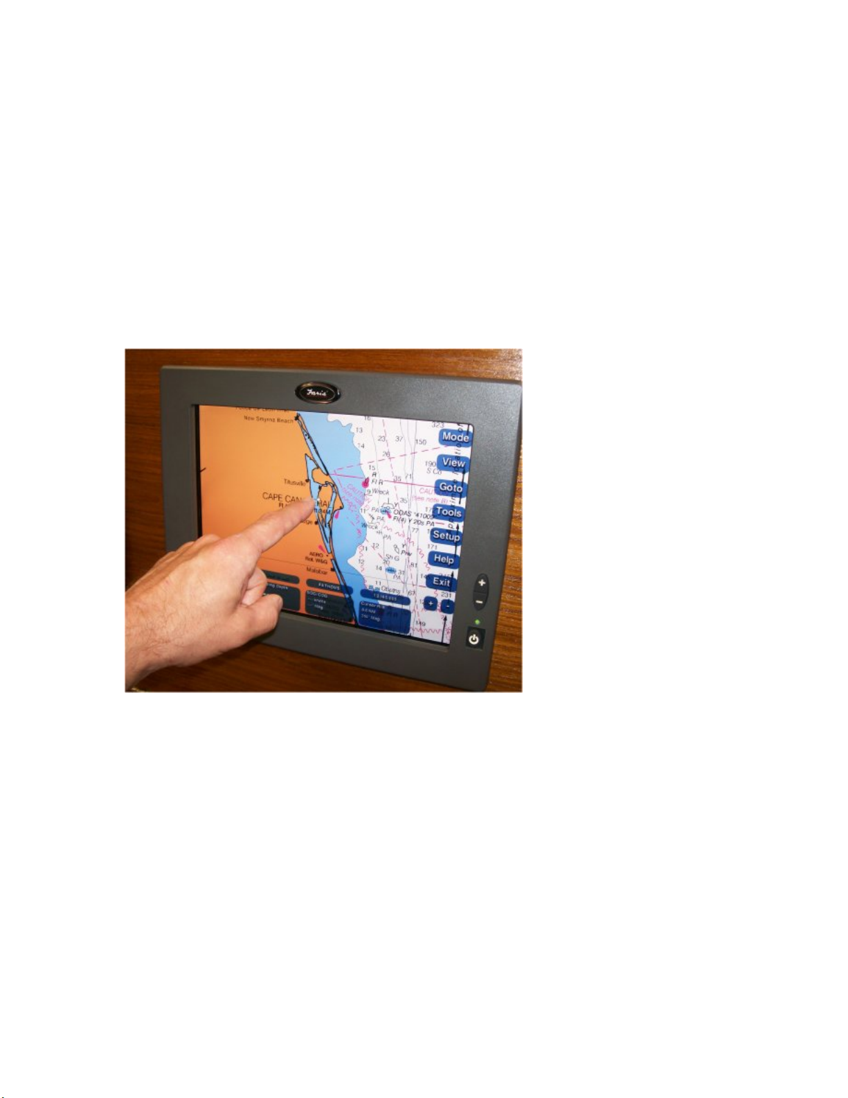
Mode Menu.................................................................................................................... 6
View Menu..................................................................................................................... 9
Go To Menu................................................................................................................. 10
Route Menu ................................................................................................................. 11
Tools Menu.................................................................................................................. 13
Setup Menu ................................................................................................................. 14
Help ............................................................................................................................. 15
Exit............................................................................................................................... 15
Plus and Minus Buttons...............................................................................................16
Data Windows ............................................................................................................. 17
Set Up Chart Plotter ...................................................................................................... 23
Chart Setup ................................................................................................................. 23
Contour Charts Setup.................................................................................................. 25
Depth Features Setup ................................................................................................. 30
Display Quality............................................................................................................. 32
Manage Marks............................................................................................................. 32
Overlays Setup ............................................................................................................ 33
Range Rings Settings..................................................................................................33
Range Bearing Lines (RBL) Setup .............................................................................. 34
Manage Routes ........................................................................................................... 37
Day/Night Adjustments ................................................................................................ 38
Chart Colors Adjustments............................................................................................ 39
Scroll Speed Setup......................................................................................................40
Manage Tracks............................................................................................................ 40
Unit Display Formats ................................................................................................... 41
Upgrade CD/DVD ........................................................................................................ 43
Vessel Information....................................................................................................... 43
Waypoints - Set Alarms ............................................................................................... 44
Zoom Buttons .............................................................................................................. 44
Charts............................................................................................................................. 47
View Charts ................................................................................................................. 47
Marine Facilities........................................................................................................... 50
Traversing the Charts .................................................................................................. 51
Linking .........................................................................................................................54
Find Specific Locations................................................................................................ 54
Marks...........................................................................................................................55
Managing Waypoints ................................................................................................... 56
Contour Charts ............................................................................................................ 59
Split-Screen ................................................................................................................. 61
Plot and Store Routes................................................................................................... 65
Go To...........................................................................................................................66
Routes on Contour Charts........................................................................................... 69
Navigation by Marks .................................................................................................... 70
Managing Waypoints ................................................................................................... 71
Autopilot.......................................................................................................................74
Create Routes Across Multiple Charts ........................................................................ 74

Maestro Navigator 3.5.3.doc
iv
Recording Tracks ........................................................................................................ 76
Range/Bearing Lines (RBLs).......................................................................................79
Distance and Bearing .................................................................................................. 81
Tides............................................................................................................................... 83
Tide Graphs................................................................................................................. 83
Historical Tides ............................................................................................................ 84
Tide Stations................................................................................................................ 85
Currents ......................................................................................................................... 87
Current Graphs............................................................................................................ 87
Historical Currents ....................................................................................................... 88
Current Stations........................................................................................................... 89
Weather.......................................................................................................................... 91
Customize Satellite System......................................................................................... 93
Map View Buttons........................................................................................................ 94
Weather Display Features ........................................................................................... 95
National Weather Service Warnings.......................................................................... 101
Mapping and GPS Options........................................................................................ 104
Radar............................................................................................................................ 107
Radar Safety.............................................................................................................. 107
Configure the Radar Display ..................................................................................... 108
Radar Setup Submenu .............................................................................................. 114
Sonar/Fish Finder........................................................................................................ 119
Customize Sonar Panel............................................................................................. 121
Working with Targets.................................................................................................123
Sonar History............................................................................................................. 124
Sonar Data on Contour Charts .................................................................................. 127
Sonar-Related Depth Setup Options ......................................................................... 130
Cameras ....................................................................................................................... 137
Troubleshooting.......................................................................................................... 139
Troubleshooting: General .......................................................................................... 139
Troubleshooting: GPS ............................................................................................... 140
Troubleshooting: Radar ............................................................................................. 140
Troubleshooting: Depth ............................................................................................. 141
Troubleshooting: Touch Screen ................................................................................ 142
Troubleshooting: CD/DVD Drive................................................................................ 142
Troubleshooting: Vessel and Routes......................................................................... 143
Troubleshooting: Charts ............................................................................................ 144
Troubleshooting: XM WX Satellite Weather .............................................................. 146

1
Introduction
Welcome to Maestro Navigator.
In this Manual
This Owner’s Manual guides you through all of Maestro Navigator’s features and
capabilities. An electronic version of this manual is built into the Maestro Navigator
system for easy access on board your vessel. To open the electronic manual, touch the
Help button in the Navigation Menu and choose Maestro Navigator Help. Touch any
topic heading for more information.
Faria’s Maestro Navigator displays Nautical Charts, Contour Charts and Navigation
Photos. It provides tools to plot your vessel’s location on those charts using your GPS
signal and provides data to help you plan, measure and monitor your progress.
The Touch Screen
Maestro Navigator’s touch screen brings a new level of convenience to navigating your
vessel. With a touch screen, you use your fingertip to move the cursor instead of
dragging it with a mouse. Instead of clicking on buttons and menus, you touch them
directly on the screen.
x“Press” or “Touch” means you should tap the screen with your finger. This is
equivalent to clicking with the left mouse button on a desktop computer.
x“Double-Touch” means you should tap the screen twice, the same as double-
clicking with the left mouse button. Two successive taps are recognized as a
double-touch if the taps occur within a certain amount of time. You can set this
time using the Touch Screen button on the NavPanel (see below).
x“Drag” means you should touch the screen, with your finger remaining in
contact with the screen, move your fingertip to the desired location, and then
lift your finger from the screen.

Maestro Navigator 3.5.3.doc
2
Monitor Buttons
In addition to the buttons displayed on the Navigation computer screen, there are 3
buttons on the monitor, 2 are for adjusting screen brightness and the one is the power
button.
Screen Brightness
To adjust the monitor’s brightness, use the buttons on the side of the screen display.
The screen brightens (+) or darkens (-) a shade each time you press. Press multiple
times if necessary to reach the desired brightness. Models without these buttons use
the Screen Ctrl button described below.
You can also adjust the screen colors for better visibility as lighting conditions change
using the Setup menu options.
Power Button
You should not use the Power button located on the monitor as the standard method for
shutting down Maestro Navigator. This method does not complete the close out and
save procedures before shutting down; it just ends processes wherever there are.
The NavPanel
Once the navigation computer is powered up, the NavPanel is displayed on the screen.
The NavPanel acts as your onboard computer’s “desktop” and provides access to all
features, information and options for configuring how the system looks and operates.
The six large buttons in the center of the NavPanel serve as links to the various
components of the Maestro Navigator system. These buttons vary depending on the
model of your vessel and optional components.
Press any button for access to the related information or application as described below:
Navigation - Starts the Maestro Navigator chart plotter
Cameras - Displays video from security cameras
Weather* - Starts the weather information system
Engines* - Provides access to the engine monitoring options
Internet Explorer - Provides access to the internet
Help* - Opens the electronic version of this manual
*Can also be accessed from the Navigator Menu.

Introduction
3
There is a row of smaller buttons along the bottom of the NavPanel. Press the buttons
for the functions described below:
Set Time - Press on this button to set the system date and time. This time setting is
used in tracking and predicting your progress. The accuracy of your system time affects
the accuracy of several data readings, so be sure to enter the time and date correctly.
Touch Screen - Follow the on-screen prompts to calibrate your touch screen. Set the
size and location of “touchable” areas, double-touch speed, etc.
Day/Night - Adjusts the screen colors for better visibility as lighting conditions change.
Press this button to toggle between day and night color palettes. The day color palette
is designed to reproduce accurately the colors found on printed charts. Night uses a
darker color palette based on shades of gray and red. This darker color scheme helps
preserve your night vision by keeping the display just bright enough for nighttime use.
Screen Ctrl (Screen Control) - Touch here to adjust the brightness and contrast of
Maestro Navigator's touch screen (may not be available on all models)
Conn. Mgr. - Touch this button to configure your internet connection settings
Shut Off - Turns off the navigation computer
If you have a dual station network, the NavPanel displays two buttons in addition to the
ones described above:
Backup - Backs up all data from your primary navigation computer to your auxiliary
station
Restore - Transfers data from the auxiliary station to the primary station
Shut Down
The two recommended options for shutting down the computer are from the display
screen as described below:
NavPanel: Touch the Shut Off button
Navigator Menu: Touch Exit, then select Shut Down Computer… from the pop up
menu
Computer Screen Freezes
If the Navigator “freezes" and does not respond to proper shutdown commands, press
and hold the Power button on the Navigator computer until it powers down and turns
itself off. This method should only be used when necessary. Overuse of this shutdown
method may interfere with the computer’s operating system.


5
Navigator Menu
The first time you start up the Maestro Navigator or Chart Plotter window, the World
Chart is displayed by default.
The Navigator menu buttons are displayed down the right side of the screen and there
are 8 user-defined Data Windows along the bottom. Use these buttons as described
below and throughout this manual to access the various features and tools Maestro
Navigator has to offer.
xMode - Choose between navigation chart maps, contour view and split screen
options
xView - Access to details and lists such as Charts, Marks, Tides and Currents,
etc.
xGo To - The first step in plotting a route. The Go To option is only available
when there is no active Route
xRoute - Access to details and functions for the “active” Route. The Route
option is only available when there is an active Route
xTools - Access to the various Maestro Navigator tools and features, such as
Mark, Distance and Tracking tools
xSetup - Access to the tools for customizing Maestro display screens. Details
are described in the “Setup Chart Plotter” section of this manual.
xHelp - Provides access to additional Faria supplied features, such as Chart
Symbols, Tides, Lights, etc
xExit - To hide the Chart Plotter window and access other screens on the
computer, to exit from the Navigator software or shut down the computer
xPlus/Minus - The plus and minus buttons at the lower right of the Maestro
Navigator window let you go in for a closer view, or move back to see a larger
area of the Chart.

Maestro Navigator 3.5.3.doc
6
Mode Menu
Maestro Navigator provides views using various types of charts such as nautical charts,
contour charts, topographic maps of coastal areas, and navigation photos (available in
selected coastal areas).
Use the Mode button to switch between these different types of charts.
Nautical Chart
Nautical Chart is the default mode used to display charts.
In the chart list, Nautical Charts are indicated with a blue icon

Navigator Menu
7
Navigation Photo
Navigation photos are created from satellite or aerial images, and are available for many
coastal areas.
Navigation photos provide some inland coverage, showing buildings, roadways, etc. in
greater detail than nautical charts. Bodies of water are sometimes darkened or
otherwise edited to remove glare, making it easy to see your vessel icon.
To open a navigation
photo, you must first
be viewing a nautical
chart. To switch to a
navigation photo for
the area you’re
viewing, touch Mode,
Navigation Photo.
When no navigation photo is available for the area, the “Navigation Photo” menu option
is displayed with darkened print and cannot be selected, as pictured above.
In the chart list, Navigation Photo Charts are indicated with a camera icon
Topo Map
Some of Faria’s digital chart packages include USGS topographic maps covering up to
five miles inshore from coastal areas. If you have installed these Topo Maps, you can
use them to get a more detailed look at coastal terrain.
When you are cruising close to shore in an
area where you have Topo Map coverage,
touch Mode, Topo Map to open a map of your
area.
You can also select Topo Map titles directly
from the chart list, which can be handy if
you’re planning a visit to a specific harbor or
town: press View, Chart and select a Topo
Map title.
In the chart list, Topo Maps are indicated with
a green map icon.

Maestro Navigator 3.5.3.doc
8
Contour
All Contour and Fish Finder images reproduced by permission from NSI, inc © 2007
Maestro Navigator can show your vessel location on contour charts. Contour Charts are
3-D renderings of the underwater terrain.
© 2007 NSI, inc
Your location is represented by a vessel icon positioned above the terrain, atop a vertical
line indicating the water depth.
To view your vessel location on a Contour Chart, touch Mode, Contour Chart. This
changes the chart you are currently viewing to a Contour Chart for your location. To view
contour coverage for an area that does NOT contain your vessel location, you must first
open a nautical chart for the desired area, then switch to Contour Chart coverage.
Touch View, Chart and select a nautical chart title. When the map is displayed then
touch Mode, Contour Chart to switch to and see a contour chart view of that area.
Split-Screen
To open two types of charts simultaneously, touch Mode, Split With…, and then choose
another chart type. Both charts will be displayed side by side. Refer to the Contour
Charts section of this help guide for more details.
© 2007 NSI, inc

Navigator Menu
9
View Menu
This section provides a quick overview of the View Menu option functions.
xVessel - Adjusts the view of the current Chart to
include the location of your vessel
xWaypoint/Mark - Displays a list of Waypoints and
Marks in the active route, touch a name to refresh
the screen and center the display on that Waypoint
or Mark
xChart - Displays a list of available Charts, touch one
to change the display and show that Chart
xLat/Lon - Displays a on screen keypad for entering
Latitude and Longitude coordinates, touch OK to
refresh the screen and center the display on the
coordinates entered
xTrack - Displays a list of saved Tracks, touch one to
display it
xMarine Facility - Displays a list of Marine
Facilities, you can change the display sorting order.
Select a name to refresh the screen and view the
chart where the facility is located. Touch the mark on
the chart to see a pop up display of facility
information.
xTide Station - Displays a list of available Tide
Station Charts, you can change the sorting order.
Select the name then touch Station Information to
view that graph
xCurrent Station - Displays a list of available Current Station Charts, you can change
the sorting order. Select the name then touch Station Information to view that graph
xRange/Bearing Line - Displays a list of saved Range Bearing Lines (RBLs). Select a
name to center the display on that RBL for 12 seconds
xChart Overview - Displays a thumbnail sized image of the chart you’re viewing in a
pop up window in the top left corner of the screen
Refer to the corresponding sections in the following chapters of this manual for more
details.

Maestro Navigator 3.5.3.doc
10
Go To Menu
For detailed information on how to use the Go To menu options, refer to the Plotting and
Storing Routes section of this Manual. The Go To option is not available when there is
an active Route.

Navigator Menu
11
Route Menu
This section provides a quick overview on the features of the Route Menu For detailed
information on how to plot Routes and using the navigation features refer to the Plotting
and Storing Routes section of this Manual.
The Route option is only available when there is an active route.
xAdd New Waypoint: Create another Waypoint and
add it to your route. Touch the Route button, choose
Add New Waypoint, and then touch the chart location
where you would like to place the new Waypoint. When
you touch any area outside the Route, the new
Waypoint is attached to the end of the route.
xAdd Stored Waypoint/Mark: Select a Mark from the
list of Marks that you have created and insert it as a
Waypoint at the end of your route.
xAdd Marine Facility: Choose a Marine Facility and
add it to the end of your route.
xAdd Lat/Lon: Extend your route by adding a
Waypoint at the coordinates you assign.
xLock Route: Lock all the Waypoints in the selected
Route to prevent them from being moved accidentally.
When a Route is not locked, you can use your finger to
drag Waypoints to locations on the chart. Text label
changes to Unlock Route.
xDeactivate Route: Tells Navigator that you are abandoning this route.
xReverse Direction: For returning to the beginning of the route (reverses the
sequence of Waypoints).
xRename Active Route: When you create a route, it is automatically assigned a
name consisting of the date and time of the route’s creation. The Rename option lets
you change the name of the route.
xRoute Information: Provides distance and bearing to next Waypoint, time per
upcoming route segment, and ETA at next Waypoint.
xChange Active Waypoint: The active Waypoint, represented by a yellow symbol, is
the Waypoint to which your vessel is headed next. Whenever you activate a Route,
its first Waypoint is automatically selected as the active Waypoint, because Maestro
Navigator assumes you will be starting that Route from the beginning. If you want to
pick up the Route at a different Waypoint, touch the Route button and choose
Change Active Waypoint. Maestro Navigator shows you a list of all Waypoints in
the active Route; touch the name of the next Waypoint.
xCancel: If you don’t need any of these options, choose Cancel to close the menu.

Maestro Navigator 3.5.3.doc
12
New Waypoint Tips
While you’re following a Route, you can create and add new Waypoints. Touch the
Route button and choose Add New Waypoint, then touch the chart location where you
would like to place the new Waypoint. When you touch any area outside the route, the
new Waypoint is attached to the end of the route.
before after
To insert the new Waypoint between other Waypoints within the route, touch the route
line at the new location.
before after
Remember, you can move Waypoints by touching and dragging them to the new
location.

Navigator Menu
13
Route Information
While you are following a Route, touch the Route button and choose Route Information
for data on your progress. The Route Information window shows your range and
bearing to the next Waypoint, time required for each upcoming leg of the route, and the
ETA for the next Waypoint.
Information on the active Waypoint - the one you’re headed for - is highlighted in green.
As you continue along the Route, your vessel’s location relative to the Waypoints is
indicated by the word “Vessel” in the From column. As you move along the route, the
"Vessel" moves down in the list, until the trip is complete. Your heading and ETA
readings are updated as you change course or speed.
Touch Close to remove the window from view (just touch Route, Route Information
again any time you want to take another look at updated data).
Tools Menu
This is a quick overview on what options are available in the Tools Menu. For detailed
information on how to further use the options available for each Tool, refer to the Charts
or Plot and Store Routes sections of this manual.
xMark Tool - Create and Name preset locations on
charts
xDrag/Pan Tool - Default tool, touch and drag your
finger to move the display area of the current chart
xDistance Tool - Measure the distance between two
points on a chart
xRange/Bearing Line Tool - Create and Name
preset destination locations for Range Bearing Lines
(RBLs)
xVessel Placement Tool - Change the location of
where the vessel is located on the chart. This tool
cannot be used when there is an active Route.
xLocate Vessel - Change the chart display to center
on your vessel’s location
xInsert Mark at Vessel - Create and Name a Mark at
the vessel’s location
xTracking - Create a name and start recording your
progress as a Track on the Chart

Maestro Navigator 3.5.3.doc
14
Setup Menu
This is a quick overview of what is available in the Setup menu. For detailed information
on the functions of each Setup menu option, click on the link to be immediately
connected to that section of the help guide.
xCharts: Check Available Disk Space, copy
charts from a Faria CD/DVD to your hard drive
or Delete existing Charts
xContour: Manage how Contour Charts are
displayed, adjust chart color schemes to help
you see contour chart details under different
lighting conditions, Show or Hide Obstructions
and adjust the Depth Line: a visual aid for use
with contour charts
xDepth: Adjust settings for Depth Alarm:
sounds a beep upon approaching shallow
water and the Depth Offset: compensates for
height of transducer on hull
xDisplay Quality: Adjust the quality of the
screen display, change from High to Low to
improve program performance in some
circumstances
xMarks: Rename or delete existing Marks, set
course for a Mark and create new Marks
xOverlays: Show or Hide icons on the chart -
Photo, Tide/Current
xRange Rings: Set the distance between the
Range Rings that are drawn around the
vessel to help gauge distance
xRange/Bearing Lines: A Range/Bearing Line
(RBL), is a straight line between your vessel
and another point on the chart
xRoutes: Displays a list of all Routes with
options to rename or delete existing routes, or
create new ones
xDay/Night: Adjust the colors used on the
touch screen for Daytime or Nighttime viewing
xChart Colors: Adjust the colors used on the Charts from Normal to High Contrast to
improve the readability of charts in certain lighting conditions
xScroll Speed: Adjust the speed at which the chart image scrolls, or disable the
Scrolling feature
xTracks: Rename or delete existing Tracks or convert a Track into a Route
xUnits: Set preferences for Units of Measurement for Compass, Coordinates,
Distance, Depth, Time, Temperature (for example: Nautical, Statute or Metric) on
screen displays and calculations
xUpgrade: To install a software upgrade manually

Navigator Menu
15
xVessel: To enter Simulator Speed, Vessel Name and Owner’s Name using the on-
screen keypad.
xWaypoints: Set Waypoint Alarms, specify the distance at which to sound the
Waypoint arrival alarm, or to disable the alarm
xZoom Buttons: Control the behavior of the + and – buttons in the lower right corner
of the Maestro Navigator screen.
For more detail on any of these options, refer to the following sections.
Help
In addition to top-quality digital charts, Maestro Navigator also provides information to
help you plan your cruises. Press the Help button to access to the information described
below:
xHelp: The online version of the Maestro Navigator help file
xTides: Tide tables and other data for various tide stations
xCurrents: Data on current speed and direction, at various current stations
throughout the area
xCoast Pilot: Published by NOAA as a supplement to nautical charts, Coast
Pilot contains channel descriptions, bridge and cable clearances, ice
conditions, traffic separation schemes, and other information not found on the
printed charts.
xLight List: Descriptions and locations of lights, buoys etc
xChart Symbols: A key to the symbols and abbreviations commonly used on
NOAA nautical charts
xAbout : Tells you the version number and serial number of your Maestro
Navigator software
xLicense: Maestro Navigator’s License Agreement
Exit
When you are using the Maestro Navigator features, you can temporarily hide its window
and later return without interrupting your activities.
To do this, press Exit in the Navigator Menu and choose Hide Navigation Program
from the pop up menu that opens.
The Navigator window is removed from view and focus changes back to the computer
desktop display.
Even though you can’t see it, the Navigator is still running behind the scenes.

Maestro Navigator 3.5.3.doc
16
To return to the Maestro Navigator, use the Navigation icon in the desktop tool bar or
NavPanel.
The Exit option closes down the Maestro Navigation software without turning off the
computer.
The Shut Down Computer... button closes down all Maestro Navigator processes down
and powers off the computer
Plus and Minus Buttons
The plus and minus buttons at the lower right of the Maestro Navigator window let you
go in for a closer view, or move back to see a larger area of the Chart.
Each press of the plus (+) button, zooms in closer by a factor of approximately 50%
(roughly twice as close).
Press the minus (-) button to move farther out from the chart, also by a factor of
approximately 50% to see more area on the screen.
In each case, the point at the center of the screen remains the same.
Limit of Plus (+) button
For areas where you do not have detailed chart coverage, Navigator zooms in to the
maximum usable zoom level on the most detailed chart available.
When the plus button is grayed out, this indicates that you have already attained the
closest view available for that area.
Table of contents