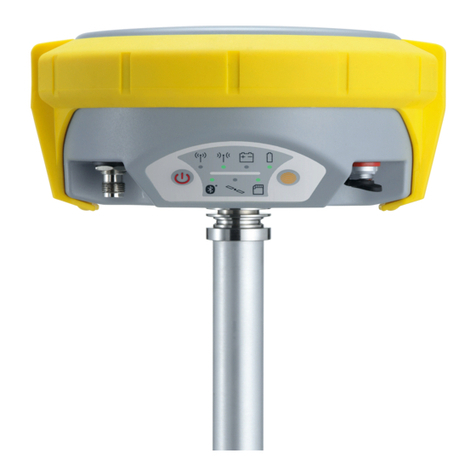
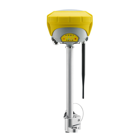
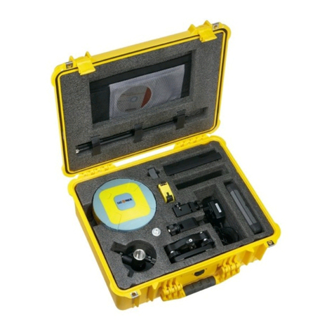
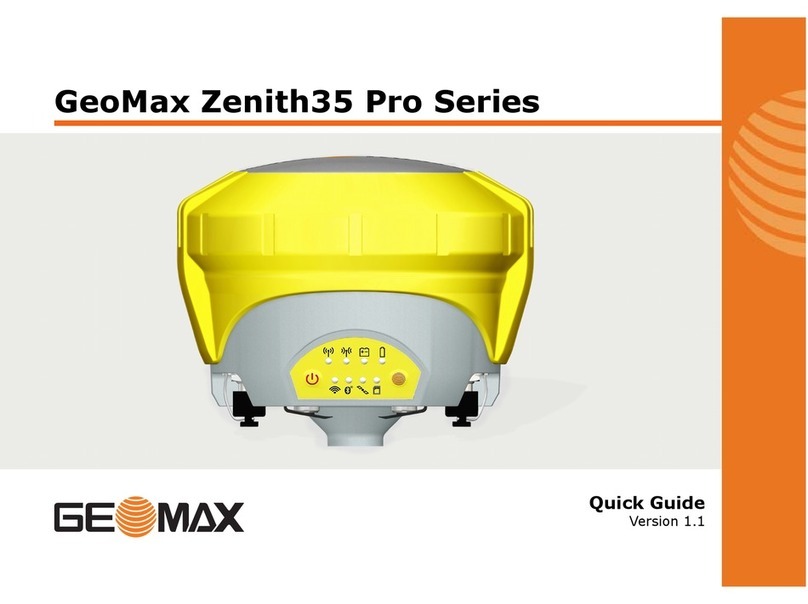
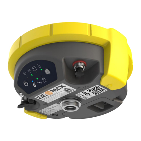
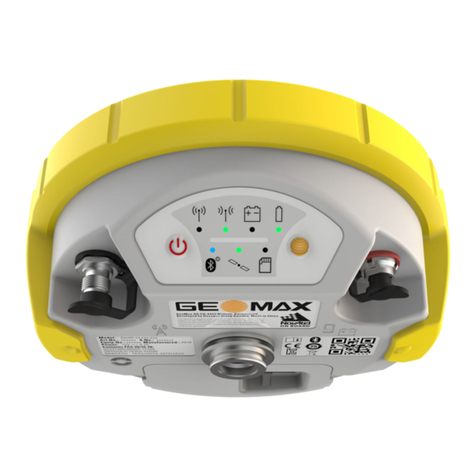
GeoMax Zenith35 Pro Series User manual

GeoMax Zenith35 Pro Series
User Manual
Version 1.1
English

Introduction
This manual contains important safety directions as well as instructions for setting up the prod-
uct and operating it. Refer to "1 Safety Directions" for further information.
Read carefully through the User Manual before you switch on the product.
The model and serial number of your product are indicated on the type plate.
Always refer to this information when you contact your agency or GeoMax authorised service
workshop.
•Windows is a registered trademark of Microsoft Corporation in the United States and other
countries
•Bluetooth® is a registered trademark of Bluetooth SIG, Inc.
•microSD Logo is a trademark of SD-3C, LLC.
All other trademarks are the property of their respective owners.
This manual applies to the Zenith35 ProGNSS instrument.
Product identification
Trademarks
Validity of this manual
2

Table of Contents
1 Safety Directions 4
1.1 General Introduction 4
1.2 Definition of Use 4
1.3 Limits of Use 5
1.4 Responsibilities 5
1.5 Hazards of Use 5
1.6 Electromagnetic Compatibility EMC 9
1.7 FCC Statement, Applicable in U.S. 10
2 Description of the System 12
2.1 System Components 12
2.2 Container Contents 12
2.3 System Concept 13
2.3.1 Software Concept 13
2.3.2 Power Concept 13
2.3.3 Data Storage Concept 13
2.4 Instrument Components 14
2.5 Pin Assignments 14
2.6 The Antenna Reference Plane, ARP 15
3 User Interface 16
3.1 Keyboard 16
3.2 LED Indicators 17
4 Operation 19
4.1 Guidelines for Correct Results with GNSS Surveys 19
4.2 Equipment Setup 19
4.2.1 Setting up as a Real-Time Base 19
4.2.2 Setting up as a Post-Processing Base 20
4.2.3 Setting Up as a Real-Time Rover 20
4.2.4 Fixing the Field Controller to a Holder and Pole 22
4.2.5 Connecting to a Personal Computer 22
4.2.6 Zenith35 Pro WebManager 23
4.3 Batteries 24
4.3.1 Operating Principles 24
4.3.2 Inserting and removing the Battery 24
4.4 Inserting a microSD/SIM Card 25
5 Care and Transport 27
5.1 Transport 27
5.2 Storage 27
5.3 Cleaning and Drying 27
6 Technical Data 28
6.1 Technical Data 28
6.1.1 Tracking Characteristics 28
6.1.2 Accuracy 28
6.1.3 GNSS antenna specifications 29
6.1.4 Internal devices 29
6.1.5 Technical Data 29
6.1.6 Environmental specifications 30
6.2 Conformity to National Regulations 30
6.3 Dangerous Goods Regulations 32
Table of Contents 3

1 Safety Directions
1.1 General Introduction
The following directions enable the person responsible for the product, and the person who
actually uses the equipment, to anticipate and avoid operational hazards.
The person responsible for the product must ensure that all users understand these directions
and adhere to them.
Warning messages are an essential part of the safety concept of the instrument. They appear
wherever hazards or hazardous situations can occur.
Warning messages...
•make the user alert about direct and indirect hazards concerning the use of the product.
•contain general rules of behaviour.
For the users‘ safety, all safety instructions and safety messages shall be strictly observed and
followed! Therefore, the manual must always be available to all persons performing any tasks
described here.
DANGER, WARNING, CAUTION and NOTICE are standardised signal words for identifying lev-
els of hazards and risks related to personal injury and property damage. For your safety, it is
important to read and fully understand the following table with the different signal words and
their definitions! Supplementary safety information symbols may be placed within a warning
message as well as supplementary text.
Type Description
DANGER
Indicates an imminently hazardous situation which, if
not avoided, will result in death or serious injury.
WARNING
Indicates a potentially hazardous situation or an unin-
tended use which, if not avoided, could result in death
or serious injury.
CAUTION
Indicates a potentially hazardous situation or an unin-
tended use which, if not avoided, may result in minor
or moderate injury.
NOTICE Indicates a potentially hazardous situation or an unin-
tended use which, if not avoided, may result in appre-
ciable material, financial and environmental damage.
☞Important paragraphs which must be adhered to in
practice as they enable the product to be used in a
technically correct and efficient manner.
1.2 Definition of Use
•Computing with software.
•Recording measurements.
•Carrying out measurement tasks using various GNSS measuring techniques.
•Recording GNSS and point related data.
•Remote control of product.
•Data communication with external appliances.
•Measuring raw data and computing coordinates using carrier phase and code signal from
GNSS satellites.
Description
About warning messages
Intended use
4 Safety Directions

•Use of the product without instruction.
•Use outside of the intended use and limits.
•Disabling safety systems.
•Removal of hazard notices.
•Opening the product using tools, for example screwdriver, unless this is permitted for cer-
tain functions.
•Modification or conversion of the product.
•Use after misappropriation.
•Use of products with obvious damages or defects.
•Use with accessories from other manufacturers without the prior explicit approval of Geo-
Max.
•Inadequate safeguards at the working site.
•Controlling of machines, moving objects or similar monitoring application without additional
control and safety installations.
1.3 Limits of Use
Suitable for use in an atmosphere appropriate for permanent human habitation: not suitable for
use in aggressive or explosive environments.
WARNING
Working in hazardous areas, or close to electrical installations or similar situations.
Life Risk.
Precautions:
▶Local safety authorities and safety experts must be contacted by the person responsible for
the product before working in such conditions.
1.4 Responsibilities
GeoMax AG, CH-9443 Widnau, hereinafter referred to as GeoMax, is responsible for supplying
the product, including the user manual and original accessories, in a safe condition.
The person responsible for the product has the following duties:
•To understand the safety instructions on the product and the instructions in the user man-
ual.
•To ensure that it is used in accordance with the instructions.
•To be familiar with local regulations relating to safety and accident prevention.
•To inform GeoMax immediately if the product and the application becomes unsafe.
•To ensure that the national laws, regulations and conditions for the operation of e.g. radio
transmitters or lasers are respected.
1.5 Hazards of Use
DANGER
Risk of electrocution
Because of the risk of electrocution, it is dangerous to use poles, levelling staffs and extensions
in the vicinity of electrical installations such as power cables or electrical railways.
Precautions:
▶Keep at a safe distance from electrical installations. If it is essential to work in this environ-
ment, first contact the safety authorities responsible for the electrical installations and fol-
low their instructions.
Reasonably foreseeable
misuse
Environment
Manufacturer of the prod-
uct
Person responsible for the
product
Safety Directions 5

WARNING
Distraction/loss of attention
During dynamic applications, for example stakeout procedures, there is a danger of accidents
occurring if the user does not pay attention to the environmental conditions around, for example
obstacles, excavations or traffic.
Precautions:
▶The person responsible for the product must make all users fully aware of the existing dan-
gers.
WARNING
Inadequate securing of the working site.
This can lead to dangerous situations, for example in traffic, on building sites and at industrial
installations.
Precautions:
▶Always ensure that the working site is adequately secured.
▶Adhere to the regulations governing safety, accident prevention and road traffic.
CAUTION
Not properly secured accessories.
If the accessories used with the product are not properly secured and the product is subjected to
mechanical shock, for example blows or falling, the product may be damaged or people can sus-
tain injury.
Precautions:
▶When setting up the product, make sure that the accessories are correctly adapted, fitted,
secured, and locked in position.
▶Avoid subjecting the product to mechanical stress.
WARNING
Lightning strike
If the product is used with accessories, for example masts, staffs, poles, you may increase the
risk of being struck by lightning.
Precautions:
▶Do not use the product in a thunderstorm.
6 Safety Directions

DANGER
Risk of being struck by lightning
If the product is used with accessories, for example on masts, staffs, poles, you may increase
the risk of being struck by lightning. Danger from high voltages also exists near power lines.
Lightning, voltage peaks, or the touching of power lines can cause damage, injury and death.
Precautions:
▶Do not use the product in a thunderstorm as you can increase the risk of being struck by
lightning.
▶Be sure to remain at a safe distance from electrical installations. Do not use the product
directly under or close to power lines. If it is essential to work in such an environment con-
tact the safety authorities responsible for electrical installations and follow their instruc-
tions.
▶If the product has to be permanently mounted in an exposed location, it is advisable to pro-
vide a lightning conductor system. A suggestion on how to design a lightning conductor for
the product is given below. Always follow the regulations in force in your country regarding
grounding antennas and masts. These installations must be carried out by an authorised
specialist.
▶To prevent damages due to indirect lightning strikes (voltage spikes) cables, for example
for antenna, power source or modem should be protected with appropriate protection ele-
ments, like a lightning arrester. These installations must be carried out by an authorised
specialist.
▶If there is a risk of a thunderstorm, or if the equipment is to remain unused and unatten-
ded for a long period, protect your product additionally by unplugging all systems compo-
nents and disconnecting all connecting cables and supply cables, for example, instrument -
antenna.
Suggestion for design of a lightning conductor for a GNSS system:
1.On non-metallic structures
Protection by air terminals is recommended. An air terminal is a pointed solid or tubular rod
of conducting material with proper mounting and connection to a conductor. The position of
four air terminals can be uniformly distributed around the antenna at a distance equal to
the height of the air terminal.
The air terminal diameter should be 12 mm for copper or 15 mm for aluminium. The height
of the air terminals should be 25 cm to 50 cm. All air terminals should be connected to the
down conductors. The diameter of the air terminal should be kept to a minimum to reduce
GNSS signal shading.
2.On metallic structures
Protection is as described for non-metallic structures, but the air terminals can be connec-
ted directly to the conducting structure without the need for down conductors.
GS_039
a
b
c
a Antenna
b Support structure
c Air terminal
Lightning conductors
Air terminal arrangement,
plan view
Safety Directions 7

GS_040
e
d
c
a
b
a Antenna
b Lightning conductor array
c Antenna/instrument connection
d Metallic mast
e Connection to earth
CAUTION
Inappropriate mechanical influences to batteries
During the transport, shipping or disposal of batteries it is possible for inappropriate mechanical
influences to constitute a fire hazard.
Precautions:
▶Before shipping the product or disposing of it, discharge the batteries by running the prod-
uct until they are flat.
▶When transporting or shipping batteries, the person in charge of the product must ensure
that the applicable national and international rules and regulations are observed.
▶Before transportation or shipping contact your local passenger or freight transport com-
pany.
WARNING
Exposure of batteries to high mechanical stress, high ambient temperatures or immer-
sion into fluids
This can cause leakage, fire or explosion of the batteries.
Precautions:
▶Protect the batteries from mechanical influences and high ambient temperatures. Do not
drop or immerse batteries into fluids.
WARNING
Short circuit of battery terminals
If battery terminals are short circuited e.g. by coming in contact with jewellery, keys, metallised
paper or other metals, the battery can overheat and cause injury or fire, for example by storing
or transporting in pockets.
Precautions:
▶Make sure that the battery terminals do not come into contact with metallic objects.
WARNING
Incorrect fastening of the external antenna
Incorrect fastening of the external antenna to vehicles or transporters poses the risk of the
equipment being broken by mechanical influence, vibration or airstream. This may result in acci-
dent and physical injury.
Precautions:
▶Attach the external antenna professionally. The external antenna must be secured addition-
ally, for example by use of a safety cord. Ensure that the mounting device is correctly
mounted and able to carry the weight of the external antenna (>1 kg) safely.
Grounding the
instrument/antenna
8 Safety Directions

WARNING
If the product is improperly disposed of, the following can happen:
•If polymer parts are burnt, poisonous gases are produced which may impair health.
•If batteries are damaged or are heated strongly, they can explode and cause poisoning,
burning, corrosion or environmental contamination.
•By disposing of the product irresponsibly you may enable unauthorised persons to use it in
contravention of the regulations, exposing themselves and third parties to the risk of severe
injury and rendering the environment liable to contamination.
Precautions:
▶The product must not be disposed with household waste.
Dispose of the product appropriately in accordance with the national
regulations in force in your country.
Always prevent access to the product by unauthorised personnel.
Product-specific treatment and waste management information is available from GeoMax
AG.
WARNING
Only GeoMax authorised service workshops are entitled to repair these products.
1.6 Electromagnetic Compatibility EMC
The term Electromagnetic Compatibility is taken to mean the capability of the product to function
smoothly in an environment where electromagnetic radiation and electrostatic discharges are
present, and without causing electromagnetic disturbances to other equipment.
WARNING
Electromagnetic radiation can cause disturbances in other equipment.
Although the product meets the strict regulations and standards which are in force in this
respect, GeoMax cannot completely exclude the possibility that other equipment may be distur-
bed.
CAUTION
There is a risk that disturbances may be caused in other equipment if the product is used with
accessories from other manufacturers, for example field computers, personal computers or other
electronic equipment, non-standard cables or external batteries.
Precautions:
▶Use only the equipment and accessories recommended by GeoMax. When combined with
the product, they meet the strict requirements stipulated by the guidelines and standards.
When using computers or other electronic equipment, pay attention to the information
about electromagnetic compatibility provided by the manufacturer.
CAUTION
Disturbances caused by electromagnetic radiation can result in erroneous measurements.
Although the product meets the strict regulations and standards which are in force in this
respect, GeoMax cannot completely exclude the possibility that the product may be disturbed by
intense electromagnetic radiation, for example, near radio transmitters, two-way radios or diesel
generators.
Precautions:
▶Check the plausibility of results obtained under these conditions.
Description
Safety Directions 9

CAUTION
Electromagnetic radiation due to improper connection of cables
If the product is operated with connecting cables attached at only one of their two ends, for
example external supply cables, interface cables, the permitted level of electromagnetic radia-
tion may be exceeded and the correct functioning of other products may be impaired.
Precautions:
▶While the product is in use, connecting cables, for example product to external battery,
product to computer, must be connected at both ends.
Use of product with radio or digital cellular phone devices:
WARNING
Electromagnetic fields can cause disturbances in other equipment, in installations, in medical
devices, for example pacemakers or hearing aids and in aircraft. It can also affect humans and
animals.
Precautions:
▶Although the product meets the strict regulations and standards which are in force in this
respect, GeoMax cannot completely exclude the possibility that other equipment can be dis-
turbed or that humans or animals can be affected.
•Do not operate the product with radio or digital cellular phone devices in the vicinity of
filling stations or chemical installations, or in other areas where an explosion hazard
exists.
•Do not operate the product with radio or digital cellular phone devices near to medical
equipment.
•Do not operate the product with radio or digital cellular phone devices in aircraft.
1.7 FCC Statement, Applicable in U.S.
WARNING
This equipment has been tested and found to comply with the limits for a Class B digital
device, pursuant to part 15 of the FCC rules.
These limits are designed to provide reasonable protection against harmful interference in a
residential installation.
This equipment generates, uses and can radiate radio frequency energy and, if not installed
and used in accordance with the instructions, may cause harmful interference to radio com-
munications. However, there is no guarantee that interference will not occur in a particular
installation.
If this equipment does cause harmful interference to radio or television reception, which can
be determined by turning the equipment off and on, the user is encouraged to try to correct
the interference by one or more of the following measures:
•Reorient or relocate the receiving antenna.
•Increase the separation between the equipment and the receiver.
•Connect the equipment into an outlet on a circuit different from that to which the
receiver is connected.
•Consult the dealer or an experienced radio/TV technician for help.
WARNING
Changes or modifications not expressly approved by GeoMax for compliance could void the
user's authority to operate the equipment.
Radios or digital cellular
phones
10 Safety Directions
1588
Model: Zenith35 Pro
GSM-UHF
Input: 9-18 0.7A
Art.No.: 847645
GeoMax AG
Espenstrasse
CH-9443 Widnau
Switzerland
Contains FCC IDs:
MRBSATEL-TA23,
2ABNA-PHS8P
2ABNA-G01
Contains IC:
2422A-SATELTA23,
11648A-PHS8P
11648A-G01
012986_001
010004_001
WARNING
This Class (B) digital apparatus complies with Canadian ICES-003.
Cet appareil numérique de la classe (B) est conforme à la norme NMB-003 du Canada.
Canada Compliance Statement
This device complies with Industry Canada’s license-exempt RSSs. Operation is subject to the
following two conditions:
1.This device may not cause interference; and
2.This device must accept any interference, including interference that may cause unde-
sired operation of the device.
Canada Déclaration de Conformité
Le présent appareil est conforme aux CNR d’Industrie Canada applicables aux appareils radio
exempts de licence. L’exploitation est autorisée aux deux conditions suivantes:
1.l’appareil ne doit pas produire de brouillage;
2.l’appareil doit accepter tout brouillage radioélectrique subi, même si le brouillage est
susceptible d’en compromettre le fonctionnement.
Labelling Zenith35 Pro
Labelling internal battery
ZBA601
Safety Directions 11
2 Description of the System
2.1 System Components
Component Description
Instrument A GNSS receiver with integrated communication devices.
Field controller A multi-purpose device enabling the control of GeoMax instru-
ments.
GeoMax Geo Office An office software used for the processing of raw GNSS data.
Zenith35 Pro WebManager A web-based user interface used to manage the GNSS receiver.
2.2 Container Contents
010005_001
a
b
d
ef
g
c
a Zenith35 Pro instrument
b Cable for charger
c Battery charger
d Tribrach*
e Carrier or field controller*
f Battery
g Measuring tape*
*optional
Main components
Container for Zenith35 Pro
instrument and accesso-
ries part 1 of 2
12 Description of the System

010006_002
a
c
d
b
a UHF radio antenna and
GSM antenna
b GNSS antenna arm*
c USB/RS232 cable
d Quick Guide and CD
*optional
2.3 System Concept
2.3.1 Software Concept
The software can be uploaded using Zenith35 Pro WebManager.
☞Refer to "4.2.6 Zenith35 Pro WebManager".
2.3.2 Power Concept
Use the GeoMax batteries, chargers and accessories or accessories recommended by GeoMax to
ensure the correct functionality of the instrument.
Power for the instrument can be supplied either internally or externally.
Internal power supply: One battery fitting into the instrument.
External power supply: 9V to 18V DC external power input with over-voltage
protection up to 28V.
2.3.3 Data Storage Concept
GNSS raw data can be recorded on the microSD card or internal memory.
☞Unplugging connecting cables or removing the microSD card during the measurement
can cause loss of data. Only remove the microSD card or unplug connecting cables
when the instrument is switched off.
Device Description
microSD card The instrument has a microSD card slot fitted as
standard. A microSD card can be inserted and
removed.
Container for Zenith35 Pro
instrument and accesso-
ries part 2 of 2
Software upload
General
Power options
Description
Data storage device
Description of the System 13

Device Description
Internal memory The instrument has an internal memory fitted as
standard. Available capacity: 4 GB.
2.4 Instrument Components
010007_001
a
be
d
f
cg
a TNC connector for UHF
antenna
b LEMO port 1
c Battery compartment
with SIM card and
microSD card holder
d Keyboard with LEDs,
ON/OFF button and Func-
tion button
e LEMO port 2
f TNC connector for UMTS
antenna
g Antenna Reference Plane
(ARP), where the instru-
ment heights are meas-
ured.
2.5 Pin Assignments
Pin Signal Name Function
1 PWR 12V power supply in
2 GND Signal and chassis ground
3 TxD RS232, transmit data
4 GND Signal ground
5 RxD RS232, receive data
Pin Signal Name Function
1 NC Not used
2 USB_D- USB data line
3 PWR 5V power supply (USB)
4 USB_D+ USB data line
5 TxD RS232, transmit data
6 RxD RS232, receive data
7 GND Signal ground
Port1: LEMO-1, 5 pin, LEMO EEG.0B.305.CLN
Port2: LEMO-1, 7 pin, LEMO EEG.0B.307.CLN
Zenith35 Pro components
Pin assignments for port 1
1
5
43
2
0010010_001
Pin assignments for port 2
1
5
43
2
6
7
0010008_001
Plug types
14 Description of the System

2.6 The Antenna Reference Plane, ARP
The Antenna Reference Plane:
•is where the instrument heights are measured to.
•is where the phase centre variations refer to.
•varies for different instruments.
The ARP for the instrument is shown in the diagram.
010014_001 a
a The Antenna Reference
Plane is the underside of
the thread.
Description
ARP for instrument
Description of the System 15

3 User Interface
3.1 Keyboard
010015_001
ab
a ON/OFF key
b Function key
Key Function
ON/OFF If Zenith35 Pro is off:
Turns on Zenith35 Pro when held for 2 s.
☞While the Zenith35 Pro is booting the two Power LEDs
flash.
If Zenith35 Pro is already on:
Turns off Zenith35 Pro when held for 2 s.
☞All functions described assume the Zenith35 Pro is already on.
Key Function
Function Press and hold key for <1 s.
Switches the Zenith35 Pro between rover or base mode.
Press and hold key for 3 s.
Updates the base position coordinates when Zenith35 Pro is in base
mode. The RTK base LED flashes for 2 s. When no position is availa-
ble, the LED flashes 2 times.
Press and hold key for 5 s.
Connects to the configured RTK base station or NTRIP server when
the Zenith35 Pro is in rover mode. The RTK rover LED flashes for 2 s.
No action if a rover mode is not configured.
Key Function
ON/OFF Press and hold keys for 1 s.
Function The current almanacs stored on the GNSS instrument are deleted and
new almanacs are downloaded. The Position LED flashes yellow three
times.
Press and hold keys for 5 s.
Using the keyboard
ON/OFF key
Function key
Key combinations
16 User Interface

Key Function
The Memory LED flashes red quickly three times. The microSD card of
the GNSS instrument is formatted. The Memory LED continues to
flash red as the SD card is formatted.
Press and hold keys for 10 s.
The System RAM on the GNSS instrument is formatted. Settings of all
installed software will be deleted. The Storage LED flashes red. The
RTK Base and RTK Rover LEDs flash green. The Position LED flashes
yellow quickly three times. After the formatting the System RAM, the
GNSS instrument is turned off.
3.2 LED Indicators
Description
The Zenith35 Pro has Light Emitting Diode indicators. They indicate the basic instrument status.
Diagram
010017_001
ab c c
eg
f
d
a RTK Base LED
b RTK Rover LED
c Power LED
d Wi-Fi LED
e Bluetooth LED
f Position LED
g Storage LED
IF the is THEN
Wi-Fi LED green Wi-Fi is in data mode and ready for con-
necting.
blue Wi-Fi has connected.
Bluetooth
LED green Bluetooth is in data mode and ready for
connecting.
blue Bluetooth has connected.
RTK Base
LED green Zenith35 Pro is in RTK base mode. No RTK
data is being passed to the interface of
the communication device.
flashing green Zenith35 Pro is in RTK base mode. Data is
being passed to the interface of the com-
munication device.
RTK Rover
LED green Zenith35 Pro is in rover mode. No RTK
data is being received at the interface of
the communication device.
flashing green Zenith35 Pro is in rover mode. RTK data is
being received at the interface of the
communication device.
Position
LED off no satellites are tracked.
LED indicators
Description of the LEDs
User Interface 17

IF the is THEN
flashing yellow less than four satellites are tracked, a
position is not yet available.
yellow a navigated position is available.
flashing green a code-only position is available.
green a fixed RTK position is available.
Power LED off battery is not connected, flat or Zenith35
Pro is switched off.
green power is 20% - 100%.
red power is 5% - 20%. The remaining time
for which enough power is available
depends on the type of survey, the tem-
perature and the age of the battery.
fast flashing red power is low (<5%).
Storage
LED green microSD card is inserted but no raw data
is being logged.
flashing green raw data is being logged.
flashing red raw data is being logged but only 5%
memory left.
red microSD card is full, no raw data is being
logged or no microSD card is inserted but
Zenith35 Pro is configured to log raw
data.
18 User Interface

4 Operation
4.1 Guidelines for Correct Results with GNSS Surveys
Successful GNSS surveys require undisturbed satellite signal reception, especially at the instru-
ment which serves as a base. Set up the instrument in locations which are free of obstructions
such as trees, buildings or mountains.
For static surveys, the instrument must be kept perfectly steady throughout the whole occupa-
tion of a point. Place the instrument on a tripod or pillar.
Centre and level the instrument precisely over the marker.
4.2 Equipment Setup
4.2.1 Setting up as a Real-Time Base
The following equipment setup is used for real-time base stations. Raw observation data can also
be collected for post-processing.
010018_001
a
b
c
d
e
f
j
i
h
g
a Zenith35 Pro instrument
b Battery
c Carrier
d Field controller
e Tribrach
f Tripod
g UHF antenna
h Antenna arm
i Antenna cable
j Pole
1. Set up the tripod.
2. Mount the tribrach on the tripod.
3. Ensure that the tribrach is over the marker.
4. Mount and level the carrier on the tribrach.
5. Insert the battery into the instrument.
6. Connect the UHF antenna to the instrument using the antenna arm and the antenna
cable.
7. Press the ON/OFF button on the instrument for 2 s to switch on the instrument.
8. Screw the instrument onto the carrier.
9. Check that the tribrach and carrier are still level.
Undisturbed satellite sig-
nal reception
Steady instrument for
static surveys
Centred and levelled
instrument
Use
Equipment setup -
Zenith35 Pro
Equipment setup step-by-
step
Operation 19

10. Connect the field controller to the instrument through Bluetooth or through Wi-Fi to
the Zenith35 Pro WebManager.
11. Measure the instrument height using the measuring tape. Refer to "2.6 The Antenna
Reference Plane, ARP" for information on the instrument height.
4.2.2 Setting up as a Post-Processing Base
The following equipment setup is used for static operations over markers.
010030_001
a
b
c
d
e
f
a Zenith35 Pro instrument
b Battery
c Carrier
d Tribrach
e Tripod
f Field controller
1. Set up the tripod.
2. Mount the tribrach on the tripod.
3. Ensure that the tribrach is over the marker.
4. Mount and level the carrier on the tribrach.
5. Insert the battery into the instrument.
6. Press the ON/OFF button on the instrument for 2 s to switch on the instrument.
7. Screw the instrument onto the carrier.
8. Check that the tribrach and carrier are still level.
9. Connect the field controller to the instrument through Bluetooth or through Wi-Fi to
the Zenith35 Pro WebManager.
10. Measure the instrument height using the measuring tape. Refer to "2.6 The Antenna
Reference Plane, ARP" for information on the instrument height.
4.2.3 Setting Up as a Real-Time Rover
The following equipment setup is used for real-time rover.
Use
Equipment setup -
Zenith35 Pro
Equipment setup step-by-
step
Use
20 Operation
Other manuals for Zenith35 Pro Series
6
Table of contents
Other GeoMax Receiver manuals

GeoMax
GeoMax Zenith15 User manual

GeoMax
GeoMax Zenith15 User manual

GeoMax
GeoMax Zenith 16 Series User manual

GeoMax
GeoMax Zenith35 Pro Series User manual

GeoMax
GeoMax Zenith35 Pro Series User manual

GeoMax
GeoMax Zenith35 Pro Series User manual

GeoMax
GeoMax Zenith15 User manual

GeoMax
GeoMax Zenith16 Series User manual

GeoMax
GeoMax Zenith35 Pro Series Administrator Guide

GeoMax
GeoMax Zenith16 Series User manual