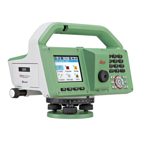
Leica LS10 User manual

Leica LS10/LS15
User Manual
Version 5.0
English

Introduction
Congratulations on the purchase of a Leica LS10/LS15 Digital Level.
This manual contains important safety directions as well as instructions for
setting up the product and operating it. Refer to 1 Safety Directions for fur-
ther information.
Read carefully through the User Manual before you switch on the product.
The content of this document is subject to change without prior notice. Ensure
that the product is used in accordance with the latest version of this docu-
ment.
Updated versions are available for download at the following Internet address:
https://myworld.leica-geosystems.com > myDownloads.
Keep for future reference!
The model and serial number of your product are indicated on the type plate.
Always refer to this information when you need to contact your agency or
Leica Geosystems authorised service centre.
•Windows® is a registered trademark of Microsoft Corporation in the
United States and other countries
•Bluetooth® is a registered trademark of Bluetooth SIG, Inc.
All other trademarks are the property of their respective owners.
This manual applies to the LS10/LS15 Digital Levels. Where there are differ-
ences between the instruments they are clearly described.
Name Description/Format
LS10/LS15
Quick Guide
Provides an overview of the product
together with technical data and
safety directions. Intended as a
quick reference guide.
ü ü
LS10/LS15
User Manual
All instructions required in order to
operate the product to a basic level
are contained in the User Manual.
Provides an overview of the product
together with technical data and
safety directions.
-ü
Refer to the following resources for all LS10/LS15 documentation/soft-
ware:
•the USB documentation card coming with Leica Digital Levels
•https://myworld.leica-geosystems.com
Purchase
☞
☞
Product identication
Trademarks
Validity of this
manual
Available
documentation
2

On the last page of this manual, you can nd the address of Leica Geosystems
headquarters. For a list of regional contacts, please visit
http://leica-geosystems.com/contact-us/sales_support.
myWorld@Leica Geosystems (https://myworld.leica-geosystems.com)
offers a wide range of services, information and training material.
With direct access to myWorld, you are able to access all relevant services
whenever it is convenient for you.
Service Description
myProducts Add all products that you and your company own
and explore your world of Leica Geosystems: View
detailed information on your products and update
your products with the latest software and keep up-
to-date with the latest documentation.
myService View the current service status and full service his-
tory of your products in Leica Geosystems service
centres. Access detailed information on the services
performed and download your latest calibration cer-
ticates and service reports.
mySupport Create new support requests for your products that
will be answered by your local Leica Geosystems
Support Team. View the complete history of your
support requests and view detailed information on
each request in case you want to refer to previous
support requests.
myLearning Welcome to the home of Leica Geosystems online
learning! There are numerous online courses – avail-
able to all customers with products that have valid
CCPs (Customer Care Packages).
myTrustedServices Add your subscriptions and manage users for Leica
Geosystems Trusted Services, the secure software
services, that assist you to optimise your workow
and increase your efciency.
mySmartNet HxGN SmartNet is the GNSS correction service built
on the world’s largest reference station network,
enabling GNSS-capable devices to quickly determine
precise positions in the range of one to two centi-
metre accuracy. The service is provided 24/7 by a
highly-available infrastructure and professional sup-
port team with more than 10 years of experience
reliably delivering the service.
myDownloads Downloads of software, manuals, tools, training
material and news for Leica Geosystems products.
Leica Geosystems
address book
3
Table of Contents
1 Safety Directions 7
1.1 General 7
1.2 Denition of Use 8
1.3 Limits of Use 8
1.4 Responsibilities 8
1.5 Hazards of Use 9
1.6 Electromagnetic Compatibility (EMC) 12
1.7 FCC Statement, Applicable in U.S. 14
2 Description of the System 16
2.1 System Components 16
2.2 Container Contents 17
2.3 Instrument Components 17
3 User Interface 19
3.1 Keyboard 19
3.2 Operating Principles 20
3.3 Screen 21

3.4 Status Icons 21
3.5 Softkeys 23
4 Operation 25
4.1 Power Supply 25
4.1.1 Working with the Battery 25
4.2 Data Storage 26
4.3 Instrument Setup 26
4.4 Startup 28
4.5 Main Menu 29
5 Measurement Guidelines 31
5.1 General Measurement Guidelines 31
5.2 Guidelines for Special Measurement Situations 32
5.3 Guidelines for Taking a Measurement 34
5.4 Manual Input Screen for Optical Height Reading 37
6 Settings 38
6.1 Work Settings 38
6.2 Regional Settings 39
6.3 Data Settings 41
6.4 Screen & Audio Settings 42
6.5 Mode Settings 43
6.6 Interface Settings 45
7 Programs 48
7.1 General 48
7.1.1 Common Fields 48
7.1.2 Point Search 48
7.1.3 Point ID & Incrementation 49
7.2 Q-Level Program 51
7.2.1 General 51
7.2.2 Measurement Procedure for Q-Level 52
7.3 BasicLevel Program 58
7.4 LineLevel Program 59
7.4.1 General 59
7.4.2 Setting a Job 60
7.4.3 Setting Tolerances 61
4 Table of Contents

7.4.4 Setting a Line and a Method 64
7.4.5 Measurement Procedure for LineLevel 65
7.5 LineAdjust Program 69
7.5.1 General 69
7.5.2 Line Adjustment Step-by-Step 70
8 Favourites 73
9 Coding 75
10 Free Coding 77
11 MapView 79
11.1 Overview 79
11.2 MapView Components 79
11.2.1 Screen Area 79
12 Tools 81
12.1 Adjust 81
12.2 System Information 81
12.3 Licence Keys 83
12.4 Instrument Protection with PIN 83
12.5 Loading Software 84
12.6 Compass 85
13 Data Management 87
13.1 Manage 87
13.2 Exporting Data 88
13.3 Importing Data 91
13.4 Working with a USB Memory Stick 94
13.5 Working with Bluetooth 95
13.6 Working with Leica Innity 96
14 Check & Adjust 97
14.1 Overview 97
14.2 Preparation 97
14.3 Adjusting Line of Sight Error 98
14.4 Adjusting the Optical Crosshairs 101
14.5 Aligning the Camera Crosshairs 102
14.6 Calibrating the Digital Compass 103
14.7 Adjusting the Circular Level of the Instrument 103
14.8 Adjusting the Digital Bubble 104
14.9 Servicing the Tripod 104
15 mySecurity 106
16 Care and Transport 108
16.1 Care 108
16.2 Transport 108
16.3 Storage 108
16.4 Cleaning and Drying 109
17 Technical Data 110
17.1 General Technical Data of the Product 110
17.2 Measurements 113
17.3 Conformity to National Regulations 113
17.3.1 General 113
17.3.2 Dangerous Goods Regulations 114
18 Software Licence Agreement/Warranty 115
Appendix A Menu Tree 116
Table of Contents 5

1 Safety Directions
1.1 General
The following directions enable the person responsible for the product, and
the person who actually uses the equipment, to anticipate and avoid opera-
tional hazards.
The person responsible for the product must ensure that all users understand
these directions and adhere to them.
Warning messages are an essential part of the safety concept of the instru-
ment. They appear wherever hazards or hazardous situations can occur.
Warning messages...
•make the user alert about direct and indirect hazards concerning the use
of the product.
•contain general rules of behaviour.
For the users‘ safety, all safety instructions and safety messages shall be
strictly observed and followed! Therefore, the manual must always be available
to all persons performing any tasks described here.
DANGER, WARNING, CAUTION and NOTICE are standardised signal words for
identifying levels of hazards and risks related to personal injury and property
damage. For your safety, it is important to read and fully understand the fol-
lowing table with the different signal words and their denitions! Supplement-
ary safety information symbols may be placed within a warning message as
well as supplementary text.
Type Description
DANGER Indicates an imminently hazardous situation
which, if not avoided, will result in death or
serious injury.
WARNING Indicates a potentially hazardous situation or
an unintended use which, if not avoided,
could result in death or serious injury.
CAUTION Indicates a potentially hazardous situation or
an unintended use which, if not avoided,
may result in minor or moderate injury.
NOTICE
Indicates a potentially hazardous situation or
an unintended use which, if not avoided,
may result in appreciable material, nancial
and environmental damage.
☞Important paragraphs which must be
adhered to in practice as they enable the
product to be used in a technically correct
and efcient manner.
Description
About warning
messages
Safety Directions 7

1.2 Denition of Use
•Electronic and optical height and distance measurements to a levelling
staff
•Angle measurement with the integrated compass (LS15 only) or the hori-
zontal circle
•Recording measurements
•Calculations using measuring programs
•Capturing and recording screenshots
•Visualising the aiming direction and vertical axis
•Data communication with external appliances
•Use of the product without instruction
•Use outside of the intended use and limits
•Disabling safety systems
•Removal of hazard notices
•Opening the product using tools, for example screwdriver, unless this is
permitted for certain functions
•Modication or conversion of the product
•Use after misappropriation
•Use of products with recognisable damage or defects
•Use with accessories from other manufacturers without the prior explicit
approval of Leica Geosystems
•Aiming directly into the sun
•Inadequate safeguards at the working site
1.3 Limits of Use
Suitable for use in an atmosphere appropriate for permanent human habita-
tion. Not suitable for use in aggressive or explosive environments.
WARNING
Working in hazardous areas, or close to electrical installations or sim-
ilar situations
Life Risk.
Precautions:
▶Local safety authorities and safety experts must be contacted by the per-
son responsible for the product before working in such conditions.
Suitable for use in dry environments only and not under adverse conditions.
1.4 Responsibilities
Leica Geosystems AG, CH-9435 Heerbrugg, hereinafter referred to as Leica
Geosystems, is responsible for supplying the product, including the User
Manual and original accessories, in a safe condition.
Intended use
Reasonably foresee-
able misuse
Environment
Environmental condi-
tions for indoor char-
gers
Manufacturer of the
product
8 Safety Directions

The person responsible for the product has the following duties:
•To understand the safety instructions on the product and the instructions
in the User Manual
•To ensure that it is used in accordance with the instructions
•To be familiar with local regulations relating to safety and accident pre-
vention
•To inform Leica Geosystems immediately if the product and the applica-
tion become unsafe
•To ensure that the national laws, regulations and conditions for the oper-
ation of the product are respected
1.5 Hazards of Use
DANGER
Risk of electrocution
Because of the risk of electrocution, it is dangerous to use poles, levelling
staffs and extensions in the vicinity of electrical installations such as power
cables or electrical railways.
Precautions:
▶Keep at a safe distance from electrical installations. If it is essential to
work in this environment, rst contact the safety authorities responsible
for the electrical installations and follow their instructions.
WARNING
Lightning strike
If the product is used with accessories, for example masts, staffs, poles, you
may increase the risk of being struck by lightning.
Precautions:
▶Do not use the product in a thunderstorm.
CAUTION
Pointing product toward the sun
Be careful when pointing the product toward the sun, because the telescope
functions as a magnifying glass and can injure your eyes and/or cause damage
inside the product.
Precautions:
▶Do not point the product directly at the sun.
Person responsible
for the product
Safety Directions 9

WARNING
Distraction/loss of attention
During dynamic applications, for example stakeout procedures, there is a
danger of accidents occurring if the user does not pay attention to the envir-
onmental conditions around, for example obstacles, excavations or trafc.
Precautions:
▶The person responsible for the product must make all users fully aware of
the existing dangers.
WARNING
Inadequate securing of the working site
This can lead to dangerous situations, for example in trafc, on building sites
and at industrial installations.
Precautions:
▶Always ensure that the working site is adequately secured.
▶Adhere to the regulations governing safety, accident prevention and road
trafc.
NOTICE
Dropping, misusing, modifying, storing the product for long periods or
transporting the product
Watch out for erroneous measurement results.
Precautions:
▶Periodically carry out test measurements and perform the eld adjust-
ments indicated in the User Manual, particularly after the product has
been subjected to abnormal use as well as before and after important
measurements.
NOTICE
Strong magnetic elds in the immediate vicinity (e.g. transformers, melting
furnaces...) may inuence the compensator and compass (only LS15) of the
instrument and lead to measuring errors.
Precautions:
▶When working near strong magnetic elds, check results for plausibility.
CAUTION
Not properly secured accessories
If the accessories used with the product are not properly secured and the
product is subjected to mechanical shock, for example blows or falling, the
product may be damaged or people can sustain injury.
Precautions:
▶When setting up the product, make sure that the accessories are correctly
adapted, tted, secured, and locked in position.
▶Avoid subjecting the product to mechanical stress.
10 Safety Directions

WARNING
Inappropriate mechanical inuences to batteries
During the transport, shipping or disposal of batteries it is possible for inap-
propriate mechanical inuences to constitute a re hazard.
Precautions:
▶Before shipping the product or disposing it, discharge the batteries by the
product until they are at.
▶When transporting or shipping batteries, the person in charge of the
product must ensure that the applicable national and international rules
and regulations are observed.
▶Before transportation or shipping, contact your local passenger or freight
transport company.
WARNING
Exposure of batteries to high mechanical stress, high ambient temper-
atures or immersion into uids
This can cause leakage, re or explosion of the batteries.
Precautions:
▶Protect the batteries from mechanical inuences and high ambient tem-
peratures. Do not drop or immerse batteries into uids.
WARNING
Short circuit of battery terminals
If battery terminals are short circuited e.g. by coming in contact with jewellery,
keys, metallised paper or other metals, the battery can overheat and cause
injury or re, for example by storing or transporting in pockets.
Precautions:
▶Make sure that the battery terminals do not come into contact with
metallic objects.
Safety Directions 11

WARNING
Improper disposal
If the product is improperly disposed of, the following can happen:
•If polymer parts are burnt, poisonous gases are produced which may
impair health.
•If batteries are damaged or are heated strongly, they can explode and
cause poisoning, burning, corrosion or environmental contamination.
•By disposing of the product irresponsibly you may enable unauthorised
persons to use it in contravention of the regulations, exposing themselves
and third parties to the risk of severe injury and rendering the environ-
ment liable to contamination.
•Improper disposal of silicone oil may cause environmental contamination.
Precautions:
▶The product must not be disposed with household waste.
Dispose of the product appropriately in accordance with
the national regulations in force in your country.
Always prevent access to the product by unauthorised
personnel.
Product-specic treatment and waste management information can be
received from your Leica Geosystems distributor.
WARNING
Improperly repaired equipment
Risk of injuries to users and equipment destruction due to lack of repair
knowledge.
Precautions:
▶Only authorised Leica Geosystems Service Centres are entitled to repair
these products.
1.6 Electromagnetic Compatibility (EMC)
The term Electromagnetic Compatibility is taken to mean the capability of the
product to function smoothly in an environment where electromagnetic radi-
ation and electrostatic discharges are present, and without causing electro-
magnetic disturbances to other equipment.
WARNING
Electromagnetic radiation
Electromagnetic radiation can cause disturbances in other equipment.
Precautions:
▶Although the product meets the strict regulations and standards which
are in force in this respect, Leica Geosystems cannot completely
exclude the possibility that other equipment may be disturbed.
Description
12 Safety Directions

CAUTION
Use of the product with accessories from other manufacturers. For
example eld computers, personal computers or other electronic equip-
ment, non-standard cables or external batteries
This may cause disturbances in other equipment.
Precautions:
▶Use only the equipment and accessories recommended by Leica Geosys-
tems.
▶When combined with the product, they meet the strict requirements stip-
ulated by the guidelines and standards.
▶When using computers, two-way radios or other electronic equipment,
pay attention to the information about electromagnetic compatibility
provided by the manufacturer.
CAUTION
Intense electromagnetic radiation. For example, near radio transmit-
ters, transponders, two-way radios or diesel generators
Although the product meets the strict regulations and standards which are in
force in this respect, Leica Geosystems cannot completely exclude the possib-
ility that function of the product may be disturbed in such an electromagnetic
environment.
Precautions:
▶Check the plausibility of results obtained under these conditions.
CAUTION
Electromagnetic radiation due to improper connection of cables
If the product is operated with connecting cables attached at only one of their
two ends, for example external supply cables, interface cables, the permitted
level of electromagnetic radiation may be exceeded and the correct function-
ing of other products may be impaired.
Precautions:
▶While the product is in use, connecting cables, for example product to
external battery, product to computer, must be connected at both ends.
Safety Directions 13

WARNING
Use of product with radio or digital cellular phone devices
Electromagnetic elds can cause disturbances in other equipment, in installa-
tions, in medical devices, for example pacemakers or hearing aids and in air-
crafts. Electromagnetic elds can also affect humans and animals.
Precautions:
▶Although the product meets the strict regulations and standards which
are in force in this respect, Leica Geosystems cannot completely exclude
the possibility that other equipment can be disturbed or that humans or
animals can be affected.
▶Do not operate the product with radio or digital cellular phone devices in
the vicinity of lling stations or chemical installations, or in other areas
where an explosion hazard exists.
▶Do not operate the product with radio or digital cellular phone devices
near to medical equipment.
▶Do not operate the product with radio or digital cellular phone devices in
aircrafts.
▶Do not operate the product with radio or digital cellular phone devices for
long periods with the product immediately next to your body.
☞This warning also applies when using products with Bluetooth.
1.7 FCC Statement, Applicable in U.S.
☞The greyed paragraph below is only applicable for products without
radio.
WARNING
This equipment has been tested and found to comply with the limits for a
Class B digital device, pursuant to part 15 of the FCC rules.
These limits are designed to provide reasonable protection against harmful
interference in a residential installation.
This equipment generates, uses and can radiate radio frequency energy and,
if not installed and used in accordance with the instructions, may cause
harmful interference to radio communications. However, there is no guaran-
tee that interference will not occur in a particular installation.
If this equipment does cause harmful interference to radio or television
reception, which can be determined by turning the equipment off and on,
the user is encouraged to try to correct the interference by one or more of
the following measures:
•Reorient or relocate the receiving antenna.
•Increase the separation between the equipment and the receiver.
•Connect the equipment into an outlet on a circuit different from that to
which the receiver is connected.
•Consult the dealer or an experienced radio/TV technician for help.
Radios, digital cellular
phones or products
with Bluetooth
14 Safety Directions

123456
S.No.:
123456
Art.No.:
LeicaGeosystemsAG
CH-9435Heerbrugg
Made in Singapore
Manufactured: 20XX
Equip.No.: 1234567
Power:10.5V-18V ,4.0Wmax
Type: LS1X 0.Xmm
This devicecomplieswithpart15oftheFCCRules. Operation issubjectto
thefollowingtwo conditions:(1)Thisdevicemaynot cause harmful
interference, and(2) Thisdevicemustaccept anyinterference received,
includinginterferencethatmaycauseundesiredoperation.
Contains transmitter module:
FCC-ID T7V1316 / IC: 216Q-1316
10763_002
8469_007
Labelling LS10/LS15
Labelling GEB331
Safety Directions 15

2 Description of the System
2.1 System Components
Component Description
LS10/LS15 instrument An instrument for measuring, calculating and
capturing data. Ideally suited for measure-
ment tasks such as single height measure-
ments, line levelling jobs, adjustment of
point heights or staking out heights.
Equipped with a package of standard applic-
ations to complete these tasks.
Standard applications All standard applications are already installed
on the instrument. Standard applications
include Q-Level, Line Levelling, Line Adjust-
ment, Intermediate, Set Out and additional
Tools features.
Innity software An ofce software consisting of a suite of
standard and extended programs for the
viewing, exchanging, managing and post-
processing of data.
Data transfer Data can be transferred between the instru-
ment and a computer via a data transfer
cable, a USB memory stick, a USB cable or
Bluetooth.
Feature LS10 LS15
Height measurement l l
Distance measurement l l
Magnetically damped compensator l l
32x Magnication telescope l l
Manual focus l l
Autofocus - l
Overview camera - l
Compass - l
MapView / Coordinates for ofce export - l
Circular level bubble l l
Digital level bubble / Tilt check l l
Communication (USB host, USB device) l l
Bluetooth l l
RS232/USB-to-LEMO interface - l
Internal ash memory for 30.000 measurements l l
l Available
- Not available
Main components
Features of
LS10/LS15
16 Description of the System

2.2 Container Contents
010043_001
a
b
c
e
g
h
f
d
i
j
k
a Instrument
bQuick Guide/USB documentation card
c GKL311 battery charger (optional)
d GEB331 batteries (optional)
e Spare stylus (optional)
f Allen keys (1.5 mm/2 mm)
g GEV223 USB data transfer cable (optional)
h Car adapter cable for GKL311 (optional)
i GEV192 AC power adapter for GKL311 (optional)
j Sunshade
k Rain Cover
2.3 Instrument Components
010044_002
a
d
c
b
i
j
e
f
g
h
k
l
m
a Optical sight
bHandle with integrated prism
for viewing the circular level
c Circular level
d Touch screen
e Battery compartment, also
containing interface for
USB stick and mini USB
f Horizontal drive
g Push button to open battery
compartment
h Function keys
i ON/OFF key
j Keyboard
k Eyepiece
l Protective cap for crosshairs
adjustment screw
m Horizontal circle
Container contents
Instrument
components
(part 1)
Description of the System 17

010045_002
a
d
c
b
i
j
e
f
g
h
k
a Optical sight
bFocussing drive
c Trigger key
d Stylus for touch screen
e RS232 serial/USB interface
with external power supply
(only LS15)
f Horizontal drive
g Overview camera (only LS15)
h Objective
i Horizontal circle
j Footscrews
k Base plate
Instrument
components
(part 2)
18 Description of the System

3 User Interface
3.1 Keyboard
010046_002
a
d
cb
ij
efg h kl
a Touch screen
bON/OFF key
c Alphanumeric keypad
d Function keys F1 to F4
e Home key
f Page key
g User key 1
h Navigation keys
i Enter key
j User key 2
k ESC key
l Favourites key
Key Description
ON/OFF key to switch the instrument on or off or to set it
into standby mode.
Alphanumeric keypad for entering text and numerical values.
Home key. Returns to the Main Menu.
Page key. Displays the next screen when several screens are
available.
Favourites key. Quick-access to measurement supporting
functions.
ESC key (in general): Quits a screen or edit mode without
saving changes. Returns to next higher level.
ESC key (in all levelling applications): After conrming the
action, the ESC key deletes the last observation and allows
to repeat it.
User key 1. Programmable with a function from the Favour-
ites menu.
User key 2. Programmable with a function from the Favour-
ites menu.
Navigation keys. Control the focus bar within the screen and
the entry bar within a eld.
ENTER key. Conrms an entry and continues to the next
eld.
Trigger key. Triggers a measurement. Programmable with
functions which allow the auto-focussing of the telescope
(only LS15), the height and distance reading and the storing
of the measurement data.
For details on how to dene the functions of trigger key,
refer to 6.1 Work Settings.
Keyboard
Keys
User Interface 19

Key Description
Function keys that are assigned to the variable functions
displayed at the bottom of the screen.
3.2 Operating Principles
Use the alphanumeric keypad to enter characters directly into editable elds.
•Numeric elds: Can only contain numerical values. Press a key of the
keypad to enter a number.
•Alphanumeric elds: Can contain numbers and letters. Press a key of the
keypad to enter one of the characters written above that key. To toggle
through the characters, press the key several times until the required
character is displayed. For example: A>B>C>2>A>B>...
Within the menu screens, you can select a menu option by pressing a key on
the alphanumeric keyboard. To select a menu option, press the respective
number that is displayed at the upper left corner of the menu icon .
Example:
☞Press 2 on the alphanu-
meric keyboard to open
the menu Programs.
Key Description
ESC key Deletes any change and restores the previ-
ous value.
Left navigation key Moves the cursor to the left.
Right navigation key Moves the cursor to the right.
Softkey Insert If alphanumeric mode is activated: Inserts a
whitespace at the cursor position.
If numeric mode is activated: Inserts zero at
the cursor position.
Softkey Delete Deletes the character at the cursor position.
Softkey Clear Deletes all characters entered into the input
eld.
Edit Fields with
Alphanumeric Keypad
Select a menu option
with alphanumeric
keypad
Keys for editing input
elds
20 User Interface
Other manuals for LS10
3
This manual suits for next models
1
Table of contents
Other Leica Laser Level manuals

Leica
Leica Rugby 640G User manual

Leica
Leica Jogger 20 User manual

Leica
Leica Rugby 810 User manual

Leica
Leica Rugby 610 User manual

Leica
Leica Wild t1010 User manual

Leica
Leica NA720 User manual

Leica
Leica BLK ARC User manual

Leica
Leica 3D Disto User manual

Leica
Leica Rugby 300 SG User manual

Leica
Leica Lino P5 User manual

Leica
Leica Rugby 100 User manual

Leica
Leica Lino L4P1 User manual

Leica
Leica Lino L360 User manual

Leica
Leica Rugby 670 User manual

Leica
Leica Rugby 410 User manual

Leica
Leica Rugby 260SG User manual

Leica
Leica N3-70 User manual

Leica
Leica Lino L360 User manual

Leica
Leica LINO L2Gs-1 User manual

Leica
Leica Rugby 820 User manual