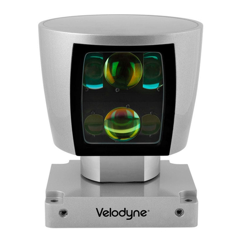
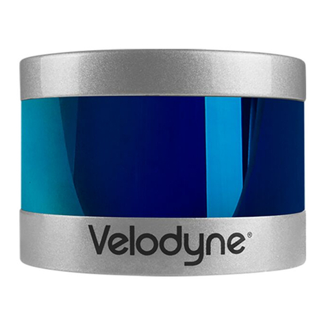
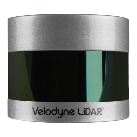
Velodyne VLS-128 User manual

VLS-128 User Manual
63-9483 Rev. A
DRAFT

Copyright 2018 Velodyne LiDAR, Inc. All rights reserved.
Trademarks
Velodyne™, HDL-32E™, HDL-64E™, VLP-16™, VLP-32™, Puck™, Puck LITE™, Puck Hi-Res™, Ultra Puck™, VLS-128™,
and Velarray™ are trademarks of Velodyne LiDAR, Inc. All other trademarks, service marks, and company names in this
document or website are properties of their respective owners.
Disclaimer of Liability
The information contained in this document is subject to change without notice. Velodyne LiDAR, Inc. shall not be liable for
errors contained herein or for incidental or consequential damage in connection with the furnishing, performance, or use
of this document or equipment supplied with it.
The materials and information contained herein are being provided by Velodyne LiDAR, Inc. to its Customer solely for Cus-
tomer’s use for its internal business purposes. Velodyne LiDAR, Inc. retains all right, title, interest in and copyrights to the
materials and information herein. The materials and information contained herein constitute confidential information of
Velodyne LiDAR, Inc. and Customer shall not disclose or transfer any of these materials or information to any third party.
No part of this publication may be reproduced or transmitted in any form or by any means, electronic or mechanical, includ-
ing photocopying and recording, or stored in a database or retrieval system for any purpose without the express written
permission of Velodyne LiDAR, Inc., which reserves the right to make changes to this document at any time without notice
and assumes no responsibility for its use. This document contains the most current information available at the time of pub-
lication. When new or revised information becomes available, this entire document will be updated and distributed to all
registered users.
Limited Warranty
Except as specified below, products sold hereunder shall be free from defects in materials and workmanship and shall con-
form to Velodyne's published specifications or other specifications accepted in writing by Velodyne for a period of one (1)
year from the date of shipment of the products. The foregoing warranty does not apply to any Garmin products, other
products not manufactured by Velodyne or products that have been subject to misuse, neglect, or accident, or have been
opened, dissembled, or altered in any way. Velodyne shall make the final determination as to whether its products are
defective. Velodyne 's sole obligation for products failing to comply with this warranty shall be, at its option, to either repair,
replace or issue credit for the nonconforming product where, within fourteen (14) days of the expiration of the warranty
period, (i) Velodyne has received written notice of any nonconformity; (ii) after Velodyne's written authorization, Buyer has
returned the nonconforming product to Velodyne at Buyer's expense; and (iii) Velodyne has determined that the product is
nonconforming and that such nonconformity is not the result of improper installation, repair or other misuse. Velodyne will
pay for return shipping for all equipment repaired or replaced under warranty and Buyer will pay all duties or taxes, if any,
on all equipment repaired or replaced under warranty. THE FOREGOING WARRANTY AND REMEDIES ARE
EXCLUSIVE AND MADE EXPRESSLY IN LIEU OF ALL OTHER WARRANTIES, EXPRESSED, IMPLIED OR
OTHERWISE, INCLUDING WARRANTIES OF 65-0003 Rev E Velodyne LiDAR Terms & Conditions Page 3 of 5 2016-
03-31 MERCHANTABILITY AND FITNESS FOR A PARTICULAR PURPOSE. VELODYNE DOES NOT ASSUME OR
AUTHORIZE ANY OTHER PERSON TO ASSUME FOR IT ANY OTHER LIABILITY IN CONNECTION WITH ITS
PRODUCTS. This warranty is non-transferable.
Velodyne LiDAR, Inc.
5521 Hellyer Ave
San Jose, CA 95138
Phone +1 408-465-2800
DRAFT

Table of Contents
Chapter 1 • About This Manual
1.1 Manual Scope
16
1.2 Prerequisite Knowledge
16
1.3 Audience
16
1.4 Document Conventions
16
Chapter 2 • VLS-128 Overview
2.1 Overview
18
2.2 Product Models
19
2.3 Time of Flight
19
2.4 Data Interpretation Requirements
19
Chapter 3 • Safety Precautions
3.1 Warning and Caution Definitions
20
3.1.1 Caution Hazard Alerts
20
3.2 Safety Overview
20
3.2.1 Electrical Safety
20
3.2.2 Mechanical Safety
20
3.2.3 Laser Safety
20
Chapter 4 • Unboxing & Verification
4.1 What’s in the Box?
22
4.1.1 Bulkhead Connectors
22
4.1.1.1 Ethernet Bulkhead Connector
22
4.1.1.2 Power+GPS Bulkhead Connector
22
4.1.2 Accessories
22
4.1.3 Variants
23
4.2 Verification Procedure
23
4.2.1 Network Setup in Isolation
23
4.2.2 Access Sensor’s Web Interface
25
4.2.3 Visualize Live Sensor Data with VeloView
26
4.2.3.1 VeloView Operation
27
4 VLS-128 User Manual
DRAFT

Chapter 5 • Installation & Integration
5.1 Overview
28
5.2 Mounting
28
5.3 Encapsulation, Solar Hats, and Ventilation
29
5.4 Connections
29
5.4.1 Interface Box and Cable
29
5.4.2 Operation Without an Interface Box
29
5.4.3 Power
29
5.4.3.1 Power Considerations
30
Chapter 6 • Key Features
6.1 Calibrated Reflectivity
31
6.2 Laser Return Modes
31
6.2.1 Single Return Modes: Strongest, Last
31
6.2.2 Multiple Returns
32
6.2.3 Dual Return Mode
32
6.3 Phase Locking Multiple Sensors
36
Chapter 7 • Sensor Inputs
7.1 Power Requirements
38
7.2 Interface Box Signals
39
7.3 Ethernet Interface
40
7.4 GPS, Pulse Per Second (PPS) and NMEA GPRMC Message
40
7.4.1 GPS Input Signals
40
7.4.2 Electrical Requirements
40
7.4.3 Timing and Polarity Requirements
40
7.4.4 GPS Connection Scenarios
43
7.4.4.1 Connecting a Garmin 18x LVC GPS Receiver
43
7.4.4.2 Connecting to a computer's serial port
45
7.4.4.3 Connecting to a microcomputer’s UART
45
7.4.5 NMEA Message Formats
46
7.4.5.1 Pre-NMEA Version 2.3 Message Format
46
7.4.5.2 NMEA Version 2.3 Message Format
47
5
DRAFT

7.4.6 Accepting NMEA Messages Via Ethernet
48
Chapter 8 • Sensor Operation
8.1 Firing Sequence
49
8.2 Throughput Calculations
49
8.2.1 Data Packet Rate
49
8.2.2 Position Packet Rate
49
8.2.3 Total Packet Rate
49
8.2.4 Laser Measurements Per Second
50
8.2.4.1 Single Return Mode (Strongest, Last)
50
8.2.4.2 Dual Return Mode
50
8.3 Rotation Speed (RPM)
50
8.3.1 Horizontal Angular (Azimuth) Resolution
50
8.3.2 Rotation Speed Fluctuation and Point Density
51
Chapter 9 • Sensor Data
9.1 Sensor Origin and Frame of Reference
52
9.2 Calculating X,Y,Z Coordinates from Collected Spherical Data
52
9.3 Packet Types and Definitions
53
9.3.1 Definitions
53
9.3.1.1 Firing Sequence
54
9.3.1.2 Laser Channel
54
9.3.1.3 Data Point
54
9.3.1.4 Azimuth
54
9.3.1.5 Data Block
54
9.3.1.6 Time Stamp
54
9.3.1.7 Factory Bytes
55
9.3.2 Data Packet Structure
56
9.3.3 Position Packet Structure
57
9.4 Discreet Point Timing Calculation
60
9.5 Precision Azimuth Calculation
62
9.6 Converting PCAP Files to Point Cloud Formats
65
6 VLS-128 User Manual
DRAFT

Chapter 10 • Sensor Communication
10.1 Web Interface
67
10.1.1 Configuration Screen
68
10.1.1.1 MAC Address
70
10.1.1.2 Correctly reset MAC Address to Factory MAC Address
70
10.1.2 System Screen
71
10.1.3 Info Screen
72
10.1.4 Diagnostics Screen
74
10.2 Sensor Control with curl
75
10.2.1 Using curl with Velodyne LiDAR Sensors
75
10.2.2 curl Command Parameters
75
10.2.3 Command Line curl Examples
76
10.2.3.1 Get Diagnostic Data
76
10.2.3.2 Conversion Formulas
77
10.2.3.3 Interpret Diagnostic Data
77
10.2.3.3.1 top:hv
77
10.2.3.3.2 top:lm20_temp
78
10.2.3.3.3 top:pwr_5v
78
10.2.3.3.4 top:pwr_2_5v
78
10.2.3.3.5 top:pwr_3_3v
78
10.2.3.3.6 top:pwr_raw
79
10.2.3.3.7 top:pwr_vccint
79
10.2.3.3.8 bot:i_out
79
10.2.3.3.9 bot:lm20_temp
79
10.2.3.3.10 bot:pwr_1_2v
80
10.2.3.3.11 bot:pwr_1_25v
80
10.2.3.3.12 bot:pwr_2_5v
80
10.2.3.3.13 bot:pwr_3_3v
80
10.2.3.3.14 bot:pwr_5v
80
10.2.3.3.15 bot:pwr_v_in
81
10.2.3.4 Get Snapshot
81
7
DRAFT

10.2.3.5 Get Sensor Status
81
10.2.3.6 Set Motor RPM
81
10.2.3.7 Set Field of View
82
10.2.3.8 Set Return Type (Strongest, Last, Dual)
82
10.2.3.9 Save Configuration
82
10.2.3.10 Reset System
82
10.2.3.11 Network Configuration
83
10.2.3.12 Set Host (Destination) IP Address
83
10.2.3.13 Set Data Port
83
10.2.3.14 Set Telemetry Port
83
10.2.3.15 Set Network (Sensor) IP Address
83
10.2.3.16 Set Netmask
83
10.2.3.17 Set Gateway
83
10.2.3.18 Set DHCP
83
10.2.4 curl Example using Python
84
Chapter 11 • Troubleshooting
11.1 Troubleshooting Process
86
11.1.1 Turned DHCP On, Lost Contact With Sensor
88
11.2 Service and Maintenance
88
11.2.1 Fuse Replacement
88
11.3 Technical Support
89
11.3.1 Purchased through a Distributor
89
11.3.2 Factory Support
89
11.3.3 Support Desk
89
11.4 Return Merchandise Authorization (RMA)
89
Appendix A • Sensor Specifications
Appendix B • Firmware Update
B.1 Firmware Update Procedure
91
B.1.1 Special Procedure to Update Firmware
97
B.1.2 If An Error Occurs
98
8 VLS-128 User Manual
DRAFT

Appendix C • Mechanical Diagrams
C.1 Interface Box Mechanical Drawing
100
C.2 VLS-128 Mechanical Drawing
101
C.3 VLS-128 Optical Keep Out Zone
102
Appendix D • Wiring Diagrams
D.1 Interface Box Wiring Diagram
104
D.2 Interface Box Schematic
105
Appendix E • VeloView
E.1 Features
106
E.2 Install VeloView
107
E.3 Visualize Streaming Sensor Data
107
E.4 Capture Streaming Sensor Data to PCAP File
108
E.5 Replay Captured Sensor Data from PCAP File
108
Appendix F • Laser Pulse
F.1 The Semiconductor Laser Diode
113
F.2 Laser Patterns
114
F.2.1 Laser Spot Pattern
114
F.2.2 Laser Scan Pattern
114
F.2.3 Beam Divergence
115
Appendix G • Time Synchronization
G.1 Introduction
116
G.2 Background
116
G.3 PPS Qualifier
117
G.3.1 Require GPS Receiver Valid
117
G.3.2 Require PPS Lock
117
G.3.3 Delay
118
G.4 GPS Qualifier
118
G.5 Application
118
G.6 Logic Tables
118
Appendix H • Phase Lock
9
DRAFT

H.1 Phase Lock
120
H.1.1 Setting the Phase Lock
120
H.1.2 Application Scenarios
121
H.2 Field of View
123
H.3 Status
123
Appendix I • Sensor Care
I.1 Cleaning the Sensor
125
I.1.1 Required Materials
125
I.1.2 Determine Method of Cleaning
126
I.1.3 Method One
126
I.1.4 Method Two
126
I.1.5 Method Three
126
I.1.6 Method Four
127
Appendix J • Network Configuration
J.1 Ethernet and Network Setup
128
J.1.1 Defaults
128
J.1.2 Establishing Communication via Ethernet
128
J.2 Network Considerations
129
J.2.1 Throughput Requirements
129
J.2.2 Single Sensor Transmitting to a Broadcast Address
130
J.2.3 Multiple Sensors in the Same Network
130
J.2.3.1 Multiple Sensors Transmitting to a Broadcast Address
130
J.2.3.2 Multiple Sensors Transmitting to a Specific Address
131
10 VLS-128 User Manual
DRAFT

List of Tables
Table 1-1 Document Conventions
16
Table 2-1 3D Sensing System Components
19
Table 7-1 Interface Box Signals
39
Table 7-2 Pre-NMEA Version 2.3 Message Format
47
Table 7-3 Post-NMEA Version 2.3 Message Format
47
Table 8-1 Rotation Speed vs Resolution
51
Table 9-1 Factory Byte Values
55
Table 9-2 Position Packet Structure Field Offsets
58
Table 9-3 PPS Status Byte Values
59
Table 10-1 Configuration Screen Functionality and Features
68
Table 10-2 System Screen Functionality and Features
71
Table 10-3 Info Screen Functionality and Features
72
Table 10-4 System Screen Functionality and Features
74
Table 11-1 Common Problems and Resolutions
86
Table F-1 VLS-128 Beam Divergence
115
11
DRAFT

List of Figures
Figure 2-1 Example 3D Sensing System
18
Figure 3-1 Class 1 Laser
21
Figure 4-1 Sensor Network Settings
24
Figure 4-2 Interface Box (power and data connections)
25
Figure 4-3 Sample Web Interface Main Configuration Screen
25
Figure 4-4 VeloView Open Sensor Stream
27
Figure 6-1 A Single Return
32
Figure 6-2 Dual Return with Last and Strongest Returns
33
Figure 6-3 Dual Return with Second Strongest Return
34
Figure 6-4 Dual Return with Far Retro-Reflector
35
Figure 6-5 Forestry Application Multiple Returns
36
Figure 6-6 Phase Locking Example
37
Figure 7-1 Interface Box (sensor power and data connections)
39
Figure 7-2 Synchronizing PPS with NMEA GPRMC Message
40
Figure 7-3 PPS Signal Closely Followed by NMEA GPRMC Message
41
Figure 7-4 PPS Signal Followed 600 ms later by NMEA GPRMC Message
41
Figure 7-5 RS-232 Example Transmission
42
Figure 7-6 Garmin 18x LVC Configuration
43
Figure 7-7 Garmin GPRMC Message
44
Figure 7-8 DB9 Pin-outs (DTE) and USB-to-Serial Adapter
45
Figure 7-9 Signal Directly from UART (incorrect polarity)
45
Figure 7-10 Inverted Signal from UART (correct polarity)
46
Figure 8-1 Point Density Example
51
Figure 9-1 VLS-128 Sensor Coordinate System
53
Figure 9-2 VLS-128 Single Return Mode Data Structure
56
Figure 9-3 VLS-128 Dual Return Mode Data Structure
57
Figure 9-4 Wireshark Position Packet Trace
60
Figure 9-5 Firing Sequence Timing
61
Figure 9-6 Single Return Mode Timing Offsets (in µs)
62
Figure 9-7 Dual Return Mode Timing Offsets (in µs)
62
Figure 9-8 VLS-128 Azimuth Offsets by Elevation
63
Figure 9-9 VLS-128 Laser Pattern
64
Figure 10-1 VLS-128 Configuration Screen
68
Figure 10-2 VLS-128 System Screen
71
12 VLS-128 User Manual
DRAFT

Figure 10-3 VLS-128 Info Screen
72
Figure 10-4 VLS-128 Diagnostics Screen
74
Figure B-1 Velodyne Downloads Page
91
Figure B-2 Compare Firmware Versions
92
Figure B-3 Select New Firmware Image
93
Figure B-4 Upload New Firmware Image
94
Figure B-5 Firmware Update Complete Page
95
Figure B-6 Finalize Firmware Update
96
Figure B-7 Verify Firmware Versions
97
Figure C-1 Interface Box Mechanical Drawing 50-1483 Rev 1
100
Figure C-2 VLS-128 Mechanical Drawing 86-0137 REV A
101
Figure C-3 VLS-128 Optical Keep Out Zone 86-0137 REV A
102
Figure D-1 Interface Box Wiring Diagram 86-0107A
104
Figure D-2 Interface Box Schematic 69-8230A
105
Figure E-1 VeloView Open Sensor Stream
107
Figure E-2 VeloView Record Button
108
Figure E-3 VeloView Open Capture File
109
Figure E-4 VeloView Play Button
109
Figure E-5 VeloView Spreadsheet Tool
110
Figure E-6 VeloView Data Point Table
110
Figure E-7 VeloView Show Only Selected Elements
111
Figure E-8 VeloView Select All Points
111
Figure E-9 VeloView List Selected Points
112
Figure F-1 Laser Diode Concept
113
Figure F-2 Laser Spot Shape
114
Figure G-1 Web Interface PPS and GPS Qualifier Option Selections
116
Figure G-2 Top of Hour Counters
117
Figure G-3 Sub-Second Counter Behavior
118
Figure G-4 Minutes and Seconds Counter Behavior
119
Figure H-1 Direction of Laser Firing
120
Figure H-2 Configuration Screen - Phase Lock
121
Figure H-3 Right and Left Sensor Phase Offset
122
Figure H-4 Fore and Aft Sensor Phase Offset
122
Figure H-5 Sensor Data Shadows
123
Figure J-1 Sensor Network Settings
129
Figure J-2 Single Sensor Broadcasting on a Simple Network
130
13
DRAFT

Chapter 1 • About This Manual
1.1 Manual Scope
This manual provides descriptions and procedures supporting the installation, verification, operation, and diagnostic eval-
uation of the VLS-128 sensor.
1.2 Prerequisite Knowledge
This manual is written with the premise that the user has some basic engineering experience and general understanding
of LiDAR technology. In addition, some familiarity with the configuration and operation of networking applications and
equipment is recommended.
It is recommended that prior to installation or other procedures covered in this manual, the user fully reads and com-
prehends all information within this manual.
1.3 Audience
The user mentioned occasionally in this document is typically an engineer tasked with sensor integration for a project, a
tech tasked with sensor upkeep, or data scientist looking to understand sensor output data.
1.4 Document Conventions
This document uses the following typographic conventions:
Convention Description
Bold Indicates text on a window, other than the window title, including menus, menu options, buttons,
fields, and labels. Example: Click OK.
Italic
Indicates a variable, which is a placeholder for actual text provided by the user or system. Example:
copy
source-file
target-file
Note: Angled brackets (< >) are also used to indicate variables.
screen/code Indicates text that is displayed on screen or entered by the user. Example:
# pairdisplay -g oradb
[ ] square
brackets Indicates optional values. Example: [ a | b ] indicates that you can choose a, b, or nothing.
{ } braces Indicates required or expected values. Example: { a | b } indicates that you must choose either a or
b.
| vertical bar Indicates that you have a choice between two or more options or arguments. Examples: [ a | b ]
indicates that you can choose a, b, or nothing. { a | b } indicates that you must choose either a or b.
Table 1-1 Document Conventions
16 VLS-128 User Manual
DRAFT

Note: Notes such as this indicate important information. They call attention to an operating procedure or practice which
may enhance user interaction with the product. Notes may also be used to prevent information loss or product damage.
Chapter 1 • About This Manual 17
DRAFT

Chapter 2 • VLS-128 Overview
This chapter provides basic information on the sensor's hardware and software components.
2.1 Overview
18
2.2 Product Models
19
2.3 Time of Flight
19
2.4 Data Interpretation Requirements
19
2.1 Overview
The VLS-128 sensor uses 128 infra-red (IR) lasers paired with IR detectors to measure distances to objects. The device is
mounted securely within a compact, weather-resistant housing. The assembly of laser/detector pairs spins rapidly within
its fixed housing to scan the surrounding environment, firing each laser over 18,500 times per second, providing, in real-
time, a rich set of 3D point data.
Advanced digital signal processing and waveform analysis provide highly accurate long-range sensing, as well as cal-
ibrated reflectivity data, enabling easy detection of retro-reflectors like street-signs, license plates, and lane markings.
Sensor data is made available to your application via Ethernet in real-time in the form of UDP packets.
Figure 2-1 Example 3D Sensing System
18 VLS-128 User Manual
DRAFT

Item Description
1 Desktop/Laptop Computer
2 INS/GPS Antenna/Interface (optional)
3 Velodyne Interface Box
4 Velodyne LiDAR Sensor
5 DC Power Supply
Table 2-1 3D Sensing System Components
Note: Optional - not included unless ordered: Garmin GPS 18x LVC receiver (P/N: 80-GPS18LVC). When purchased
through Velodyne LiDAR, it comes pre-configured for use with any Velodyne sensors, making it a great reference GPS
receiver. Plugs directly into the Interface Box.
2.2 Product Models
For ordering information, contact Sales at http://www.velodynelidar.com/contacts.php. Data sheets for available models
can be downloaded from http://velodynelidar.com/downloads.html#datasheets.
2.3 Time of Flight
Velodyne LiDAR sensors use time-of-flight (ToF) methodology.
When each IR laser emits a laser pulse, its time-of-shooting and direction are registered. The laser pulse travels through
air until it hits an obstacle which reflects some of the energy. A portion of that energy is received by the paired IR detector,
which registers the time-of-acquisition and power received.
2.4 Data Interpretation Requirements
Desktop, Laptop or Embedded computer
Advanced geo-referencing software application
GPS-Based
SLAM-Based
User Built
Purchased from System Integrator
For more software details, see
Converting PCAP Files to Point Cloud Formats on page 65
.
Note: Click the following link to view a list of Velodyne system integrators who can sell you imaging software or a complete
system: http://velodyneLiDAR.com/integrators.php.
Chapter 2 • VLS-128 Overview 19
DRAFT

Chapter 3 • Safety Precautions
This chapter provides information necessary for the safe operation of Velodyne LiDAR sensors.
Observe the following general safety precautions during all LiDAR sensor phases of operation. Failure to comply with
these precautions or with specific warnings elsewhere in this manual violates safety standards of intended sensor usage
and may impair the protection provided by the equipment. Velodyne LiDAR, Inc. assumes no liability for failure to comply
with these requirements.
3.1 Warning and Caution Definitions
3.1.1 Caution Hazard Alerts
CAUTION
CAUTION indicates a potentially hazardous situation which may res-
ult in minor or moderate injury. It may also be used to alert against
unsafe practices. The icon shown in the left column displays the spe-
cific concern; in this case, a hot surface.
3.2 Safety Overview
3.2.1 Electrical Safety
IMPORTANT: Read all installations instructions before powering up the sensor.
Note: The VLS-128 sensor is not field serviceable. For servicing and repair, the equipment must be completely shut off,
removed, packaged carefully, and shipped back to the manufacturer's facility with a completed RMA Form. See
Service
and Maintenance on page 88
for details.
3.2.2 Mechanical Safety
CAUTION
The VLS-128 sensor contains a rapidly spinning assembly. Do not
operate the VLS-128 sensor without its cover firmly installed. The
sensor does not contain user serviceable parts. It should not be
opened in the field.
3.2.3 Laser Safety
This device complies with FDA performance standards for laser products except for deviations pursuant to Laser Notice
No. 50, dated June 24, 2007.
20 VLS-128 User Manual
DRAFT
Table of contents
Other Velodyne Accessories manuals

Velodyne
Velodyne SC-ICG - INSTALLATION REV A User manual

Velodyne
Velodyne SC-600 IW User manual

Velodyne
Velodyne HD HDL-64E S2.1 User manual

Velodyne
Velodyne VLP-16 User manual

Velodyne
Velodyne Chrysalis IA-400D User manual

Velodyne
Velodyne HDL-64E S3 Operating instructions

Velodyne
Velodyne HDL-32E User manual

Velodyne
Velodyne VLP-32C User manual

Velodyne
Velodyne HDL-64E User manual