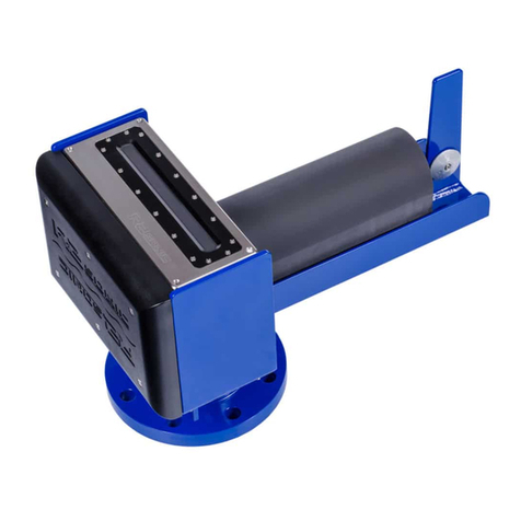
RADAC WaveGuide 5 Direction Onboard 2 User manual

WaveGuide Direction Onboard 2
User Manual

WaveGuide Direction-OnBoard 2
User Manual
Version 5.2-1-1
4th of Nov. 2020
Applicable for product number
WG5-DO2-CP
Related to software versions:
do2 5.2-1
Radac B.V.
Elektronicaweg 16b
2628 XG Delft
The Netherlands
tel: +31(0)15 890 3203
e-mail: [email protected]
website: www.radac.nl

Preface
This user manual and technical documentation is intended for engineers and technicians
involved in the software and hardware setup of the WaveGuide 5 Direction-OnBoard 2,
Compact version (WG5-DO2-CP).
Note
All connections to the instrument must be made with shielded cables with exception of the
mains. The shielding must be grounded on both ends of the cable. For more information
regarding wiring and cable specifications, please refer to Chapter 2.
Legal aspects
The mechanical and electrical installation shall only be carried out by trained personnel with
knowledge of the local requirements and regulations for installation of electronic equipment.
The information in this installation guide is the copyright property of Radac BV, the
Netehrlands.
Radac BV disclaims any responsibility for personal injury or damage to equipment caused
by:
• Deviation from any of the prescribed procedures.
• Execution of activities that are not prescribed.
• Neglect of the general safety precautions for handling tools and use of electricity.
The contents, descriptions and specifications in this installation guide are subject to change
without notice. Radac BV accepts no responsibility for any errors that may appear in this
user manual.
Additional information
Please do not hesitate to contact Radac or its representative if you require additional
information.

Contents
Preface
Introduction 1
1 Positioning and installation 3
1.1 Safetynotes.................................... 3
1.2 Positioning .................................... 4
1.3 Thepointarray.................................. 7
1.4 Thelinearray................................... 9
1.5 Thetrianglearray ................................ 10
2 Wiring 11
2.1 Blockdiagram .................................. 11
2.2 WaveGuideradar................................. 12
2.3 WaveGuide processing unit . . . . . . . . . . . . . . . . . . . . . . . . . . . 14
3 WaveGuide system commissioning 15
Step 1. Connect the WaveGuide processing unit to a computer . . . . . . . . . . 16
Step 2. Become an authorized user . . . . . . . . . . . . . . . . . . . . . . . . . . 17
Step3.Configuration ................................. 18
Step 3.1: Set system date and time . . . . . . . . . . . . . . . . . . . . . . . . . . 18
Step 3.2: Adjust network settings . . . . . . . . . . . . . . . . . . . . . . . . . . . 19
Step 3.3: Sensor configuration . . . . . . . . . . . . . . . . . . . . . . . . . . . . . 20
Step 4: Perform a system check . . . . . . . . . . . . . . . . . . . . . . . . . . . . 23
Step 4.1: Check the System Information page . . . . . . . . . . . . . . . . . . . . 23
Step 4.2: Check the reflection diagrams . . . . . . . . . . . . . . . . . . . . . . . 24
Step 4.3: Check measurements . . . . . . . . . . . . . . . . . . . . . . . . . . . . 25
Step 5: Configure the distribution of data . . . . . . . . . . . . . . . . . . . . . . 25
Technicalassistance .................................. 28
4 Using the system 29
4.1 Calculatedparameters .............................. 29
4.2 Datalogging ................................... 29
Appendix 1: System parameters 31
Appendix 2: System specifications 34
Appendix 3: LED blinking modes 36

Introduction
The principle of operation of a WaveGuide 5 Direction-OnBoard 2 is based on the syn-
chronized measurements of sea elevation (heave) at three different spots on the surface of
the water. Using these measured elevations, and while taking into account the motion of
the sensors, the water surface slopes are calculated relative to two perpendicular horizontal
axis. Then the correlations between the calculated slopes and the measured heave values
are used to determine the wave characteristics and directional information.
The three WaveGuide sensors are composed of 2 WaveGuide Waterlevel sensors and one
WaveGuide OnBoard 2 sensor. The sensors communicate their data to a processing unit.
All three sensor measure the distance to the water surface and the OnBoard 2 sensor
measures the motion of the system. The processing unit takes care of the data handling
(synchronizing measurement, processing, distribution and presentation). The processing
unit also facilitates commissioning and (remote) servicing of the system. All facilities are
accessible via the built in web-server that runs on the processing unit.
The WaveGuide sensors are low power X-band FMCW radars that measure the distance
between the water surface and their antennas with an accuracy of < 1 [cm].
The WaveGuide sensors are available in two versions:
• The Explosion proof version, where the electronics are build into an explosion proof
housing.
• The Compact version, where the antenna and electronics are built into a compact
stainless steel housing. The antenna and electronics are the same in both versions
but the stainless steel version is easier to handle due to its compact size.
This manual describes the Compact version of the WaveGuide 5 Direction-OnBoard 2.
Please refer to the radac website for all other manuals.
Warning
Do not use the instrument for anything else than its intended purpose.
This manual consists of 4 chapters. Chapter 1 specifies the criteria of sensor positioning
for optimal quality of measurements. Chapter 2 illustrates the mounting and installation
procedure. Chapter 3 describes the commissioning of the system via the user interface.
Chapter 4 explains data processing, data presentation and data distribution.
Please refer to Appendix 1: System parameters for a list of measured and calculated pa-
rameters. Refer to Appendix 2: System specifications for specifications, information about
certification and environmental conditions applicable to the WaveGuide Direction-OnBoard
2. For information on the LED blinking modes please refer to Appendix 3: LED blinking
modes.
1

Chapter 1
Positioning and installation
1.1 Safety notes
The personnel installing the WaveGuide system must have basic technical skills to be able
to safely install the equipment. When the WaveGuide system is installed in a hazardous
area, the personnel must work in accordance with the (local) requirements for electrical
equipment in hazardous areas.
Caution
Modification to the instrument may only be carried out by trained personnel that are
authorized by Radac BV. Failure to adhere to this will invalidate the warranty and the
approval certificate.
Warning
In hazardous areas it is compulsory to:
• Use personal protection and safety gear such as hard hat, fire-resistive overall, safety
shoes, safety glasses and working gloves.
• Avoid possible generation of static electricity.
• Use non-sparking tools and explosion-proof testers.
• Make sure no dangerous quantities of combustible gas mixtures
are present in the working area.
• Never start working before the work permit has been signed by all parties.
Warning
Make sure that all power to the instrument is switched offbefore opening the covers of the
WaveGuide radar. Failure to do so may cause danger to persons or damage the equipment.
All covers of the WaveGuide radar must be closed before switching on the power.
3

1.2 Positioning
Figure 1.1: The 5o[deg] half top
angle of the F08 antenna beam.
Figure 1.2: Radar dimensions
and the zero reference point.
Note that the reference point is
located at the crossing of the cen-
tral axis with the lower surface of
the mounting flange.
For obtaining the best results from each WaveGuide sensor, the
following positioning criteria must be taken into account:
• It is advised to choose a mounting position such that the
WaveGuide radar beam is free of large reflecting obstacles
(the beam of the F08 antenna can be approximated to a
conical shape having a 5◦[deg] half top angle as shown
in Fig. 1.1). The minimum horizontal distance between
a sensor and any obstacle in the beam’s path should be
at least 10% of the vertical distance between the sensor
and the obstacle. This does not only include horizontal
objects in the beam’s path but also vertical structures.
• Any structure that the WaveGuide sensors are mounted
to might have some influence on the waves progressing
around it. Hence, it is advised to mount the sensors at
a position facing the mean wave direction so that they
can measure the least disturbed water surface. As each
vessel has a unique shape, it is the user’s responsibility
to carefully identify the best position for mounting the
WaveGuide radar. In most cases the vessel’s bow provides
the optimal mounting position.
• The minimum measuring distance is at 2 meter. As such,
the sensor should be mounted with its reference point at
least 2 meter above the highest expected waterlevel during
the period in which the water surface is monitored. The
reference level for the mounting height of the radars is
shown in Fig. 1.2.
• The expected roll and pith motion of the vessel should
be taken into account when mounting the sensor. For
optimal performance, the resulting sensor attitude during
operation must not exceed 15◦[deg] of tilt from vertical. It
is good practice to align the sensor’s tilt axis with the most
stable vessel axis. For example, tilting the sensor along a
ships longitudinal axis when the expected maximum pitch
angles are lower than the maximum roll angles. At the
same time the sensor must be pointed away from the vessel
to avoid radar reflections from the vessel’s body.
4

The working principle of the WaveGuide Direction-OnBoard 2 is based on the measurement
of surface elevation at three different positions, using an array consisting of three radars.
The array design criteria are:
• The footprints (measurement points) of the three radars on the sea surface must form
a triangle.
• To obtain directional information of the same quality for all wave directions an equi-
lateral triangle is preferable but not critical.
• The measurement of wave directional parameters is optimal for wave lengths that are
more than 3 times the array size (distance between the center of two radar footprints).
For example, if the dominant wave periods are between 3 and 10 [sec] long (wave
lengths from 15 to 150 [m] long). Then for such waves, a configuration allowing 5 [m]
between radar foot-prints would be optimal.
• For the optimal setup, it is recommended to mount the Radar A sensor in a vertical
position.
To allow the WaveGuide Direction-OnBoard 2 to be installed in various locations it is
designed to be mounted in one of three array configurations. All three configurations allow
for the radar array footprints to form an equilateral triangle on the sea surface at mean
water level.
• The point array is the recommended configuration in most situations. For that pur-
pose a 10 [deg] radar mounting frame WG5-MPD10-CP can be supplied by Radac.
Here the three radars are mounted on a single frame. One radar is looking vertically
downwards. The other two radars are tilted with an angle of 10 [deg] from the verti-
cal in the direction away from the downward looking radar. In this case the size and
position of the array footprints depend on the choice of tilt angle and the vertical
position of the radars (height above actual water level).
• The line array, where the mounting positions of the three radars form a straight line.
The two outside radars are mounted at zero inclination angles and the middle radar
is tilted with an angle between 10 and 15 [deg] in a direction perpendicular to the line
the radars are mounted on. In this case the size and position of the array footprints
depend on the mounting position, the tilt angle and the vertical position of the radars
(height above actual water level).
• The triangle array, where the mounting positions of the three radars form a triangle
and all three radars are mounted at a zero inclination angle (resulting in optimal per-
formance). In this case the size and orientation of the array footprints are determined
only by the horizontal positions of the radars.
5

North
+βo
B
+αBo
+αCo
Y
X
C
A+αAo
+βo
Radar sensor (functional)
position and orientation
α
Tilt angle of radar sensor
(functional) with respect
to vertical
β
Angle formed by the
line AC (functional)
and reference North
XY
X and Y axis of the
Directional System
Figure 1.3: Definitions for WaveGuide Direction-OnBoard 2 systems.
The proper installation of a WaveGuide Direction-OnBoard 2 array of radar sensors requires
understanding the following naming conventions and standards:
• Each of the three radars, defined by its serial number, is given a functional name (A,
B or C). If necessary it is possible to adjust these relations through the user interface.
• By definition, radar B will always be positioned on the right side of the line A-C, or
in the case of a line array on the line A-C.
• The positions of radars A and C define the array orientation with respect to the
reference North.
• When specifying a tilt angle for radar B and C, the tilting direction will be aligned
with the position of radar A and the tilt angle will be positive when tilting away from
A. (Right hand rule in Fig. 1.3.)
• It is very important to correctly position and orient Radar A:
–Radar A must be a WaveGuide Onboard 2 sensor.
–The symmetry axis of radar A must align with the center of the angle formed
by the AB & AC lines.
–When specifying a tilt angle for radar A the tilting direction must align with the
center of the angle formed by the lines AB & AC. The rotation axis follows the
right hand rule as shown in Fig 1.3.
• On the "Configuration -> Sensor" page of the web-interface the following parame-
ters can be found (more information about accessing and using the web-interface is
available in Chapter 3):
–Distances between radars A, B and C.
–The angle from the reference North to A to C.
–Relation between the radar A, B and C (functional) and the physical radars
defined by their serial number.
–The configuration parameters and reflection diagrams of the selected radar.
6

1.3 The point array
Figure 1.4: Top view of the
three radar positions labeled A,B
and C in an anticlockwise se-
quence. In this case the labels
apply to the physical radars and
their functional definitions.
The point array has proven to be an easy to install configuration
that requires the smallest amount of space on the supporting
structure. The correct installation requires the radars to be
installed in a counter clockwise manner with radar A installed
vertically and B and C at a fixed tilt angle.
Note
It is very important to correctly align Radar A. The
mounting plate and the radar are marked with "A" labels
that indicate the correct orientation.
Upon request, Radac can provide the mounting plates alone
(product no. WG5-MPD10-CP) or the mounting plates to-
gether with a mounting frame (product no. WG5-MD10-CP).
Those standard solutions allow for easy and accurate mounting
of the system (Fig. 1.6). The three radars are mounted together
while allowing the vertical mounting of one radar and the tilted
mounting of two radars (tilted to 10 [deg] from vertical). This
results in an array footprint size that is approximately 17.4% of
the mounting height. Using the array design criteria it can be
concluded that this configuration is optimized for measuring di-
rectional wave parameters for wave lengths that are larger than
0.5 times the mounting height.
Figure 1.5: Side view of point array mounted
on standard mounting plates (product no.
WG5-MPD10-CP).
Figure 1.6: Top view of a point array instal-
lation mounted on standard mounting plates
(product no. WG5-MPD10-CP).
7

The optional point array mounting frame (product no. WG5-MPD10-CP) consists of three
parts as shown in figure 1.6. The mounting frame should be installed on two horizontal
beams (the horizontal beams are not included in the mounting frame package). Note:
when designing and producing the horizontal mounting beams, enough horizontal distance
should be left between the radars and the structure they are mounted to. That is, to
prevent reflections (as explained in the beginning of this chapter). If the customer chooses
to design and manufacture a frame, the centers of the mounted radar sensors must form
an equilateral triangle. When installing the radar array it is advised to first install the
mounting frame, and secondly position the three radars.
Radar sensor A B C
Tilt angle [deg] 0 10 10
Min. Signal [dB] 25 25 25
Table 1.1: Advised sensor settings specific to a point array.
8

1.4 The line array
ABC
+
Figure 1.7: Top view of the three
radars labeled A, B and C.
In some cases it can be decided to mount the three radars in
line with each other, for example when mounting them to the
railing of an offshore platform. This installation is called a line
array. In this case the central radar needs to be tilted to obtain
a triangular reflection footprint, which is illustrated in Fig. 1.7.
In a line array, the tilting definitions (Fig. 1.3) require that
radar A is positioned between radar B and C. This allows tilting
radar A away from the line B-C and by doing so forming a
triangle with the radar foot prints on the water surface. The
direction of the radar tilt angle is defined with the right hand
rule as shown in Fig. 1.7.
A mounting plate can be used to fix each radar to two horizontal beams at the desired
location (an example sketch of such a plate is given in Fig. 1.9). Upon request, Radac can
supply such a mounting plate (product no. WG-MP-SS). During installation it is advised
to install the mounting plate first and secondly install the radar.
Upon request, Radac can supply an optional frame (product no. WG-MH-SS) that allows
for mounting a radar at angles 0, 5, 10, 15 and 20 [deg] with the horizontal plane shown in
Fig. 1.8). Each frame includes a mounting plate.
Figure 1.8: Optional frame that allows mount-
ing of the radar at different angles (product no.
WG-MH-SS).
Figure 1.9: Optional mounting plate (product
no. WG-MP-SS) for any WaveGuide 5 Com-
pact Radar.
Radar sensor A B C
Tilt angle [deg] 10 0 0
Min. Signal [dB] 25 25 25
Table 1.2: Advised sensor settings specific to a line array.
9

1.5 The triangle array
The triangle array consists of three radars placed with no any tilt angle, typically about 3 to
6 meter apart. It can be challenging to find a good mounting position for the triangle array
on an offshore platform. On the other hand, from the perspective of retrieving the strongest
radar reflections, this is the optimal configuration for large mounting heights (above 45m).
Radars A, B and C are defined by their serial number as indicated on the type plate. The
mounting positions of radars A, B and C must be anticlockwise when looking from above (as
shown in Fig.??). The user-interface allows the user to customise the used configuration.
As with the other array configurations, it is important to use the WaveGuide OnBoard 2
sensor as Radar A.
A mounting plate can be used to fix each radar to two horizontal beams at the desired
location (an example sketch of such a plate is given in Fig. 1.11). Upon request, Radac can
supply this mounting plate (product no. WG-MP-SS). During installation it is advised to
install the mounting plates first and secondly install the radars.
Upon request, Radac can supply an optional frame plus mounting plate (product no. WG-
MH-SS) that allows for mounting a radar horizontally but with the mounting rail deviating
±5, ±10, ±15 and ±20 [deg] from vertical.
Figure 1.10: The three radar positions are num-
bered A,B and C in an anticlockwise sequence.
Figure 1.11: Optional mounting plate (product
no. WG-MP-SS) for the WaveGuide 5 Com-
pact Radar.
Radar sensor A B C
Tilt angle [deg] 0 0 0
Min. Signal [dB] 25 25 25
Table 1.1: Advised sensor settings specific to a triangle array.
10

Chapter 2
Wiring
2.1 Block diagram
Figure 2.1: Block diagram of the Waveguide 5 Direction-Onboard 2. The three sensors A, B and C are connected
to the local network as well as the processing unit. This diagram assumes the processing unit and the radars to be
powered by a single power supply.
For the system to function, the three radars and the processing unit must be powered and
connected to a local network. The processing unit provides the option to export data over
Ethernet or two RS232 serial ports and allows the use of a USB drive for storing data.
Additionally each of the radars has an internal data storage.
Depending on the installation location a junction box with a network switch can be used
to reduce the length of required cable.
The following sections explain the detailed connection of the radars and the processing
unit.
11

2.2 WaveGuide radar
Figure 2.2: Terminal compartment and connec-
tions.
A cable gland (IP68-10bar and IP69K certified) is
pre-installed on the WaveGuide sensor for use on the
terminal compartment as a watertight cable entry
point. The supplied gland allows the installation of
insulated cables from 8 to 15 [mm] in diameter.
When selecting a cable for use with a WaveGuide
system, the following specifications must be used:
• Two wires for power transmission, the choice
of power supply will influence the diameter
and insulation thickness of those wires.
• Four wires for data transmission, at least sat-
isfying Category 5e Ethernet cable (Cat 5e)
specifications.
• The cable must be shielded and can have a
maximum length of 80 [m].
Upon request, Radac can supply an optional cable
that complies with the WaveGuide system require-
ments for power and data transmission.
The terminal compartment contains a six pole and
a two pole connector as well as a ground connection
point, as shown in Fig. 2.2. The six pole connector
is used to connect the Ethernet data wires. The
poles labeled with Tx+, Tx-, Rx+ and Rx- relate to
RJ45 pins 1,2,3 and 6. Additionally a reset function
is implemented on the top two poles, which should
only be temporarily connected when resetting the
radar to its factory settings or setting a fixed IPV4 address.
The 2nd connector (2 pole connector) in the terminal compartment is used to supply the
system with either 24-65VDC or 65-240VAC power. The poles are labeled as +/~ and -/~,
yet the internal power supply operates also when the + and - poles are switched around.
Please do take into account the voltage drop due to wire resistance between the power
supply unit and the radar, the radar must at all times receive more than 21.0 VDC. For
this reason, to be sure to stay within the limits, at longer distances it is advised to use a
36VDC or a 48VDC power supply.
The cable shielding must be connected to ground at both ends of the cable.
Label RJ45 Profinet Color
Tx+ 1 Yellow
Tx- 2 Orange
Rx+ 3 White
Rx- 6 Blue
Table 2.1: Ethernet wiring instruction.
12

Note
Connecting the Reset poles for for 0.5 to 2 seconds during operation will cause the sensor
to temporarily use the default IPV4 address 192.168.111.71 until the system is rebooted.
Connecting the Reset poles for longer than 10 seconds during operation will cause the
sensor to reset to default factory settings and reboot. The indicator LED will flash
rapidly during this procedure. Refer to Appendix 3: LED blinking modes for a
description of the LED blinking modes.
Warning
Improper wiring can damage the radar’s communication board. Always check that power
is applied to the right connector before connecting it!
Warning
Make sure the housing of the device is properly connected to the ground reference! Make
sure the electrical resistance of the ground connection is below the maximum prescribed
by local requirements!
Upon powering the system the status LED will turn on and continue to shine while the
system is starting up. When the startup process is completed and the system is running in
normal mode, the LED will blink twice for half a second after which it will remain offfor 4
seconds. Any other blinking mode will warn you that the system is not functioning in its
normal mode of operation. See Appendix 3: LED blinking modes for a description of the
different LED blinking modes.
13

2.3 WaveGuide processing unit
Note
The RS485 connectors labeled as Sensor 1, Sensor 2 and Sensor 3 should not be used.
Figure 2.3: Connector panel on the WaveGuide processing unit.
The connector panel of the WaveGuide processing unit includes the following functional
connectors:
• COM1: Serial port for RS-232 data output.
• COM2: Serial port for RS-232 data output.
• USB: For connecting a USB data storage.
• LAN ports: Ethernet access to the processing unit.
• Input DC: For supplying the processing unit with 24V to 48V power.
• Sensor 1, 2 and 3: Not in use.
14

Chapter 3
WaveGuide system commissioning
With all system components correctly connected as described in the previous chapter,
the processing unit can be configured using the following steps (explained in the current
chapter):
1. Connect the WaveGuide processing unit to a computer.
2. Become an authorized user.
3. Configure the system.
4. Perform a system check.
5. Configure the distribution of data.
The display on the processing unit shows system information and measured parameters and
is controlled using the buttons on the front:
• Left and right: To switch between groups.
• Up and down: To switch between items within each group.
• OK: To confirm mounting and unmounting of USB data storage.
The processing unit display contains the following groups and items:
• Parameters
–Scrolls through selected parameters (Appendix 1: System parameters)
• Network
–Host name
–IP address
• System information
–Date and time
–Uptime
–Software version
• USB storage (only appears when USB device is connected)
–State
–Mount USB disk?/ Unmount USB disk?
15

Step 1. Connect the WaveGuide processing unit to a computer
Once the WaveGuide system is connected to a Local-Area-Network, communication can be
done via the available web interface (Fig. 3.1). For this purpose any web browser with
JavaScript enabled can be used.
Figure 3.1: The web-interface of the WaveGuide processing unit.
Note
A computer can be connected to the WaveGuide processing unit directly using a network
cable (a crossover cable is not required).
By default, the WaveGuide processing unit tries to obtain an IPv4-address by searching
the Local-Area-Network for a DHCP server. When required the user can also setup the
system to always use a defined static IPv4 address.
When the WaveGuide processing unit completes the startup process, its IP-address can
be found via the LCD display (it can take up to 5 minutes for the IP-address to appear).
To view the IP-address, scroll through the menu using the left and right buttons until
network information is displayed and then use the up and down buttons to switch between
displaying the Host-Name and the IP-address.
An other way of locating the system in a network is by making use of the installed Zeroconf
client. Using a Zeroconf browser makes it easy to find the processing unit and the connected
radars.
To access the web-interface, type the IP-address indicated on the LCD display in the address
line of your web-browser (e.g. 192.168.111.71).
Note
That in order to access the user interface both the computer and the WaveGuide
processing unit must be on the same IPV4 address subnet.
The WaveGuide processing unit homepage contains three main sections (Dashboard, Con-
figuration and Status) as listed in Table 3.1.
16

Link Description
Dashboard Visualisation of the measured data.
Configuration Changing the settings and configuration of the system.
Status System state overview and general information.
Table 3.1: Description of the WaveGuide system main sections.
Step 2. Become an authorized user
To modify the WaveGuide system’s configuration you need to be an authorized user. There-
fore, an authorization dialogue will appear when the user enters the configuration page.
The authorization will be valid for a duration of 30 minutes. However, the web browser may
store the login name and password. In that case, the authorization data will be submitted
automatically by the browser without a pop-up dialog. The default login password is
“radac”.
After a successful authorization, the user can view and change settings. After submitting
any new settings a reboot dialog will appear. To ensure proper initialization of the new
settings, the WaveGuide system must be rebooted.
Figure 3.2: Login window.
17
This manual suits for next models
1
Table of contents