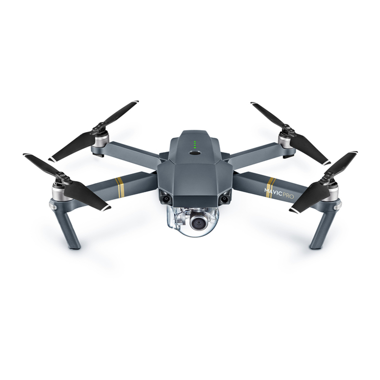
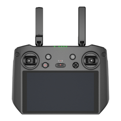
dji mavic User manual

v1.0
Quick Start Guide
快速入门指南
快速入門指南
クイックスタートガイド
퀵 스타트 가이드
Kurzanleitung
Guía de inicio rápido
Guide de démarrage rapide
Guida di avvio rapido
Snelstartgids
Guia de início rápido
Guia de Início Rápido
Краткое руководство пользователя

EN
CHS
CHT
JP
KR
DE
ES
FR
IT
NL
PT
PT-BR
RU
Quick Start Guide 2
快速入门指南 10
快速入門指南 18
クイックスタートガイド26
퀵 스타트 가이드 35
Kurzanleitung 43
Guía de inicio rápido 52
Guide de démarrage rapide 61
Guida di avvio rapido 70
Snelstartgids 79
Guia de Início Rápido 96
Guia de início rápido 87
Краткое руководство пользователя 105
Contents

2
EN
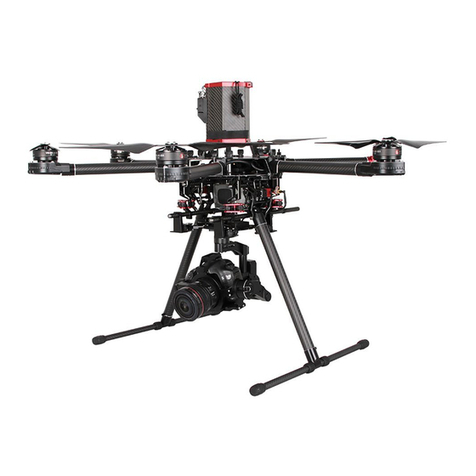
Aircraft
DJITM MAVICTM 3M features both an Infrared Sensing System and Upward,
Downward, and Horizontal Omnidirectional Vision Systems, allowing
for hovering and flying indoors as well as outdoors and for automatic
Return to Home while avoiding obstacles in all directions. * The built-in
DJI AirSense system senses nearby aircraft in the surrounding airspace
to ensure safety. With a precise three-axis gimbal to stabilize the high-
performance multi-camera payload, the DJI PILOTTM 2 app can be used
to view in real-time from the RGB and multispectral cameras. The
RTK module provides data for centimeter-level precision positioning
accuracy. ** At the same time, the spectral sunlight sensor on top of the
aircraft detects solar irradiance in real-time for imaging compensation,
maximizing the accuracy of collected multispectral data and improving
efficiency for agriculture missions and environmental monitoring.
11
8
4
10
7
2
5
2
1
3
9
6
12
17
18
15
14
13
19
16
1. Gimbal and Camera
2. Horizontal Omnidirectional Vision
System
3. RTK Module
4. Auxiliary Bottom Light
5. Downward Vision System
6. Infrared Sensing System
7. Front LEDs
8. Motors
9. Propellers
10. Aircraft Status Indicators
11. Landing Gears (built-in
antennas)
12. Upward Vision System
13. USB-C Port
14. microSD Card Slot
15. Battery Level LEDs
16. Intelligent Flight Battery
17. Power Button
18. Battery Buckles
19. Spectral Sunlight Sensor
* The vision and infrared sensing systems are affected by the surrounding conditions.
Read the User Manual for more information.
** To be used with a Network RTK service, DJI D-RTK 2 High Precision GNSS Mobile
Station (sold seperately), or post-processed kinematic (PPK) data (recommended when
RTK signal is weak during operations).

3
EN
Remote Controller
The DJI RC Pro Enterprise remote controller features O3 Enterprise,
the latest version of DJI’s signature OCUSYNCTM image transmission
technology, and can transmit a live HD view from the camera of the
aircraft at a distance of up to 15 km*. The remote controller has a
wide range of aircraft and gimbal controls as well as customizable
buttons. The built-in microphone allows recording voice and the 5.5-in
high brightness 1000 cd/m2screen boasts a resolution of 1920×1080
pixels. Users can connect to the internet via Wi-Fi and the Android
operating system comes with a variety of functions such as Bluetooth
and GNSS.
ENTERPRISE
1
56
78
9
3
4
10 11 12 13 14
15
16
17
17
18 19
20
21
22
23
242526
27
2
ENTERPRISE
1
56
78
9
3
4
10 11 12 13 14
15
16
17
17
18 19
20
21
22
23
242526
27
2
ENTERPRISE
1
56
78
9
3
4
10 11 12 13 14
15
16
17
17
18 19
20
21
22
23
242526
27
2
1. Control Sticks
2. Back/Function Button
3. RTH Button
4. Flight Pause Button
5. Flight Mode Switch
6. 5D Button
7. Power Button
8. Confirm Button
9. Touchscreen
10. M4 Screw Hole
11. microSD Card Slot
12. USB-C Port
13. Mini HDMI Port
14. Microphone
15. Gimbal Dial
16. Record Button
17. Antennas
18. Status LED
19. Battery Level LEDs
20. Focus/Shutter Button
21. Camera Settings Dial
22. Air Vent
23. Control Sticks Storage Slot
24. Customizable C1 Button
25. Speaker
26. Customizable C2 Button
27. Air Intake
* The remote controller can reach its maximum transmission distance (FCC) in a wide-
open area with no electromagnetic interference at an altitude of about 120 m (400 ft).

4
EN
1. Watching the Tutorials
Scan the QR code or visit DJI official website to watch the tutorial
videos.
2. Charging the Battery
Charge to activate the Intelligent Flight Battery and the internal
battery of the Remote Controller before using it for the first time.
Check battery level: press once.
Power on/off: press, then press and hold.
https://ag.dji.com/mavic-3-m/video

5
EN
B
B
A
A
1
2
3. Preparing the Aircraft
Unfold the front arms Unfold the rear arms
Remove the gimbal protector from the camera
Match the propellers to motors
Press the
propellers down
and rotate until
they click in place
Unfolded
• Unfold the front arms before the rear arms. All arms and propellers must be
unfolded before takeoff.
1
2

6
EN
4. Preparing the Remote Controller
Attach the control sticks and
twist to secure
Unfold the antennasRemove the control
sticks from the
storage slots
• DO NOT operate other wireless devices at the same frequency as the
remote controller, to avoid signal interference.
• A warning prompt appears in DJI Pilot 2 if the transmission signal is weak.
Adjust the antennas to make sure that the aircraft is within the optimal
transmission range.
The optimal transmission range is where the antennas face the
aircraft, with the angle between the antennas and the back of the
remote controller being 180° or 270°.
DJI Pilot 2
App
5.GettingReadyforTakeo
Power on the remote
controller
Power on the aircraft Launch DJI Pilot 2
A DJI account and internet connection are required to activate the aircraft
and the remote controller. Before activating the aircraft in DJI Pilot 2, power
on the remote controller and follow the prompts to activate.
Internet

7
EN
6. Flight
• Manual Takeoff/Landing
Start/Stop Motors:
perform Combination
Stick Command and
hold for two seconds.
Takeoff:
slowly push the
left control stick
(mode 2) up to
take off.
Landing:
slowly push the left
control stick (mode 2)
down until the aircraft
lands. Hold for three
seconds to stop the
motors.
Or
• Control Stick Mode
The default control stick mode is mode 2. The left control stick
controls the altitude and heading of the aircraft, while the right
control stick controls the forward, backward, and sideward
movements.
• Always set an appropriate RTH mode and RTH altitude before takeoff.
• Press the Flight Pause button for emergency braking during flight.
Up Forward
Down
Backward
Turn Left LeftTurn Right Right
Specications
Aircraft (Model: M3M)
Weight (with propellers and
RTK module) 951 g
Max Takeoff Weight 1050 g
Max Ascent Speed 8 m/s (Sport mode)
6 m/s (Normal mode)

8
EN
Max Descent Speed 6 m/s (Sport mode)
6 m/s (Normal mode)
Max Horizontal Speed
(near sea level, no wind)
21 m/s (Sport mode), 19 m/s (Sport mode, EU)
15 m/s (Normal mode)
Max Take-off Altitude
Above Sea Level
(without payload)
6,000 m
Max Flight Time
(without wind) 43 mins
Max Hover Time
(without wind) 37 mins
Max Wind Speed
Resistance 12 m/s
Operating Temperature -10° to 40° C (14° to 104° F)
GNSS GPS + Galileo + BeiDou + GLONASS (GLONASS is
supported only when RTK module is enabled)
Operating Frequency 2.400-2.4835 GHz, 5.725-5.850 GHz*
Transmitter Power (EIRP) 2.4 GHz: <33 dBm (FCC), <20 dBm (CE/SRRC/MIC)
5.8 GHz: <33 dBm (FCC), <14 dBm (CE), <30 dBm (SRRC)
Interface USB-C, microSD card slot, PSDK port
Gimbal
Angular vibration range ±0.007°
Controllable Rotating
Range Tilt: -90° to +35°
RGB Camera
Sensor 4/3 CMOS; Effective pixels: 20 MP
Lens
FOV: 84°
Format Equivalent: 24 mm
Aperture: f/2.8-f/11
Focus: 1 m to ∞(with autofocus)
Multispectral Camera
Sensor 1/2.8" CMOS; Effective Pixels: 5 MP
Lens
FOV: 73.91°
Format Equivalent: 25 mm
Aperture: f/2.0
Focus: N/A
Narrow Band Filter Green (G): 560±16 nm, Red (R): 650±16 nm, Red Edge
(RE): 730±16 nm, Near-Infrared (NIR): 860±26 nm
Intelligent Flight Battery
Capacity 5000 mAh
Standard Voltage 15.4 V
Max Charging Voltage 17.6 V
Battery Type LiPo 4S
Energy 77 Wh
Weight 335.5 g
Charging Temperature 5° to 40° C (41° to 104° F)
Battery Charger
Input 100-240 V AC, 50-60 Hz, 2.5 A

9
EN
Output
Max. 100 W (Total)
When both ports are in use, the maximum output of
one of the ports is 82 W. The charger will dynamically
allocate the output of the two ports accordingly to
the power load.
Remote Controller (Model: RM510B)
Weight Approx. 680 g
Battery Li-ion (5000 mAh @ 7.2 V)
Storage Capacity ROM 64GB + expandable storage via microSD card
Operating Time 3 hrs
Operating Temperature -10° to 40° C (14° to 104° F)
Charging Temperature 5° to 40° C (41° to 104° F)
GNSS GPS + Galileo + GLONASS
O3 Enterprise
Operating Frequency 2.400-2.4835 GHz, 5.725-5.850 GHz*
Max Transmission
Distance
(Unobstructed, free of
interference)
15 km (FCC), 8 km (CE/SRRC/MIC)
Max Transmission
Distance**
(with interference)
Strong Interference (urban landscape, limited line of
sight, many competing signals):
1.5-3 km (FCC/CE/SRRC/MIC)
Medium Interference (suburban landscape, open line
of sight, some competing signals):
3-9 km (FCC), 3-6 km (CE/SRRC/MIC)
Weak Interference (open landscape, abundant line of
sight, few competing signals):
9-15 km (FCC), 6-8 km (CE/SRRC/MIC)
Transmitter Power (EIRP) 2.4 GHz: <33 dBm (FCC), <20 dBm (CE/SRRC/MIC)
5.8 GHz: <33 dBm (FCC), <14 dBm (CE), <23 dBm (SRRC)
Wi-Fi
Protocol 802.11 a/b/g/n/ac/ax
Support 2×2 MIMO Wi-Fi
Operating Frequency 2.400-2.4835 GHz, 5.150-5.250 GHz, 5.725-5.850 GHz*
Transmitter Power (EIRP)
2.4 GHz: <26 dBm (FCC), <20 dBm (CE/SRRC/MIC)
5.1 GHz: <26 dBm (FCC), <23 dBm (CE/SRRC/MIC)
5.8 GHz: <26 dBm (FCC/SRRC), <14 dBm (CE)
Bluetooth
Protocol Bluetooth 5.1
Operating Frequency 2.400-2.4835 GHz
Transmitter Power (EIRP) <10 dBm
* 5.8GHz and 5.1GHz frequencies are prohibited in some countries. In some countries,
the 5.1GHz frequency is only allowed for indoor use.
** The data is tested in an environment with no obstructions for a variety of typical
interference intensity scenarios, without a guarantee of the actual flight distance, for
reference only.

10
CHS
11
8
4
10
7
2
5
2
1
3
9
6
12
17
18
15
14
13
19
16
飞行器
DJITM MAVICTM 3M 飞行器配备水平全向、上视、下视视觉系统及红外传感
系统 *,可在室内外稳定悬停、飞行,具备自动返航、全向障碍物感知功能。
飞行器内置 DJI AirSense 可检测周围航空器情况。高性能多相机负载使用
高精度三轴云台实现增稳,配合 DJI PILOTTM 2 App 可实时查看多光谱和
可见光的观测画面。配备 RTK 模块可提供厘米级定位 **,顶部的多光谱
光强传感器可检测实时入射光强,对成像进行补偿,以获得更精确的多光
谱信息,助力农业监测与环境监察工作高效完成。
1. 一体式云台相机
2. 水平全向视觉系统
3. RTK 模块
4. 补光灯
5. 下视视觉系统
6. 红外传感系统
7. 机头指示灯
8. 电机
9. 螺旋桨
10. 飞行器状态指示灯
11.
脚架(内含天线)
12. 上视视觉系统
13. 充电 /调参接口(USB-C)
14. 相机 microSD 卡槽
15. 电池电量指示灯
16. 智能飞行电池
17. 电池开关
18. 电池卡扣
19. 多光谱光强传感器
* 视觉系统及红外传感系统有使用环境与条件要求,请阅读《用户手册》了解安全注意事项。
** 获取厘米级定位需使用网络 RTK 服务、DJI D-RTK 2 高精度 GNSS 移动站(额外购买)或使
用后处理差分数据(实时 RTK 信号弱时推荐该方法)。

11
CHS
遥控器
DJI RC Pro Enterprise 遥控器采用 O3 行业版高清图传技术,配合完备的
功能按键可在最大 15千米 *通信距离内完成飞行器和相机的操作与设置。
遥控器内置麦克风以及 5.5 英寸 1920×1080p 高亮触摸屏,具备蓝牙及卫
星定位等功能,并支持通过 Wi-Fi 连接至互联网。
1. 摇杆
2. 返回按键 /系统功能按键
3. 智能返航按键
4. 急停按键
5. 飞行挡位切换开关
6. 五维按键
7. 电源按键
8. 确认按键
9. 触摸显示屏
10. M4 螺纹孔
11. microSD 卡槽
12. USB-C 接口
13. Mini HDMI 接口
14. 麦克风
* 在开阔无遮挡、无电磁干扰的环境飞行,并且飞行高度为 120 米左右,在 FCC 标准下遥控器
可以达到最大通信距离。
15. 云台俯仰控制拨轮
16. 录像按键
17. 天线
18. 状态指示灯
19. 电量指示灯
20. 对焦 /拍照按键
21. 相机设置拨轮
22. 出风口
23. 摇杆收纳槽
24. 自定义功能按键 C1
25. 扬声器
26. 自定义功能按键 C2
27.
入风口(打开后盖可安装 DJI
Cellular 模块)
ENTERPRISE
1
56
78
9
3
4
10 11 12 13 14
15
16
17
17
18 19
20
21
22
23
242526
27
2
ENTERPRISE
1
56
78
9
3
4
10 11 12 13 14
15
16
17
17
18 19
20
21
22
23
242526
27
2
ENTERPRISE
1
56
78
9
3
4
10 11 12 13 14
15
16
17
17
18 19
20
21
22
23
242526
27
2

12
CHS
1. 观看教学视频
扫描二维码或访问 DJI 官方网站观看教学视频。
2. 充电
首次使用需充电以唤醒智能飞行电池和遥控器内置电池。
检查电量:短按一次电源按键。
开机 /关机:短按一次、再长按 2秒电源按键。
https://ag.dji.com/mavic-3-m/video

13
CHS
B
B
A
A
1
2
3. 准备飞行器
展开前机臂 展开后机臂
移除云台保护罩
匹配标记安装螺旋桨
嵌入桨座按
压到底,沿
锁紧方向旋
转直至弹起
锁定
展开状态
•请确保按顺序展开机臂,在机臂与桨叶全部展开之后再开启飞行器。
1
2

14
CHS
4. 准备遥控器
当天线与遥控器背面呈 180° 或270° 夹角时,且天线平面正对飞行器,
可让遥控器与飞行器的信号质量达到最佳状态。
5. 准备飞行
开启遥控器
安装摇杆 展开天线取出摇杆
运行 DJI Pilot 2 App
开启飞行器
•请勿同时使用其它同频段的通信设备,以免对遥控器信号造成干扰。
•实际操作中,DJI Pilot 2 App 在图传信号不佳时将会进行提示,请根据提示调整天
线位置,确保飞行器处于最佳通信范围。
DJI Pilot 2
App
全新的设备需激活才能使用。请确保遥控器可以接入互联网,运行其自带的 DJI
Pilot 2 App 并根据界面提示进行激活。
Internet

15
CHS
6. 飞行
电机启动 /停止:
执行掰杆动作并
保持 2秒。
起飞:
缓慢向上推动
油门杆(美国
手为左摇杆),
飞行器起飞。
• 手动起飞 /降落
•请预先在 DJI Pilot 2 App 中设置合适的自动返航行为和返航高度。
• 飞行过程中遇到需要紧急刹车的情况,请按急停按键使飞行器悬停。
• 摇杆模式
遥控器出厂默认操控方式为“美国手”。飞行过程中,可使用左摇杆
控制飞行高度与方向,右摇杆控制飞行器的前进、后退以及左右飞行。
或
降落:
向下拉动油门杆(美国
手为左摇杆)至飞行器
落地,在最低位置保持
3秒,电机停止。
规格参数
裸机重量
(带桨叶和 RTK 模块) 951 g
最大起飞重量 1050 g
最大上升速度 8 m/s(运动挡)
6 m/s(普通挡)
最大下降速度 6 m/s(运动挡)
6 m/s(普通挡)
飞行器(型号:M3M)
上升 前进
下降
后退
左转 左移右转 右移

16
CHS
最大水平飞行速度
(海平面附近无风情况下)
21 m/s(运动挡),19 m/s(运动挡,欧盟地区)
15 m/s(普通挡)
最大起飞海拔高度
(无负载) 6000 m
最长飞行时间(无风环境) 43 分钟
最长悬停时间(无风环境) 37 分钟
最大可抗风速 12 m/s
工作环境温度 -10℃至 40℃
GNSS GPS + Galileo + BeiDou + GLONASS
(仅在 RTK 模块开启时支持 GLONASS)
工作频率 2.400-2.4835 GHz, 5.725-5.850 GHz*
发射功率(EIRP)2.4 GHz: <33 dBm (FCC), <20 dBm (CE/SRRC/MIC)
5.8 GHz: <33 dBm (FCC), <14 dBm (CE), <30 dBm (SRRC)
机身接口 USB-C,microSD 卡槽,PSDK 接口
云台
角度抖动量 ±0.007°
可控转动范围 俯仰:-90° 至+35°
可见光相机
影像传感器 4/3 CMOS,有效像素 2000 万
镜头
视角:84°
等效焦距:24 mm
光圈:f/2.8 至f/11
对焦点:1 m 至无穷远(带自动对焦)
多光谱相机
影像传感器 1/2.8" CMOS,有效像素 500 万
镜头
视角:73.91°
等效焦距:25 mm
光圈:f/2.0
对焦:无
窄带滤波器 绿(G):560±16 nm,红(R):650±16 nm,红边
(RE):730±16 nm,近红外(NIR):860±26 nm
智能飞行电池
容量 5000 mAh
标称电压 15.4 V
充电限制电压 17.6 V
电池类型 LiPo 4S
能量 77 Wh
重量 335.5 g
充电环境温度 5℃至 40℃
充电器
输入 100-240 V AC, 50-60 Hz, 2.5 A
输出
Max. 100 W (总共)
同时使用时其中一个接口最大输出功率为 82 W,充电
器会根据负载功率动态分配两个接口的输出功率
遥控器(型号:RM510B)
重量 约 680 g
电池 锂离子电池(5000 mAh @ 7.2 V)

17
CHS
存储空间 ROM 64GB + 可扩展(通过 microSD 卡)
续航时间 3小时
工作环境温度 -10℃至 40℃
充电环境温度 5℃至 40℃
GNSS GPS + Galileo + GLONASS
O3 图传行业版
工作频率 2.400-2.4835 GHz, 5.725-5.850 GHz*
最大信号有效距离
(无干扰、无遮挡) 15 km (FCC), 8 km (CE/SRRC/MIC)
最大信号有效距离 **
(有干扰)
强干扰(密集楼宇、居民区等):
1.5-3 km (FCC/CE/SRRC/MIC)
中干扰(城郊县城、城市公园等):
3-9 km (FCC), 3-6 km (CE/SRRC/MIC)
弱干扰(远郊野外、开阔农田等):
9-15 km (FCC), 6-8 km (CE/SRRC/MIC)
发射功率(EIRP)2.4 GHz: <33 dBm (FCC), <20 dBm (CE/SRRC/MIC)
5.8 GHz: <33 dBm (FCC), <14 dBm (CE), <23 dBm (SRRC)
Wi-Fi
协议 802.11b/a/g/n/ac/ax
支持 2×2 MIMO Wi-Fi
工作频率 2.400-2.4835 GHz, 5.150-5.250 GHz, 5.725-5.850 GHz*
发射功率(EIRP)
2.4 GHz: <26 dBm (FCC), <20 dBm (CE/SRRC/MIC)
5.1 GHz: <26 dBm (FCC), <23 dBm (CE/SRRC/MIC)
5.8 GHz: <26 dBm (FCC/SRRC), <14 dBm (CE)
蓝牙
协议 蓝牙 5.1
工作频率 2.400-2.4835 GHz
发射功率(EIRP)<10 dBm
* 部分地区不支持 5.1 GHz 和5.8 GHz 频段,以及部分地区 5.1 GHz 频段仅限室内使用,详情
请参考当地法律法规。
**
数据为各种典型干扰强度的场景在无遮挡的环境里测得,不承诺实际飞行距离,仅供参考。

18
CHT
11
8
4
10
7
2
5
2
1
3
9
6
12
17
18
15
14
13
19
16
航拍機
DJITM MAVICTM 3M航拍機配備水平全向、上視、下視視覺系統及紅外線感
測系統*,可在室內外穩定懸停、飛行,具備自動返航、全向障礙物感知功
能。航拍機內建DJI AirSense,可檢測周圍航空器的情況。高性能多相機負
載使用高精準度三軸雲台實現增穩,搭配DJI PILOTTM 2應用程式可即時查
看多光譜和可見光的觀測畫面。配備RTK模組可提供公分級定位**,頂端
的多光譜光強感測器可檢測即時入射光強度,對成像進行補償,以取得更
精確的多光譜資訊,協助完成高效的農業監測與環境監察作業。
1. 整合式雲台相機
2. 水平全向視覺系統
3. RTK 模組
4. 補光燈
5. 下視視覺系統
6. 紅外線感測系統
7. 機頭指示燈
8. 馬達
9. 螺旋槳
10. 航拍機狀態指示燈
11. 腳架(內含天線)
12. 上視視覺系統
13. 充電/調參連接埠 (USB-C)
14. 相機 MicroSD 卡槽
15. 電池電量指示燈
16. 智能飛行電池
17. 電池開關
18. 電池卡扣
19. 多光譜光強感測器
* 視覺系統及紅外線感測系統需符合環境與條件要求,請閱讀《使用者手冊》以瞭解安全注意
事項。
** 如欲獲取公分級定位,需使用網路RTK服務、DJI D-RTK 2高精準度GNSS移動站(另行購買)
或使用後處理差分數據(即時RTK訊號微弱時建議使用此方法)。

19
CHT
遙控器
DJI RC Pro Enterprise 遙控器採用 O3 行業版高解析影像傳輸技術,配合
完備的功能按鍵,可在最大 15 千公尺*通訊距離內完成航拍機和相機的
操作與設定。遙控器內建麥克風以及 5.5 英吋 1920×1080p 高亮度觸控螢
幕,具備藍牙及衛星定位等功能,並支援 Wi-Fi 連線至網際網路。
1. 搖桿
2. 返回按鍵/系統功能按鍵
3. 智慧返航按鍵
4. 急停按鍵
5. 飛行檔位切換開關
6. 五維按鍵
7. 電源按鍵
8. 確認按鍵
9. 觸控螢幕
10. M4 螺紋孔
11. microSD 卡插槽
12. USB-C 連接埠
13. Mini HDMI 連接埠
14. 麥克風
* 在開闊無遮蔽、無電磁波干擾的環境飛行,且飛行高度為 120 公尺左右,在 FCC 標準下遙控
器可以達到最大通訊距離。
15. 雲台俯仰控制轉盤
16. 錄影按鈕
17. 天線
18. 狀態指示燈
19. 電量指示燈
20. 對焦/拍照按鍵
21. 相機設定轉盤
22. 出風口
23. 搖桿收納槽
24. 自訂功能按鍵 C1
25. 喇叭
26. 自訂功能按鈕 C2
27. 入風口
ENTERPRISE
1
56
78
9
3
4
10 11 12 13 14
15
16
17
17
18 19
20
21
22
23
242526
27
2
ENTERPRISE
1
56
78
9
3
4
10 11 12 13 14
15
16
17
17
18 19
20
21
22
23
242526
27
2
ENTERPRISE
1
56
78
9
3
4
10 11 12 13 14
15
16
17
17
18 19
20
21
22
23
242526
27
2
Other manuals for mavic
12
Table of contents
Other dji Quadcopter manuals

dji
dji mavic User manual

dji
dji Inspire 1 V2.0 User manual

dji
dji MATRICE 200 series Instruction Manual

dji
dji Matrice 600 Pro User manual

dji
dji MATRICE 200 series Operating manual

dji
dji SPARK User manual

dji
dji PHANTOM Instruction manual

dji
dji Inspire 1 User manual

dji
dji Phantom 1 User manual

dji
dji MATRICE 30 Series User manual

dji
dji PHANTOM 4 User manual

dji
dji Spreading Wings S1000+ User manual

dji
dji Air 2S User manual

dji
dji Inspire 1 User manual

dji
dji FPV AIR UNIT User manual

dji
dji MAVIC MINI User manual

dji
dji RC Pro User manual

dji
dji S?1000 User manual

dji
dji Flamewheel F450 User instructions

dji
dji Phantom 2 Vsion+ User manual