Lorenz MAGNUM PRO User manual

MARINE ELECTRONICS
One Touch To Choose Your World
MAGNUM PRO
CODE: S3egLZctcmp_0ww 1128d970+A01/160407
MAGNUM PLUS
CODE: S3egLZctcms_0ww 1128d970+A01/160407
USER MANUAL
Copyright 2007 LORENZ ELECTRONICS Italia.
All rights reserved. Printed in Italy. No part of this publication may be reproduced or distributed in any form or by any
means, or stored in a database or retrieval system, without prior written permission of the publisher.

4User Manual
Warning!
Electronic charts displayed by the chart plotter are believed to be accurate and reliable, but they are
not intended to replace official charts which should remain your main reference for all the matters
related to the execution of a safe navigation.
For this reason we would like to remind you that you are required to carry on board and use the
officially published and approved nautical charts.
Caution
Please read through this manual before the first operation. If you have any questions, please contact
the Company's customer service or your local dealer.
The chart plotter is not built water proof. Please give attention to avoid water intrusion into the
chartplotter. Water damage is not covered by the warranty. Extensive exposure to heat may result in
damage to the chartplotter.
Connection to the power source with reversed polarity will damage the chart plotter severely. This
damage is not covered by the warranty.
The chart plotter contains dangerous high voltage circuits which only experienced technicians MUST
handle.
The C-MAP C-CARD are available from your local dealer.
We will not be liable for errors contained herein, or for incidental or consequential damages in
connection with the performance or use of this material.

5
User Manual
Table of Contents
1 Introduction .......................................................................................... 11
1.1 FEATURES .......................................................................................... 11
1.2 BASICS .......................................................................................... 12
1.3 IF YOU NEED ASSISTANCE................................................................... 12
1.3.1 World Background Charts .............................................................. 13
Worldwide Background Update...................................................... 13
2 Before You Begin .......................................................................................... 15
2.1 THE KEYBOARD...................................................................................... 15
2.2 TURNING THE CHART PLOTTER ON AND OFF .................................. 18
2.2.1 Turning On ...................................................................................... 18
2.2.2 Turning Off...................................................................................... 18
2.3 SELECTING THE LANGUAGE ................................................................ 18
2.4 EXTERNAL CONNECTIONS ................................................................... 19
2.4.1 GPS Connections ........................................................................... 19
2.4.2 Autopilot Connections .................................................................... 19
2.4.3 External NMEA Connections.......................................................... 20
2.4.4 C-COM Connections ...................................................................... 21
2.4.5 External Alarm Connection............................................................. 21
2.5 ADDITIONAL C-CARDS ........................................................................... 22
2.5.1 Inserting C-CARD ........................................................................... 22
2.5.2 Removing C-CARD......................................................................... 23
3 For the New User .......................................................................................... 25
3.1 SCREEN DISPLAY CONFIGURATION ................................................... 25
3.1.1 Charts and Text Area ..................................................................... 26
3.1.2 Depth Graph ................................................................................... 27
3.1.3 GPS Data Page .............................................................................. 28
3.1.4 Navigation Data Page..................................................................... 28
3.1.5 Graphic Data (Rolling Road) Page................................................. 29
3.1.6 The Wind Data Page ...................................................................... 29
3.2 A-B-C-D FUNCTION................................................................................ 29
3.2.1 Inserting the A-B-C-D points .......................................................... 30
3.2.2 Deleting the A-B-C-D points ........................................................... 30
3.2.3 Navigating on the A-B-C-D points .................................................. 30
3.3 NAVIGATING TO A SINGLE DESTINATION .......................................... 30
3.3.1 Distance and Bearing to Target ..................................................... 30
3.3.2 Time To Go..................................................................................... 31
3.3.3 Deleting Target ............................................................................... 31
3.4 C-MAP NT MAX INFORMATION ............................................................. 32
3.4.1 Map Menu ....................................................................................... 32
3.4.1.1 Perspective View .............................................................. 32
3.4.1.2 Palette .............................................................................. 33
3.4.1.3 Map Orientation ................................................................ 33

6User Manual
3.4.1.4 Zoom Type ...................................................................... 34
3.4.1.5 Fonts & Symbols .............................................................. 34
3.4.1.6 Dynamic Nav-Aids ............................................................ 34
3.4.1.7 Mixing Levels .................................................................... 34
3.4.1.8 Safety Status Bar (DSI - Data Safety Indicator) .............. 35
3.4.1.9 Currents Prediction........................................................... 36
3.4.1.10 Other Map Configurations ................................................ 36
3.4.2 Getting Automatic Info.................................................................... 40
3.4.2.1 Info on objects with Pictures ............................................ 40
Change Picture Size......................................................... 41
3.4.2.2 Quick Info on Lakes ......................................................... 41
3.4.2.3 Full Info on Lakes ............................................................. 42
3.4.3 Info Tree and Expanded Info page................................................. 43
3.4.4 Info Function ................................................................................... 43
3.4.5 Getting Port Info ............................................................................. 43
3.4.6 Getting Tide Info ............................................................................. 44
3.4.7 Find Function .................................................................................. 45
3.4.7.1 Finding Port Services ....................................................... 45
3.4.7.2 Finding Ports By Name .................................................... 45
3.4.7.3 Finding Ports By Distance................................................ 46
3.4.7.4 Finding Tide Stations ....................................................... 46
3.4.7.5 Finding Wrecks................................................................. 46
3.4.7.6 Finding Obstructions ........................................................ 46
3.4.7.7 Finding POIs..................................................................... 46
3.4.7.8 Finding Lakes By Names ................................................. 46
3.4.7.9 Finding Lakes Information................................................ 46
4 For the Experienced User .............................................................................. 49
4.1 MORE ABOUT CREATING AND USING ROUTES ................................ 49
4.1.1 Waypoints ....................................................................................... 49
4.1.1.1 Adding Waypoint .............................................................. 49
4.1.1.2 Creating a route................................................................ 50
4.1.1.3 Deleting Waypoint ............................................................ 50
4.1.1.4 Deleting route ................................................................... 51
4.1.1.5 Distance and Bearing to Target ....................................... 51
Time To Go....................................................................... 52
Deleting Target ................................................................. 52
4.1.1.6 Moving Waypoint .............................................................. 52
4.1.1.7 Inserting Waypoint ........................................................... 53
4.1.1.8 Editing Waypoint .............................................................. 54
4.1.1.9 Finding info about Waypoints: User Points List page...... 55
Finding User Points .......................................................... 55
Deleting selected User Point........................................... 55
Deleting all User Points with the same symbol ............... 56
Deleting all User Points with the same type .................... 56
Deleting all stored User Points......................................... 56
Send/Receive User Points ............................................... 56
4.1.2 Routes .......................................................................................... 56
4.1.2.1 Selecting route ................................................................. 56
4.1.2.2 Deleting route ................................................................... 57
4.1.2.3 Reversing route ................................................................ 57
4.1.2.4 Selecting route Color........................................................ 57
4.1.2.5 Finding information about a route: Route Report ............ 57

7
User Manual
Selecting route ................................................................. 57
Changing Speed & Fuel values........................................ 58
Reversing route ................................................................ 58
Deleting route ................................................................... 58
4.1.2.6 Route Name ..................................................................... 58
4.1.2.7 Send/Receive Route ........................................................ 58
4.2 USING MARKS & EVENTS...................................................................... 59
4.2.1 Marks .......................................................................................... 59
4.2.1.1 Adding Mark ..................................................................... 59
4.2.1.2 Deleting Mark ................................................................... 59
4.2.1.3 Goto .................................................................................. 59
4.2.1.4 Moving Mark ..................................................................... 59
4.2.1.5 Editing Mark...................................................................... 60
4.2.1.6 Finding info about Marks: User Points List page ............. 61
4.2.1.7 Add to Route..................................................................... 61
4.2.2 Events .......................................................................................... 61
4.2.2.1 Adding Event .................................................................... 61
4.2.2.2 Deleting Event .................................................................. 62
4.2.2.3 Goto .................................................................................. 62
4.2.2.4 Editing Event .................................................................... 62
4.2.2.5 Finding info about Events: List User Points page............ 62
4.2.2.6 Add to Route..................................................................... 63
4.3 EBL & VRM FUNCTION ........................................................................... 63
4.3.1 Placing EBL & VRM ....................................................................... 63
4.3.2 Deleting EBL & VRM ...................................................................... 64
4.3.3 Editing EBL & VRM ........................................................................ 64
4.4 MORE ABOUT A-B-C-D FUNCTION ....................................................... 64
4.4.1 Inserting the A-B-C-D points .......................................................... 64
4.4.2 Deleting the A-B-C-D Points........................................................... 64
4.4.3 Deleting the A-B-C-D Segment ...................................................... 65
4.4.4 Moving the A-B-C-D points............................................................. 65
4.4.5 Inserting the A-B-C-D points .......................................................... 65
4.4.6 Navigating on the A-B-C-D points .................................................. 65
4.5 USING THE TRACK FUNCTIONS........................................................... 65
4.5.1 Selecting active Track .................................................................... 65
4.5.2 Enabling Track storing.................................................................... 66
4.5.3 Displaying Track ............................................................................. 66
4.5.4 Selecting track Color ...................................................................... 66
4.5.5 Deleting Track ................................................................................ 66
4.5.6 Deleting Selected Track ................................................................. 66
4.5.7 Selecting Track memorizing type ................................................... 66
4.5.8 Selecting distance .......................................................................... 67
4.5.9 Selecting time ................................................................................. 67
4.6 USER C-CARD MENU ............................................................................. 67
4.6.1 Saving File ...................................................................................... 67
4.6.2 Loading File .................................................................................... 68
4.6.3 Deleting File .................................................................................... 69
4.6.4 Formatting User C-CARD............................................................... 69
4.6.5 Changing User C-CARD................................................................. 69
4.7 C-LINK .......................................................................................... 69
4.7.1 How C-Link system works .............................................................. 69
4.8 C-LINK NAVIGATION DATA TRANSFER ............................................... 70
4.8.1 Operations ...................................................................................... 70

8User Manual
4.8.1.1 Introductive elements ....................................................... 70
4.8.1.2 C-Link serial connection ................................................... 71
4.8.1.3 Master Chart Plotter ......................................................... 71
Operating mode............................................................... 71
4.8.1.4 Slave Chart Plotter ........................................................... 72
Operating mode................................................................ 72
Stop current navigation .................................................... 72
Inhibit Navigation operation.............................................. 72
Inhibit Route following ...................................................... 72
MOB handling................................................................... 72
Notes ................................................................................ 73
4.8.1.5 C-Link navigation data: Acquisition and Display.............. 73
4.8.1.6 Graphical representation on Map Display........................ 73
4.8.1.7 Route Data Report ........................................................... 73
4.8.1.8 Quick Info ......................................................................... 75
Route Navigation: Quick Info on the Destination............. 75
Quick info on Single Destination ...................................... 75
4.9 AIS MENU .......................................................................................... 75
4.9.1 AIS SYSTEM DEFINITIONS .......................................................... 76
4.9.2 AIS MENU ...................................................................................... 77
4.9.2.1 Display .............................................................................. 77
4.9.2.2 Activation range................................................................ 77
4.9.2.3 CPA Alarm........................................................................ 78
4.9.2.4 CPA Limit.......................................................................... 78
4.9.2.5 TCPA Alarm...................................................................... 78
4.9.2.6 TCPA Limit ....................................................................... 78
4.9.3 TO SET THE CHART PLOTTER FOR RECEIVING AIS .............. 78
4.9.4 QUICK INFO ON AIS TARGET ..................................................... 78
4.10C-STAFF .......................................................................................... 79
4.11C-WEATHER SERVICE ........................................................................... 79
4.11.1C-WEATHER SERVICE MENU ..................................................... 80
4.11.1.1 Download .......................................................................... 80
Select Country to Call ...................................................... 80
SIM PIN ............................................................................ 80
Download Area ................................................................. 80
4.11.1.2 Copy from USER C-CARD............................................... 81
4.11.1.3 Weather Forecast............................................................. 81
4.11.1.4 Real Time View ................................................................ 81
4.11.1.5 Type of Data ..................................................................... 81
4.12DSC .......................................................................................... 82
4.12.1Distress Call and Position Request................................................ 82
4.12.2DSC Menu ...................................................................................... 83
4.12.2.1 DSC LOG ......................................................................... 83
Locate ............................................................................... 83
Delete ............................................................................... 84
Delete All .......................................................................... 84
Hide/Show ........................................................................ 84
Position Request/Distress Call......................................... 84
4.12.2.2 DSC DIRECTORY............................................................ 84
Edit.................................................................................... 84
Add ................................................................................... 85
Delete ............................................................................... 85
Delete All .......................................................................... 85

9
User Manual
4.12.3Quick Info on DSC Icons ................................................................ 85
4.13FISH FINDER MENU............................................................................... 85
4.14RADAR SETUP MENU............................................................................ 86
5 Terms & Functions ......................................................................................... 87
6 For the Technician........................................................................................ 113
6.1 TECHNICAL SPECIFICATIONS............................................................. 113
6.2 INSTALLATION ...................................................................................... 114
6.3 EXTERNAL WIRING .............................................................................. 114
6.4 TYPICAL CONNECTIONS - "POWER & I/O" Connector ...................... 115
6.4.1 GPS Connections ......................................................................... 115
6.4.2 Autopilot Connections .................................................................. 115
6.4.3 External NMEA Connections........................................................ 116
6.4.4 C-COM Connection ...................................................................... 116
6.4.5 External Alarm Connection........................................................... 117
6.5 SYSTEM TEST ....................................................................................... 117
6.5.1 RAM Menu .................................................................................... 117
6.5.2 DIM Menu ..................................................................................... 118
6.5.3 CARTRIDGES .............................................................................. 118
6.5.4 SERIAL PORTS ........................................................................... 119
6.5.5 External Alarm .............................................................................. 119
6.5.6 Display Settings............................................................................ 119
A Trouble shooting ........................................................................................ 121
Analytical Index ........................................................................................ 122

10 User Manual

11
User Manual
1
Introduction
If you have not used a position-finding instrument before and intend to use
your chart plotter for navigating, we suggest that you read this user manual and
make sure you are familiar with its contents. Chapter 2 "Before You Begin" intro-
duces you to the basic information to get you start using the chart plotter. Chapter 3
"For the New User" should be read first to become familiar with your new instru-
ment. Chapter 4 "For the Experienced User" introduces the advanced features of the
chart plotter. For all other information you wish please refer to the Chapter 5 "Terms
and Functions".
Throughout this user manual, the keys are shown in capitals letters enclosed
between single inverted commas, for example 'MENU'. Menu operations are in bold
characters listed by keys sequence with the menu names enclosed between inverted
commas, for example 'MENU' + "BASIC SETTINGS" + 'ENTER' + "INPUT/
OUTPUT" + 'ENTER' means: press the 'MENU' key, using the cursor key to
select the Basic Settings menu, press the 'ENTER' key, using the cursor key to select
the Input/Output menu and then press the 'ENTER' key.
Terms and functions underlined, for example Target, are explained in the
Chapter 5.
1.1 FEATURES
The chart plotter is a computer specifically designed for nautical use but,
more precisely, to ease and speed up all calculations, which so far have been done
manually. If connected to a positioning instrument, the chart plotter displays the
current position, the speed, and the heading of the boat and its track. The user infor-
mation like Waypoints, Marks and tracks can then be stored on a User C-CARD,
and can be recalled at any time. On the screen are shown navigation data and carto-
graphic information obtained from electronic charts of C-MAP C-CARD.

12 User Manual
1.2 BASICS
The chart plotter is controlled by using 14 keys. There is also a cursor key to
move a cursor across the screen. As you press a key, a single audio beep confirms the
key action; every time the key pressed is not valid, three rapid beeps sound indicates
that no response is available.
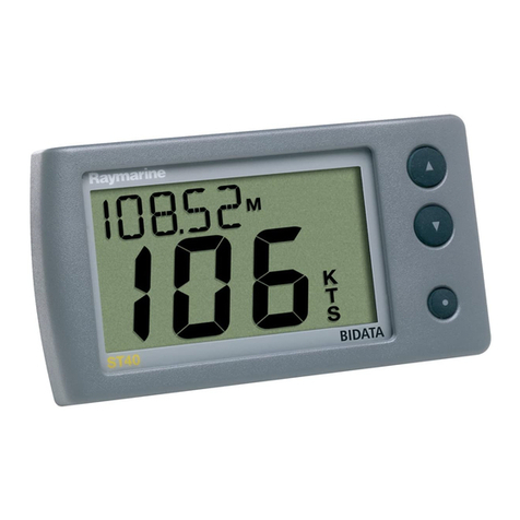
Fig. 1.2 - MAGNUM Pro
Fig. 1.2a - MAGNUM Plus
1.3 IF YOU NEED ASSISTANCE
If your chart plotter does not operate properly, go to the System Test on
Par. 6.5. Most common operating difficulties can be diagnosed using these tests. If
you still need assistance, call your local dealer, reporting the Software Release and
Cartography information available in the About Page.

13
User Manual
Select About Page: 'MENU' + "About..." + 'ENTER'
1.3.1 WORLD BACKGROUND CHARTS
The internal background charts can be updated to include the MAX A and
B level charts which provide improved marine data, rivers, lakes, terrestrial data
(major streets , highways , railways, etc...), Nav-Aids, depth areas, territorial water
areas, etc... by reading them from a special data C-CARDs (contact your local dealer).
All units must have the WorldWide Background upload function that is activated
from the system.
Worldwide Background Update
The System Update menu is entered from the About page. To select this menu fol-
low the procedure:
Plug the special data C-CARD + 'MENU' + "About..." + 'ENTER' + 'MENU' +
"Update Worldwide Charts" + 'ENTER'

14 User Manual

15
User Manual
2
Before You Begin
This chapter provides basic information to get you start using the chart plot-
ter; it will help you to become familiar with the chart display and the functions of
the controls before you start using the chart plotter.
2.1 THE KEYBOARD
The 'POWER' key
Press 'POWER' down for 1 second to turn the chart plotter On. Press and
hold 'POWER' down (once the chart plotter has been turned On) for 3 seconds
turns the chart plotter Off.
Press and immediately release 'POWER' to adjust the keyboard brightness.
The key
Excluding specific situations, returns to the previous menu or leaves a menu
without making changes. If you are not into a menu, if the GPS computing a valid
fix position and the chart plotter is not in Home mode, pressing 'CLEAR' sets Home
mode. When Home (called also Navigate) mode is set, the cursor is not shown any-
more and all cartographic functions (zoom, scroll, etc.) are leaded by the fix position.
The fix is centered in the map display and the map scrolls underneath as the fix
position changes. To deactivate Home mode move the cursor. In Basic Mode deletes
the A, B, C, D points, the User Point (Mark, Event, Waypoint), the MOB, the
Target identified by the cursor.
The key
Selects the desired option, confirms selection.
ONLY
ON
MAGNUM P
RO
in Basic Mode places A, B, C, D points on the cursor

16 User Manual
coordinates, in Advanced Mode creates Objects (Waypoint, EBL/VRM, A-B-C-D).
ONLY
ON
MAGNUM P
LUS
in Advanced Mode creates Objects (Mark, Event,
Waypoint, EBL/VRM).
The cursor key
Moves the cursor about on the display screen, quickly and accurately. The
cursor starts moving slowly the cursor key is initially pressed then accelerates after a
while if the cursor key is pressed and hold. It also scrolls the desired option in the
menu page(s): up/down move the current menu selection; right executes the func-
tion assigned to the active selection in the menu (same as 'ENTER'); left quit menu
(same as 'CLEAR').
If in Home (Navigate) mode, it allows to exit from Home mode.
The and keys
Press 'ZOOM IN' shows more details of a smaller area, by changing the
chart scale and zooming in on your display. Press 'ZOOM OUT' to operate simi-
larly to the 'ZOOM IN', except in reverse, changing the scale and showing a wider,
otherwise less detailed view.
The key
ONLY
ON
MAGNUM P
LUS
Press 'MOB' to place MOB (Man OverBoard ). Pressing 'MOB' when the
MOB is placed to delete MOB.
The key
ONLY
ON
MAGNUM P
RO
In Basic Mode pressing 'EVENT' places Event at ship's coordinates; in Ad-
vanced Mode places, deletes, edits and moves Event.
Pressing 'EVENT' for 2 seconds sets MOB (Man Overboard). Pressing
'EVENT' for 2 seconds when the MOB is placed to delete MOB.
The key
Selects the Functions Menu.
The key
Place the cursor and press 'DEST' to set Target.

17
User Manual
The key
ONLY
ON
MAGNUM P
LUS
Press 'A-B-C-D' to place the A, B, C, D points at cursor coordinates.
The key
ONLY
ON
MAGNUM P
RO
In Basic Mode pressing 'MARK' places Mark at cursor coordinates; in Ad-
vanced Mode places, deletes, edits and moves Mark.
The 'F
UNCTION
' key
ONLY
ON
MAGNUM P
LUS
This key can be customized to have a quick access to the main functions.
Press 'F
UNCTION
' for 1 second allows setting the shortcut to one of the following
functions:
'W
IND
' select Wind pages
'M
ARK
' place Mark
'E
VENT
' place Event
'W
AYPOINT
' place Waypoint
'EBL-VRM' place EBL and VRM
'C-W
EATHER
' shows C-Weather Forecast mode
Press and release 'F
UNCTION
' executes the function that was assigned.
Note
The selections Mark, Event, Waypoint and EBL.VRM are available even if Advanced Functions
is Off.
The key
ONLY
ON
MAGNUM P
RO
Pressing 'TRACK' enables or disables the track storing.
The key
If Radar is connected, pressing 'RADAR' selects the Radar page and pressing
'RADAR' for 1 second selects the Radar menu.
The key
Pressing 'MAP' selects the desired map page and pressing 'MAP' for 1 sec-
ond selects the Map Settings menu.
The key
If Fish Finder is connected, pressing 'ECHO' selects the Fish Finder page.
and pressing 'ECHO' for 1 second selects the Fish Finder menu.

18 User Manual
The key
Pressing '<PAGE' or 'PAGE>' selects previous or next page
2.2 TURNING THE CHART PLOTTER ON AND OFF
Before powering On the chart plotter, check for the correct voltage (10-35
volt dc) and the correct connections with the positioning instrument:
POWER & I/O CONNECTOR
1 BLACK GND/COMMON
2 RED +
10-35 Vdc
o
PIN # CABLE WIRE COLOR FUNCTION
Fig. 2.2 - Power On
2.2.1 TURNING ON
Press and hold the right side of 'POWER' for 1 second. The chart plotter
emits one rapid beep sound and a title page is opened.
After a few seconds, the first of the two Caution Notice pages is displayed,
reminding you that the chart plotter is only an aid to navigation, and should be used
with appropriate prudence. The electronic charts are not intended to substitute for
the official charts. Then the cartographic screen is displayed.
2.2.2 TURNING OFF
Press the right side of 'POWER' and hold for 3 seconds: a countdown timer
appears on the screen, if you release the key before the countdown timer reaches
zero, the chart plotter will remain On.
2.3 SELECTING THE LANGUAGE
It is possible to select the language in which you wish information to be
displayed (for screen labels, menus and options, but it is not affect the map informa-
tion). The default setting is Italian.
'MENU' + "BASIC SETTINGS" + 'ENTER' + "LANGUAGE" + 'ENTER' +
Choose the language you want and press 'ENTER' to confirm.

19
User Manual
2.4 EXTERNAL CONNECTIONS
2.4.1 GPS CONNECTIONS
Connects the GPS to the GPS Port (serial Port 3). To choose your preferred
setting follow the procedure:
Fig. 2.4.1 - GPS Connection on Port 3
To choose your preferred setting follow the procedure:
'MENU' + "BASIC SETTINGS" + 'ENTER' + "INPUT/OUTPUT" + 'ENTER' +
"PORT 3 INPUT" + 'ENTER'
Then choose your preferred setting among the NMEA available settings
NMEA 1200-N81-N, NMEA 4800-N81-N, NMEA 4800-N82-N, NMEA 9600-O81-
N, NMEA 9600-N81-N (the default setting is 4800-N81-N) and press 'ENTER' to
confirm.
If you are connecting the model Smart DGPS WAAS Receiver GPH00, select:
'MENU' + "BASIC SETTINGS" + 'ENTER' + "INPUT/OUTPUT" + 'ENTER' +
"PORT 3 INPUT" + 'ENTER' + "NMEA-4800-N81-N" + 'ENTER'
2.4.2 AUTOPILOT CONNECTIONS
To connect the Autopilot to the serial Port 1 see the following picture:
Fig. 2.4.2 - Autopilot Connections on Port 1
To choose your preferred setting follow the procedure:
'MENU' + "BASIC SETTINGS" + 'ENTER' + "INPUT/OUTPUT" + 'ENTER' +
"PORT 1 OUTPUT" + 'ENTER'
Then choose your preferred setting among the NMEA available settings
NMEA 0183 4800-N81-N, NMEA 0180, NMEA 0180/CDX (the default setting is
NMEA 0183 4800-N81-N) and press 'ENTER' to confirm.

20 User Manual
To connect the Autopilot to the serial Port 2 see the following picture:
Fig. 2.4.2a - Autopilot Connections on Port 2
To choose your preferred setting follow the procedure:
'MENU' + "BASIC SETTINGS" + 'ENTER' + "INPUT/OUTPUT" + 'ENTER' +
"PORT 2 OUTPUT" + 'ENTER'
Then choose your preferred setting among the NMEA available settings
NMEA 0183 4800-N81-N, NMEA 0180, NMEA 0180/CDX (the default setting is
NMEA 0183 4800-N81-N) and press 'ENTER' to confirm.
2.4.3 EXTERNAL NMEA CONNECTIONS
To connect the External NMEA to the serial Port 1 see the following picture:
Fig. 2.4.3 - External NMEA Connections on Port 1
To choose your preferred setting follow the procedure:
'MENU' + "BASIC SETTINGS" + 'ENTER' + "INPUT/OUTPUT" + 'ENTER' +
"PORT 1 INPUT" + 'ENTER'
Then choose your preferred setting among the NMEA available settings
NMEA 1200-N81-N, NMEA 4800-N81-N, NMEA 4800-N82-N, NMEA 9600-O81-N, NMEA
9600-N81-N (the default setting is 4800-N81-N) and press 'ENTER' to confirm.
To connect the External NMEA to the serial Port 2 see the following picture:

21
User Manual
Fig. 2.4.3b - External NMEA Connections on Port 2
To choose your preferred setting follow the procedure:
'MENU' + "BASIC SETTINGS" + 'ENTER' + "INPUT/OUTPUT" + 'ENTER' +
"PORT 2 INPUT" + 'ENTER'
Then choose your preferred setting among the NMEA available settings NMEA
1200-N81-N, NMEA 4800-N81-N, NMEA 4800-N82-N, NMEA 9600-O81-N, NMEA
9600-N81-N (the default setting is 4800-N81-N) and press 'ENTER' to confirm.
2.4.4 C-COM CONNECTIONS
To connect the modem C-COM to the chart plotter follow the procedure:
1. Connect Power & I/O as follows:
Fig. 2.4.4 - C-COM Connection
Note
The connection is valid for the C-COM IR and C-COM RS232 too.
2. Into the Input/Output menu, set the C-COM for Port 1 as follows:
'MENU' + "BASIC SETTINGS" + 'ENTER' + "INPUT/OUTPUT" + 'ENTER' +
"PORT 1 INPUT" + 'ENTER' + "C-COM" + 'ENTER'
Also the modem C-COM can be connected to the other Ports, in this case set
the format for the selected Port.
2.4.5 EXTERNAL ALARM CONNECTION
To connect the External Alarm device see the following picture:

22 User Manual
Fig. 2.4.5 - External Alarm Connection
Once the connection is active, to enable the External Alarm follow the procedure:
'MENU' + "ADVANCED SETTINGS" + 'ENTER' + "ALARMS" + 'ENTER' + "EX-
TERNAL ALARM" + 'ENTER' + "ON" + 'ENTER'
2.5 ADDITIONAL C-CARDS
The chart plotter uses two types of C-MAP cartridges: either a chart car-
tridge or a data storage cartridge. A chart cartridge, called C-CARD, contains de-
tailed charts of the area covered. A data storage cartridge, called User C-CARD can
be used to permanently store your routes, Waypoints, Marks, Events and tracks (see
Par. 4.6).
Note
During normal operations the C-CARD should not be removed since the chart plotter may lock up.
2.5.1 INSERTING C-CARD
Hold the C-CARD by the short inclined side so that you can see the C-MAP
label.
INSERTION
DIRECTION
INCLINED SIDES
class
date
code
ser.n.
NT
+
code date
ser.n
class
A
Fig. 2.5.1 - Inserting C-CARD (I)
Gently push the C-CARD into one of the two slots (1); push the C-CARD
in as far as it will go, then move it to the bottom (2) to hold fixed into the slot (3).
This manual suits for next models
1
Table of contents