manuals.online logo
Brands
  1. Home
  2. •
  3. Brands
  4. •
  5. Xylem
  6. •
  7. Measuring Instrument
  8. •
  9. Xylem SonTek RiverSurveyor User manual

Xylem SonTek RiverSurveyor User manual

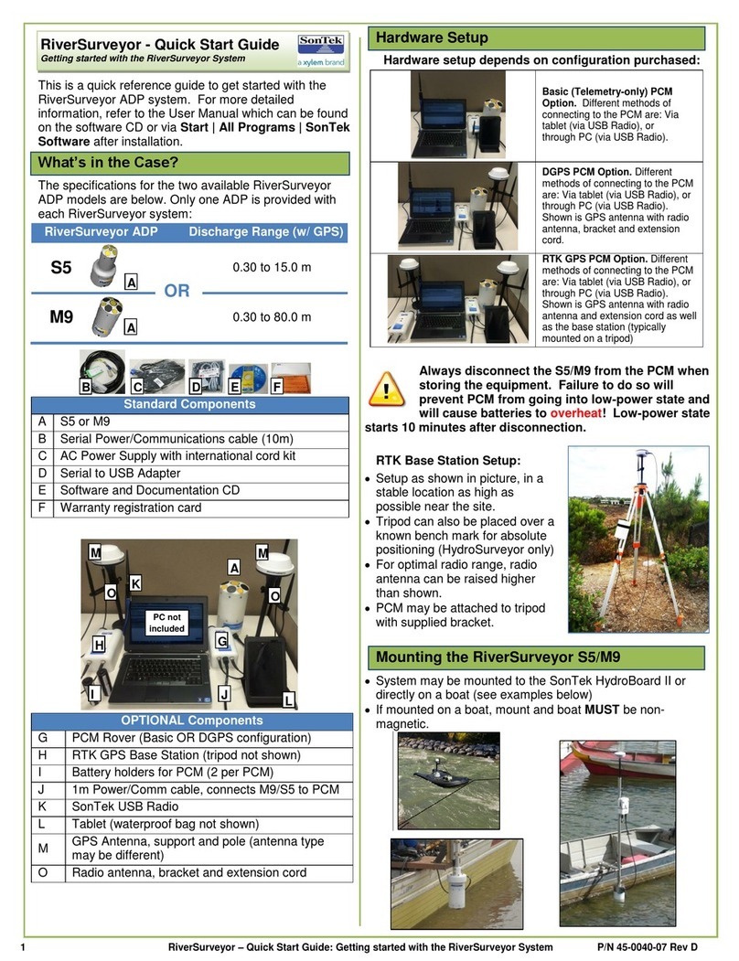
1 RiverSurveyor –Quick Start Guide: Working with RTK and SonTek DPGS P/N 45-0040-08 Rev D
This is a quick reference guide to get started with the
RiverSurveyor ADP system. For more detailed
information, refer to the User Manual which can be found
on the software CD or via Start | All Programs | SonTek
Software after installation.
Measuring Discharge - Theory
The total discharge through a measurement section is
computed based on the mean water velocity in the water
column and the cross-sectional area. For the purposes of a
measurement, the section is broken into three key
components: the Start Edge, the Transect and the End
Edge. These components are summed together to calculate
the total discharge as shown below:
Discharge Measurement Facts and Tips
Site selection is a critical part of a discharge measurement
and is fundamental to its success.
Avoid possible obstructions and sites immediately
downstream of bridges, gates and weirs
Flow should be uniform with minimal turbulence
Consider the ADP’s profiling and depth specification
(shown on the other side) and mounting depth.
Key factors when making a discharge measurement:
During the edge measurements, keep the vessel as
stationary as possible.
During the transect, maintain a constant vessel speed
and direction.
Ideally, any vessel movement should be slow
relative to the water velocity, and changes in
heading should be gradual and only when
necessary.
Windows Software Data Collection
To collect discharge data using the Windows software:
1.Press the Start button (or F5) to start
data collection. This does not record any
data, but instead it allows the data from
the system to be viewed in order to make
sure the system is operating correctly.
Make sure that all indicators (shown in
the top left) are valid (blue or green, not
red). Position the vessel at the start edge
and make sure the system can collect 2
good cells of data.
2.Press the Start Edge button (or F5) and collect at least
10 edge samples. The Edge windows
will be displayed showing both edges.
Keep the vessel as stationary as
possible during this time. Input the
start edge information into the Edge
dialog that pops up and press OK.
3.Press the Start Moving button (or F5) and the Transect
window will be displayed. Keep the vessel speed and
direction constant as you cross the river.
4.When the vessel reaches the end edge press the End
Edge button (or F5). Follow the same instructions as for
the Start Edge (Step 2).
5.Press the End Transect
button on completion of the
end edge. This automatically
opens a new data collection
window so you can start a
new measurement. The
system is still running, so if
you need to keep making measurements repeat steps 2 to
5 again or press the Abort button (or F8) to stop.
6.On completion of all your measurements, it is
recommended to go to the System tab and download all
your collected data files and format the recorder
afterward.
GPS –An Overview
GPS uses a series of satellites that orbit the earth to
determine the position of the GPS antenna on the earth’s
surface , with a high degree of accuracy. The antenna
transmits the positional data to the RiverSurveyor system
which is then automatically integrated into the data stream.
The uncertainty of the position is determined by:
1.Atmospheric conditions (e.g. rain, clouds, fog) can
reduce quality
2.Multi-path Error: The signals from the satellites can be
reflected by surfaces near the GPS receiver (such as
canyon walls, trees and large structures or bridges). When
this occurs the signals can experience interference and
multiple reflections.
3.GPS type: Regular GPS has the lowest accuracy, followed
by Differential GPS (or DGPS), and Real-Time Kinematic
GPS (or RTK GPS) has the highest accuracy.
Key GPS terms used with the RiverSurveyor include:
Latitude and Longitude are two numbers or coordinates
that are used to describe locations on the Earth. Lines of
constant latitude circle the Earth East-West. Lines of
constant longitude circle the Earth North-South. Latitude
and longitude are measured in degrees, minutes, and
seconds.
Altitude is the height of the GPS receiver above sea level.
Number of Satellites is the number of visible satellites
used in the computation of the receiver. Four satellites are
required for the computation to produce valid results.
HDOP (Horizontal Dilution of Precision) is the degree of
uncertainty in the horizontal position of the GPS receiver.
Magnetic Declination is the angular difference between
true North and magnetic North and varies depending on the
location of the survey site.
General GPS Facts and Tips
Some important tips on the GPS options and their use:
Compass calibration is critical for a good measurement
Magnetic declination must be entered
RiverSurveyor - Quick Start Guide
Working with RTK and DGPS
Start Edge
End Edge
Transect
2 RiverSurveyor –Quick Start Guide: Working with RTK and SonTek DPGS P/N 45-0040-08 Rev D
The system uses both the GGA (position-based fix) and
VTG (Doppler-based velocity fix) NMEA strings
The internal GPS data sampling rate is 10 Hz
SonTek DGPS Facts and Tips
The SonTek DGPS is the basic GPS option offered.
Provides a sub-meter differential GPS solution
Provides both GGA and VTG data
Generally the VTG data is preferable for this option
The GGA data may be differentially corrected
Requires 6 or more satellites in view
Requires channel width of 20 m or more
RTK GPS Facts and Tips

The SonTek RTK GPS is the advanced GPS option
offered.
High precision (+/- 3 cm) RTK solution
Receives RTK correction from the RTK Base Station
The Base Station must be on to receive RTK quality
data. The RiverSurveyor will continue to receive RTK
quality data for approximately 45 minutes after the Base
Station is turned off or is out of range.
Provides both GGA and VTG data
Generally the GGA data is preferable for this option
Requires 8 or more satellites in view
Requires channel width of 1 m or more
SonTek (USB) Radio Range
SonTek supplies a 2 dBi gain antenna to be used with all
PCMs. The default transmit power for all radios is 10
dBm. When used with this configuration, the ranges are:
Base to Rover: 1000 m
PC to Rover (via USB radio): 450 m
Mobile to Rover (via Bridge): 200 m
Field conditions are variable and radio ranges can be
affected by a number of environmental factors, transmit
power and antenna gain.
Water is a strong absorber of radio frequencies in the 2.4
GHz range. As such, significantly improved radio
performance can be achieved by raising antennas above
the water surface as much as possible. SonTek provides
external antennas as well as extension cables (for the
DGPS and RTK configurations) for this purpose.
Where permitted by local regulations,
customers may increase the transmit power
of the radio to improve the range. It is YOUR
responsibility to verify regional
communication regulations and ensure you
are abiding by them when you change either radio
transmit power and/or antenna gain.
Troubleshooting Guide
Some general guidelines for troubleshooting the system:
Check that all cables and antennas are properly
connected
Disable your computer’s Bluetooth and Wi-Fi options as
these may interfere with the SonTek USB Radio.
Batteries should be fully charged (if rechargeable) or new
(if alkaline)
GPS antennas on the ADP and Base Station should have
clear view of the sky
Move away from bridges or structures to avoid multi-path
errors with GPS signal.
In some cases, it may take longer than 10 minutes for the
RTK Base Station to achieve a GPS differential lock.
Software and Firmware upgrade
When upgrading software and firmware, it is strongly
recommended that BOTH are upgraded to the most
recent version at the same time. Differences in
software/firmware may cause unforeseen
issues.
PCM LEDs
The following table describes the light pattern for the different
devices.
USB
Radio
PCM
Radio
PCM
GPS
Base
Radio
Base
GPS
Bridge
Initial system power up
N/A
N/A
Radio on Stand-by
Slow
Slow
N/A
Slow
N/A
Slow
Attempting Comm.
N/A
N/A
Available for Connection
N/A
N/A
N/A
Connected
N/A
N/A
Waiting for Pairing
Connection
N/A
N/A
N/A
N/A
GPS searching for sats.
N/A
N/A
N/A
N/A
GPS Qual. 1 (RTK w/
base connection)
N/A
N/A
N/A
N/A
N/A
GPS Qual. 1 (RTK
w/o base connect.)
N/A
N/A
N/A
N/A
N/A
GPS Qual. 5 or 2 (RTK)
GPS Qual. 1 (DGPS)
N/A
N/A
N/A
N/A
GPS Qual. 4 (RTK)
GPS Qual. 2 (DGPS)
N/A
N/A
N/A
N/A
Error
Technical Support
SonTek Technical Support is available 24 hours a day, 7
days a week.
Tel: +1-858-546-8327 Email: support@sontek.com
Fax: +1-858-546-8150 Web: www.sontek.com

Other Xylem Measuring Instrument manuals

Xylem SENSUS Act-Pak 1100D User manual

Xylem

Xylem SENSUS Act-Pak 1100D User manual

Xylem Sensus 412 Series User manual

Xylem

Xylem Sensus 412 Series User manual

Xylem Sensus iPERL User manual

Xylem

Xylem Sensus iPERL User manual

Xylem Sensus Residia-M User manual

Xylem

Xylem Sensus Residia-M User manual

Xylem YSI pH/ISE 1320P User manual

Xylem

Xylem YSI pH/ISE 1320P User manual

Xylem wtw inoLab Multi 9620 IDS User manual

Xylem

Xylem wtw inoLab Multi 9620 IDS User manual

Xylem WTW inoLab Multi 9310 IDS User manual

Xylem

Xylem WTW inoLab Multi 9310 IDS User manual

Xylem SENSUS PolluTherm Integrator User manual

Xylem

Xylem SENSUS PolluTherm Integrator User manual

Xylem Sensus Modbus RTU User manual

Xylem

Xylem Sensus Modbus RTU User manual

Xylem sensus DomoJet User manual

Xylem

Xylem sensus DomoJet User manual

Xylem WTW LabStation LS Flex/430 User manual

Xylem

Xylem WTW LabStation LS Flex/430 User manual

Xylem WTW Turb PLUS 2000 User manual

Xylem

Xylem WTW Turb PLUS 2000 User manual

Xylem Sensus PulseRF HRI-A3 User manual

Xylem

Xylem Sensus PulseRF HRI-A3 User manual

Xylem YSI Pro1030 User manual

Xylem

Xylem YSI Pro1030 User manual

Xylem optimyze User manual

Xylem

Xylem optimyze User manual

Xylem WTW Multi 3320 User manual

Xylem

Xylem WTW Multi 3320 User manual

Xylem YSI Pro1020 User manual

Xylem

Xylem YSI Pro1020 User manual

Xylem WTW Multi 3320 User manual

Xylem

Xylem WTW Multi 3320 User manual

Xylem OxiTop Control OC 100 User manual

Xylem

Xylem OxiTop Control OC 100 User manual

Xylem WTW SenTix ORP-T 900-P User manual

Xylem

Xylem WTW SenTix ORP-T 900-P User manual

Xylem YSI Pro2030 User manual

Xylem

Xylem YSI Pro2030 User manual

Xylem Sensus MeiTwin User manual

Xylem

Xylem Sensus MeiTwin User manual

Xylem SI Analytics Lab 865 User manual

Xylem

Xylem SI Analytics Lab 865 User manual

Xylem WTW OxiTop-IDS Multi 3630 IDS User manual

Xylem

Xylem WTW OxiTop-IDS Multi 3630 IDS User manual

Popular Measuring Instrument manuals by other brands

Fieldpiece SC57 Operator's manual

Fieldpiece

Fieldpiece SC57 Operator's manual

JB DV-22N user manual

JB

JB DV-22N user manual

NARDA EHP-50-G user manual

NARDA

NARDA EHP-50-G user manual

Keysight N5222-60119 Installation note

Keysight

Keysight N5222-60119 Installation note

FIAMA EP3 user manual

FIAMA

FIAMA EP3 user manual

ION DIGITAL ALTIMETER user manual

ION

ION DIGITAL ALTIMETER user manual

Hanna Instruments HI 98401 instruction manual

Hanna Instruments

Hanna Instruments HI 98401 instruction manual

Steinberg Systems SBS-AM-30C user manual

Steinberg Systems

Steinberg Systems SBS-AM-30C user manual

Nikon 8431 - Monarch - Dot instruction manual

Nikon

Nikon 8431 - Monarch - Dot instruction manual

OpenEye E Slim Series user manual

OpenEye

OpenEye E Slim Series user manual

Topcon ES series Quick manual

Topcon

Topcon ES series Quick manual

Pelstar Health O Meter Professional 209HR User instructions

Pelstar

Pelstar Health O Meter Professional 209HR User instructions

JB DV-22N operating manual

JB

JB DV-22N operating manual

Projecta BLT500 user manual

Projecta

Projecta BLT500 user manual

ECP VARILUX X Series user guide

ECP

ECP VARILUX X Series user guide

Kingfisher KI 2600 Series Quick reference guide

Kingfisher

Kingfisher KI 2600 Series Quick reference guide

Oceanic Systems NMEA2000 3410 user manual

Oceanic Systems

Oceanic Systems NMEA2000 3410 user manual

Novasina AW SPRINT Series operating instructions

Novasina

Novasina AW SPRINT Series operating instructions

manuals.online logo
manuals.online logoBrands
  • About & Mission
  • Contact us
  • Privacy Policy
  • Terms and Conditions

Copyright 2025 Manuals.Online. All Rights Reserved.