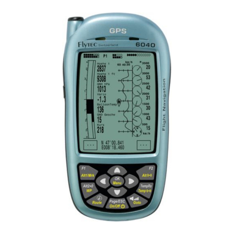
Flytec 6040 User manual

Flytec 6040 GPS / TT34
Operation Manual
Firmware Vers.2.05f 11.05.2009
Revision: 11.07.2011


Operation Manual FLYTEC 6040 GPS
Table of contents
1Operation ................................................................................................................................. 3
1.1 ......Instrument overview .......................................................................................................................3
1.2 ......6040-GPS –Switch-on and switch-off............................................................................................4
1.2.1 Switch On .................................................................................................................................4
1.2.2 Instrument Switch- off...............................................................................................................4
1.3 ......Operation philosophy .....................................................................................................................5
1.4 ......Keypad .............................................................................................................................................5
1.4.1 Function related key F1 and F2..............................................................................................5
1.5 ......Display screen.................................................................................................................................6
1.5.1 Main display screen..................................................................................................................6
1.5.1.1 Shift page of data fields........................................................................................................7
1.5.2 Map display screen...................................................................................................................8
1.6 ......„Windlayer“ Display Screen..........................................................................................................9
1.6.1.1 Shift page of data fields........................................................................................................9
1.6.1.2 Windlayer page ..................................................................................................................10
1.7 ......User defined data fields................................................................................................................11
1.8 ......The Setting menus ........................................................................................................................12
1.8.1 Menu navigation overview......................................................................................................12
1.8.1.1 User Settings......................................................................................................................13
1.8.1.2 Manage Memory ................................................................................................................13
1.8.1.3 Instrument Settings ............................................................................................................14
1.8.1.4 Factory settings..................................................................................................................14
1.8.1.5 Flight Memory and Data analysis.......................................................................................15
1.8.2 Entering Text ..........................................................................................................................15
1.9 ......First steps ......................................................................................................................................16
1.9.1 Before first balloon flight Seite..............................................................................................16
1.9.2 At start site..............................................................................................................................16
1.9.3 Handling during the balloon flight ...........................................................................................16
1.9.4 Data analysis after the balloon flight ......................................................................................16
2Functions ............................................................................................................................... 17
2.1 ......Altimeter and air pressure............................................................................................................17
2.1.1 How does an altimeter work? .................................................................................................17
2.1.2 Altimeter Alt1 (absolute Altitude) ............................................................................................18
2.1.2.1 Setting altimeter A1............................................................................................................18
2.1.2.2 User fields related to Alt1 ...................................................................................................18
2.1.3 Altimeter Alt2, Relative Altitude (User field) ...........................................................................19
2.1.3.1 Setting Altimeter Alt2..........................................................................................................19
2.1.4 Cumulated Altimeter display (User field Alt Sum) ..................................................................19
2.1.5 FL Flightlevel Altimeter display (User field FL ft)....................................................................19
2.1.6 GPS Altitude display (User field Altitude GPS) .....................................................................19
2.1.7 Altitude Alert / Alarm...............................................................................................................20
2.1.7.1 Setting of the altitude alert .................................................................................................20
2.2 ......Variometer functions ....................................................................................................................21
2.2.1 Analogue Vario .......................................................................................................................21
2.2.1.1 Basic filter...........................................................................................................................21
2.2.2 Digital-Vario (Average Vario)................................................................................................21
2.2.3 Variometer Acoustics and Volume level (Sound)...................................................................21
2.2.3.1 Audio Level ........................................................................................................................22
2.2.3.2 Variometer Acoustic Settings .............................................................................................22
2.3 ......Speed..............................................................................................................................................23
2.3.1 Wind vane sensor...................................................................................................................23
2.3.2 GPS Speed.............................................................................................................................23
2.4 ......Time of day and date ....................................................................................................................23
2.5 ......Temperature ..................................................................................................................................24
2.6 ......Envelope Temperature .................................................................................................................24
2.6.1.1 Personal temperature alarm...............................................................................................24
2.6.1.2 Maximum Temperature Alarm............................................................................................25
2.6.1.3 Temperature sensor failure ................................................................................................25
2.6.1.4 TempRx Empfang On/Off...................................................................................................25
2.7 ......Temperature transmitter FLYTEC TT34 ......................................................................................25

Operation Manual FLYTEC 6040 GPS 2
3Navigation .............................................................................................................................. 26
3.1 ......Assesment of GPS Reception quality.........................................................................................26
3.2 ......Compass and flight direction.......................................................................................................27
3.2.1 Track and Bearing ..................................................................................................................27
3.3 ......Waypoints and Coordinates.........................................................................................................28
3.3.1 Alter, delete or insert waypoints .............................................................................................28
3.3.2 Display of actual coordinates .................................................................................................29
3.3.3 Memorising the actual position...............................................................................................29
3.3.4 Go-To – Function....................................................................................................................30
3.3.5 Distance to Waypoint (User Datafield) ...................................................................................30
3.4 ......Routes ............................................................................................................................................30
3.4.1 Creating a Route ....................................................................................................................31
3.4.2 Altering a Route......................................................................................................................31
3.4.3 Deleting a Route.....................................................................................................................31
3.4.4 Flying Routes..........................................................................................................................32
3.4.4.1 Distance to Start Site .........................................................................................................32
3.4.4.2 XT Error, Crosstrack Error ..............................................................................................33
3.4.5 Flight duration.........................................................................................................................33
4Map of Flight Obstacles (Restricted areas)......................................................................... 34
4.1 ......Flight obstacles – Edit manually .................................................................................................34
4.2 ......Map of flight obstacles - Edit with Flychart...............................................................................36
4.2.1 Air Space in OpenAir Format *.txt or *.fas..............................................................................36
4.2.2 Calling the function Air Space in Flychart ..............................................................................36
4.2.2.1 Downloading Air Spaces ....................................................................................................37
4.2.2.2 User Air Spaces ending with *.fa5 .....................................................................................37
4.2.2.3 Selection of Air Spaces ......................................................................................................37
4.2.2.4 Editing Air Spaces..............................................................................................................38
5Flight-Memory and Flight-Analysis...................................................................................... 40
5.1.1 Flight logbook and Flight-Analysis page ................................................................................40
5.1.2 Graphic display of Flights in Map format................................................................................41
6Data transfer .......................................................................................................................... 42
6.1 ......Data exchange via PC...................................................................................................................42
6.1.1 Waypoints and Routes ...........................................................................................................43
6.1.2 Air Spaces ..............................................................................................................................43
7Simulation .............................................................................................................................. 43
8Battery- Management............................................................................................................ 44
9Transferring new software-(-firmware)to the Flytec 6040-GPS......................................... 45
10 Miscellaneous........................................................................................................................ 46
10.1 ....Optional Software (additional Software)...................................................................................46
11 Additional Information ..........................................................................................................47
11.1 ....Altimeter.........................................................................................................................................47
11.2 ....Navigation......................................................................................................................................47
11.2.1 Reception quality of GPS .......................................................................................................47
11.2.2 Accuracy of GPS Altitude .......................................................................................................48
11.3 ....Flight Memory and IGC File..........................................................................................................50
11.3.1 Content of IGC File.................................................................................................................50
11.3.2 Evidence of flights – Security against manipulation...............................................................52
11.3.3 Digital Signature -...................................................................................................................52
12 Maintenance........................................................................................................................... 53
12.1.1 Exposure to Water..................................................................................................................53
13 Warranty................................................................................................................................. 53
14 Technical Data ....................................................................................................................... 54
15 Approval / Conformity...........................................................................................................54
16 Attachment............................................................................................................................. 55
16.1.1 Mounting instruction for the Radio Temperatur Transmission Unit Funksensor TT34 ..........55

Operation Manual FLYTEC 6040 GPS 3
1 Operation
1.1 Instrument overview
USB Mini B
Charger Jack
SD Card Slot
Safety Cord
Cover right side
USB Plug
PC side
Loudspeaker
Key Pad
Connection jack for wind
vane sensor (option)
On / Off
switch key
Veh. Charge
cable 12V DC
chargin LED’s
Charging set
110-230 V/AC
Antenna TT34 Receiver

Operation Manual FLYTEC 6040 GPS 4
1.2 6040-GPS –Switch-on and switch-off
1.2.1 Switch On
The instrument is switched-on by pressing the On/Off key.
By use of the ▲or ▼keys the required language may be selected.
The language as selected shall automatically be enabled again upon
next switch-on
After confirmation, the idsplay switches for 15 sec to the switch-on
Display with the following information:
- Type of instrument and serial number
- Software (Firmware) Version
- Time, Date
- Battery Status
1.2.2 Instrument Switch- off
For switch-off press the On/Off key as long until the question:
Switch-off?
Press OK
Is prompted on the screen.
Again, to prevent unintentional switch-off, also this action needs to
be acknowledged by pressing the OK key !
1. Following OK acknowledgement the instrument is immediately
switched-off, in case no flight recording has been made.
2. Following an active flight recording, the readout screen Flight -
Analysis is displayed before switch-off. If you want to quit the
flight analysis display, press shortly the OK or ON/OFF key,
the instrument will then be switched-off immediately.
Init EEPROM
English ↑
Deutsch
Francais
Espagñol
Italiano
Magyar ↓
---------------------------------
Bat Bank 1: xx %
Bat Bank 2: xx %
switch off ?
Ausschalten?
Arrêter ?
Press Ok
Drücke OK
Appuyer sur OK
FlyTEC AG
6040
Sn 8642
Version 3. 02 16.05.08
Date Time(UTC)
12.06.09 13:29
batterycheck
f
or 3 s..
BatteryBank1:88%
BatteryBank2:90%
TT34 Adress: 6475
Owner: not set
Balloon Typ: not set
OK

Operation Manual FLYTEC 6040 GPS 5
1.3 Operation philosophy
- white key lettering: all acoustic signal settings, the F1 / F2 key commands, the display screen shifts
and an information request (i) , can be made rapidly during the flight by short pressure
on the key.
- yellow key lettering: by long pressure of 3 sec. important functions may be called up directly during
the flight and may also be edited. The selected function remains active, until another function will be
called up!
- Main menu: all instrument settings, but also Waypoints- Routes- and Flight obstacle- editing,
can be set before the flight via the Main menu (MENU key).
Tip: all instrument settings of the Main menu can be set comfortably by use of the freebie PC-
Software Flychart on the PC and be transferred via USB-interface onto the instrument.
1.4 Keypad
Selection for revision of user
Defined fields
1.4.1 Function related key F1 and F2
Both keys F1 and F2 alter their setting possibilities acording to their functios or display. The
Signification of the keys is always shown on the right and left side of the bottom of the display.
.
Example: On the map screen the F1 key is related to the function „“Zoom Out“ and the function
“Zoom in” is related to the F2 key, whil in the set-mode waypoints the function related to the F1
key is_”Add waypoints” and “Delete waypoints” for the F2 key.
Setting alttude A1
Insert Marker during flight
into flight recording
Info Key Display of
current coordinates and
information
Route selection
Setting altitude alert
Audio Sound level
WP-Selection
Acknowledgement key OK
Instrument Main menu
Wireless Temperatur Transmission
TT34 key
Function Menu
Display shift / in menu 1 setp backward
On/off ke
y
Altitude A2 set to 0
Selection of waypoints
within a route
Shifting the user defined
pages
Funcitons of F2 key
Functions of F1 key
16
56
Alt1
GPS
Mod Alt 1
u
v
Alt 1
1013

Operation Manual FLYTEC 6040 GPS 6
1.5 Display screen
The 6040 instrument offers three different display screens. After the switch-on display screen, the
main display screen is automatically displayed
.
Main display sreen Map display screen Windlayer display screen
After short pressure on the page-key the display screen can be shifted.
1.5.1 Main display screen
Temperatursender Empfang
Temperatursender Batteriestatus
Speed Unit
Digital Vario Display
Altitude
Function of F2 key
Infoline 1
Infoline 2
Function of F1 key
User selectable
Data fields
Compass
Analogue Vario
Vario Unitt
Battery charge bank 1
bank 2
GND Speed
GPS
Number of satelites
Digital Speed Anzeige
Direction to next but
One WP
Direction to WP
Data fiels page number
Sink Audio ?
Alarm-level ?
Km/h
3
3
4
4
2
QNH
Int
1.4
2816
1013
m
28
60
50
30
P1
EnvTemp
81.6
Time
10:35
10
N E
S
W 40
20
0
Kurs
45
Flugzeit
1:25
Alti
Gps
Mod Alt 1 uv
m/s
Alt
1013
2
+
Stanserhorn
10
Start
Zug
V
ario
1.9
A
ltitude Speed EnvelTemp
1248 16
Zoom
Out
Zoom
In
CTR Buochs
Mod Alt1
81.6
km/h
420
3
40
2
4
Alt1
GPS
Mod Alt 1
u
v
---
Alt 1
1
0
1
3
QNH hPa
1013
81.6
Huellen Temp
Kurs
23
Hoehe1
2018
Gnd Geschw
31
P1
18
3500
60
1
1
2
3
50
3000
45
2500
13
2000
30
1500
42
1000
15
500
i
m/s
km/h
3
3
4
4
2
2
m/s
1.8
2816
m
28
60
50
30
1
0
NE
SW40
2
0
0
Alt 1
GPS
Mod Alt 1 uv
- - -
m/s
Alt 1
1013
QNH hPa
101
3
86.2
EnvelTemp
45
Kurs
Uhrzeit Flugzeit
18:45 1:26
P1 i
Aktive Information

Operation Manual FLYTEC 6040 GPS 7
User defined data fields
There are 7 data fields in the lower part of the display which may be allocated individually.
In total more than 20 selectable data fields are at disposal. For list of data fields please refer
to 1.7 - User defined data fields page 10. (depending on firmware version!)
Alter data fields manually
Mark by repeated pressing of the ◄arrow key the data field to be altered. The selected data field
shall be designated by a black bar. By use of the ▲or ▼arrow keys it is possible to assign
a new readout value to the selected data field. The field designation is displayed at the same time in big
lettering in Infoline 1.
If nothing is changed after having selected a field, the instrument returns to normal function after 10
sec. and the previous display is shown again
Alter data fields on the PC
All user defined readouts can be set comfortably by use of the freebie PC-Software Flychart on the PC
and be transferred via USB-interface onto the instrument
Caution: for safety reasons it is not possible to alter the user selectable fields during the flight!
1.5.1.1 Shift page of data fields
The seven data fields exist 3 times on each page of data field! Therefore you have the possibility to
configure in total 21 data fields individually!
The very same function is also available on
the windlayer display page
!
Short pressing of the right side arrow key
gives access to the next page. The page
number is shown in the upper part of the
display next to the battery-charge state
readout as P1, P2 or P3.
In -> Main Setup Menu -> Instr. settings ->
User fields it is possible to configure these
readout pages with 4 big or 6 small fields !
We would like to present to the user some
proven recommendations in regard to the
default values of the 3 adjustable pages.
Some of the readouts are of such interest
that we recommend to keep them on each
of the 3 possible pages always at the same
position. For example: the “Speed over
ground - Gnd-Speed” or the wind
component “Speed diff.”
Example:
page 1) General Flight information is called up before the start or when the pilot is currently
in a normal balloon flight.
page 2) Navigation page is used if a Waypoint (WP) has been selected as goal to fly to.
Instead of the values recommended above, this field should mainly contain navigation readouts, such
as “Dist. to WP”, “Alt. a. BG”,; “Alt. a. WP”.
page 3) General information with altitude Alerter Here the pilot can configure the6 field-display. The
two new Data-fields can be used to display the upper and lower Altitude alert Level. The most important
data fields such as ONH and Envelop Temp, should also be present on this page.
Km/h
3
3
4
4
2
Diffgeschw
Int
-2.5
2816
14
m
57
90
80
60
P3
Dist Ziel
9.4
GLZ Gnd
11.2
40
N E
S
W 70
50
30
Abw BGZiel
6
5
GLZ Ziel
10.5
A
lti
Gps
Mod Alt 1 uv
m/s
Alt
1013
2
Km/h
3
3
4
4
2
Alt 2
Int
-2.5
2816
1165
m
57
90
80
60
P2
Kurs
42
Peilung WP
2:4
5
Dist WP
12 . 4
40
NE
S
W70
50
30
Abw SpurW
0.
6
GLZ Soll
12
GLZ Grund
10.5
Alti
Gps
Mod Alt 1 uv
m/s
A
lt
1013
2
Km/h
3
3
4
4
2
A
lt 2
Int
-2.5
2816
1165
m
57
90
80
60
Time
16:0
8
FltTime
2:4
5
Temp
1
6
40
NE
S
W70
50
30
GLZGrund
8.
6
Wind
12
GndGesch
56
A
lti
Gps
Mod Alt 1 uv
m/s
A
lt
1013
2
P1

Operation Manual FLYTEC 6040 GPS 8
1.5.2 Map display screen
By short pressing on the „page“ key the map format page is selected. (North is always at the top!)
The map mode display screen illustrates the current track. In addition, Air space data such as
TMA, CTR, Wildlife protected areas and stored Waypoints with cross and its name are displayed.
In case of active COMPETITION Route, the start and Waypoint cylinder as well as Waypoint
interconnections of the Route are also displayed.
This screen also displays the flight relevant data such as analogue Vario, altimeter, speed and
Digital-Vario.
By using the two function keys F1 and F2 you can magnify or also scale down the map segment.
The map scale is shown in the lower part on right side.
F1: Zoom out: the map scale is gradually decreased until the total map overview is achieved.
F2: Zoom in: the map scale is gradually magnified, therewith individual details of the
recording are clearly recognisable !
OK: from each graph back to the screen optimised graph.
Info i: Information related to the next three flight obstacles shall be shown.
Page: return to main screen page.
All other keys cause the Track in the current selection to be redrawn.
Arrow keys:
By using the right side arrow key, you can fade out all Waypoints not being part of the Route
during the flight. For any new map-/screen graph selection, all Waypoints are always shown.
During the flight the active position is in the centre. The display screen is scrolling by half
when the active position has reached the map border, or if one returns from another readout screen to
map mode.
.
hen viewing a stored flight in the Flight Memory, and using the arrow keys, the illustrated area can be
shifted up, down, left or right. However, this function is not enabled during an actual flight.
Information lines
Function of F1 key Function of F2 key
Digital variometer Envelope Temp
Scale
Track
Waypoint
Air space
Waypoint with cylinder
Analogue
Variometer display
GND Speed
+
Stanserhorn
10
Start
Zug
Vario
1.9
Altitude Speed EnvelTemp
2486 16 82.6
Zoom
Out
Zoom
In
CTR Buochs
Mod Alt1
Altimeter

Operation Manual FLYTEC 6040 GPS 9
Remark: any screen layout may take a few seconds according to the relevant data volume.
The more Trackpoints are already stored in memory, the more time is required for the completion of
screen layout. If a zoom or pan key is activated during the screen layout, the momentary layout process
will be stopped and will resume with the new values. Thus one can obtain the desired graph rapidly.
The Track is plotted back from the active position. This may be important for the screen layout
during very long flights and short recording intervals.
1.6 „Windlayer“ Display Screen
After a short pressure of the page-key, the windlayer display screen will be displayed just after the
map displiay screen.
Status battery bank 1
Status battery bank 2
1.6.1.1 Shift page of data fields
The seven data fields exist 3 times on each page of data field! Therefore you have the possibility to
configure in total 21 data fields individually!
Short pressing of the right side arrow keygives access to the next page. The page number is shown
in the upper part of the display next to the battery-charge state readout as P1, P2 or P3..
See list of the data fields under 1.7. User defiended datafields page 10(depends on the version of
the firmware)
Tipp: This function is also available on the main display screen.
Wind Speed
TT34 Receiption of envelop temp
Status battery of temp receiver
Compass Wind direction mp
Function of F2 key
Function of F1 key
User selectable Datafileds
Analogue Vario
Vario Unitt
Actual altitude / position
number of GPS
satelitesf
Altutde of the
windla
y
ers
Data field page number
Sink audio Alarm
Treshold
Curve indicating
windpower
IInformation lines
km/h
4
20
3
40
2
4
Alt1
GPS
Mod Alt 1 uv
- - -
Alt 1
1013
P1
18
3500
60
1
1
2
3
50
3000
45
2500
31
2000
30
1500
42
1000
15
500
i
Hoehe1 m
QNH hPa
1013
85.2
Huellen Tem
p
Kurs
16
2018
Gnd Geschw
31
Aktive Information

Operation Manual FLYTEC 6040 GPS 10
1.6.1.2 Windlayer page
Ascent phase
After switch on, befor start, the scale is at its maximum of
100 m resolution. The start point is always between the
two lowest scale units. When the top margin is reached
the whole scale will be shifted down by one scale unit
Example: Start 530m ÆAscent up to 840m
Descant phase
During descant th old values from the ascent phase
will be overwritten with the new data
Windlayer scale Zoom and Scroll
After entering the windlayer page F1 and F2 are
prest with Zoom and Scroll function. A brief
keypress activates the function. The activated
function is visible in the information display
Zoom Function
With the up and down arrow the zoomfcator for
the scale can be chosen. There ar 4 zoom steps
(100m - 200m - 500m - 1000m). After entering a
new zoom display. the actual position is between
the 4th and the 5th scale unit.
Scroll Function
The windlyer scale can be shifted with the up and
down arrow key.
Hint:
A long keypress on Alt1 activates the
altitude adjustement function for about 10
seconds. The function keys F1/F2 will
show the available functions
40
km/h
20
40
Alt1
GPS
Alt 1 uv
18
3500
50
3000
45
2500
31
2000
30
1500
42
1000
15
500
60
m
E
W
N
S
40
20
Alt1
GPS
1100
1000
900
800
700
500
m
E
W
N
S
km/h
20
40
Alt1
GPS
Alt 1 uv
1100
900
31
800
30
700
600
500
60
m
E
W
N
S
3
2
4
Scrol
Z
oo
m uv
- - -
Zoom
Kurs
1
6
Gnd Geschw
31
1
3
1500
4
1000
1
500
E
W
N
S

Operation Manual FLYTEC 6040 GPS 11
1.7 User defined data fields
The main display page contains 3 pages each which are stepped forward by using the ►key.
Thus it is possible to display almost all of the following measuring values in the right context.
The page number is shown next to the battery-charge state readout as P1 .. P3.
page
displlay remains empty
Time Time of day 23
Flight time Flight time since take-off 40
Vario Digital Vario 21
Altitude 1 m Absolute altitude 18
Altitude 1 ft Absolute altitude in ft 18
Altitude 2 Reference altitude, may be set to 0 user-defined 19
GPS altitude GPS altitude 19
Altitude 3 Sum Cumulated gain in height during the flight 19
FL (ft) Flight level in feet. Not alterable 18
QNH hPa Air pressure in Hektopascal 18
QNH inHg Air pressure in inch of Mercury 18
Gnd Speed Speed over Ground * ( = GS) 23
Air Speed Vane wheel sensor air speed (Option) 23
Track Flight direction (Course)* 27
Bearing WP Direction to selected Waypoint * 27
CrossTrack Error Perpendicular distance to the active leg of a route 33
Dist WP Distance to selected Waypoint * 30
Dist t End Distance to end of route 31
Dist Start Distance from take-off position 32
Dist Cyl Distance to WP cylinder 30
Dist CTR Distance to next Air space 34
Up Alert Upper Altitude Alert 20
Low Alert Lower Altitude Alert 20
Temperatur Instrument Temperature 23
Env. Temp Envelope Temperature 24
Max. Env. Max. Envelope Temperature 25
SMS p/t Number of SMS Pending/transmitted (option) 46
If nothing is changed after having selected a field, the instrument returns to normal function
after 10 sec. and the previous display is shown again.

Operation Manual FLYTEC 6040 GPS 12
1.8 The Setting menus
Long pressure on the MENU key gives access to setting mode. By use of ▼and ▲keys one
of the Menu items is selected and by pressing the OK key access is given to the corresponding
subdirectory.
1.8.1 Menu navigation overview
page
Flight memory 40
Waypoints 28
Routes 30
Air space 34
>User Settings
>Variometer
Basic filter 21
Digital Vario Integrator 21
Sink Alarm
>Variometer Acoustics
Acoustic settings 21
Threshold Sinktone 21
>Speed
Speed Scale 23
Setting wind vane 23
>Flight Memory
Recording Auto/Man 40
Recording interval 15
Envelope Temperatur 24
Pilot’s name 15
Type of aircraft 15
Aircraft ID 15
>
Manage Memory
Delete flights 12
Delete WP&Routes 12
Formatting Memory 12
Delete Airspace 12
Simulation 43
>Instrument Settings
Display contrast 14
TT34 Number 24
Battery type 44
Time zone 23
Units 14
Coordinates format 14
Pressure sensor Corr 14
User Filds 11
Language 14
Bluetooth Option
SMS Option
>Opt.Software 46
>Factory settings

Operation Manual FLYTEC 6040 GPS 13
1.8.1.1 User Settings
Aseries of settings allow the instrument to be programmed in accordance to the user’s wishes. Every
pilot may realise his very own ideas here. All the basic settings may be set comfortably
on the PC by use of the PC-Software „Flychart“ and be transferred later to the instrument via the
PC interface.
In most cases the possible setting range and its previously valid value is indicated individually for each
of the settings. If this value should be modified, pressing on the OK key gives access to change mode,
the value to be modified will blink and can now be altered by use of the ▼and ▲arrow keys. Pressing
the OK key confirms the new value, pressing of the ESC key recalls the previous setting.
Term Denotation more Factory Settings
Variometer info
Basic filter Diagnose time constant f Vario and
Speed
21 2
Acoustics settings Sink tone-freequency, 22 800 Hz
Sink tone Threshold Activation point of sink tone 22 2 m/s (ft/min.)
Activation point of sink alarm 22 4 m/s (ft/min.)
Speed
Analog Scale Scale 23
Sensro setting wind
vane
Correction wind vane 70 ... 150 % 23 100 %
Flight memory
Recording Auto/Man Autom. or manual Flight recording 40 Aut.
Recording intervall Time interval per recording point- 2 to
30 seconds.
40 10 Sec
Envelope temp. Alarm Alarm Range 70-130 °C 24 100°C
Pilot`s name Entry of pilot`s name max. 25
characters
15 not set
Type of balloon Type , name of the balloon for IGC 15 not set
Balloon ID Identity number of the balloon for IGC 15 not set
1.8.1.2 Manage Memory
Deelet flights Deleting the entire flight memory. This
command reformats the flight memory,
although the other settings are not lost.
40 No
Delete
WP & Route
Deleting all WP’s and Routes 28 No
Formatting memory Reset of Basic values to factory settings 40 No
Delete Air space Reorganisation of the Memory zone for the
Restricted Areas (CTR’s)
34 No
Caution: when deleting WP, Routes or flights the deletion process will take a couple of seconds, please
wait during this time span.

Operation Manual FLYTEC 6040 GPS 14
1.8.1.3 Instrument Settings
Term Denotation more Factory setting
Info
Display contrast Range 0.. 100 % - 50 %
TT34 Number Serial nb. Temperatur transitter 24
Battery type Battery type. Selectable between Alcaline or
NiMH
44 Alcaline
Time zone Difference to UTC; also 0.5h time zones are
adjustable
23 -2
Units Meter or feet; km/h or mph or knots.
Temp. in °C or °F
- m ; km/h ; °C
Coordinates format dd'mm.mmm or dd.ddddd or dd'mm"ss, UTM
or Swiss-Grid
dd'mm.mmm
Pressure sensor
Correction
Due to this setting it is possible to remediate
a possible ageing of the
pressure sensor. As monitoringthe QNH
value is applied. If you know the QNH value
of a certain location (e.g. airfield altitudee)
the altitude must be concordant to the
effective altitude. 1hPa corresponds at 500m
to approx. 8m.
- 0 hPa
User Fields 7
Language Selection possible from 5 different
languages
4 English
Bluetooth Only active when the SW Package Bluetooth
is activated. Here is made the Pairing of
Bluetooth interface for the SMS function.
46 pls see separate
documentation
SMS Only active when the Bluetooth and SMS
SW Package is activated. Here is entered
the target telephone number as well as the
Mode.
46 pls.see separate
documentation
Opt. Software Here additional SW funktions (Packages)
are activated. For this purpose the
relevant manufacturer’s Code is required.
46
Factory settings Disabled zone 14
1.8.1.4 Factory settings
This setting item, which is not accessible to the pilot, contains all basic settings of the instrument. In
particular, both the sensor specific parameters and all calibration data are
located here.

Operation Manual FLYTEC 6040 GPS 15
1.8.1.5 Flight Memory and Data analysis
Flights are recorded in a Flash-Memory (see hereunder). Each Trackpoint contains time of day, position,
GPS-altitude, barometric altitude as well as flight speed. In this way, it is possible to graph the Barogram,
variogram, speed gram and course of the flight over a map for later evaluation.
These data are processed for flight analysis by various evaluation programs. In Flychart 4.52 it is possible
to show the flight on the PC monitor in 3D mode on the corresponding landscape. (Google Earth)
The Bräuniger COMPEO+ is provided with totalling 3 different memory zones.
Content Type Access with Deleting
Program memory Flash Flasher Tool at
instrument off-state
The Flasher Tool overwrites the
memory each time
Flight memory Flash Main Setup Menu
⇒
Flight
memory
Readout of flights via the
USB interface
Main Setup Menu
⇒
Manage
Memory
⇒
Delete all flights
Waypoints, Routes
and Air space
EEPROM Main Setup Menu
⇒
Waypoints or
⇒
Routes
or
⇒
Air space
Main Setup Menu
⇒
Manage
Memory
⇒
Delete all Wp&Rt or
⇒
Delete all Air space
User and Instrument
Settings
EEPROM Main Setup Menu
⇒
User Settings or
⇒
Instr.
Settings
Main Setup Menu
⇒
Manage
Memory
⇒
Formatting Memory.
Serial number,
Adjustment data
EEPROM Main Setup Menu
⇒
Instr.
Settings
⇒
Factory Settings.
Only with password
Not possible
With Main Setup Menu
⇒
Manage Memory
⇒
Formatting Memory manufacturer approved basic
settings are called-up and are saved again in the settings. This function should only be used in
case of emergency, as by its activation also all Waypoints and Routes shall be deleted.
1.8.2 Entering Text
It is possible to enter on certain fields, as for example pilot’s name, type of aircraft, aircraft ID,
or in regard to Waypoints and Routes, the desired text directly on the instrument.
Text entry on the instrument is demonstrated here for the example of a Waypoint:
By use of the ▲and ▼arrow keys a WP is selected and after pressing the OK key it is altered with the
arrow keys. The 1st letter of the WP name shall be flashing, again by using the ▲and ▼arrow keys the
required letter is selected; numbers, letters as well as a range of special characters are available. By
pressing the ►key the cursor moves to the next letter position etc In this mode the F1 key is used to
switch between capitals and minuscules. The F2 key is used to rub out one character. It is possible to
enter max. 17 characters. When the name has been entered completely, it is to be confirmed by
pressing OK.
It is much more easier to carry out the text entry by use of the PC using the program Flychart 4.52,
and to transfer it to the instrument.

Operation Manual FLYTEC 6040 GPS 16
1.9 First steps
1.9.1 Before first balloon flight
Seite
- Entry of pilot’s name, type and number of aircraft 15
- Selection of recording interval 400
- Settings of acoustics 21
- Check accu and charge. If due to lack of time charging is not possible, they
are to be replaced by batteries ! 44
- Enter Waypoints 28
- Determine Routes
- Enter flight obstacles such as CTR’s of the flight area 34
- Regroup the user selectable fields of the 3 pages according to one’s own
personal needs. 9
.
1.9.2 At start site
- Switch-on the instrument on time to ensure correct GPS reception.
We recommend approx. 10 min. 26
- Set altitude A1 to altitude of start site. If the altitude is known this value
should be set directly (highest accuracy).
- If you want to adopt the GPS altitude (F2 key), please consider that the GPS-receiver
only indicates the reliable altitude value after approx. 2 minutes!
In case of poor Satellite constellation or bad reception, altitude deviation
of up to 100 m will occur ! 18
1.9.3 Handling during the balloon flight
Flight recording is automatically activated after the start.
Just enjoy the flight and watch not to commit an air space violation.
The instrument shows all important data on the large display screen at any time
or by audible message via loudspeaker.
- Flying time, Speed over Ground, Wind Strenght. 33, 34
The most important commands during flight are:
- Page key for shifting between both Main- and Map pages.
- Right arrow key for shifting to user- data field page.
- Audio keys to switch-on and switch-off the audible information such as Sink alarm
Altitude Alarm
Completion of the flight is detected automatically after landing, or flight recording
can be cancelled at anytime by long pressure on the ON/OFF key. 40
Do not forget to switch-off the instrument
1.9.4 Data analysis after the balloon flight
Switch-on the instrument and connect to the PC with the Mini USB cable.
For data transfer the instrument needs to be switched to the Main Setup Menu
(long pressure on Menu key). Activate flight analysis program Flychart. 51
(For possible other programs see chapter data exchange). Select the correct
interface or have it done by search command and then download the flight from the
instrument. Several programs allow for direct entry to the OLC or similar online Flychart
competitions.
Download the flights regularly from the instrument to the PC and format the flight memory
from time to time with Del. All Records in Menu „Manage Memory“.
This way you are ensured to record successfully your flights at any time. 12

Operation Manual FLYTEC 6040 GPS 17
2 Functions
2.1 Altimeter and air pressure
2.1.1 How does an altimeter work?
A barometric altimeter calculates altitude from the present air pressure of the atmosphere.
Air pressure will decrease at increasing height. Due to the fact that air may be compressed,
the pressure decrease is not linear, but indeed exponential. The basis for altitude calculation
in aviation is an international formula which defines a standard atmosphere.
In the CINA- Standard atmosphere the basic pressure on sea level is 1013,25 hPa (Hektopascal) at a
temperature of 15°C. Furthermore it defines a continuous temperature decrease at increasing
height of 0,65°C per 100m ascent.
Therefore is binding: a barometric aviation altimeter displays the precise altitude only if weather
conditions are in exact accordance to the standard atmosphere. In practice, such analoguey is more
likely to be the exception!
Air weight and pressure are strongly influenced by air temperature. If temperature deviates
from standard atmosphere, the display of altitude calculated as per the international formula
is no longer correct. The altimeter displays during summer, when temperatures are higher, indeed
altitude parameters which are too low, and during wintertime it is exactly the contrary!
Flying at lower temperatures is effectively done at lower altitude, and at higher temperatures
flight altitude is higher than the altimeter displays! The deviation of 1 °C per 1000 height meters induces
approx. 4 m error. (This empirical formula is valid for up to 4000m!)
If you are flying during summer through 2000 height meters in an air mass being too warm
by 16 °C compared to standard atmosphere, the altimeter will then display 2 x 4 x 16 = 128m
difference in altitude below real height! Based upon the internationally determined altitude calculation
with standard values, this display error caused by air temperature shall not be
rectified by the instrument.
Air pressure changes in relation to weather conditions. In order to compensate for display
fluctuations, an altimeter always needs to be gauged. This means that the altimeter has to
be set precisely before take-off for any flight to a well-known altitude value. Caution:
the atmospheric pressure may change during the timeline of one day up to five Hektopascal
(for ex. cold front). As a result this is after all the equivalent of more than 40 meters height difference.
There is another possibility to gauge the altimeter which is to enter the current QNH pressure value.
The QNH (Question Normal Height) applied in aviation matches the current local
air pressure, as it would be at sea level, so that the altimeter would indeed display 0m.
Due to this process the local pressure data recorded by the various measurement stations
is area-wide comparable, irrespective of the geographical height.
The QNH-value is subject to be continuously updated and may be read in the flight weather report, or
required by radio from airfields, or by enquiry on the Internet.
The instrument provides5 altitude displays and one QNH pressure indicator.
ALT1 The altimeter absolute altitude shows the altitude over sea level.
ALT2 The altimeter relative altitude shows the altitude towards a reference point.
Alt. Sum Displays the cumulated altitude for one flight.
FL (ft) Flightlevel pressure altimeter display in relation to 1013hPa
ALT GPS GPS altitude
QNH hPa Actual air pressure at sea level in relation to A1 in hPa
QNH inHg Actual air pressure at sea level in relation to A1 in inHg

Operation Manual FLYTEC 6040 GPS 18
2.1.2 Altimeter Alt1 (absolute Altitude)
Altimeter Alt1 is always the absolute altitude above sea level. The Alt1 display is permanently
shown on the Main page as well as on the Map page.
The Alt1 display is also shown in both user defined readout screens Altitude1m and Altitude1ft.
Due to this feature it is possible to readout the absolute altitude besides the main display in unit meter
but also in unit feet. This fact is important for communication with air traffic controllers during flights in
Restricted Areas !
2.1.2.1 Setting altimeter A1
The altimeter function A1 is called-up
by long pressure on the ALT1 key.
The possible settings are shown in the
Information line and in both function
key fields.
Manual setting
By brief pressure on one arrow key the
readout value can be adjusted meter by
meter. Under keystroke the display shall be
changed automatically until the key
is released.
Due to this adjustment the QNH display (userfield) is also altered.
Adopt GPS altitude
By brief pressure on the F2 (Alt1 GPS) key it is possible to adopt the GPS altitude.
Please consider that the GPS-receiver only provides the reliable altitude value after
approx. 2 minutes! In case of poor Satellite constellation or bad reception, altitude
deviation of up to 100 m will occur!
Set altitude to pressure standard 1013hPa
By brief pressure on the F1 key the altitude is set to 1013hPa.
.
2.1.2.2 User fields related to Alt1
--Altitude 1m ÆAltimeter display 1 in meter
-Altitude 1ft ÆAltimeter display 1 in feet
-QNH hPaÆlocally reduced pressure readout at sea level in relation to Alt1
Tip:
Altitude A1 can be selected as unit ft in the user defined fields. This information
might be important when being in contact with an air traffic manager.
If the user does not know the altitude of his present location, he may obtain the data
by fading in the User Field QNH and, using the arrow keys, by changing the altitude
value until the QNH matches the actual QNH as per weather forecast or indication
issued by air traffic management.
16
56
Alt1
GPS
Mod Alt 1 uv
Alt 1
1013
Other manuals for 6040
1
Table of contents
Other Flytec GPS manuals
Flytec
Flytec 6015 User manual
Flytec
Flytec 5030 GPS User manual

Flytec
Flytec 5020 User manual
Flytec
Flytec 6040 User manual
Flytec
Flytec 6015 User manual

Flytec
Flytec 6020 User manual
Flytec
Flytec 6030 User manual
Flytec
Flytec 5020 User manual
Flytec
Flytec ELEMENT User manual

Flytec
Flytec 5030 GPS User manual
Popular GPS manuals by other brands

MeiTrack
MeiTrack MT90G user guide

UsGlobalSat
UsGlobalSat GD-101 quick start guide
Garmin
Garmin Approach G5 - GPS-Enabled Golf Handheld Important Safety and Product Information

Garmin
Garmin iQUE 3600 operating instructions

Pioneer
Pioneer AVIC-8DVD Service manual

Bushnell
Bushnell Yardage Pro XGC user manual
