manuals.online logo
Brands
  1. Home
  2. •
  3. Brands
  4. •
  5. Garmin
  6. •
  7. Marine GPS System
  8. •
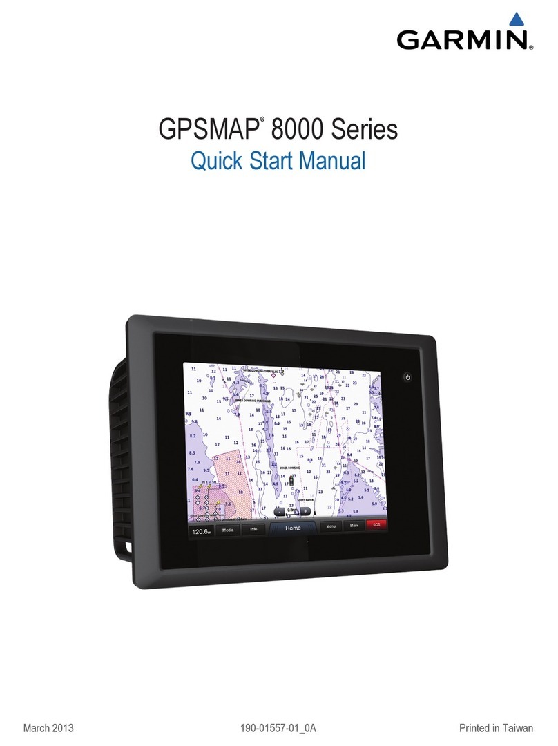
  9. Garmin GPSMAP 180 User manual

Garmin GPSMAP 180 User manual

Other manuals for GPSMAP 180

3

Other Garmin Marine GPS System manuals

Garmin GPSMAP 520 - Marine GPS Receiver Reference guide

Garmin

Garmin GPSMAP 520 - Marine GPS Receiver Reference guide

Garmin GPSMAP 7012 User manual

Garmin

Garmin GPSMAP 7012 User manual

Garmin Fishfinder 100 Blue User manual

Garmin

Garmin Fishfinder 100 Blue User manual

Garmin GPSMAP 6008 Reference guide

Garmin

Garmin GPSMAP 6008 Reference guide

Garmin GNX 21 User manual

Garmin

Garmin GNX 21 User manual

Garmin GPSMAP 6000 Series User manual

Garmin

Garmin GPSMAP 6000 Series User manual

Garmin GPSMAP 5215 User manual

Garmin

Garmin GPSMAP 5215 User manual

Garmin GPS 17 Series User manual

Garmin

Garmin GPS 17 Series User manual

Garmin quatix Reference guide

Garmin

Garmin quatix Reference guide

Garmin GPSMAP 640 User manual

Garmin

Garmin GPSMAP 640 User manual

Garmin Echomap Plus 40 series User manual

Garmin

Garmin Echomap Plus 40 series User manual

Garmin GPSMAP 180 User manual

Garmin

Garmin GPSMAP 180 User manual

Garmin GPSMAP 182 User manual

Garmin

Garmin GPSMAP 182 User manual

Garmin GPSMAP 4012 - Marine GPS Receiver User manual

Garmin

Garmin GPSMAP 4012 - Marine GPS Receiver User manual

Garmin GPSMAP 185 Sounder User manual

Garmin

Garmin GPSMAP 185 Sounder User manual

Garmin GPSMAP 7015 User manual

Garmin

Garmin GPSMAP 7015 User manual

Garmin echomap chirp 40 series User manual

Garmin

Garmin echomap chirp 40 series User manual

Garmin GPSMAP 751 Instruction manual

Garmin

Garmin GPSMAP 751 Instruction manual

Garmin Echomap Plus 40 series User manual

Garmin

Garmin Echomap Plus 40 series User manual

Garmin Fishfinder 340C User manual

Garmin

Garmin Fishfinder 340C User manual

Garmin GPSMAP 6008 User manual

Garmin

Garmin GPSMAP 6008 User manual

Garmin GPSMAP 702 series User manual

Garmin

Garmin GPSMAP 702 series User manual

Garmin GWS 10 Marine Wind Sensor User manual

Garmin

Garmin GWS 10 Marine Wind Sensor User manual

Garmin GPSMAP 3205 - Marine GPS Receiver User manual

Garmin

Garmin GPSMAP 3205 - Marine GPS Receiver User manual

Popular Marine GPS System manuals by other brands

Airmar Technology Corporation GH2183 Owner's guide and installation instructions

Airmar Technology Corporation

Airmar Technology Corporation GH2183 Owner's guide and installation instructions

JRC JHS-183 installation manual

JRC

JRC JHS-183 installation manual

Thuraya IP Voyager user guide

Thuraya

Thuraya IP Voyager user guide

Furuno GP-1610CF Operator's manual

Furuno

Furuno GP-1610CF Operator's manual

Raytheon NautoPilot NP 5100 Operator's manual

Raytheon

Raytheon NautoPilot NP 5100 Operator's manual

Furuno GP-1650WDF Operator's manual

Furuno

Furuno GP-1650WDF Operator's manual

TracPhone V7 user guide

TracPhone

TracPhone V7 user guide

Nera WorldSet Pro user guide

Nera

Nera WorldSet Pro user guide

Hughes Thuraya IP Voyager user guide

Hughes

Hughes Thuraya IP Voyager user guide

Satcube Ku quick start guide

Satcube

Satcube Ku quick start guide

Furuno FELCOM 12 Operator's manual

Furuno

Furuno FELCOM 12 Operator's manual

Thuraya ATLAS IP+ user manual

Thuraya

Thuraya ATLAS IP+ user manual

Raymarine G-Series system Installation & commissioning instructions

Raymarine

Raymarine G-Series system Installation & commissioning instructions

Radio Zeeland DMP Sigma 120 manual

Radio Zeeland DMP

Radio Zeeland DMP Sigma 120 manual

Addvalue Innovation wideye SABRE RANGER 5000 quick start guide

Addvalue Innovation

Addvalue Innovation wideye SABRE RANGER 5000 quick start guide

Humminbird 532162-1_B installation guide

Humminbird

Humminbird 532162-1_B installation guide

Thuraya ATLAS IP user manual

Thuraya

Thuraya ATLAS IP user manual

Telstra Iridium GO! user manual

Telstra

Telstra Iridium GO! user manual

manuals.online logo
manuals.online logoBrands
  • About & Mission
  • Contact us
  • Privacy Policy
  • Terms and Conditions

Copyright 2025 Manuals.Online. All Rights Reserved.

GPSMAP
180
OWNERS MANUAL
AND REFERENCE
© 1999 GARMIN Corproation
Garmin International, Inc., 1200 E. 151st Street, Olathe, KS 66062 USA
Tel: 913-397-8200 FAX: 913-397-8282
Garmin (Europe) Ltd., Unit 5, The Quadrangle, Abbey Park Industrial Estate, Romsey SO51 9AQ UK
Tel: 011-44-1794-519944 FAX: 011-44-1794-519222
Garmin (Asia) Corp., 3F, No. 1, Lane 45, Pao Hsing Road, Hsin Tien, Taipei, Taiwan R.O.C.
Tel: 011-886-02-2917-4107 FAX: 011-886-02-2917-1758
i
INTRODUCTION
Foreword
GARMIN
TM
, Micro G-chart
TM
, AutoLocate
TM
,
TracBack
TM
and PhaseTrac12
TM
are trademarks
of GARMIN Corporation and may only be used
with permission. All rights are reserved.
Software Version 4.02 or above
Internal Database Version 3.00
Micro G-chart
TM
cartridge data is copyrighted by Navionics Corporation and
GARMIN Corporation and may not be copied or used for any other purpose with-
out permission.
© Copyright 1999
GARMIN Corporation
All Rights Reserved
Except as expressly provided herein, no part of this manual may be reproduced,
copied, transmitted, disseminated, downloaded or stored in any storage medium,
for any purpose without the express prior written consent of GARMIN
Corporation. GARMIN Corporation hereby grants permission to download a sin-
gle copy of this manual and of any revision to this manual onto a hard drive or
other electronic storage medium to be viewed and to print one copy of this manu-
al or of any revision hereto, provided that such electronic or printed copy of this
manual or revision must contain the complete text of this copyright notice and
provided further that any unauthorized commercial distribution of this manual or
any revision hereto is strictly prohibited.
Information in this document is subject to change without notice. GARMIN
reserves the right to change or improve its products and to make changes in the
content without obligation to notify any person or organization of such changes
or improvements.
March 1999 Part #190-00157-10 Rev. A Printed in Taiwan.
The GPS system is operated by the United States government, which is solely
responsible for its accuracy and maintenance. The system is subject to changes
which could affect the accuracy and performance of all GPS equipment. Although
the GARMIN GPSMAP 180 is a precision electronic NAVigation AID (NAVAID), any
NAVAID can be misused or misinterpreted and, therefore, become unsafe.
Use the GPSMAP 180 at your own risk. To reduce the risk of unsafe operation,
carefully review and understand all aspects of this Owners Manualand thoroughly
practice operation using the simulator mode prior to actual use. When in actual use,
carefully compare indications from the GPSMAP 180 to all available navigation
sources, including the information from other NAVAIDs, visual sightings, charts, etc.
For safety, always resolve any discrepancies before continuing navigation.
NOTE: This equipment generates, uses, and can radiate radio frequency energy
and, if not installed and used in accordance with the instructions, may cause harmful
interference to radio communications. However, there is no guarantee that interfer-
ence will not occur in a particular installation. If this equipment does cause harmful
interference, the user is encouraged to try to correct the interference by relocating
the equipment or connecting the equipment to a different circuit. Consult an autho-
rized dealer or other qualified technician for additional help if these remedies do not
correct the problem.
This device complies with Part 15 of the FCC limits for class B digital devices for
home or office use. Operation is subject to the following conditions: (1) This device
may not cause harmful interference, and (2) this device must accept any interference
received, including interference that may cause undesired operation.
The GPSMAP180 contains no user-serviceable parts. Repairs should only be made
by an authorized service center. Unauthorized repairs or modifications could void
your warranty and your authority to operate this device under Part 15
regulations.
ii
INTRODUCTION
Cautions
CAUTION!
The GARMIN GPSMAP 180 has no user-ser-
viceable parts. Should you ever encounter a
problem with your unit, please take it to an
authorized GARMIN dealer for repairs.
iii
INTRODUCTION
Capabilities
Designed for detailed electronic charting and simple operation, the GARMIN
GPSMAP 180 is a powerful navigation device that can help guide you in water-
ways around the world:
Precision Performance
 160 x 240 pixel High-contrast 4-level gray LCD screen
 PhaseTrac12
TM
receiver tracks and uses up to 12 satellites simultaneously
for fast, accurate positioning
 Differential-Ready just add the optional GBR 21 beacon receiver for better
than 10-meter accuracy
 Gasketed case for use in exposed locations
Advanced Navigating and Plotting
 250 alphanumeric waypoints with selectable icons and comments
 Built-in worldwide database usable from 4096 to 64 nm scales
 20 reversible routes with up to 30 waypoints each
 Micro G-chart
TM
electronic charting with inland and offshore coverage
 On-screen point-to-point distance and bearing calculations
 TracBack
TM
route feature which allows you to quickly retrace your track log to
a starting position
 Built-in simulator mode
LIMITED WARRANTY
GARMIN warrants this product to be free from defects in materials and work-
manship for one year from the date of purchase. GARMIN International, Inc. will at
its sole option, repair or replace any components which fail in normal use. Such
repairs or replacement will be made at no charge to the customer for parts or labor.
The customer is, however, responsible for any transportation costs. This warranty
does not cover failures due to abuse, misuse, accident, or unauthorized alteration or
repairs. GARMIN International, Inc. assumes no responsibility for special, inciden-
tal, punitive or consequential damages, or loss of use.
The warranties and remedies contained herein are exclusive, and in lieu of all
other warranties expressed or implied, including any liability arising under warranty
of merchantability or fitness for a particular purpose, statutory or otherwise. This
warranty gives you specific legal rights, which may vary from state to state.
To obtain warranty service, contact the GARMIN Customer Service department
at 913-397-8200 for a returned merchandise tracking number. The unit should be
securely packaged with the tracking number clearly marked on the outside of the
package, and sent freight prepaid and insured to a GARMIN warranty service sta-
tion. A copy of the original sales receipt is required as the proof of purchase for war-
ranty repairs. GARMIN retains the exclusive right to repair or replace the unit or
software at its sole discretion.
iv
INTRODUCTION
Warranty
v
INTRODUCTION
Preface
Congratulations on choosing one of the most advanced marine navigation sys-
tems available! The GARMIN GPSMAP 180 combines the proven performance of
GARMIN GPS with powerful Micro G-Chart electronic charting for detailed car-
tography and plotting wherever you cruise.
To get the most out of your new navigation system, take the time to go through
this operators manual and learn the operating procedures for your unit. This
manual is broken down into two sections for your convenience.
Getting Started introduces you to the GPSMAP 180 and provides a tutorial that
will help you become more familiar with the unit. This part will provide you with
a basic working knowledge necessary to use the unit to its fullest
potential.
The Reference portion is divided into sections that provide detailed instructions
on the advanced features and operations of the GPSMAP 180. This allows you to
concentrate on a specific topic quickly, without reading through entire portions of
text that you may not need.
An Appendix section concludes the manual with specific information needed
for custom setup, trouble shooting, and indexing.
PREFACE
WARNING!
The electronic chart is an aid to navigation
and is designed to facilitate the use of autho-
rized government charts, not replace them.
Only official government charts and notices to
mariners contain all information needed for
the safety of navigationand, as always, the
user is responsible for their prudent use.
INTRODUCTION
Packing List
vi
Before installing and getting started with your unit, please check to see that
your package includes the following items. If any parts are missing, please see
your GARMIN dealer immediately.
Standard Package:
 GPSMAP 180 Unit
 External Antenna and 30 cable
 Power/Data Cable
 Mounting Bracket and Knobs
 Owners Manual
 Quick Reference Card
Optional Accessories:
 Micro G-chart Electronic Chart Cartridges
 PC Kit
vii
GETTING STARTED
Table of Contents
Foreword .........................................................................................................................i
Cautions..........................................................................................................................ii
Capabilities/Warranty ................................................................................................iii-iv
Preface/Packing List.....................................................................................................v-vi
Table of Contents/Keypad Usage ................................................................................vii-x
Getting Started...........................................................................................................1-16
Initializing the Receiver . . . . . . . . . . . . . . . . . . . . . . . . . . . . . . . . . . . . . .1-2
Turning the Unit On & Screen Contrast . . . . . . . . . . . . . . . . . . . . . . . . . . .3
Satellite Page Intro & Position Page Intro . . . . . . . . . . . . . . . . . . . . . . . . .4-5
Marking Your Present Position . . . . . . . . . . . . . . . . . . . . . . . . . . . . . . . . . .6
Map Page Introduction . . . . . . . . . . . . . . . . . . . . . . . . . . . . . . . . . . . . . . . .7
Using the Cursor . . . . . . . . . . . . . . . . . . . . . . . . . . . . . . . . . . . . . . . . . . . . .8
Going to a Destination & Activating a Route . . . . . . . . . . . . . . . . . . . . . . . .9
Navigation Simulator & Map Scale Intro . . . . . . . . . . . . . . . . . . . . . . . . . .10
Using the Cursor to Pan and Mark Waypoints . . . . . . . . . . . . . . . . . . .10-11
Navigation Page Intro . . . . . . . . . . . . . . . . . . . . . . . . . . . . . . . . . . . . . . . .12
Changing Simulated Speed & Direction and Highway Scales/Data Fields .13
Active Route Page & Deactivating a Route . . . . . . . . . . . . . . . . . . . . . . . . .14
Main Menu Intro & Deleting the Track Log . . . . . . . . . . . . . . . . . . . . . . .15
Turning the Unit Off . . . . . . . . . . . . . . . . . . . . . . . . . . . . . . . . . . . . . . . . .16
Section 1: GPSMAP Status Page ...............................................................................17-19
Satellite Page Overview . . . . . . . . . . . . . . . . . . . . . . . . . . . . . . . . . . . . . . .17
Satellite Status . . . . . . . . . . . . . . . . . . . . . . . . . . . . . . . . . . . . . . . . . . . . . .18
Satellite Page Options . . . . . . . . . . . . . . . . . . . . . . . . . . . . . . . . . . . . . . . .19
Section 2: Position Page ...........................................................................................20-21
Position Page Overview . . . . . . . . . . . . . . . . . . . . . . . . . . . . . . . . . . . . . . .20
Position Page Options . . . . . . . . . . . . . . . . . . . . . . . . . . . . . . . . . . . . . . . .21
Section 3: Map Page.................................................................................................22-29
Map Page Overview & Data Window . . . . . . . . . . . . . . . . . . . . . . . . . . . .22
Map Modes
Position Mode & Cursor Mode . . . . . . . . . . . . . . . . . . . . . . . . . . . . . .23
Using the Cursor . . . . . . . . . . . . . . . . . . . . . . . . . . . . . . . . . . . . . . . . . . . .24
Selecting Map Scales
Over Zoom & No Map . . . . . . . . . . . . . . . . . . . . . . . . . . . . . . . . . .25
Map Page Options . . . . . . . . . . . . . . . . . . . . . . . . . . . . . . . . . . . . . . . . . . .26
Map Configuration . . . . . . . . . . . . . . . . . . . . . . . . . . . . . . . . . . . . . . . .27-28
Map Colors . . . . . . . . . . . . . . . . . . . . . . . . . . . . . . . . . . . . . . . . . . . . . . . .28
Map Display & Data Fields . . . . . . . . . . . . . . . . . . . . . . . . . . . . . . . . . . . .29
Section 4: Navigation Page ......................................................................................30-32
Navigation Page Overview . . . . . . . . . . . . . . . . . . . . . . . . . . . . . . . . . . . . .30
Highway Scale & Navigation Page Options . . . . . . . . . . . . . . . . . . . . .31-32
Section 5: Main Menu Page .. ........................................................................................33
Main Menu Page Overview . . . . . . . . . . . . . . . . . . . . . . . . . . . . . . . . . . . .33
Section 6: Waypoints ..............................................................................................34-42
Creating Waypoints & Using the Mark Key . . . . . . . . . . . . . . . . . . . . .34-35
Creating Waypoints On Map & By Text . . . . . . . . . . . . . . . . . . . . . . . . . .36
Reference Waypoints . . . . . . . . . . . . . . . . . . . . . . . . . . . . . . . . . . . . . . . . .37
Reviewing and Editing Waypoints by Text . . . . . . . . . . . . . . . . . . . . . . . .38
Waypoint Definition Page Options . . . . . . . . . . . . . . . . . . . . . . . . . . . . . .39
Waypoint Submenus & Nearest Waypoints . . . . . . . . . . . . . . . . . . . . . . .40
Proximity Waypoints . . . . . . . . . . . . . . . . . . . . . . . . . . . . . . . . . . . . . . . .41
Create Waypoint & Waypoint List . . . . . . . . . . . . . . . . . . . . . . . . . . . . . .42
Section 7: GOTO/MOB/TracBack Functions ............................................................43-46
Selecting A GOTO . . . . . . . . . . . . . . . . . . . . . . . . . . . . . . . . . . . . . . . . . . .43
GOTO Key . . . . . . . . . . . . . . . . . . . . . . . . . . . . . . . . . . . . . . . . . . . . . . . .44
MOB & TracBack Navigation . . . . . . . . . . . . . . . . . . . . . . . . . . . . . . . .45-46
viii
GETTING STARTED
Table Of Contents