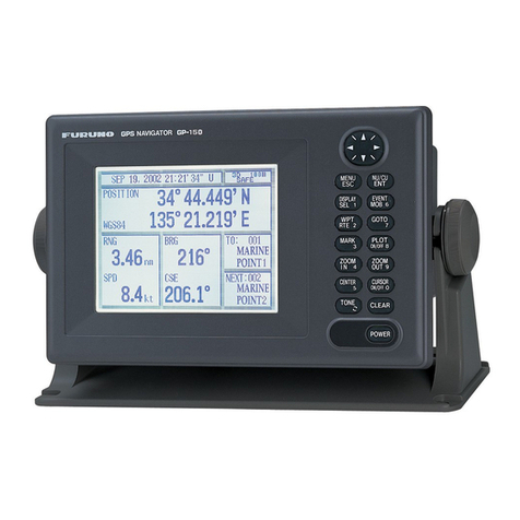
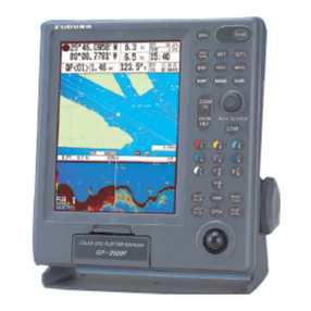
Furuno GD-3300 User manual


C
9-52, Ashihara-cho,
Nishinomiya, Japan
Telephone: 0798-65-2111
Telefax: 0798-65-4200
Your Local Agent/Dealer
All rights reserved.
PUB. No. OME-43920
GD/GP-3300
(DAMI)
FIRST EDITION :AUG.1998
F1 :OCT.3, 2002
Printed in Japan

iiiiiiiiiiiii
i
SAFETY INSTRUCTIONS
WARNING
Immediately turn off the power at the
switchboard if water leaks into the
equipment or something is dropped in
the equipment.
Continued use of the equipment can cause
fire or electrical shock. Contact a FURUNO
agent for service.
Do not disassemble or modify the
equipment.
Fire, electrical shock or serious injury can
result.
Do not place liquid-filled containers on
the top of the equipment.
Fire or electrical shock can result if a liquid
spills into the equipment.
Immediately turn off the power at the
switchboard if the equipment is emitting
smoke or fire.
Continued use of the equipment can cause
fire or electrical shock. Contact a FURUNO
agent for service.
Make sure no rain or water splash leaks
into the equipment.
Fire or electrical shock can result if water
leaks in the equipment.
ELECTRICAL SHOCK HAZARD
Do not open the equipment.
Only qualified personnel
should work inside the
equipment.
WARNING
Keep heater away from equipment.
A heater can melt the equipment’s power
cord, which can cause fire or electrical
shock.
Use the proper fuse.
Fuse rating is shown on the equipment.
Use of a wrong fuse can result in equipment
damage.

ii
The TFT LCD is constructed using the
latest LCD techniques, and displays
99.99% of its pixels. The remaining 0.01%
of the pixels may drop out or blink, how-
ever this is not an indication of malfunc-
tion.
About the TFT LCD
CAUTION
Do not use the equipment for other than
its intended purpose.
Use of the equipment as a stepping stool,
for example, can result in personal injury
or equipment damage.
No one navigation device should ever be
solely replied upon for the navigation of
a vessel.
Always confirm position against all available
aids to navigation, for safety of vessel and
crew.
A warning label is attached to the equip-
ment. Do not remove the label. If the
label is missing or illegible, contact
a FURUNO agent or dealer.
WARNING
To avoid electrical shock, do not
remove cover. No user-serviceable
parts inside.
Name: Warning Label (1)
Type: 86-003-1011-0
Code No.: 100-236-230

iii
TABLE OF CONTENTS
FOREWORD..........................................................................................................................vi
MENU TREE........................................................................................................................viii
SYSTEM CONFIGURATION........................................................................................ix
OPERATIONAL OVERVIEW
1.1 Control Description ...............................................................................................................1-1
1.2 Inserting Chart Cards.............................................................................................................1-2
1.3 Turning the Power On/Off .....................................................................................................1-3
1.4 The Trackball .........................................................................................................................1-4
1.5 The Cursor .............................................................................................................................1-4
1.6 Shifting the Display ...............................................................................................................1-5
1.7 Returning Own Ship Marker to Screen Center......................................................................1-5
1.8 Selecting Screen Center by Cursor Position..........................................................................1-6
1.9 Chart Scale.............................................................................................................................1-7
1.10 Display Brilliance and Key Backlighting............................................................................1-7
1.11 Card Drives, Chart Cards.....................................................................................................1-8
1.12 The Data Window ..............................................................................................................1-12
1.13 Display Modes...................................................................................................................1-13
1.14 Menu Operation.................................................................................................................1-14
1.15 Operation on the Display...................................................................................................1-16
1.16 Operational Status Icons....................................................................................................1-17
1.17 Economy Mode .................................................................................................................1-17
1.18 Plot Mode Displays ...........................................................................................................1-18
1.19 Setting the Time and Date .................................................................................................1-20
TRACK
2.1 Stopping Track Recording .....................................................................................................2-1
2.2 Track Color ............................................................................................................................2-2
2.3 Changing Color,Appearance of Specific Track ....................................................................2-2
2.4 Deleting Track .......................................................................................................................2-4
2.5 Track Plotting Interval ...........................................................................................................2-6
2.6 Customizing the Hold Function.............................................................................................2-8
2.7 Customizing the PLOT INTVL Key .....................................................................................2-9
MARKS, LINES
3.1 Entering Marks ......................................................................................................................3-1
3.2 Changing Current Mark Color...............................................................................................3-2
3.3 Changing Shape, Color of Specific Marks ............................................................................3-3
3.4 Deleting Marks ......................................................................................................................3-4

iv
3.5 External Event Mark..............................................................................................................3-5
3.6 Target Mark ...........................................................................................................................3-5
3.7 Lines ......................................................................................................................................3-5
WAYPOINTS
4.1 Entering Waypoints ...............................................................................................................4-2
4.2 Entering a Comment for a Waypoint .....................................................................................4-5
4.3 Turning Specific Waypoint Displays On/Off.........................................................................4-6
4.4 Deleting Waypoints ...............................................................................................................4-7
4.5 Destination Waypoint ............................................................................................................4-8
4.6 Cancelling Destination Waypoint ........................................................................................4-12
ROUTE NAVIGATION
5.1 Creating Routes .....................................................................................................................5-2
5.2 Following a Route .................................................................................................................5-5
5.3 Temporarily Deselecting a Route Waypoint ..........................................................................5-6
5.4 Deleting Route Waypoints .....................................................................................................5-7
5.5 Cancelling Route Navigation.................................................................................................5-8
5.6 Route Calculation ..................................................................................................................5-9
ALARMS
6.1 Arrival Alarm,Anchor Watch Alarm .....................................................................................6-1
6.2 XTEAlarm, Border Alarm ....................................................................................................6-3
6.3 Ship’s SpeedAlarm ...............................................................................................................6-4
6.4 When theAlarm Buzzer Sounds............................................................................................6-5
VIDEO PILOT DISPLAY, NAVIGATION DATA DISPLAY
7.1 Video Pilot Display................................................................................................................7-1
7.2 Navigation Data Display .......................................................................................................7-4
AUTOPILOT DATA
8.1 Features Available with Autopilot Connection......................................................................8-1
8.2 Autopilot Information on Plot Display ..................................................................................8-2
8.3 Autopilot Information on Video Pilot Display ......................................................................8-3
MEMORY CARD OPERATIONS
9.1 Formatting Memory Cards ....................................................................................................9-1
9.2 Saving Data to Memory Cards ..............................................................................................9-2
9.3 Playing Back Memory Cards.................................................................................................9-4
9.4 Saving, Playing Back Initial Settings ....................................................................................9-5
9.5 Editing Memory Cards ..........................................................................................................9-6

v
GPS RECEIVER OPERATION (GP-3300)
10.1 GPS Information on the Navigation Data Display ............................................................10-1
10.2 GPS and DGPS Initial Settings .........................................................................................10-3
10.3 Satellite Force Health/Deselection ....................................................................................10-5
10.4 GPS Smoothing .................................................................................................................10-6
10.5 Cold Start...........................................................................................................................10-8
10.6 Geodetic Datum.................................................................................................................10-9
10.7 Correcting GPS Position....................................................................................................10-9
OTHER FUNCTIONS
11.1 Displaying Position in Loran TDs .....................................................................................11-1
11.2 Bearing Display Reference ................................................................................................ 11-2
11.3 Magnetic Deviation ........................................................................................................... 11-3
11.4 Changing Chart Appearance ..............................................................................................11-4
11.5 Correcting Chart Position .................................................................................................. 11-5
11.6 Loran TD Correction .........................................................................................................11-7
11.7 Calculating R/B Between Two Points ...............................................................................11-8
11.8 Locking Preferred Settings ..............................................................................................11-10
11.9 Memory Capacity ............................................................................................................11-10
11.10 Apportioning the Memory ............................................................................................. 11-12
11.11 Reading Number of Track, Marks Used ........................................................................11-13
11.12 Smoothing...................................................................................................................... 11-14
11.13 Selecting Navaid ............................................................................................................ 11-15
11.14 Track, Mark and Marker Attributes ............................................................................... 11-16
11.15 Chart Symbols, Contour Lines Attributes......................................................................11-19
MAINTENANCE & TROUBLESHOOTING
12.1 Preventive Maintenance ....................................................................................................12-1
12.2 Diagnostic Tests.................................................................................................................12-2
12.3 Error Messages ..................................................................................................................12-5
12.4 Replacement of Fuse .........................................................................................................12-7
12.5 Replacement of Batteries...................................................................................................12-8
12.6 Verifying Program Version No. .........................................................................................12-9
12.7 Troubleshooting Table .....................................................................................................12-10
12.8 Clearing Memories ..........................................................................................................12-12
APPENDIX
Time Differences ........................................................................................................................A-1
Geodetic Chart List..................................................................................................................... A-2
SPECIFICATIONS......................................................................................................... SP-1
INDEX...............................................................................................................................Index-1
Declaration of Conformity

vi
FOREWORD
A Word to FURUNO GD-3300/GP-3300 Owners
FURUNO Electric Company thanks you for considering and purchas-
ing the FURUNO GD-3300/GP-3300. We are confident you will dis-
cover why FURUNO has become synonymous with quality and
reliability.
For over 40 years FURUNO Electric Company has enjoyed an envi-
able reputation for efficient and dependable marine electronicsequip-
ment. This dedication to excellenceis furthered by ourextensive global
network of agents and dealers.
Your unit is designed and manufactured to meet the rigorous demands
of the marine environment. However, no machine can perform to the
utmost of its ability unless properly operated and maintained. Please
carefully read and follow the recommended procedures for operation
and maintenance.
We would appreciate hearing from you, the end-user, about whether
we are achieving our purposes.
Thank you for considering and purchasing FURUNO.

vii
Features
The GD-3300 and the GP-3300 mostly share the same features. The
GP-3300 is additionally equipped with a GPS receiver and a GPS
antenna, to receive and process GPS satellite signals.
Navigation data appear on a high-resolution 10.4-inch color LCD.
Data shown are shp’s position in latitude and longitude, speed and
course, cursor position, range and bearing to cursor, range and bear-
ing to a waypoint.
The display unit is powered by a 12 V or 24 VDC power supply.
• GP-3300 accepts connection of DGPS Beacon Receiver
• NAVIONICS chart card compatible
• Alarms: Arrival alarm, Anchor Watch alarm, Cross-track Error
alarm, Border alarm, Ship’s Speed alarm
• Large capacity memory: 8,000 points of tracks and marks, 98
waypoints, 10 routes with 15 waypoints per route
• Comprehensive navigation display of alphanumeric navigation
data plus automatic track plotting
• Economy mode reduces power consumption – LCD is turned off
while receiver/processor keeps updating data.
• Factory-digitized electronic charts on ROM cards.
• Memory cards for storage of track, waypoints, marks
• Menu-driven operation
• Navigation planning from/to waypoint or route

viii
MENU TREE
MENU
1WAYPOINT
2ROUTE
3SAVE DATA TO MEMORY CARD
1 TRACK
2 MARK/LINE
3 WAYPOINT/ROUTE
4 INITIAL SETTINGS
7 DELETE MEMORY CARD DATA
8 FORMAT MEMORY CARD
9 SELECT CARD SLOT
( 1 UPPER 2 LOWER)
4LOAD MEMORY CARD
1 TRACK
2 MARK/LINE
3 WAYPOINT/ROUTE
4 INITIAL SETTINGS
9 SELECT CARD SLOT
( 1 UPPER 2 LOWER)
5DISPLAY MEMORY CARD
6CORRECT POSITION
7APPORTION/DELETE MEMORY
1 APPORTION MEMORY
2 DELETE TRACK
3 DELETE MARK
8INITIAL SETTINGS (See below.)
9MISC
1 EDIT TRACK/MARK
2CALCULATE
RANGE/BEARING
6 SPECIAL
SELECT MARKS/
CONTOUR LINE
8CLEAR
MEMORY
9 SELF TEST
1CLEAR SCREEN
DATA
2CLEAR ALL GD
DATA
3CLEAR GPS
DATA
4 CLEAR ALL DATA
1MEMORY • I/O
PORT
2 KEYBOARD
3TEST
PATTERN 1
4TEST
PATTERN 2
7
INITIAL SETTINGS, page 1
INTERNAL NAV
EXTERNAL NAV
I/O DATA FORMAT
L/L SMOOTHING
PLOT INTERVAL 1
PLOT INTERVAL 2
WAYPOINT MARK
EVENT MARK
TRACK(HOLD PLOT)
LINE (HOLD PLOT)
MAGNETIC DEVIATION
BEARING
COURSE VECTOR
MARK SIZE
CURSOR SIZE
OWN SHIP MARK
TRACK WIDTH
RANGE UNIT
VTD AVG TIME
DATE
TIME
EXTERNAL CLOCK
AUTOPILOT DISPLAY
TD INDICATION
INITIAL SETTINGS, page 2 (GPS settings)
POSITION FIXING MODE
GEODETIC DATUM
HDOP THRESHOLD
TIME DIFFERENCE
LATITUDE
LONGITUDE
DELTA LATITUDE
DELTA LONGITUDE
SMOOTHING
ANTENNA HEIGHT
COLD START
CST SATELLITE NO.
MIN. ELEVATION ANGLE
DESELECT SAT NO.
D.GPS MODE
RTCM VER
BYTE FORM
FIRST BIT
PARITY BIT
STOP BIT
BIT RATE
BAUD RATES

ix
SYSTEM CONFIGURATION
GPS PLOTTER
ON
POWER
OFF
9
6
32
5
87
4
1
0
BRILL
ECONO
E
N
T
CEN
TER
SELECT
MARK
COLOR
FR/TO WPT
ROUTE ALARM
TRACK
COLOR
PLOT
INTVL
CHART
C
L
R
EVENT
PLOT
MODE
VIDEO
PILOT NAV
DATA MANU
ZOOM
IN ZOOM
OUT
CURSOR
ON/OFF
GPS ANTENNA UNIT
GPA-017S
(For GP-3300)
Navigator (for GD-3300)
Video Sounder
Radar
Autopilot
Event Switch
Differential GPS
Receiver GR-80*
(GP-3300 only)
: Option
: Connectable external equipment
* Cannot be connected to GD-3300.
DISPLAY UNIT
GP-3300-E/ GD-3300-E
SHIP’S MAINS
10.8 - 31.2 VDC
Rectifier
PR-62
100/110/220/230 VAC
50/60 Hz

1-1
OPERATIONAL OVERVIEW
This chapter acquaints you with the basics of your unit – from turn-
ing on the power to entering the time and date.
1.1 Control Description
The keyboard consists of 40 logically arranged keys. The unit con-
firms correct key input by releasing a single beep. Invalid key input
is denoted by a series of beeps.
GPS PLOTTER
ON
POWER
OFF
9
6
32
5
87
4
1
0
BRILL
ECONO
E
N
T
CEN
TER
SELECT
MARK
COLOR
FR/TO WPT
ROUTE ALARM
TRACK
COLOR
PLOT
INTVL
CHART
C
L
R
EVENT
PLOT
MODE
VIDEO
PILOT NAV
DATA MANU
Power switch Card slot
Memory card (upper)
Electronic chart card (lower)
Trackball
Keyboard
ZOOM
IN ZOOM
OUT
CURSOR
ON/OFF
Figure 1-1 Display unit

1-2
Table 1-1 Control description
lortnoC/yeKnoitcnuF
TOLP .syalpsidatadffo/nonrutotsnoitcnufoslA.yalpsidtolpstceleS
TOLIPOEDIV .syalpsidatadffo/nonrutotsnoitcnufoslA.yalpsidtolipoedivstceleS
ATADVAN.yalpsidatadnoitagivanstceleS
UNEM .neercssuoiverpsyalpsid;unemsesolc/snepO
OT/RF.tniopyawnoitanitsedslecnac/steS
TPW.stniopyawsretsigeR
ETUOR.setuorsretsigeR
MRALA.unemmralasyalpsiD
TRAHC .trahccinortceledezitigid-yrotcaffosetubirttasegnahC
ROLOCKCART.rolockcartsegnahC
LVTNITOLP .kcartgnidrocerspotsrolavretnitolpastcelessserphcaE
ROLOCKRAM.rolockramsegnahC
TNEVEdnasyeKKRAM nehwrotagivanotnoitisops’pihsstuptuO:TNEVE(.enil/kramsretnE ).desserp
syeKciremuN.atadciremunretnE
RLC secnelis;tniopyawrokramseteled;atadfoenileritnenasraelC .mralaelbidua
TNE.tupnidraobyeksetanimreT
]+[ tniopyawnosnrut;tsaErohtroNotetanidroocedutitalsegnahC .stniopetuorstceles;yalpsid
]-[ tniopyawffosnrut;tseWrohtuoSotetanidroocedutignolsegnahC .stniopetuorstcelesed;yalpsid
FFO/NOROSRUC.ffo/norosrucsnruT
NIMOOZ TUOMOOZ .elacstrahcegnahC
.egapsllorcs;)sDTnaroLroL/L(dohtemnoitacidninoitisopsegnahC :etoN ".yekegnahC"sasyalpsidunemnosraeppayeksihT
RETNEC .retnecneercsotrosruc/rekrampihsnwosnruteR
syeKworrA.rosrucdnayalpsidtfihS
ONOCELLIRB otsnoitcnufoslA.gnithgilkcabdraobyekdnaecnaillirbneercsstsujdA DCLehtlitnunwoddlohdnasserp(edomymonoceehtffo/nonrut .)ffosnrut
1.2 Inserting Chart Cards
Normally, insert appropriate chart card before turning on the power.
1. Open the card drive cover.
Figure 1-2 Opening chart slot

1-3
2. Insert the electronic chart card which contains a chart of your sea
area into the lower card drive.
Figure 1-3 Inserting chart card
Note: Always close the card drive cover to keep humidity and water
out of the drive.
1.3 Turning the Power On/Off
Turning the power on
Press the [POWER] switch at bottom left-hand side of the unit. You
will hear a “peep” when turning on the power. To turn off the power
press the switch again.
After turning on the power the display changes in the sequence illus-
trated in Figure 1-4.About 20 seconds later accurate own ship’s posi-
tion is displayed in case of the GP-3300.
GPS PLOTTER
ON
POWER
OFF
9
6
32
5
87
4
1
0
BRILL
ECONO
E
N
T
CEN
TER
SELECT
MARK
COLOR
FR/TO WPT
ROUTE ALARM
TRACK
COLOR
PLOT
INTVL
CHART
C
L
R
EVENT
PLOT
MODE
VIDEO
PILOT NAV
DATA MANU
Power switch
ZOOM
IN ZOOM
OUT
CURSOR
ON/OFF
Figure 1-4 GD-3300/GP-3300
For the GP-3300, at the first power application after installation, it
takes about two minutes to acquire GPS satellite data, called the al-
manac. While the unit is acquiring the almanac, the indication “CST”
appearsat the top ofthe display.“CST” is replaced by “2D”or “ACQ”
after the almanac is acquired. If the vessel has moved more than 600
miles with the system turned off, reenter estimated position on the
GPS INITIAL SETTINGS menu (key sequence: [MENU], [8], [ ]).
If asterisks appear instead of ship’s position data, this means there is
no navigation input. Check to make sure proper navigation aid is
selected on the INITIAL SETTINGS menu (keying sequence:
[MENU], [8]).

1-4
1.4 The Trackball
The main function of the trackball is to
shift the cursor and the display. The dis-
play may be shifted when the cursor is
turned off; the cursor when it is turned on.
Figure 1-5 Operating the trackball,
shifting the picture (cursor off)
1.5 The Cursor
The cursor functions to
• Find latitude and longitude of a location
• Find range and bearing from your ship to position selected
• Enter and erase marks, lines and waypoints
Note:You can select cursor configuration (cross hairs or entire screen
cursor) on the INITIAL SETTINGS menu (keying sequence:
[MENU], [8]). The default cursor configuration is the cross hairs.
Turning the cursor on/off
Each press of the [CURSOR ON/OFF] key turns the cursor on/off.
With the cursor on, operate the trackball or the arrow keys to shift the
cursor. Use the trackball for general placement and the arrow keys
for fine tuning. The cursor moves in the direction of the trackball
moves. When the cursor reaches the edge of the display, the display
shifts in the opposite direction.
Figure 1-6 Shifting the cursor

1-5
Cursor information
Cursor position in latitude and longitude and the range and bearing
from your ship to the cursor appear in the data window at the top of
the display.
+36°44.257’ N 340.5°
134°40.719’ E 10.0KTS
1.46NM
109.8
°
0.10NM
2D 1.2
40 42
Cursor range
Cursor bearing
Cursor position
Cursor
Figure 1-7 Location of cursor information
1.6 Shifting the Display
The display can be shifted, when the cursor is off, by the trackball or
arrow keys. The display shifts in the direction of trackball rotation or
arrow key pressed. Note that this function is only available with
FURUNO chart cards.
1.7 Returning Own Ship Marker to Screen Center
You can return the own ship marker to the screen center by pressing
the [CENTER] key. This function is only available with FURUNO
chart cards.

1-6
1.8 Selecting Screen Center by Cursor Position
In normal usage your ship is at the screen center. This function is
only available with FURUNO chart cards.
If you want to select a land feature as the screen center, do the follow-
ing:
1. Display the cursor (if it is not already displayed) by pressing the
[CURSOR ON/OFF] key.
2. Operate the trackball to place cursor on position desired.
3. Press the [CENTER] key.
CENTER
Figure 1-8 How to select screen center

1-7
1.9 Chart Scale
The chart scale can be adjusted with the [ZOOM IN] and [ZOOM
OUT] keys. Note that the [ZOOM IN] key shrinks the picture, and
the [ZOOM OUT] key “blows up” the picture. With a smaller range,
you may find that the track appears in tiers.
The horizontal range of the display in nautical miles appears at the
top right-hand corner of the Data Display. Whenever the scale is
changed the new range appears momentarily at the screen center.
34°44.258’ N 340.5°123.4NM
134°40.719’ E 341.2°
0’ 10"
GPS 1.2
Horizontal range
Horizontal range (123.4 NM)
DATA DISPLAY (2)
123.4NM
Figure 1-9 Location of chart scale indications
1.10 Display Brilliance and Key Backlighting
The [BRILL ECONO] key adjusts display screen brilliance and key-
board backlighting in seven levels including off.

1-8
1.11 Card Drives, Chart Cards
Card drives
Two card drives are behind the card drive door: the upper slot is for
memorycardswhichstore display data (waypoints, tracks, and marks),
and the lower slot is for digitized chart cards.
Displaying an electronic chart with the power
turned on
Follow the procedure below to display an electronic chart with the
power turned on.
1. Open the card slot door.
Figure 1-10 Opening card slot door
2. Insert chart card label side up in the lower slot.
This side up.
FURUNO
Card NAVIONICS
Card
Figure 1-11 Inserting chart card
3. Close the card slot door.
4. Press [ZOOM IN] or [ZOOM OUT] key to display chart.

1-9
Ejecting the chart card
Press the eject button.
Figure 1-12 Removing chart card
Care and handling of the cards
• Keep the cards away from direct sunlight, heat sources, and active
gases.
• Keep cards away from water and chemicals.
• Keep the connector free of foreign material.
• Do not drop the cards.
Chart card troubleshooting
• Chart does not disappear after removing card.
Operate [ZOOM IN] or [ZOOM OUT] key.
• Card inserted but chart does not appear.
Operate [ZOOM IN] and [ZOOM OUT] keys.
• Small island or object is not filled in (it is hollow).
Operate [ZOOM IN] and [ZOOM OUT] keys.
• Part of land on video pilot display is hollow.
Shift display.
• Land areas on a chart are hollow.
Chart overenlarged. Operate [ZOOM IN] key.
This manual suits for next models
1
Table of contents
Other Furuno Marine GPS System manuals

Furuno
Furuno GP-80 User manual

Furuno
Furuno GP-3500F-D User manual

Furuno
Furuno GP-1800 User manual

Furuno
Furuno FELCOM 16 User manual

Furuno
Furuno GP-7000 Manual

Furuno
Furuno GP-1600F User manual

Furuno
Furuno NAVpilot-500 User manual

Furuno
Furuno Navpilot 500 Manual

Furuno
Furuno FELCOM 12 User manual

Furuno
Furuno SC-30 Owner's manual

Furuno
Furuno GP-50 User manual

Furuno
Furuno Marine GPS System User manual

Furuno
Furuno SC-33 User manual

Furuno
Furuno Navpilot 500 User manual

Furuno
Furuno BR-2000 User manual

Furuno
Furuno GP-1670F User manual

Furuno
Furuno GP-3500F User manual

Furuno
Furuno 1734C User manual

Furuno
Furuno GP-1871F User manual

Furuno
Furuno GP-50 User manual