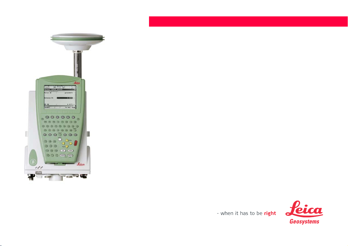
Leica GPS1200+ Product manual

Leica GPS1200+
Technical Reference Manual
Version 7.0
English

2GPS1200+Introduction
Introduction
Purchase Congratulations on the purchase of a GPS1200+ Series instrument.
)To use the product in a permitted manner, please refer to the detailed safety directions in the
User Manual.
Product identification The type and the serial number of your product are indicated on the type plate.
Enter the type and serial number in your manual and always refer to this information when
you need to contact your agency or Leica Geosystems authorized service workshop.
Symbols The symbols used in this manual have the following meanings:
Trademarks • Windows and Windows CE are a registered trademark of Microsoft Corporation
• CompactFlash and CF are trademarks of SanDisk Corporation
• Bluetooth is a registered trademark of Bluetooth SIG, Inc
All other trademarks are the property of their respective owners.
Type: _________________________
Serial No.: _________________________
Type Description
)Important paragraphs which must be adhered to in practice as they enable
the product to be used in a technically correct and efficient manner.

Introduction GPS1200+ 3
Validity of this manual • This manual applies to all GPS1200+ instruments. Differences between the various
models are marked and described.
• The RX1200 is available as RX1210 or with touch screen functionality as RX1210T,
RX1250X, RX1250Xc, RX1250T or RX1250Tc. The name RX1210 is used throughout
the manual and may also represent the touch screen models. Only use the supplied
stylus on the screens of the touch screen models.
Illustrations For the purpose of the illustrations, a GX1230+ model has been selected which is represent-
ative for all models.
Available
documentation Name Description Format
User Manual All instructions required in order to operate the
product to a basic level are contained in the
User Manual. Provides an overview of the
product together with technical data and safety
directions.
XX

4GPS1200+Introduction
Refer to the following resources for all GPS1200+ documentation and software:
• the SmartWorx DVD
• http://www.leica-geosystems.com/downloads
Name Description Format
System Field Manual Describes the general working of the product in
standard use. Intended as a quick reference
field guide.
X
Application Programs
Field Manual
Describes specific onboard application
programs in standard use. Intended as a quick
reference field guide. The RoadRunner applica-
tion program is described in a separate manual.
XX
Technical Reference
Manual
Overall comprehensive guide to the product and
program functions. Included are detailed
descriptions of special software/hardware
settings and software/hardware functions
intended for technical specialists.
X

Table of Contents GPS1200+ 5
Table of Contents
In this manual Chapter Page
1 Equipment Setup 27
1.1 Receiver Ports 27
1.2 Post-Processed Static Reference on Pillar 31
1.3 Post-Processed Static Reference on Tripod 35
1.4 Post-Processed Kinematic, Pole and Minipack 39
1.5 Post-Processed Kinematic, All-on-Pole - Option 1 45
1.6 Post-Processed Kinematic, All-on-Pole - Option 2 49
1.7 Real-Time Reference, Single Tripod 52
1.8 Real-Time Reference, Two Tripods 56
1.9 Real-Time Reference using SmartAntenna, RX1250 and GHT56 60
1.10 SmartRover - External Radio 64
1.11 SmartRover - External Radio, Maximized Radio Coverage 68
1.12 Real-Time Rover, Pole and Minipack 72
1.13 Real-Time Rover, All-on-Pole - Option 1 78
1.14 Real-Time Rover, All-on-Pole - Option 2 81
1.15 Using the Minipack 84
1.16 Checking and Adjusting the Circular Level on the Tribrach 87
2 Antenna Heights 90
2.1 Overview 90
2.2 Mechanical Reference Planes, MRP 93
2.3 Determining Antenna Heights 95
2.3.1 Pillar Setup 95
2.3.2 Tripod Setup 100

6GPS1200+Table of Contents
2.3.3 Pole Setup 103
2.4 Measuring Slope Antenna Heights 105
3 Using GPS1200+ without RX1200 107
4 Using RX1250 111
4.1 Overview 111
4.2 Switching between Leica SmartWorx software and Windows CE
desktop 112
4.3 Sleep Mode 114
4.4 Configuring Interfaces 115
4.4.1 Overview 115
4.4.2 Configuring SmartAntenna Interface 116
4.4.3 Configuring Clip-On Interface 118
5 Receiver Protection with PIN 119
6 Configurable Keys 125
6.1 Hot Keys 125
6.2 USER Key 127
7 Main Menu 129
7.1 Main Menu Functions 129
7.2 Survey 132
7.3 Programs... 133
7.4 Manage... 135
7.5 Convert... 137
7.6 Config... 138
7.7 Tools... 139

Table of Contents GPS1200+ 7
8 Manage...\Jobs 140
8.1 Overview 140
8.2 Accessing Job Management 141
8.3 Creating a New Job 143
8.4 Editing a Job 147
8.5 Managing Job Codes 150
9 Manage...\Data 154
9.1 Overview 154
9.2 Accessing Data Management 155
9.3 Point Management 160
9.3.1 Terminology 160
9.3.2 Creating a New Point 170
9.3.3 Editing a Point 174
9.3.4 Mean Page 179
9.4 Line/Area Management 186
9.4.1 Overview 186
9.4.2 Creating a New Line/Area 187
9.4.3 Editing a Line/Area 191
9.4.4 Working Example 194
9.5 Data Log 197
9.6 Point Sorting and Filters 200
9.6.1 Sorting and Filters for Points, Lines and Areas 200
9.6.2 Point, Line and Area Code Filter 209
9.6.3 Stakeout Filter 211
10 Manage...\Codelists 213
10.1 Terminology 213
10.2 Overview 220

8GPS1200+Table of Contents
10.3 Accessing Codelist Management 221
10.4 Creating/Editing a Codelist 223
10.5 Managing Codes 224
10.5.1 Accessing MANAGE Codes 224
10.5.2 Creating a New Code 227
10.5.3 Editing a Code 230
10.6 Managing Code Groups 231
11 Coding 233
11.1 Overview 233
11.2 Thematical Coding 236
11.2.1 Thematical Coding with Codelist 236
11.2.2 Thematical Coding without Codelist 241
11.3 Free Coding 243
11.3.1 Free Coding Using a Codelist 243
11.3.2 Free Coding with Direct Input 247
11.4 Quick Coding 249
11.5 SmartCodes 253
11.5.1 Overview 253
11.5.2 Configuring SmartCodes 254
11.5.3 Code Block 258
11.5.4 Using SmartCodes 261
11.6 Code and Attribute Mismatch 263
11.6.1 Code Mismatch 263
11.6.2 Attribute Mismatch 265
12 Linework 267
12.1 Overview 267
12.2 Performing Linework 268

Table of Contents GPS1200+ 9
12.3 Combining Linework and Coding 273
13 Manage...\Coordinate Systems 280
13.1 Overview 280
13.2 Terminology 284
13.3 Accessing Coordinate System Management 287
13.4 Coordinate Systems 290
13.4.1 Creating a New Coordinate System 290
13.4.2 Editing a Coordinate System 292
13.5 Transformations 294
13.5.1 Accessing Transformation Management 294
13.5.2 Creating a New Transformation 297
13.5.3 Editing a Transformation 299
13.6 Ellipsoids 300
13.6.1 Accessing Ellipsoid Management 300
13.6.2 Creating a New Ellipsoid 303
13.6.3 Editing an Ellipsoid 304
13.7 Projections 305
13.7.1 Accessing Projection Management 305
13.7.2 Creating a New Projection 310
13.7.3 Editing a Projection 311
13.8 Geoid Models 312
13.8.1 Overview 312
13.8.2 Accessing Geoid Model Management 314
13.8.3 Creating a New Geoid Model from the CompactFlash Card /
Internal Memory 316
13.9 CSCS Models 317

10GPS1200+Table of Contents
14 Manage...\Configuration Sets 318
14.1 Overview 318
14.2 Accessing Configuration Set Management 319
14.3 Creating a New Configuration Set 321
14.3.1 Initial Steps 321
14.3.2 Configuration Set for Static Operations 323
14.3.3 Configuration Set for Post-Processed Kinematic Operations 326
14.3.4 Configuration Set for Real-Time Reference Operations 329
14.3.5 Configuration Set for Real-Time Rover Operations 332
14.4 Editing a Configuration Set 336
15 Manage...\Antennas 338
15.1 Overview 338
15.2 Accessing Antenna Management 339
15.3 Creating a New Antenna 341
15.4 Editing an Antenna 343
16 Convert...\Export Data from Job 344
16.1 Overview 344
16.2 Accessing the Data Export Functionality 347
16.3 Exporting Data from a Job to a Custom ASCII Format 348
16.4 Exporting Data from a Job to another Device 351
16.5 Exporting Data in DXF Format 353
16.6 Exporting Data in LandXML Format 356
17 Convert...\Import Data to Job 359
17.1 Overview 359
17.2 Accessing the Data Import Functionality 364
17.3 Importing Data in ASCII Format 365

Table of Contents GPS1200+ 11
17.4 Importing Data in GSI Format 367
17.5 Importing Data in DXF Format 369
18 Convert...\Copy Points Between Jobs 371
19 Config...\Survey Settings... 373
19.1 ID Templates 373
19.1.1 Overview 373
19.1.2 Accessing ID Template Configuration 375
19.1.3 Creating a New ID Template 377
19.1.4 Editing an ID Template 381
19.1.5 Deleting an ID Template 383
19.1.6 Working Example 384
19.2 Display Settings 387
19.3 Coding & Linework 393
19.4 Quality Control Settings 399
19.5 Logging of Raw Obs 402
19.6 Point Occupation Settings 408
19.6.1 Configuration of Point Occupation Settings 408
19.6.2 Working Example 420
19.7 Seismic Recording 422
19.8 Ring Buffer 425
19.8.1 Overview 425
19.8.2 Configuring and Using a Ring Buffer 427
20 Config...\Instrument Settings... 431
20.1 Antenna & Antenna Heights 431
20.2 Satellite Settings 434
20.3 Time Zone 439
20.4 Instrument ID 441

12GPS1200+Table of Contents
20.5 Set NET Parameters 443
21 Config...\General Settings... 446
21.1 Wizard Mode 446
21.2 Hot Keys & User Menu 448
21.3 Units & Formats 452
21.4 Language 460
21.5 Display, Beeps, Text 462
21.6 Start Up & Power Down 466
22 Config...\Interfaces... - General 473
22.1 Overview 473
22.2 Accessing Configuration Interfaces 474
22.3 Real-Time 477
22.3.1 Overview 477
22.3.2 Configuration without Real-Time Interface 479
22.3.3 Configuration of a Reference Real-Time Interface 480
22.3.4 Configuration of a Rover Real-Time Interface 492
22.3.5 Configuration with Digital Cellular Phone and Radio 508
22.3.6 Configuration of SBAS 509
22.3.7 Configuration of GGA Message Sending for Reference
Network Applications 512
22.4 ASCII Input 516
22.4.1 Overview 516
22.4.2 Configuration of an ASCII Input Interface 517
22.4.3 Configuration of Annotations 519
22.4.4 Configuration of a Command to the Device 521
22.4.5 Working Example 1 522
22.4.6 Working Example 2 525

Table of Contents GPS1200+ 13
22.5 NMEA Out 528
22.6 Export Job 536
22.7 Hidden Point 539
22.8 Tilt 547
22.9 Meteo 551
22.10 SmartAntenna 552
22.11 Internet 555
22.12 PPS Output 559
22.13 Event Input 562
22.14 External Oscillator 565
22.15 ASCII Remote 568
22.16 Remote 571
23 Configuration of Devices 574
23.1 Devices 574
23.1.1 Overview 574
23.1.2 Digital Cellular Phones 575
23.1.3 Modems 578
23.1.4 Radios 580
23.1.5 RS232 582
23.1.6 SMARTgate 583
23.1.7 Hidden Point Measurement Devices 584
23.1.8 GPRS / Internet Devices 586
23.2 Accessing CONFIGURE Devices / CONFIGURE GPRS Internet
Devices 588
23.3 Creating a New Device 591
23.4 Editing a Device 595

14GPS1200+Table of Contents
24 Config...\Interfaces... - Controlling Devices 596
24.1 Digital Cellular Phones 596
24.1.1 Overview 596
24.1.2 Configuring a GSM Connection 598
24.1.3 Configuring a CDMA Connection 601
24.2 Modems 604
24.3 Radios 606
24.4 RS232 609
24.5 SMARTgate Boxes 611
24.6 Hidden Point Measurement Devices 613
24.7 GPRS / Internet Devices 615
24.8 Internet / Ethernet 617
24.9 Scanning Reference Stations 621
24.10 Configuring the Stations to Dial 623
24.10.1 Overview 623
24.10.2 Accessing CONFIGURE Stations to Dial 624
24.10.3 Creating a New Station to Dial 626
24.10.4 Editing a Station to Dial 628
24.11 Configuring the Server to Connect 629
24.11.1 Overview 629
24.11.2 Accessing CONFIGURE Server to Connect 630
24.11.3 Creating a New Server 632
24.11.4 Editing a Server to Connect 633

Table of Contents GPS1200+ 15
25 Tools...\Format Memory Device 634
26 Tools...\Transfer Objects... 636
27 Tools...\Upload System Files... 640
27.1 Application Programs 640
27.2 System Languages 642
27.3 Instrument Firmware 644
28 Tools...\Calculator 646
28.1 Overview 646
28.2 Accessing the Calculator 647
28.3 Configuring the Calculator 648
28.4 Using the Calculator 650
28.4.1 RPN Mode 650
28.4.2 Standard Mode 653
28.4.3 Description of Softkeys 656
28.4.4 Calling and Closing the Calculator from an Input Field for
Numeric Characters 661
29 Tools...\File Viewer 663
30 Tools...\Licence Keys 667
31 Tools...\Field to Office 670
32 STATUS 675
32.1 STATUS Functions 675
32.2 STATUS: Survey... 677
32.2.1 Satellite Status 677
32.2.2 Real-Time Status 684

16GPS1200+Table of Contents
32.2.3 Current Position 696
32.2.4 Logging Status 700
32.2.5 Occupation Information Status 705
32.3 STATUS: Battery & Memory 708
32.4 STATUS: System Information 712
32.5 STATUS: Interfaces... 714
32.5.1 Real-Time Input 714
32.5.2 ASCII Input 715
32.5.3 Tilt 717
32.5.4 Meteo 719
32.5.5 SmartAntenna 720
32.5.6 Internet 721
32.5.7 Event Input 722
32.5.8 Remote Interfaces 724
32.6 Bluetooth 726
33 MapView Interactive Display Feature 727
33.1 Overview 727
33.2 Accessing MapView 729
33.3 Configuring MapView 732
33.4 MapView Components 737
33.4.1 Softkeys 737
33.4.2 Screen Area 739
33.4.3 Toolbar 741
33.4.4 Point Symbols 742
33.5 Map Mode 743
33.5.1 MapView in Map Mode 743
33.5.2 Selecting Points, Lines and Areas 745
33.6 Plot Mode - MapView Screen Area 749

Table of Contents GPS1200+ 17
33.7 Survey Mode 754
33.7.1 MapView in Survey Mode 754
33.7.2 MapView in Staking Out Survey Mode 756
33.7.3 Selecting Lines and Areas 759
34 Update Setups 761
34.1 Terminology 761
34.2 Procedure of Updating Setups 763
35 NTRIP via Internet 766
35.1 Overview 766
35.2 Configuring a Real-Time Rover for Using NTRIP Service 770
35.2.1 Configuring an Access to the Internet 770
35.2.2 Configuring to Connect to a Server 773
35.2.3 Using the NTRIP Service with a Real-Time Rover 776
35.3 Configuring a GRX1200+/GRX1200+ GNSS for Connecting a
NTRIP Server 779
36 Reference Station 781
37 Application Programs - General 783
37.1 Overview 783
37.2 Accessing the Application Programs Menu 785
38 COGO 787
38.1 Overview 787
38.2 Accessing COGO 789
38.3 Configuring COGO 798
38.4 COGO Calculation - Inverse Method 804
38.4.1 Inverse Point - Point 804
38.4.2 Inverse Point - Line 808

18GPS1200+Table of Contents
38.4.3 Inverse Point - Arc 814
38.4.4 Inverse Point - Current Position 821
38.5 COGO Calculation - Traverse Method 825
38.5.1 Overview 825
38.5.2 Traverse with Azimuth/Bearing 828
38.5.3 Traverse with Angle Right 833
38.6 COGO Calculation - Intersections Method 835
38.6.1 Intersection with Bearing - Bearing 835
38.6.2 Intersection with Bearing - Distance 841
38.6.3 Intersection with Distance - Distance 846
38.6.4 Intersection with By Points 849
38.6.5 Intersection with TPS Observation - TPS Observation 854
38.7 COGO Calculation - Line Calculations Method 858
38.7.1 Line Calculation - Base Point 858
38.7.2 Line Calculation - Offset Point 865
38.7.3 Line Calculation - Segmentation 867
38.8 COGO Calculation - Arc Calculations Method 871
38.8.1 Arc Calculation - Arc Center 871
38.8.2 Arc Calculation - Base Point 877
38.8.3 Arc Calculation - Offset Point 880
38.8.4 Arc Calculation - Segmentation 882
38.9 COGO Calculation - Shift, Rotate & Scale (Manual) Method 883
38.10 COGO Calculation - Shift, Rotate & Scale (Match Pts) Method 897
38.11 COGO Calculation - Area Division 903
38.11.1 Overview 903
38.11.2 Choosing an Area to be Divided 910
38.11.3 Dividing an Area 915
38.11.4 Results of the Area Division 919
38.11.5 Working Example 922

Table of Contents GPS1200+ 19
38.12 Selecting a Result from Previous COGO Inverse Calculations 926
38.13 Modifying Values for Azimuths, Distances and Offsets 928
39 Determine Coordinate System - General 932
39.1 Overview 932
39.2 Accessing Determine Coordinate System 944
39.3 Configuring Determine Coordinate System 947
39.3.1 Configuring Determine Coordinate System - Normal 947
39.3.2 Configuring Determine Coordinate System -
One Point Localisation 953
40 Determine Coordinate System - Normal 959
40.1 Overview 959
40.2 Determining a New Coordinate System 960
40.3 Updating a Coordinate System 973
40.4 Matching Points 974
40.4.1 Overview 974
40.4.2 Selecting a New Pair of Matching Points 975
40.4.3 Editing a Pair of Matching Points 976
40.5 Transformation Results 977
40.5.1 Accessing Transformation Results 977
40.5.2 Results for Onestep and Twostep Transformations 978
40.5.3 Results for Classic 3D Transformation 980
41 Determine Coordinate System - One Point Localisation 982
41.1 Accessing Determine Coordinate System - One Point Localisation 982
41.2 Determine Coordinate System - Onestep Transformation 984
41.3 Determine Coordinate System - Twostep Transformation 996
41.3.1 Twostep Transformation 996
41.3.2 Computing the Grid Scale Factor 1009

20GPS1200+Table of Contents
41.3.3 Computing the Height Scale Factor 1011
41.4 Determine Coordinate System - Classic 3D Transformation 1014
41.5 Computing Required Azimuth 1018
42 Reference Line 1020
42.1 Overview 1020
42.2 Accessing Reference Line 1025
42.3 Configuring Reference Line 1028
42.4 Managing Reference Lines/Arcs 1038
42.4.1 Overview 1038
42.4.2 Manually Entering a Reference Line/Arc 1039
42.4.3 Selecting a Reference Line/Arc from the Job 1045
42.4.4 Defining Reference Line/Arc Offsets 1053
42.4.5 Defining Reference Line/Arc Slopes 1057
42.5 Measuring to a Reference Line/Arc 1060
42.5.1 Measure Points 1060
42.5.2 Working Example 1070
42.6 Staking to a Reference Line/Arc 1074
42.6.1 Stakeout Points 1074
42.6.2 Working Example 1086
42.7 Gridstaking to a Reference Line/Arc 1091
42.7.1 Gridstaking Points 1091
42.7.2 Working Example 1099
42.8 Staking to Polyline 1104
42.8.1 Overview 1104
42.8.2 Accessing Staking to Polylines & Choosing a Polyline 1107
42.8.3 Stake Parameters 1109
42.8.4 Staking Operation 1112
42.8.5 Results of Stakeout 1118
Other manuals for GPS1200+
1
Table of contents
Other Leica GPS manuals

Leica
Leica MojoMINI User manual

Leica
Leica GPS1200 Series User manual

Leica
Leica Digilux 2 User manual

Leica
Leica mojo3D User manual

Leica
Leica GG02 User manual

Leica
Leica GPS System 500 User manual

Leica
Leica DistoX2 User manual

Leica
Leica GPS1200 Series Product manual

Leica
Leica INEX 1-1296 User manual

Leica
Leica apMK12 User manual