Leica GS18 User manual

Leica GS18
User Manual
Version 1.0
English

Introduction
Congratulations on the purchase of the Leica GS18.
This manual contains important safety directions as well as instructions for set-
ting up the product and operating it. Refer to "1 Safety Directions" for further
information.
Read carefully through the User Manual before you switch on the product.
The model and serial number of your product are indicated on the type plate.
Always refer to this information when you need to contact your agency or
Leica Geosystems authorised service centre.
•
Bluetooth
®is a registered trademark of Bluetooth SIG, Inc.
All other trademarks are the property of their respective owners.
This manual applies to all models of the Leica GS18 GNSS instrument. Where
there are differences between the various instruments they are clearly descri-
bed.
Name Description/Format
GS18 Quick Guide Provides an overview of the product
together with technical data and
safety directions. Intended as a quick
reference guide.
ü ü
GS18 User Manual All instructions required in order to
operate the product to a basic level
are contained in the User Manual.
Provides an overview of the product
together with technical data and
safety directions.
-ü
Name Description/Format
Captivate Technical
Reference Manual
Overall comprehensive guide to the
product and apps. Included are
detailed descriptions of special soft-
ware/hardware settings and soft-
ware/hardware functions intended
for technical specialists.
-ü
Refer to the following resources for documentation/software:
•the LeicaCaptivate USB documentation card
•https://myworld.leica-geosystems.com
myWorld@Leica Geosystems (https://myworld.leica-geosystems.com) offers
a wide range of services, information and training material.
With direct access to myWorld, you are able to access all relevant services
whenever it is convenient for you.
Purchase
Product Identification
Trademarks
Validity of this
manual
Available Documenta-
tion
2

Service Description
myProducts Add all products that you and your company own
and explore your world of Leica Geosystems: View
detailed information on your products and update
your products with the latest software and keep up-
to-date with the latest documentation.
myService View the current service status and full service his-
tory of your products in Leica Geosystems service
centres. Access detailed information on the services
performed and download your latest calibration cer-
tificates and service reports.
mySupport View the current service status and full service his-
tory of your products in Leica Geosystems service
centres. Access detailed information on the services
performed and download your latest calibration cer-
tificates and service reports.
myTraining Enhance your product knowledge with Leica Geosys-
tems Campus - Information, Knowledge, Training.
Study the latest online training material on your
products and register for seminars or courses in your
country.
myTrustedServices Add your subscriptions and manage users for Leica
Geosystems Trusted Services, the secure software
services, that assist you to optimise your workflow
and increase your efficiency.
3

Table of Contents
1 Safety Directions 5
1.1 General Introduction 5
1.2 Definition of Use 6
1.3 Limits of Use 6
1.4 Responsibilities 6
1.5 Hazards of Use 7
1.6 Electromagnetic Compatibility EMC 10
1.7 FCC Statement, Applicable in U.S. 12
1.8 ICES-003 Statement, Applicable in Canada 13
2 Description of the System 14
2.1 System Components 14
2.2 System Concept 14
2.2.1 Software Concept 14
2.2.2 Power Concept 15
2.2.3 Data Storage Concept 15
2.3 Container Contents 16
2.4 Instrument Components 18
3 User Interface 20
3.1 Keyboard 20
3.2 Operating Principles 22
4 Operation 23
4.1 Equipment Setup 23
4.1.1 Setting up as a Post-Processing Base 23
4.1.2 Setting up as a Real-Time Base 24
4.1.3 Setting up as a Real-Time Rover 27
4.1.4 Fixing the Field Controller to a Holder and Pole 30
4.1.5 Connecting to a Personal Computer 32
4.1.6 Connecting to the Web Server 35
4.2 Batteries 37
4.2.1 Operating Principles 37
4.2.2 Battery for GS18 37
4.3 Working with the SD Card 38
4.4 Working with the Tilt Compensation 38
4.5 LED Indicators on GS18 42
4.6 Guidelines for Correct Results with GNSS Surveys 45
5 Care and Transport 46
5.1 Transport 46
5.2 Storage 46
5.3 Cleaning and Drying 46
6 Technical Data 48
6.1 GS18 Technical Data 48
6.1.1 Tracking Characteristics 48
6.1.2 Accuracy 48
6.1.3 Technical Data 49
6.2 Conformity to National Regulations 51
6.2.1 GS18 51
6.2.2 Dangerous Goods Regulations 52
7 Software Licence Agreement 53
Appendix A Pin Assignments and Sockets 54
4 Table of Contents

1 Safety Directions
1.1 General Introduction
The following directions enable the person responsible for the product, and the
person who actually uses the equipment, to anticipate and avoid operational
hazards.
The person responsible for the product must ensure that all users understand
these directions and adhere to them.
Warning messages are an essential part of the safety concept of the instru-
ment. They appear wherever hazards or hazardous situations can occur.
Warning messages...
•make the user alert about direct and indirect hazards concerning the use
of the product.
•contain general rules of behaviour.
For the users‘ safety, all safety instructions and safety messages shall be
strictly observed and followed! Therefore, the manual must always be available
to all persons performing any tasks described here.
DANGER, WARNING, CAUTION and NOTICE are standardised signal words for
identifying levels of hazards and risks related to personal injury and property
damage. For your safety, it is important to read and fully understand the fol-
lowing table with the different signal words and their definitions! Supplemen-
tary safety information symbols may be placed within a warning message as
well as supplementary text.
Type Description
DANGER Indicates an imminently hazardous situation
which, if not avoided, will result in death or
serious injury.
WARNING Indicates a potentially hazardous situation or
an unintended use which, if not avoided,
could result in death or serious injury.
CAUTION Indicates a potentially hazardous situation or
an unintended use which, if not avoided,
may result in minor or moderate injury.
NOTICE
Indicates a potentially hazardous situation or
an unintended use which, if not avoided,
may result in appreciable material, financial
and environmental damage.
☞Important paragraphs which must be adhered
to in practice as they enable the product to
be used in a technically correct and efficient
manner.
Description
About Warning Mes-
sages
Safety Directions 5

1.2 Definition of Use
•Computing with software.
•Recording measurements.
•Carrying out measurement tasks using various GNSS measuring techni-
ques.
•Recording GNSS and point related data.
•Remote control of product.
•Data communication with external appliances.
•Measuring raw data and computing coordinates using carrier phase and
code signal from GNSS satellites.
•Use of the product without instruction.
•Use outside of the intended use and limits.
•Disabling safety systems.
•Removal of hazard notices.
•Opening the product using tools, for example screwdriver, unless this is
permitted for certain functions.
•Modification or conversion of the product.
•Use after misappropriation.
•Use of products with recognizable damages or defects.
•Use with accessories from other manufacturers without the prior explicit
approval of Leica Geosystems.
•Inadequate safeguards at the working site.
•Controlling of machines, moving objects or similar monitoring application
without additional control and safety installations.
1.3 Limits of Use
Suitable for use in an atmosphere appropriate for permanent human habita-
tion: not suitable for use in aggressive or explosive environments.
DANGER
▶Local safety authorities and safety experts must be contacted before work-
ing in hazardous areas, or close to electrical installations or similar situa-
tions by the person in charge of the product.
1.4 Responsibilities
Leica Geosystems AG, CH-9435 Heerbrugg, hereinafter referred to as Leica
Geosystems, is responsible for supplying the product, including the user man-
ual and original accessories, in a safe condition.
Intended use
Reasonably foreseea-
ble misuse
Environment
Manufacturer of the
product
6 Safety Directions

The person responsible for the product has the following duties:
•To understand the safety instructions on the product and the instructions
in the user manual.
•To ensure that it is used in accordance with the instructions.
•To be familiar with local regulations relating to safety and accident preven-
tion.
•To inform Leica Geosystems immediately if the product and the application
becomes unsafe.
•To ensure that the national laws, regulations and conditions for the opera-
tion of the product are respected.
•To ensure that the radio modem is not operated without the permission of
the local authorities on frequencies and/or output power levels other than
those specifically reserved and intended for use without a specific permit.
The internal and external radio modems have been designed to operate on
frequency ranges and output power ranges, the exact use of which differs
from one region and/or country to another.
1.5 Hazards of Use
DANGER
Because of the risk of electrocution, it is dangerous to use poles, levelling
staffs and extensions in the vicinity of electrical installations such as power
cables or electrical railways.
Precautions:
▶Keep at a safe distance from electrical installations. If it is essential to
work in this environment, first contact the safety authorities responsible
for the electrical installations and follow their instructions.
WARNING
During dynamic applications, for example stakeout procedures there is a dan-
ger of accidents occurring if the user does not pay attention to the environ-
mental conditions around, for example obstacles, excavations or traffic.
Precautions:
▶The person responsible for the product must make all users fully aware of
the existing dangers.
WARNING
Inadequate securing of the working site can lead to dangerous situations, for
example in traffic, on building sites and at industrial installations.
Precautions:
▶Always ensure that the working site is adequately secured. Adhere to the
regulations governing safety, accident prevention and road traffic.
Person responsible
for the product
Safety Directions 7

CAUTION
If the accessories used with the product are not properly secured and the
product is subjected to mechanical shock, for example blows or falling, the
product may be damaged or people can sustain injury.
Precautions:
▶When setting up the product, make sure that the accessories are correctly
adapted, fitted, secured, and locked in position.
Avoid subjecting the product to mechanical stress.
WARNING
If the product is used with accessories, for example masts, staffs, poles, you
may increase the risk of being struck by lightning.
Precautions:
▶Do not use the product in a thunderstorm.
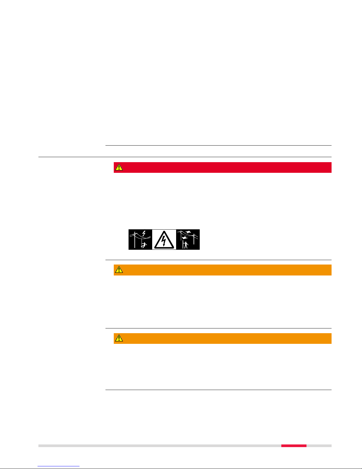
DANGER
If the product is used with accessories, for example on masts, staffs, poles,
you may increase the risk of being struck by lightning. Danger from high vol-
tages also exists near power lines. Lightning, voltage peaks, or the touching of
power lines can cause damage, injury and death.
Precautions:
▶Do not use the product in a thunderstorm as you can increase the risk of
being struck by lightning.
▶Be sure to remain at a safe distance from electrical installations. Do not
use the product directly under or close to power lines. If it is essential to
work in such an environment contact the safety authorities responsible for
electrical installations and follow their instructions.
▶If the product has to be permanently mounted in an exposed location, it is
advisable to provide a lightning conductor system. A suggestion on how to
design a lightning conductor for the product is given below. Always follow
the regulations in force in your country regarding grounding antennas and
masts. These installations must be carried out by an authorised specialist.
▶To prevent damages due to indirect lightning strikes (voltage spikes)
cables, for example for antenna, power source or modem should be pro-
tected with appropriate protection elements, like a lightning arrester. These
installations must be carried out by an authorised specialist.
▶If there is a risk of a thunderstorm, or if the equipment is to remain
unused and unattended for a long period, protect your product additionally
by unplugging all systems components and disconnecting all connecting
cables and supply cables, for example, instrument - antenna.
8 Safety Directions

Suggestion for design of a lightning conductor for a GNSS system:
1.On non-metallic structures
Protection by air terminals is recommended. An air terminal is a pointed
solid or tubular rod of conducting material with proper mounting and con-
nection to a conductor. The position of four air terminals can be uniformly
distributed around the antenna at a distance equal to the height of the air
terminal.
The air terminal diameter should be 12 mm for copper or 15 mm for alumi-
nium. The height of the air terminals should be 25 cm to 50 cm. All air ter-
minals should be connected to the down conductors. The diameter of the
air terminal should be kept to a minimum to reduce GNSS signal shading.
2.On metallic structures
Protection is as described for non-metallic structures, but the air terminals
can be connected directly to the conducting structure without the need for
down conductors.
GS_039
a
b
c
a Antenna
bSupport structure
c Air terminal
GS_040 e
d
c
a
b
a Antenna
bLightning conductor array
c Antenna/instrument connec-
tion
d Metallic mast
e Connection to earth
CAUTION
During the transport, shipping or disposal of batteries it is possible for inappro-
priate mechanical influences to constitute a fire hazard.
Precautions:
▶Before shipping the product or disposing of it, discharge the batteries by
running the product until they are flat.
When transporting or shipping batteries, the person in charge of the prod-
uct must ensure that the applicable national and international rules and
regulations are observed. Before transportation or shipping contact your
local passenger or freight transport company.
Lightning conductors
Air terminal
arrangement, plan
view
Grounding the
instrument/ antenna
Safety Directions 9

WARNING
High mechanical stress, high ambient temperatures or immersion into fluids
can cause leakage, fire or explosions of the batteries.
Precautions:
▶Protect the batteries from mechanical influences and high ambient temper-
atures. Do not drop or immerse batteries into fluids.
WARNING
If battery terminals are short circuited e.g. by coming in contact with jewellery,
keys, metallised paper or other metals, the battery can overheat and cause
injury or fire, for example by storing or transporting in pockets.
Precautions:
▶Make sure that the battery terminals do not come into contact with metal-
lic objects.
WARNING
If the product is improperly disposed of, the following can happen:
•If polymer parts are burnt, poisonous gases are produced which may
impair health.
•If batteries are damaged or are heated strongly, they can explode and
cause poisoning, burning, corrosion or environmental contamination.
•By disposing of the product irresponsibly you may enable unauthorised
persons to use it in contravention of the regulations, exposing themselves
and third parties to the risk of severe injury and rendering the environment
liable to contamination.
•The product includes parts of Beryllium inside. Any modification of some
internal parts can release dust or fragments, creating health hazard.
Precautions:
▶The product must not be disposed with household waste.
Dispose of the product appropriately in accordance with
the national regulations in force in your country.
Always prevent access to the product by unauthorised
personnel.
Product-specific treatment and waste management information can be
received from your Leica Geosystems distributor.
WARNING
Only Leica Geosystems authorised service centres are entitled to repair these
products.
1.6 Electromagnetic Compatibility EMC
The term Electromagnetic Compatibility is taken to mean the capability of the
product to function smoothly in an environment where electromagnetic radia-
tion and electrostatic discharges are present, and without causing electromag-
netic disturbances to other equipment.
WARNING
Description
10 Safety Directions

Electromagnetic radiation can cause disturbances in other equipment.
Although the product meets the strict regulations and standards which are in
force in this respect, Leica Geosystems cannot completely exclude the possibil-
ity that other equipment may be disturbed.
CAUTION
There is a risk that disturbances may be caused in other equipment if the prod-
uct is used with accessories from other manufacturers, for example field com-
puters, personal computers or other electronic equipment, non-standard cables
or external batteries.
Precautions:
▶Use only the equipment and accessories recommended by Leica Geosys-
tems. When combined with the product, they meet the strict requirements
stipulated by the guidelines and standards. When using computers or other
electronic equipment, pay attention to the information about electromag-
netic compatibility provided by the manufacturer.
CAUTION
Disturbances caused by electromagnetic radiation can result in erroneous
measurements.
Although the product meets the strict regulations and standards which are in
force in this respect, Leica Geosystems cannot completely exclude the possibil-
ity that the product may be disturbed by intense electromagnetic radiation, for
example, near radio transmitters, two-way radios or diesel generators.
Precautions:
▶Check the plausibility of results obtained under these conditions.
CAUTION
If the product is operated with connecting cables attached at only one of their
two ends, for example external supply cables, interface cables, the permitted
level of electromagnetic radiation may be exceeded and the correct functioning
of other products may be impaired.
Precautions:
▶While the product is in use, connecting cables, for example product to
external battery, product to computer, must be connected at both ends.
Safety Directions 11

Use of product with radio or digital cellular phone devices:
WARNING
Electromagnetic fields can cause disturbances in other
equipment, in installations, in medical devices, for
example pacemakers or hearing aids and in aircraft. It
can also affect humans and animals.
Although the product meets the strict regulations and
standards which are in force in this respect, Leica Geo-
systems cannot completely exclude the possibility that
other equipment can be disturbed or that humans or
animals can be affected.
Precautions:
▶Do not operate the product with radio or digital
cellular phone devices in the vicinity of filling sta-
tions or chemical installations, or in other areas
where an explosion hazard exists.
▶Do not operate the product with radio or digital
cellular phone devices near to medical equipment.
▶Do not operate the product with radio or digital
cellular phone devices in aircraft.
1.7 FCC Statement, Applicable in U.S.
The greyed paragraph below is only applicable for products without radio.
WARNING
This equipment has been tested and found to comply with the limits for a
Class B digital device, pursuant to part 15 of the FCC rules.
These limits are designed to provide reasonable protection against harmful
interference in a residential installation.
This equipment generates, uses and can radiate radio frequency energy and,
if not installed and used in accordance with the instructions, may cause
harmful interference to radio communications. However, there is no guaran-
tee that interference will not occur in a particular installation.
If this equipment does cause harmful interference to radio or television
reception, which can be determined by turning the equipment off and on,
the user is encouraged to try to correct the interference by one or more of
the following measures:
•Reorient or relocate the receiving antenna.
•Increase the separation between the equipment and the receiver.
•Connect the equipment into an outlet on a circuit different from that to
which the receiver is connected.
•Consult the dealer or an experienced radio/TV technician for help.
WARNING
Changes or modifications not expressly approved by Leica Geosystems for
compliance could void the user's authority to operate the equipment.
Radios or Digital Cel-
lular Phones
☞
12 Safety Directions

0014277_001
This device complies with part 15 of the FCC Rules.
Operation is subject to the following two conditions:
(1) This device may not cause harmful interference, and
(2) this device must accept any interference received.
Including interference that may cause undesired
operation.
Model: GS18
Equip. No: 12345678
Leica GeosystemsAG, CH-9435 Heerbrugg
Manufactured: 2017, Made in Switzerland
Power: 15V nominal /2.5Amax
Contains: FCC-ID / IC
RFD-BTWCO / 3177A-BTWCO
S.No.:1579025
Art.No.: 848293
11WE
MH29443
This device complies with part 15 of the FCC Rules.
Operation is subject to the following two conditions:
(1) This device may not cause harmful interference, and
(2) this device must accept any interference received,
including interference that may cause undesired operation.
008469_004
1.8 ICES-003 Statement, Applicable in Canada
WARNING
This Class (B) digital apparatus complies with Canadian ICES-003.
Cet appareil numérique de la classe (B) est conforme à la norme NMB-003 du
Canada.
Labelling GS18
Labelling Internal Bat-
tery GEB331
Safety Directions 13

2 Description of the System
2.1 System Components
Component Description
Instrument To calculate a position from the computed ranges to all
visible GNSS (Global Navigation Satellite System) satel-
lites.
To estimate a tilt compensated pole tip position by com-
bining the GNSS position with attitude information from
an Inertial Measurement Unit (IMU).
Web server Web-based tool to preprogram the GNSS instrument.
Antenna To receive the satellite signals from the GNSS satellites.
Leica Infinity The office software including a series of help programs
which support working with Leica instruments.
Instrument Description
GS18 GPS, GLONASS, BeiDou and Galileo GNSS receiver,
multi-frequency, SBAS (EGNOS, WAAS, MSAS, GAGAN),
code and phase, real-time capable, integrated Inertial
Measurement Unit.
2.2 System Concept
2.2.1 Software Concept
All instruments use the same software concept.
Software type Description
GS firmware
(GS_xx.fw)
This software covers all functions of the instrument.
The Web server application is integrated into the firm-
ware and cannot be deleted.
The English language is integrated into the firmware and
cannot be deleted.
Language soft-
ware
(WEB_LANG.sxx)
Numerous languages are available for the Web server
application.
The English language is the default language. One lan-
guage is chosen as the active language.
☞Uploading GS firmware can take some time. Ensure that the battery is
at least 75% full before beginning the upload, and do not remove the
battery during the upload process.
Software for Description
All GS models The software can be uploaded using the Leica Web
server application or myWorld@Leica Geosystems.
Main components
Instrument
Description
Software for all GS
GNSS instruments
Software upload
14 Description of the System

Software for Description
☞Ensure that a Leica SD card is inserted into the
GS instrument before starting the upload.
Refer to "4.3 Working with the SD Card".
2.2.2 Power Concept
Use the batteries, chargers and accessories recommended by Leica Geosystems
to ensure the correct functionality of the instrument.
Power for the instrument can be supplied either internally or externally.
Internal power sup-
ply:
One battery (GEB331) fits into the instrument.
External power sup-
ply:
GEB371 battery connected via a cable.
OR
Car battery connected via a converter cable supplied
by Leica Geosystems.
OR
10.5 V‑28 V DC power supply via a converter cable
supplied by Leica Geosystems.
OR
110 V/240 V AC to 12 V DC power supply unit, sup-
plied by Leica Geosystems.
For permanent operations use Uninterruptible Power Supply units as a back-up
in a main power failure.
2.2.3 Data Storage Concept
Data (Leica GNSS raw data and RINEX data) can be recorded on the SD card.
SD card: The GS18 GNSS instrument has an SD card slot fitted as standard.
An SD card can be inserted and removed. Available capacity:
1 GB, 8 GB.
☞While other SD cards can be used, Leica Geosystems recommends
to only use Leica industrial grade SD cards and is not responsible
for data loss or any other error that can occur while using a non-
Leica card.
Unplugging connecting cables, removing the data storage device or interrupting
the power supply during the measurement can cause loss of data. Only remove
the data storage device, unplug connecting cables or interrupt the power sup-
ply when the GS GNSS instrument is switched off.
SD cards can directly be used in an OMNI drive as supplied by Leica Geosys-
tems. Other PC card drives can require an adaptor.
General
Power options
☞
Description
Memory device
☞
☞
Description of the System 15

2.3 Container Contents
0014958_001
d
a
b
c
e
f
g
h
i
j
k
l
m
n
o
p
q
a GHT63 clamp
b Manuals and USB documentation card
c GEB212 or GEB331 batteries
d Antenna
e GAT18, GAT27 or GAT28 mobile antenna
f GAT21, GAT25 or GAT26 radio antenna
g CS20 field controller with GHT66 holder or CS15 field controller with
GHT62 holder or CS35 tablet
h Tribrach
i Height hook
j USB stick
k Cables
l Antenna
m Stylus
n SD cards
o GAD34 arm 3 cm
p TNC QN-adapter
q Allen key and adjustment tool
Container for GS
instrument and acces-
sories 1/2
16 Description of the System

0014961_001
a
b
c
i
d
e
h
f
g
j
j
a GHT36 base for telescopic rod
b Antenna arm
c GFU RTK modem
d GAD32 telescopic rod
e GAT1 or GAT2 radio antennas
f GEB212 or GEB331 batteries
g GRT146 or GRT247 carrier
h GAD33 arm
i GHT58 tripod bracket for GFU
j External battery
Container for GS
instrument and acces-
sories 2/2
Description of the System 17

0014955_001
a h
i
j
k
l
b
c
d
e
f
g
a Field controller
b Antenna
c CRP15, quick release adaptor for quick mounting and demounting the
GS18 to the pole without screwing
d GAT25, GAT26, GAT27 or GAT28 antenna
e Stylus
f GHT63 clamp
g USB stick
h GAT1 or GAT2 radio antennas
i Antenna arm
j microSD card including adapter or SD card
k Manual & USB documentation card
l GEB212 or GEB331 batteries
2.4 Instrument Components
The instrument can be preprogrammed using the Web server application run-
ning from the instrument on a web browser of a Windows device. Connect the
instrument to a computer using a cable. Turn on the instrument by holding
down the Power key for 2 s. A green blinking light at the connectivity and the
storage LED indicates that the instrument powers up.
Container for GS
instrument and acces-
sories
☞
18 Description of the System

0014278_001
a
b
c
e
f
d
a SMB-connector for external
UHF antenna, only for models
with UHF radio
b SMB-connector for external
LTE antenna
c LEDs, ON/OFF button and
Function button
d Battery compartment with SD
card and micro SIM card slot
e LEMO port, serial, USB and
external power
f Antenna Reference Plane
(ARP)
0014496_001
a
a Antenna reference plane
(ARP)
A Bluetooth port is included inside all GS GNSS instruments enabling
connectivity to the field controller.
GS18 components
GS18
☞
Description of the System 19

3 User Interface
3.1 Keyboard
0014280_001
a b
a ON/OFF button
b Function button
Button Function
ON/OFF If GS18 already off:
Turns on GS18 when held for 2 s.
☞While the GS18 is booting the Connectivity
and Storage LED are flashing green. The
Battery and or Power LEDs shine green or
red depending on the power source and
the battery status.
If GS18 already on:
Turns off GS18 when held for 2 s.
☞The Position LED shines orange. The Tilt
and the Storage LEDs shine red. RTK Base
and RTK Rover LEDs shine green. The Con-
nectivity LED shines blue or green,
depending on the connectivity. The Battery
and Power LEDs shine green or red
depending on the battery status.
☞All functions following described assume the GS18 is already on.
Button Function
Function Press and hold button for <1 s.
If the GS18 is in:
•base mode: The GS18 switches to be in rover
mode.
•rover mode and in static mode: No action.
•rover mode and in kinematic mode: The GS18
switches to be in base mode.
Press and hold button for 3 s.
If the GS18 is in:
Keyboard GS18
ON/OFF button
Function button
20 User Interface
Table of contents
Other Leica Receiver manuals

Leica
Leica GR30 Reference guide

Leica
Leica Zeno 10 User manual

Leica
Leica GMX902 GG User manual

Leica
Leica Viva GNSS User manual

Leica
Leica GS10 User manual

Leica
Leica GPS1200 Series User manual

Leica
Leica GR10 Quick start guide

Leica
Leica GR10 User manual

Leica
Leica GGo4 Instruction Manual

Leica
Leica GR10 User manual